Showing posts with label Trip index. Show all posts

Sunday, November 07, 2010

Ailsa Craig from Lendalfoot, Ayrshire.

A 32km day trip round Ailsa Craig in the outer Firth of Clyde.

Tidal streams between the Ayrshire coast and Ailsa Craig are generally weak, towards the Craig they are about 0.5knots at springs. The NE going flood starts about  +0535 HW Greenock (-0530 HW Dover) and the SE going ebb starts about -0050 HW Greenock (+0030 HW Dover).

Remember to take a good broad brimmed hat.

A little rockhopping in the Firth of Clyde.

3,000 sea kayaks behind Ailsa Craig, but all was quiet.

Hats are de rigeur on the far side of Ailsa Craig.

A fog horn and a siren on Ailsa Craig.

Photo album map.

Tuesday, November 02, 2010

A Fyne trip on Argyll's Secret Coast!


A 21km day trip from Portavadie to Otter Ferry, Loch Fyne.


Auchalick Bay, Loch Fyne

Tidal streams in Loch Fyne are generally weak. In the Otter Ferry narrows:
+0555 HW Greenock (-0510 HW Dover) north-east going flood begins.
+0015 HW Greenock (+0135 HW Dover) south-west going ebb begins.
In mid channel the rate in each direction is 1 knot. Close to the beacon at the end of the spit, the rate is about 2 knots in each direction.

How sweet is the Clyde?

One way trade and a one way voyage.

Missed the gun but not the boat, in Loch Fyne.

Auchalick Bay, Loch Fyne.

High water in Kilfinan Bay.

Reviresco on the Loch Fyne Riviera.

Let them eat oysters, in Otter Ferry.

Fellow travellers on Loch Fyne.

The Oystercatcher, Otter Ferry, Loch Fyne.

Photo album map.

Thursday, October 21, 2010

The Garvellachs from Seil


A 32km day trip round the Garvellach islands from Ellenabeich on Seil. August 2010.


the NW coast of Eileach na Naoimh.

Tidal streams from Insh Island to the north end of the Sound of Luing:
+0430 HW Oban (-0100 HW Dover) north-east going flood begins.
-0155 HW Oban (+0500 HW Dover) south-west going ebb begins.

The spring rate is 6-7 knots through the islands at the N end of the Sound of Luing. On the N going stream a strong tide race extends from Rhubha Fiola to Ormsa then past the SW side of Belnahua. Between the Garvellachs and the Black Islands the spring rate 2-3knots. On the west side of Lunga the spring rate is from 3-3.5knots. South of Insh Island, the spring rate is 1-1.5knots.

Eddys are frequent, especially round the north end of the Garvellachs.

On the day, it was 4 days after springs Oban HW 0915 LW 1531 HW 2138. We left Ellenabeich at 1015, the SW ebb had started at 0720. On the return we left Garbh Eileach at 1605, the NE flood had started at 13:45. We returned to Ellenabeich at 1757.

A rough crossing to the Rough Islands.

Sea kayaking under the west coast cliffs of Garbh Eileach.

A fishless lunch on Eileach an Naoimh.

Garvellachs rock face.

The great eagle of Eileach an Naoimh.

Return tickets for the Sound of Luing express.

Bear right at Belnahua!

An encounter with Loti on an uneasy sea.

A unobstructed view thanks to midges and shaggy dogs.


Photo album map. (Note that Google maps know nothing of the Garvellachs or Insh Island!)

Friday, July 09, 2010

Sea kayaking from Loch Feochan to Loch Etive


A 36km paddle from the south side of Loch Feochan via Oban harbour to Taynuilt pier. It took 2 hours to drive from Glasgow to Taynuilt pier. It took another 1hr 45mins to run the shuttle to Loch Feochan and get on the water.

Tidal streams:

Loch Feochan narrows

At low water the norrows almost dry leaving a norrow channel of about 0.3m. As a result the ingoing flood does not begin until the level outside the narrows has risen by 1m this results in the flood running for only 4 hours and the ebb running for 8 hours.

Ingoing flood begins -o355 HW Oban (+0300 HW Dover) 5 knots springs

Outgoing ebb begins +0030 HW Oban (-0500 Dover) 5 knots springs

HW inside the loch as HW Oban (-0530 HW Dover)

Sound of Kerrera the flood enters the south end and exits the north end by Oban

In mid channel

NE going flood begins +0430 HW Oban (-0100 HW Dover) up to 2.5 knots springs

SW going ebb begins -0155 HW Oban (+0500 HW Dover) up to 2.5 knots springs


Falls of Lora, Loch Etive
These times may vary by up to 0130hrs dependent on meterological conditions, more often occuring earlier rather than later.

West going ebb starts HW Oban +0210 (-0320 HW Dover) 6 knots
Ebb strongest waves HW Oban +0430 till LW Oban

East going flood starts HW Oban -0320 (LW Oban +0250) ( +0335 HW Dover) 6 knots
Best waves HW Oban -0100 till HW Oban +0030

Up to date info on Falls of Lora.

On the day Oban tide times were:
HW 02:10 LW 08:35 HW 16:03 LW 21:06
So, at Falls of Lora:
Flood starts LW Oban +0250 09:25
Best waves HW Oban -0100 15:03 till HW Oban +0030 16:33 (we found only a gentle ingoing current of 1 knot at 1610)
Ebb starts HW Oban +0210 18:13
Strongest waves HW oban +0430 20:33 till LW Oban 21:06

Kilmaronag Narrows, Loch Etive

As Falls of Lora

Bonawe Narrows, Loch Etive

west going ebb starts +0215 HW Oban (-0316 HW Dover) 2.5 knots springs
east going flood starts -0300 HW Oban (+0355 HW Dover) 1.5 knots springs


Loch Feochan narrows looking west to Mull.


Oban nestling under McCaig's Folly on the hill.


Firth of Lorn off Ganavan.


Sunset behind the mountains of Mull from Loch Etive.

An icy start at Loch Feochan.

Stopped in his tracks in Loch Feochan.

A cottage and a castle at Loch Feochan

Luncheon below a volcano.

Arrival in Oban

The Pharos and the Pole Star

Better days for some in Oban harbour.

Dark deeds on the north shore of Oban Bay.

Waving goodbye to Oban.

The skies cleared over the Firth of Lorn.

A welcome break at Ganavan.

All quiet at Dunstaffnage

Made in Scotland from girders and glaciers.

Of time and tide at the Falls of Lora

Last supper at Dun Creagach, Loch Etive

In the picture: a blaze of glory in Glen Etive

The end of a perfect day, in Loch Etive.


Photo album map

Friday, May 28, 2010

A crusade by sea kayak to the Holy Island


A 20km paddle from Brodick on Arran round Holy Island, March 2010.

The north going flood tide enters Lamlash Bay by the South channel and exits by the North Channel the south going ebb tide runs in the reverse direction.

N going flood +0605 HW Greenock -0500 HW Dover, 1knt springs S channel 0.75knt N channel
S going ebb +0040 HW Greenock +0200 HW Dover, 1.5 knt springs S channel 1 knt N channel

Lamlash tidal constant -0025 Greenock +0050 Dover


Destination Holy Island!


The mountains of Arran

No egos at Portencross!

Seeking shelter in Brodick Bay.

Egalitarian cruising on the Clyde

Little and Large in Lamlash Bay.

Do Holy Island monks think they are above the Law of Scotland?

The west coast of Holy Island, Arran

The Inner (and Outer) Light of Holy Island

Tony hangs up his hat on Holy Island

End of a Crusade to Holy Island


Photo album map

Monday, May 10, 2010

Sea kayaking round the Mull of Oa, Islay


A 26km paddle from Port Ellen to Kintra round the Mull of Oa Islay early March 2010.

Tidal streams 200m off the Oa peninsula at spring tides run at 4-5knots:
NW going flood begins HW Dover (11:31 on the day) overfalls off Rubha nan Leacan
SE going ebb begins -0610 HW Dover overfalls off Mull of Oa

However, we found that close inshore, the NW stream begins at least -0100 HW Dover.


A bottle nose dolphin off Sgeirean Buidhe.


Bottle nose dolphins


Soldier's Rock.


This was a day trip from Glasgow, made possible by a temporary late evening sailing from Port Askaig. I do not normally make such a rigid timetable but given the distances, ferry times and tide times it was essential. As it happened, we arrived at Kintra at 15:45 and used a taxi to recover the car. What a day!

I have mentioned both before but two really excellent sources of information on Islay are:

Armin's Islay Blog

Ron's Islay Weblog


This was the tidal atlas, marked up with the times for the day. We were there 2 days before springs.

Day return to Islay, please.

The most southern point of the Hebrides.

Oa what a beautiful morning, Oa what a beautiful day!

The SE coast of the Mull of Oa, Islay

The point of no return, Rubha an Leacan to Gob an Rubha Dhuibh, Oa, Islay

Sea kayaking with dolphins at the Mull of Oa

Going with the flow, round the Mull of Oa!

A glimpse of distant white shell sand promised a break.

Oa what a paradise!

The most southerly Gargoyles in all of the Hebrides

Oa speak no evil

Threading the Oa of a needle

All hail Soldier's Rock, Islay

What a geo on Oa!

End of an Islay day.

Oa, I'm so sorry about all the dreadfull puns.

Photo album map.

Tuesday, April 20, 2010

Sea kayaking from Portpatrick to the Mull of Logan


A 33km paddle from Portpatrick to the Mull of Logan and back in late February 2010.

Tidal streams in the North Channel, close inshore between Corsewall Point and the Mull of Galloway, run at 5knots springs of Black Head and to the south of it, north of Black head: 4knots off Craig Laggan and 2.5knots off Corsewall Point. Expect to find counter eddies in the bays especially in the last 3 hours of the stream.

NW going ebb -0250 HW Greenock -0130 HW Dover
SE going flood +0310 HW Greenock +0430 HW Dover

There are races SE of Crammag Head and off Mull of Logan, Money Head and Morroch Bay.

In mid channel the streams begin +0130 after the coastal streams.


The Old Man of the Mull of Logan keeps an eye on the Devil's Bridge.


Sunset behind the Portpatrick lighthouse.

Potted pheasant at Portpatrick

Going with the flow on the Rhins of Galloway

A Galloway snow squall warning

Where will we take luncheon today?

Any port in a storm #2

Slack water in the North Channel.

The Old Man of the Mull of Logan.

We four represented the sum of human activity in these parts.

What happens after you test a P&H Cetus LV?

Have you ever heard of Knockienausk Head?

The bright lights of Portpatrick


Photo album map

Friday, April 09, 2010

Sea Kayaking round Laggan peninsula Mull via Lochs Spelve and Buie


A 44km paddle from Ellenabeich on the Island of Seil across the Firth of Lorn and round the Laggan peninsula of Mull via Loch Spelve, freshwater Loch Uisg and Loch Buie, February 2010. This route takes you through part of Scotland's Great Glen Fault, which just clips SE Mull. It involves two portages and two open crossings. Although this was a day trip, it would make a fantastic multi day expedition. From Glasgow it takes about 2hrs 45minutes to drive to Ellenabeich.

Tidal streams in the Firth of Lorn south of the entrance to Loch Spelve run at 2 knots springs
NE going +0515 HW Oban -0015 HW Dover
SW going -0105 HW Oban +0555 HW Dover

Tidal streams at Loch Spelve entrance run at 3.5-4 knots springs
Ingoing -0530 HW Oban +0125 HW Dover
Outgoing +0015 HW Oban -0515 HW Dover
Strong eddies and overfalls

Tidal streams off Frank Lockwood's Island run at 1 knot springs
NE going +0430 HW Oban -0100 HW Dover
SW going -0115 HW Oban +0500 HW Dover
W going eddy to Loch Buie during NE stream


Loch Spelve


Loch Buie

Google maps, short by an Insh!

Dark volcanic sands of Mull.

A Lorn view at luncheon

The Loch Spelve welcoming committee.

Loch Spelve and its mysterious pier.

A sea kayaking milestone on Mull.

Sea kayakers get fresh on Loch Uisg, Mull

Lochbuie, his highlanders and an admirable port.

The road to Loch Buie.

Sea kayaking at sundown in Loch Buie.

A night crossing of the Firth of Lorn by kayak.


Photo album map.

Saturday, March 27, 2010

Sea kayaking Loch Creran, Firth of Lorn


A 33km paddle from Port Appin to the head of Loch Creran and back, Feruary 2010.

Tidal streams at NE end of Lynn of Lorn run at 2 knots springs
NE going +0600 HW Oban
SW going -0015 HW Oban

Tidal streams at Loch Creran entrance run at 3-4 knots springs
Ingoing +0600 HW Oban
Outgoing -0030 HW Oban

Tidal streams at Creagan narrows run at 5 knots springs
Ingoing -0520 HW oban
Outgoing +0025 HW Oban overfalls extend for 0.8km into the outer loch.


Paddling NE towards Bein Sgulaird.


Sunset over the distant mountains of Mull.

Little and large on the road north to Appin

The hidden entrance to Loch Creran

Loud, discordant, half naked and very hairy Celts in Loch Creran!

A shilling a whole horse, in Loch Creran

On edge in Loch Creran, a satisfying gurgle from the stern.

Bold kayakers out run speeding glacier!

No food at the inn!

End of day in Loch Creran

After sunset in the Lynn of Lorn.


Photo album map.

Tuesday, February 16, 2010

A tour of the Clyde Lochs and rocks


A tour of the Clyde lochs and rocks from Lunderston Bay, Firth of Clyde, 30km, January 2010.


The Cloch lighthouse.

Two iconic, but ultimately impotent, towers on the Clyde

Keeping an eye open for ferries at Gourock

Little and Large on the Clyde: Ocean terminal and Kilcreggan pier

A warm glow in a wintery Loch Long

The number 475 bus and an occasional sea kayaker

A nice shade of grey, in Hunter's Quay

Dunoon, and her unused new pier

The Gantock Rocks

Passing ships in the night.


Photo album map.

Arran West Coast to Carradale


A day trip from Dougarie on the west coast of Arran to Carradale on the Kintyre peninsula, Firth of Clyde, 25km, January 2010.


A distant Ayrshire coast and Ailsa Craig from near Carradale.

An early morning wardrobe malfunction.

"Bru'd in Carradale from girders"

Torrisdale Bay in the Kilbrannan Sound.

Time to go in the Carradale Water

Return to Dougarie


Photo album map.

Seakayakphoto.com trip index 2010

2010 running total distance: 1235km

Ayr to Dunure, Firth of Clyde, 20km
Arran west coast to Carradale, Firth of Clyde, 25km
A tour of the Clyde lochs and rocks from Lunderston Bay, Firth of Clyde, 30km
Ganavan Bay to Kerrera, Firth of Lorn, 29km
Auchencairn Bay to Needle's Eye, Solway Firth, 21km
Ballantrae to Portandea, Firth of Clyde, 19km
Port Appin to Loch Creran, Firth of Lorn, 33km
Seil to Laggan Deer Forest, Mull, Firth of Lorn, 44km
Portpatrick to the Mull of Logan, North Channel, 33km
The Mull of Oa, Islay, Inner Hebrides, 26km
Holy Island from Brodick, Firth of Clyde, 20km
Loch Feochan to Loch Etive, Firth of Lorn, 36km
Ailsa Craig from Lendalfoot, Firth of Clyde 32km
Loch Fyne, St Catherines to Otter Ferry, Firth of Clyde 36km
Loch Fyne, Portavadie to Otter Ferry, Firth of Clyde 21km
Circumnavigation of Morvern, Firth of Lorn to Loch Sunart 115km
North Islay and west Jura, Inner Hebrides 82km
Islands of Fleet and Kirkandrews Bay Solway Firth 14km
Heads of Ayr from Seafield, Firth of Clyde 14km
Lunga and Scarba from Crinan, Sound of Jura, 47km
Fleet Bay, Solway Firth 21km
Rhinns of Islay, Inner Hebrides 47km
Mull of Oa, Islay, Inner Hebrides 44km
Sound of Islay 15km
Fleet Bay Solway Firth 39km
Gigha and Cara 46km
The Garvellachs from Seil, Firth of Lorn 32km
Cumbraes and Bute from Largs, Firth of Clyde 34km
Fleet Bay, Solway Firth 11km
Kirkcudbright from Fleet Bay, Solway Firth 43km
Fleet Bay, Solway Firth 5.5km
Portavadie to Colintraive via the Kyles of Bute, Firth of Clyde 33km
Derwent water, Lake District, England 11km
Arran from Portencross, Firth of Clyde 31km
Loch Long to Loch Goil, Firth of Clyde 25km
Loch Eil to Loch Linnhe, Firth of Lorn 30km
The Cumbraes from Largs, Firth of Clyde 25km
Seafield to Maidens, Firth of Clyde 21km
Arran from Portencross 2, Firth of Clyde 31km
Glasgow Green to Port Glasgow, Firth of Clyde 33km

Monday, January 05, 2009

Seakayakphoto.com trip index 2009

For those who would like to follow the thread of a single trip, I hope this index will be useful. Unfortunately the Google "search this blog" function is not working properly at the moment so the link may not recover all the relevent posts.

2009 running total distance: 890km

December:
The Cumbraes, Firth of Clyde, 27km
The Mull of Galloway tide race, at full belt! 21km

November:
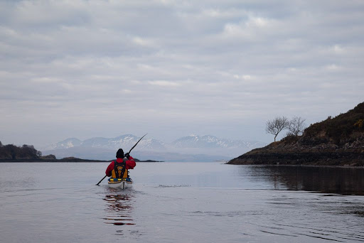
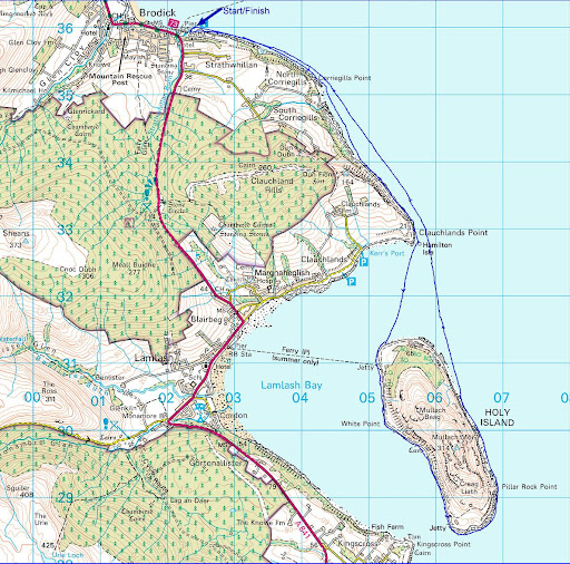
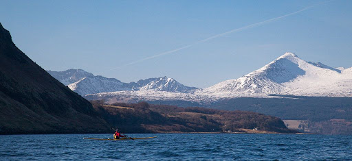
Sannox synchronicity: Portencross to Brodick, Arran, 31km

Maidens to Ayr, 20km

October:
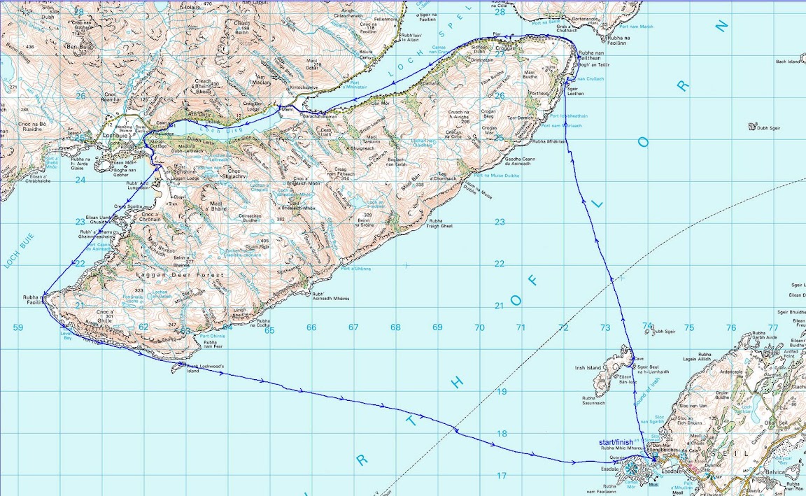
A trinity of tide races: circumnavigation of Scarba 38km

September:
Fleet bay Solway Firth, 3km
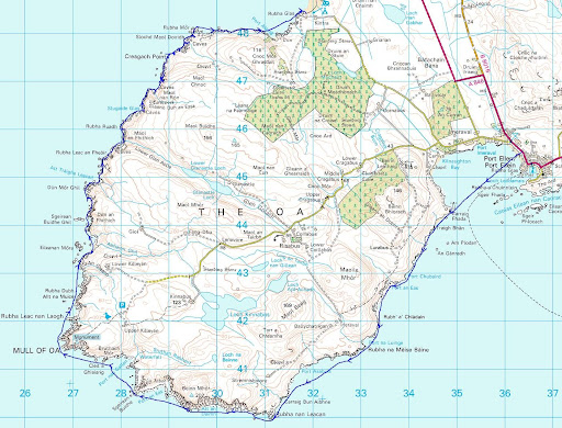
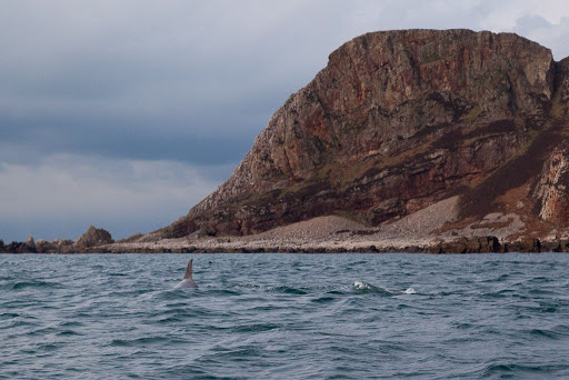
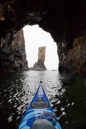
Islay, Oronsay, Colonsay, Jura, Islay 109km

August:
Seafield, Ayr, Firth of Clyde, 7km
Lady Isle, Troon Firth of Clyde 9km

June:
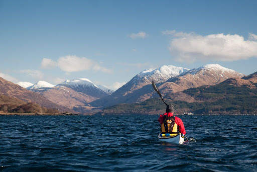
Ardnamurchan to Coll, Gunna and Tiree
Inner Hebrides
15/06/09 Coll to Ardnamurchan, 18km
14/06/09 Gunna to Rubha Sgor-innis, Coll, 34km
13/06/09 NW Coll to Scarinish, Tiree, 40km
12/06/09 Ardnamurchan to the Cairns of Coll, 28km

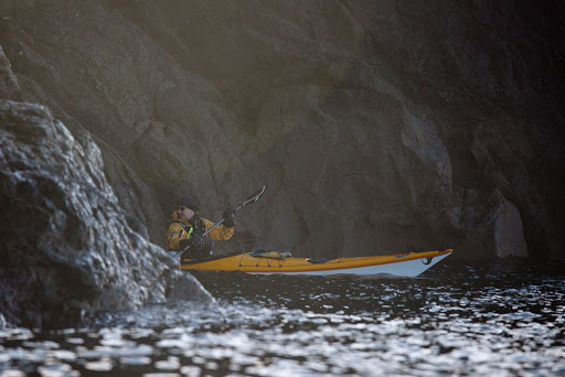
A Solway smugglers' Ccave
Fleet Bay
09/06/09 Solway Firth 9km

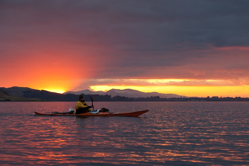
Full Moon at Rumblekirn
Fleet Bay
08/06/09 Solway Firth 14km

Sea shells and egg shells
Fleet Bay
01/06/09 am Solway Firth 10km

The great dun of Carrick
Fleet Bay
31/05/09 pm Solway Firth 19km

Three Pillars of Knockbrex
Fleet Bay
31/05/09 am Solway Firth 12km

Plumage and blossom on the Solway
Fleet Bay
30/05/09 Solway Firth 13km

Sea eagles and coral sands
Loch Eishort
23/05/09 Isle of Skye 19km

A big day!
Portuairk to Mull and return.
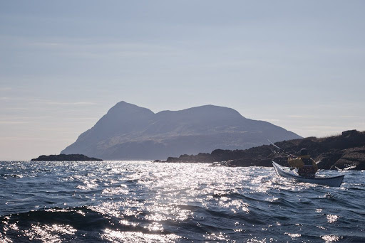
10/05/09 Ardnamurchan Point 42km.

Surf's up on Ayrshire's Atlantic Coast
Finnarts Bay to Lendalfoot
02/05/09 Firth of Clyde 21km

Arran Direct, Firth of Clyde
19/04/09 Kildonnan to Brodick 19km
18/04/09 Lendalfoot to Ailsa Craig then Pladda then Kildonnan, Arran 41km

Dumfries to Southerness in search of the Nith bore!
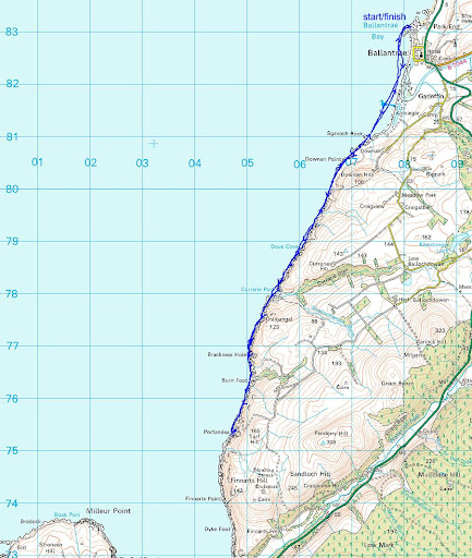
13/04/09 Solway Firth 25km

The Islands of Fleet
11/04/09 Solway Firth 12km

Fairlie to Little Cumbrae
04/04/09 Firth of Clyde 20km

The Islands of Fleet
02/04/09 Solway Firth 11km

Troon Ballast Bank to Lady Isle
01/04/09 Firth of Clyde 11km

From Portencross to Bute and Arran
21/03/09 Firth of Clyde 31km

"End of the Winter timetable!"
By ferry to Loch Ranza on Arran and return to Portavadie
19/03/09 Firth of Clyde 30km

The Carrick coast, Maidens to Ayr
15/03/09 Firth of Clyde 20km

The islands of Loch Leven
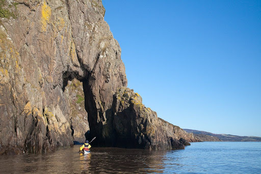
01/03/09 Firth of Lorn 11km

Port Appin to Loch Leven
28/02/09 Firth of Lorn 29km

"Any port in a storm on Great Cumbrae"
21/02/09 Firth of Clyde 19km

Bute from Seamill.
15/02/09 Firth of Clyde 23km

Surfing from Turnberry Point to Carrick Shore
08/01/09 Firth of Clyde 9km

The MacCormaig Islands from Carsaig Bay
02/01/09 The Sound of Jura 35km

Monday, September 08, 2008

Sea Kayakphoto.com trip index 2008

I have been posting little snippets of various trips concurrently. For those who would like to follow the thread of a single trip, I hope this index will be useful.

Less is more round Lismore!
27/12/08

What a carry on round the Mull!
15/12/08 The Mull of Galloway

Another West coast sunset! Firth of Clyde
14/12/08 Bute from Portencross,

Dunure from Maidens, Firth of Clyde
06/12/08

The Four Castles of Carrick, Firth of Clyde.
02/11/08 Turnberry to Ayr

The River Fleet from Fleet Bay
17/10/08

Loch nan Ceall and the Sound of Arisaig
13/09/08
14/09/08

To the Corryvreckan
30/08/08 Seil to Scarba via the Corryvreckan
31/08/08 Scarba to Seil via the Grey Dogs and the Cuan Sound

The Mull of Kintyre
26/07/08 Macrihanish to Sanda via the Mull
27/07/08 Sanda to Davaar Island

To Islay
12/07/08 Claggain Bay
13/07/08 Traigh Bhan
14/07/08 An Claddach
15/07/08 Port Askaig

To St Kilda
30/05/08 Loch Roag
31/05/08 Taransay
01/06/08 Monach Islands
02/06/08 Hirta and Dun
03/06/08 am Village Bay, Hirta
03/06/08 pm Boreray and the stacks
04/06/08 Loch Reasort to Scarp
05/06/08 Pabaigh Mor and Bhacsaigh

To the Garvellachs
10/05/08 Seil to the Grey Dogs via the Corryvreckan
11/05/08 Grey Dogs to the Garvellachs and Seil

Lady Isle
08/05/08 A busy night at Troon

Ailsa Craig
05/05/08 Gannets and granite

Fleet Bay
02/05/08 Solway sunshine

A misty Firth of Clyde
27/04/08 Maidens to Ayr

Arran
18/03/08 Portencross to Brodick via the Wee Cumbrae, Bute and Glen Sannox

Mull of Galloway
17/02/08 Ardwell Bay to East Tarbet

Dorus Mor
12/02/08 Craignish through the Dorus Mor to Crinan and Loch Craignish then back through the Dorus Mor as the sun set.

The four maritime castles of Carrick
20/01/08 Turnberry to Ayr.

The Cumbraes and Bute
12/01/2008 A day trip in the Clyde from Largs