Showing posts with label arches. Show all posts

Sunday, January 14, 2018

A cold second breakfast at dead end beach, Jura

We woke on the morning of our fourth day of our trip round Jura and Colonsay on the machair of Shian Bay on the west coast of Jura. A cold NW wind was blowing  and it felt like spring had retreated to allow the return of winter.

As we had no intention of paddling through the Gulf of Corryvreckan against the west going flood tide, in wind over tide conditions, we wanted to arrive at the west end of the Corryvreckan at slack water before the east going ebb started. That was not until late afternoon and as the Corryvreckan was only 24km away, we had some time to kill. Unfortunately there was not a scrap of shelter on Shian Bay so, on the one morning we could have enjoyed a relaxed start, we had to get moving to keep warm.

We donned full winter attire and...

...Sam even had his pogies on. What a contrastv to the previous few days.

As we left Shian Bay the wind had just a little too much north in it to get our sails up which...

...pleased sail-less Sam. Then, as soon as we rounded the first headland (backed by huge raised beaches of cobbles),...

...the wind freed enough to get our sails up and we were soon making excellent progress up the...

...remote NW coast of Jura, which is always a delight.

In addition to the raised cobble beaches there are several levels of raised cliffs, which feature dry arches and caves and are interspersed by sand dunes. They represent the varying sea levels after the last Ice Age. The west coast of Jura is one of the geological wonders of the World but it gets hardly any visitors.

Our first stop was at Corpach Bay, some 7km further on from Shian Bay. Corpach Bay is backed by caves which were once used to store corpses from Argyll on their final journey to Iona for burial. Iona is 45km away on the horizon at the extreme left of this photo. Often sea conditions were too rough to complete the journey, especially in winter. One can imagine the smell in the caves come springtime when the mourners returned.

We needed some shelter for second breakfast and, not fancying the caves, we spotted a dry sea stack at the back of the beach.

This provided excellent shelter for a most convivial second breakfast. We were all in excellent spirits as we were in no hurry and had no dead to bury.


Tuesday, May 03, 2016

Rendezvous with a swarm of oxymoronic priapic dykes on the SW coast of Jura

Leaving the mouth of West Loch Tarbert we made our way along the SW shore of Jura towards the northern entrance of the Sound of Islay.

No sooner had we entered the Sound, which is guarded by the Ruvaal Lighthouse on its Islay shore, than this otter popped up right by Mike's bow, what a treat.

As we travelled over the turquoise and ultramarine water of the Sound, the Paps of Jura increasingly...

 ...dominated the landscape, heaving high into the sky above a sea cliff which was now high above the current sea level. Unseen in this photo, there are raised beaches of cobbles above these old cliffs. The land and seascape of Jura is unique, even in a country of such varied geology as Scotland.

The cliffs are broken by a swarm of dykes that march down the hillsides and down into the waters of the Sound.

This particularly fine priapic (if that is not an oxymoron when discussing a dyke) specimen is a potent landmark which can be found to the WNW of Loch na Sgrioba (loch of the furrow).

Jura really is a stunning place to paddle but it was now 14km since we had had a decent stop so we took a break...

...on a little cobbled beach that nestled within a swarm of dykes. We took our second luncheon with our backs to a sun warmed basalt dyke which sheltered us from a cold north wind. We toasted ourselves with a further snifter of Jura Superstion. We had plenty of time as the tide was still running north.

We attempted a little coastal exploration while waiting for the tide to turn.

We managed to get through some arches and ...

...scrambled up some ledges but turned back above these dykes as we were on steep sloping grass that ended above some cliffs.

From our vantage point we spotted a French mine warfare vessel, possibly M642 FS Cassiopée. She was taking part in the Joint Warrior NATO exercise.

Back at the beach, the tide had turned, it was time to set off on the last leg of our journey...

Thursday, November 26, 2015

A rocky epilogue in Corbies Cove.

From Corbies' Cove it was a short paddle to the contorted rocks of Ravenshall Point.

 It was near HW and we were able to make our way through several rocky channels to...

 ...the NW side of the point where this rather fine arch is situated.

 At this point we turned back towards...

 ...Corbies' Cove where the sand below the waterfall was now well under water.

As we paddled east we dallied at almost every corner...

 ...it was so warm that many Red Admiral butterflies were warming themselves on the rocks just inches from the sea.

 We really did not make rapid progress as we looked for any excuse to divert into...

 ...every nook and cranny.

We came across this rather fine cave that stretched in as far as the eye could see.  I am pretty sure this would have been used by the many smugglers that used to frequent this coast.

This section of coast at high tide is a real treat, the gaps between the rocks become ever smaller!

Along this coast most of the rock is Silurian greywacke sandstone but there are a few volcanic dolerite intrusions, like this one, complete with gas bubbles. Our trip to the Solway was nearly over as just round the corner we would pass a series of caravan sites but what a wonderful rocky epilogue Corbies Cove had proved to be.

Wednesday, October 28, 2015

The Old Man of the Mull of Logan.

At the Mull of Logan there are a number of hidden inlets which lead to the great rock arch called the Devil's Bridge. Phil, Tony and I had been before but as Maurice had not been before (and we had said nothing to him) he amazed when he found it.

 Those entering the recesses and passing under bthe arch do so under the baleful stone gaze of the Old Man of the Mull of Logan.

 We dallied for some time in this wonderful spot but the tide was still rushing north and we were now going to head south to Port Logan...

 ...against the tide.  There was no eddy on the SE side of the Mull but close in the tide was only running at 4km/hr compared with 9km/hr just a few meters out.

 Soon we were in quiter waters and the coast here has a maze of gullies many of them interconnecting. This arch is called Little Bridge.

 Further along we came to this old cabin before we arrived...

 ...in Port Logan Bay which is backed by the fertile fields of the Rhins of Galloway.

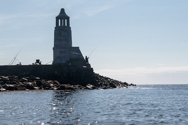
Our final obstacle was clearing the lines of the many fishermen who lined the old pier. Port Logan was originally called Port Nessock and in the 1
7th century attempts were made by the McDouall family to establish it as a ferry port for Ireland. They also built the Port Logan Inn which is sadly closed at the moment.

The quay and Port Logan Light were built in 1830 by Colonel Andrew McDouall. The light is a conical stone tower with a platform for a lantern. It is not known when it was last lit but for sometime after that it had a bell, which was rung to guide local boats back in foggy conditions. A decent road to the village was not constructed until the early 20th century, so most of the village's trade and traffic depended upon the sea. A life boat station was built at Port Logan in 1866. It closed in 1932 as the RNLI lifeboat at Portpatrick, 18km to the north west, was motorised by then. The boat house is now the village hall which you can find near the quay.

Our 24km trip from the East Tarbet round the Mull of Galloway, Crammag Head and the Mull of Logan is one of the finest paddles in Scotland. However, due to the tides it can be very serious if there is any wind.

Wednesday, June 03, 2015

The northern Sound of Islay, the sound of superlatives.

The north half of the Sound of Islay is blessed with...

 ...some amazing rock architecture on the Jura shore. We were treated to more dykes, arches,...

 ....caves and stacks.

 We were enjoying the view so much that we kept close inshore out of the main south going flow.

 The Islay shore was also not without its delights. This is the Bunnahabhain distillery.

 Meanwhile back on the Jura shore the succession of caves and...

 dykes continued.

 Then gradually the Sound narrowed and as we approached...

 ...the lighthouse at Carragh an t-Sruith the full force of the ebb tide caught us and we sped south at 13km/hr.

 The next Islay delight was the Caol Ila distillery very rapidly followed by...

...Port Askaig, where the ferries from Kintyre, Jura, Colonsay and Oban call. This evening it was only the Eilean Dhiura, the Jura ferry, that was in port.

As we reflected on what we had seen in our rapid transit of the northern Sound of Islay, we agreed that it truly was a Sound of Superlatives. As we would now be crossing from Jura to Islay I was particularly glad I had brought some Caol Ila 18y old malt for later that night. Jura malt on Jura then Islay malt on Islay, what could be better?