Showing posts with label archaeology. Show all posts

Monday, November 09, 2015

Buzzing walls and more follies at Castle Haven.

 From the beach at Barlocco we continued SE towards Kirkandrews where...

...we were passed by two small shellfish boats. This one is "Irene K" A3 and her home port is Campbeltown. They had both been launched from road trailers near Kirkandrews. They seemed a long way from home.

On the way we passed Corseyard farm with its tower and model dairy. The tower is not an old castle, it is actually a water tower and the dairy is a veritable "coo palace". The farm was built by Mr Brown of Knockbrex who had retired there from the Manchester department store of Affleck and Brown.

 The light, clouds, wind and tide were Solway paddling at its best but yet again...

 ...we made a diversion, this time into Castlehaven Bay.

At the back of the bay lies the ruins of Castle Haven which was built during the Iron Age on a rocky promontory. It is thought that over 1000 years after it was built, the Vikings refortified the site as a "borg", giving rise to the name of the local hamlet of Borgue.

 We decided to land and explore further.

 We entered via the postern gate which leads down to the sea.

Castle Haven was excavated by Mr Brown of Knockbrex and James Barbour F.S.A.Sco in 1905 and they demonstrated that it had a galleried wall structure as is shown...

...in this plan which was made at the time and published in the Journal of the Society of Antiquaries of Scotland in 1907.

After the excavations were finished Mr Brown rebuilt some of the dry stone walls by adding height onto the existing foundations.

The doubled wall structure clearly seen in this photo is very typical of the brochs and duns found in the highlands and islands of Scotland. This makes Castle Haven the most southerly broch in Scotland. Most duns are circular but Castle Haven is D shaped as its sea edge follows the line of the vertically raised rock strata at the edge of the bay.

We were not alone. The air was full of the sound of buzzing bees who were gathering nectar from the climbing plants that were gradually choking the walls of Castle Haven.

Read more on Ian's blog here.

Thursday, August 20, 2015

Seals and boats on the east coast of Inchmarnock.

As we paddled up the east coast of Inchmarnock we came to the abandoned farm at Midpark. 

On the shore below Midpark lie the sad remains of the wooden ferry MV Dhuirnish. The Dhuirnish was built as a turntable ferry in 1956 for J & A Gardner Ltd. who operated the Taynuilt/Bonawe route across Loch Etive until the service closed in 1966. In 1967 the Bute Ferry Co. Ltd. bought her, removed the turntable and fitted a bow ramp. They operated her on the Colintraive/Rhubodach crossing in the Kyles of Bute where she carried six cars at a time. During the Great Storm on the 14th January 1968 she sank at her mooring in Colintraive. She was raised and re-entered.service the following summer. She remained on the crossing until June 1971. By September 1971 she had had two further owners but it is not known how she ended up on Inchmarnock.

Further north we came to the modern farm buildings and slipway at  Northpark where the MV Marnock was moored. She was built on Bute in 1999 for the Inchmarnock Estate who...

 ...rear a pedigree herd of Highland cattle here.

It was now too hot for our dry suits so we landed near the north of Inchmarnock to disrobe.

 No sooner had we landed than an inquisitive group of about 30 common seals surrounded us.

 The water looked so inviting that I joined them for a quick swim.

This fellow was not for moving, despite the interest shown by his fellow members of  the Welcome to Inchmarnock committee.
 Feeling much cooler we  continued on our way towards...

 ...the north of the island where...

...a large rocky spit  makes a good place to land to explore the north of the island. It was near here where the stone cist containing the 4,000 year old remains of the "Queen of the Inch" were found.

Friday, April 19, 2013

Mucked about by the tidal information in the Sound of Eigg.

As Ian and I set across the Sound of Eigg towards Muck the ebb tide was already running like a river in the channel between between Eigg and Eilean Chathastail. We knew (from the Admiralty West Coast Pilot) that we would be in mid channel at the peak of a big spring tide that would be travelling at 3 knots to the SE, increasing to 4 knots as we approached the west coast of Muck. As a result we set off on a high ferry angle to the north but when we stopped in mid channel, the tide was only running at 0.6 knots!

 The marbled sky was reflected in a mirror sea. Between the two the Ardnamurchan peninsula stretched away as far as the eye could see. It was only 12 days previously that we had paddled that coast with Mike but it seemed such a long time ago.

 Gradually we cleared Eigg and the Rum Cuillin were revealed.

 In the distance Canna could be seen to the lefdt of Rum, some 30km to the NW.

 As we crossed the Sound of Eigg we slowly began to make out the Arnamurchan lighthouse at the end of the peninsula. It was silhouetted against Mull by a fog bank which was lying in the Sound of Mull.

 To port, Ben More on Mull rose above the lower Ardnamurchan Hills.

 To starboard the complete profile of Rum could be seen as we left Eigg behind.

 As we approached the west coast of Muck, we still expected to meet a significant tide but it never materialised. To the south the MV Loch Nevis was heading for the jetty at Port Mor on the south side of Muck.

 Given the highly favourable conditions (it was winter!) we decided to leave Port Mor till later and circumnavigate Muck in an anti clockwise direction..

...but first it was time to take first luncheon in the delightful bay of Camas na Cairidh, we had arrived on Muck. The machair to the right of the beach has a permanent composting toilet and in summer a yurt is erected, which can be rented from Isle of Muck farms. The tide was still ebbing and as it fell (leaving our kayaks high and dry) it revealed an old fish trap that had been built from a stone wall between rocky outcrops. Camas na Cairidh in Gaelic means "bay of the weir".

We enjoyed a superb view of Rum from our chosen luncheon spot. After warming homemade soup and bread, washed down by some 10 year old Jura or 12 year old The Singleton (I can't remember which, maybe it was both) it was time to make our way back down the rocks. There was just time to float the kayaks over the fish trap. As we waded through the pool behind the wall it was obvious that there was not a single trapped fish. Maybe it was because it was winter, maybe the seas are empty. Fish traps like this have been used for thousands of of years and in the past the seas were full of shoals of herring.

Thursday, March 28, 2013

Canna island have a future as well as a past?

Morning dawned grey and blustery on Canna. The wind had got up during the night and I had to get up to tighten the tent guy lines.

It was also cold. Our neighbours, these highland ponies, were standing back to the wind on the heavily frosted grass.

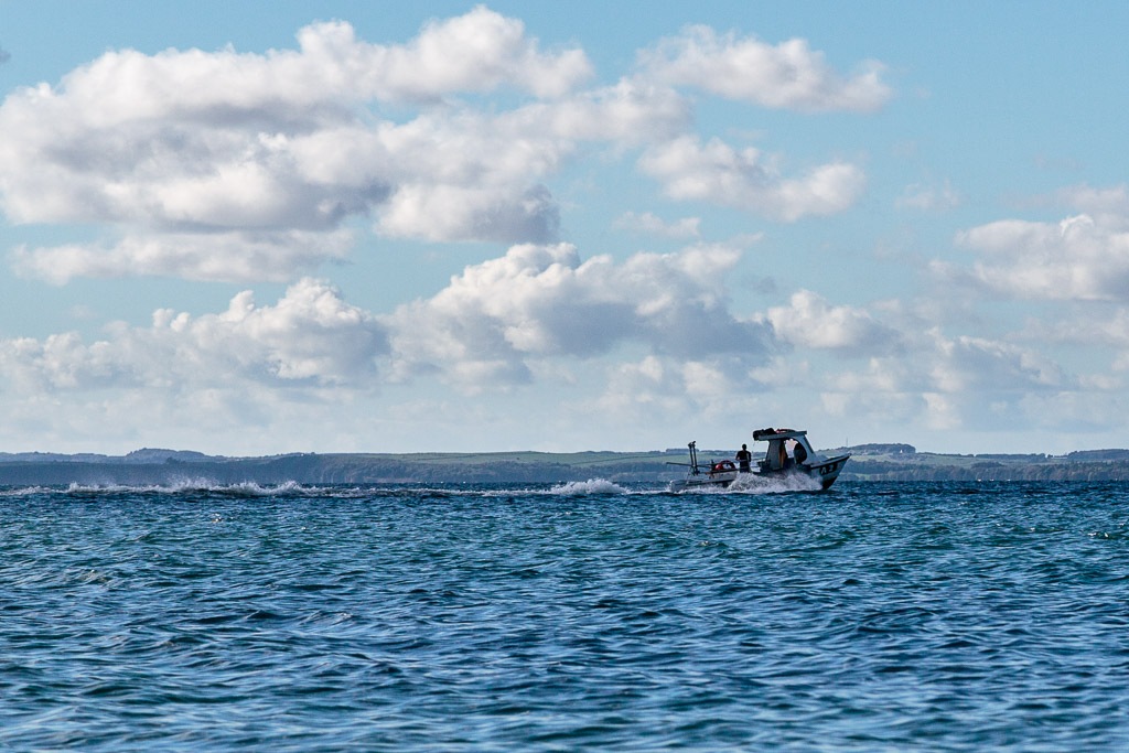
Looking over Sanday and St Edward's, the low clouds were scudding over the Rum Cuillin. Though the waters in Canna harbour were deceptively calm we were glad we did not have to consider launching of the storm beach at Guirdil on Rum. From high on Sanday, the sea to the south was rough though the F5 wind of the previous night had dropped to F4 and the forecast was for it to drop further in the afternoon. Whatever, the spring ebb tide was running straight against the southerly wind. Thoughts of paddling round Canna evaporated and we decided to go for a walk and look at the conditions again towards the end of the ebb. We set off on our walk knowing that Canna had been populated for 9,000 years. We wondered what we would find.

 Near the causeway between Canna and Sanday we found these whale vertebrae...

 ...and this old abandoned bike. I wonder if its owner has left the island?

Canna is a volcanic island and the basalt ledges of its hills rise steeply from the shore. Sitting on its elevated ledge, Kate's cottage has one of the best views on the island. We got to chatting with two builders from the mainland. They were re-roofing a cottage which had recently burned down. The previous evening they had worked late to take advantage of the settled weather. From high on the roof they had spotted us paddling into Canna Harbour and news of our arrival had spread round the island.

Near the farm buildings we discovered the reason for the midnight disturbance. It had been a rabbit cull. Since a successful operation to eradicate rats (to preserve breeding bird stocks) the rabbit population of Canna has mushroomed. They breed like...well rabbits actually.

Last year the restaurant on Canna did a nice line in rabbit pie and I am sure that was nothing to do with its recent closure.

This lovely old farm dog padded out to say hello. His hang dog appearance suggested that it would be rabbit for dinner ....again.

Next to the farm buildings is this convenient loo and shower. The shower requires a £2 coin. The National Trust for Scotland office is just across the road. We called by to present our NTS membership cards but no one was in.

 The old farm dairy has been converted into a museum displaying...

 ...dairy and...

 ...fishing implements,...

...old photos (this is Kate sitting outside her cottage) and...

...curiosities brought to Canna by the Gulf Stream.


NTS via BBC
In 2012 the farm manager found an ancient cursing stone in the ancient graveyard  above the farm. 


NTS via BBC
Amazingly it was a perfect fit for the hollow which had been worn in the base of the Celtic Cross which stands nearby.

Just to the east of the farm is the ruin of the old corn mill. It was built in the 1780's and was originally water powered but was converted to steam at a later date.

We now continued our perambulation along the front at Canna Harbour. There was no mobile phone signal on Canna so we were pleased to find...

 ...a public phone box with one of the most marvellous views in the country. Inside, it didn't smell like a city call box either.

 It was fully functioning and accepted a variety of coins. Its signal was beamed by communications dish to feed into the rest of the World's telecoms network! We phoned home for a weather forecast and to book a room in the Rum hostel for later that night.

Next we passed Canna House. It contains a large library of Gaelic books and butterflies collected by the last private owners of Canna, Dr John Lorne Campbell and his wife Margaret Fay Shaw. In 1981 the National Trust of Scotland was gifted Canna by the Campbell family.

 We continued along the shore road towards the Protestant church but our attention was...

 ...captured by a sea eagle circling over Canna harbour. When you see a sea eagle like this, there is no mistaking it for a buzzard. No doubt the sea eagle also has rabbit for first second and third luncheons.

The Protestant church has a round pencil tower which is not common in Scotland but is frequent in Ireland. It was built in 1914 in memory of Robert Thom, a Clyde shipowner who bought Canna in 1881 and who did much to improve the island until he died in 1911. It was designed by Peter Chalmers who had built a similar church in the parish of Kilmore at Dervaig on Mull.

As we approached the pier we passed this fine bull. We saw a surprising number of breeds and crosses on Canna and Sanday: Aberdeen Angus, Luing, Belted Galloway, Highland and Shorthorn.

The Canna terminal building at the pier  has a toilet and water supply.

Nearby the old terminal building has now been converted to the community shop.

Between the shop and the pier warehouse we found a number of dishes and radio links that are part of the HebNet system that brings broadband to Canna and the other Small Isles.

It was now time to think about heading back to the kayaks. This old hedge tells its own story of how windy Canna can be. However, we were grateful that the wind had delayed our departure and allowed us to explore this delightful island. Sadly the population has recently fallen to 10 after all the families with children left. I do hope others will arrive to take their place and hopefully they be able to stay. Canna has had a wonderful past, I hope it has a future.

Further reading:
The past: Canna Local History Group.
The future: Isle of Canna Community Development Trust Ltd