Showing posts with label Morvern. Show all posts

Sunday, February 15, 2015

Good companions under a Strontium blue sky.

On the third day of our winter adventure we had originally planned to drive to the head of Loch Etive. However, when we had passed the minor road end on the drive north through Glen Coe it was completely blocked by snow. The day's forecast also promised heavy snow by the afternoon. Staff in the hotel told us that the road over to the head of Loch Sunart was clear so we decided to go there!

From Ballachuilish the quickest way involves a ferry across the Corran Narrows. The ebb had already turned and was streaming past the end of the jetty. It can get very rough here with wind against tide!

 The Corran Lighthouse was built in 1860 by Thomas and David Stevenson.It was automated in 1898.

 We had a short wait as the ferry was still at the Ardgour side.

 The main ferry is the MV Corran. She was built in Hull and entered service in 2001. The relief ferry lying at mooring is the MV Maid of Glencoul. She was built in Ardrossan and entered service on the Kylesku route in 1976.  She remained there until the Kylesku bridge was built in 1984 when she was transferred here to the Corran route..

 We drove to the Strontian slipway at the head of Loch Sunart. The element strontium was discovered here.

The day already looked better than forecast. This is the view east up Glen Tarbert to the distant Glen Coe hills from which we had just driven. The summit of the glen is 117m above sea level but at the end of the last Ice Age when sea levels where higher, Loch Sunart connected to Loch Linnhe through Glen Tarbert making what is now the Morvern peninsula an island, in fact one of the Hebrides! In 2010 we paddled round Morvern, shuttling across Glen Tarbert with the cars.

We had taken the chance and texted local paddlers Simon and Liz the previous evening. Ian and I were delighted when they agreed to come. We had not all paddled together since the filming of Sea Kayak with Gordon Brown Volume 2 in 2011.

In no time we were off and right on time...

...the clouds cleared leaving a Strontium blue sky!

I love paddling on the Scottish sea lochs in the winter. Here we were surrounded by snow...

...covered mountains and we would need to paddle 46 km before we reached the open sea!

The view was equally good looking back up the loch.

The bold slopes and ridges of Garbh Bheinn 885m rose high above the head of the loch. Looking at its snowy slopes reminded me of my late friend Dr John Tolmie who died in a climbing accident at the end of March 2014. John and I had been climbing the direct start to the Great Ridge of Garbh Bheinn on 11th August 1999 when all went dark, there was a near total eclipse of the sun!

Although about half my paddling is on my own, I much prefer sharing my time outdoors with like minded folk.

I had a great chat with Simon as he has recently also bought a Canon 5D mk3. I did notice he did not produce it on the water though! Mind you his is not off to Canon UK for repairs! I hope I get it back soon!

Monday, February 28, 2011

Turning a corner on Kerrera

 We were unable to land at Gylen Castle as there was some surf breaking on the steep rocky beach so we carried on towards the south west point of Kerrera. The crashing of the waves on the dark rock of Kerrera was the only sound.

On the way, we passed interesting natural castles of conglomerate rock sitting on top of what looked like a layer of dsark basaltic rock.


The mountains of Mull came in to view as we entered the gap between Rubha nan Feundain and little Bach Island. It was the height of a large spring tide, which was travelling north through the gap at 5km/hour. All was flat as there was almost no wind but this can be a bumpy place in wind over tide conditions. It is also a good spot to see porpoises.


Turning north into the Firth of Lorn, there were no trees on this exposed side of Kerrera.  The shore alternated between steep rocks and great smooth gently sloping slabs of basalt, like natural slipways.

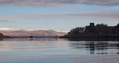
Away to the north, NLV Pole Star was working at navigation buoys on the approach to the Sound of Mull. A blink of sun lit up the snow covered hills of Morvern, contrasting with an otherwise grey sea scape.

Port Phadruaig offered a welcome break for a winter luncheon. We were surrounded by calmness and serenity

Tuesday, February 22, 2011

Better days in the Sound of Kerrera

This was the view from the sea front at Oban. In the near distance the island of Kerrera shelters Oban from the open waters of the Firth of Lorn. In the distance, the mountains of Mull were topped by a snow covered Ben More, at  966m, the highest mountain in the Inner Hebrides.

 A front was rapidly crossing the sky from the SE...

 ...as we crossed Oban Bay to Kerrera.

Ahead a monument to David Hutcheson stands above the narrow channel, which the many ferries from Oban take to the islands. Hutchieson founded a shipping company, which has now become Caledonian Macbrayne.

To the north the mountains of Morvern were stll in the sunlight but low lying Lismore was already in the shade. The Lismore ferry, MV Eigg, was entering the channel below Dunollie Castle.

 As we approached Mount Pleasant on Kerrara we came across a ruined ship which was exposed...

...by the low spring tide. She had clearly seen better days.

Saturday, February 05, 2011

Sea kayaking round Morvern

A three day, 114km paddle round the Morvern peninsula via Loch Linnhe, the Sound of Mull and Loch Sunart.

Sunset in Loch Drumbuie, an offshoot of Loch Sunart.

Tides:

Lynn of Morvern/Loch Linnhe
NE flood -0545 HW Oban ((+0110 HW Dover)
SW ebb +0025 Oban (-0505 HW Dover)

There are some peculiarities in the tides here.

A narrow stream of the flood tide entering the Lynn of Morvern hits the Morvern coast and then runs NE to Camas Chronaig where it continues to a point about 1.5km NW of Sgeir nam Tom. This stream runs at about 2.5 knots but elsewhere in the Lynn, the flood runs about one knot..

In the Lynn of Morvern, for the first 3-4 hours of a spring ebb, a SE going stream runs at about 4 knots (with a line of overfalls) from about 220m E off Rubha a'Mothair on the Morvern coast NM759411 to about 1100m NW of the SW tip of Bernera NM778392. Elsewhere in the Lynn the ebb runs about one knot.

Sound of Mull.
The flood tide goes NW and the ebb tide goes SE through the Sound.
At the NW end the flood runs for 7.5 hours and the ebb for 5 hours.
At the SW end the flood runs for 5.25 hours and the ebb runs for  7.25 hours.
The streams turn later and are stronger at the SE end.
Streams by the shores of the Sound turn 30mins earlier than in mid channel.

Throughout the Sound, by the shore,  the SE going ebb starts at approximately -0045 HW Oban (+0615 HW Dover)

The  NW going flood starts by the shore as follows working from NW to SE down the Sound:
Off Rubha nan Gall                 +0400 HW Oban (-0130 HW Dover)
Off Rubh' an t-Sean Chaisteil  +0500 HW Oban (-0030 HW Dover)
Opposite Eilean Glasa            +0600 HW Oban (+0030 HW Dover)
Off Rubha an Ridire               -0600 HW Oban (+0055 HW Dover)

At the SE of the Sound spring rates run up to 2 knots, elsewhere rates are about 1 knot with a bit more round headlands.

Loch AlineIn the entrance:
The in going flood -0525 HW Oban (+0135 HW Dover) 2.5 knots at springs.
The outgoing ebb +0040 HW Oban (-0450 HW Dover) 2.5 knots at springs

Loch Sunart
At the mouth of Loch Sunart the tide rotates through 360 degrees clockwise over 12.5 hours at generally less than one knot.
Within the loch the ingoing flood starts at -0500 HW Oban (+0200 HW Dover).
The outgoing ebb starts at +0130 HW Oban (-0400 HW Dover)
Spring rate is one knot except north of Carna and the entrances to Loch Teacuis 2.5 knots. At Laudale narrows the ingoing spring rate is 3 knots and the outgoing rate is 3.5 knots.

Day one.
Seakayakers, gypsies and bothy dwellers on Morvern.
A missed luncheon after a detour to Kingairloch?
The Boathouse, Kingairloch, Morvern
Between a rock and a hard place at Glensanda.
A bed of bluebells in the Sound of Mull.

Day two.
Trouble in the Isles
Taking the Sound of Mull to the Next World.
Mines a bacon butty in Lochaline!
A series of juxtapositions in the Sound of Mull.
Tobermory, what's the story?
Sardines and showers in Tobermory.
A barren point and fateful decision.
A banquet in Loch Drumbuie!

Day three.
Misty Morven morning.
Three jewels of Loch Sunart: Oronsay, Loch Teacuis and a buried diamond!
A post prandial doze under the ancient oak woods of Ardnamurchan.
Umbrellas in a sunny Loch Sunart.
All the essential sea kayaking elements round Morvern.


Wednesday, February 02, 2011

All the essential sea kayaking elements round Morvern.

As we approached the head of Loch Sunart we came to the Liddesdale narrows. It was spring tides and the ebb rate runs out at 3.5 knots. We arrived at slack HW and negotiated entrance to the inner loch with minimal effort.

Garbh Bheinn (Garven) 885m dominated the view to the head of the loch. It is one of the highest mountains in Ardgour which borders the Morvern peninsula to the north.

The wind freshened in the inner loch and David and I made full use of it.

We soon left Phil in our wakes but as he is such a fast paddler we felt little sympathy for his exertions.

Our voyage was nearly coming to an end and we drifted in the wind while Phil caught up. High up in the hills, a pair of golden eagles soared in the updraught from the summit crags.

 We were now nearing the end at the public slipway at Strontian. The surrounding hills contain lead and other minerals. An ore was discovered here in 1790 from which the rare element Strontium was extracted and identified in 1808. However, we were about to discover a local compound, which was present in some abundance. The heavens opened in a torrential rainstorm. Thank goodness it finished as we landed. We were able to load the trailer and run the shuttle in the dry. What a wonderful paddle the Morvern circumnavigation had proved to be. All the essential elements were there, a wild landscape, tides, mountains, castles, wild camping, great beaches, islands, hidden lochs, wildlife, waterside restaurants, picturesque villages and even hot showers! Oh and we had great company!

Tuesday, February 01, 2011

Umbrellas in a sunny Loch Sunart.

After lunch we continued westwards, deep into Loch Sunart. As we passed  Rubha Aird Earnaich we were passed...

...by the Ronja Pioneer, a live fish carrier, which was making her way up the Loch to a fish farm. Once she had loaded with fish she would make for the fish processing plant in Loch Creran.

A nice westerly breeze got up and I soon hoisted my Flat Earth sail.

Not to be outdone, David put his trusty brolly up.

It was a very pleasant cruise in the summer sunshine to another beach...

...on the Ardnamurchan shore.

We could hardly drag ourselves away from this lovely spot.

Monday, January 31, 2011

A post prandial doze under the ancient oak woods of Ardnamurchan.

From Loch Teacuis we crossed to the north shore of Loch Sunart...

...and landed at a lovely little beach under the ancient oak woods of Ardnamurchan.

David was a little too keen to land and he fell out of his cockpit, getting soaked in the process!

While David got changed, Phil and I started our luncheon. Out came oatcakes and a selection of fine mature cheeses, though we left the runnier French ones to David. All this was washed down with a variety of excellent malt whiskies.

After lunch we enjoyed a well deserved post prandial dose in the sun. We were disturbed only by the gentle lapping of the waves, some buzzing bees and David's snoring! Then the tide came in...

...reminding us we still had a fair distance to go!