Showing posts with label forts. Show all posts

Tuesday, January 02, 2018

Between a rock and a hard place on the wild west cost of Colonsay.

We set off from Oronsay up the west coast of Colonsay with Ben More on Mull away to the north.

On our previous visit in 2010 there had been a bit of a swell running and we had to keep well out beyond the skerries.

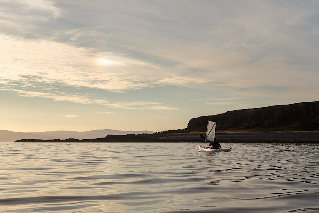
This time it was a joy to wend our way through rocky channels and past white sand beaches. Sometimes we had to reverse out of blind channels which was all part of the fun.

A week of NE winds had flattened the Atlantic swell.

Soon we were passing beneath the rocky ramparts of Dun Ghallain on the summit of which an Iron Age hill fort once stood.

Beyond Dun Ghallain we left the last of the sandy bays behind...

..and entered a more committing part of the coastline.

Far beyond these rocky reefs...

...to the west, Labrador was the next landfall.

To the east the coastline of Colonsay had become an unbroken and unyielding wall of rock. We still had a long way to go.

Read Ian's account here.

Wednesday, August 26, 2015

An atmospheric crossing to Inchmarnock with a sighting of a fire rainbow.

 At 6pm we landed for a second luncheon on a little shingle bay to the north of Garroch Head. We had paddled to this point in shorts and tee shirts. We put our salopettes on, not because it was cold (it wasn't) but because we knew we would arrive at our destination on Inchmarnock about sunset and that is when the midges come out!

As we restored energy levels with a snack and a hot drink we enjoyed the most spectacular view across to Glen Sannox on Arran.

Back on the water we had an 11km crossing to our destination of Inchmarnock. We passed Dunagoil Hill which is topped by an Iron Age hill fort.

As we crossed Scalpsie Bay clouds began to gather but the horizon to the west was clear, promising a fine sunset.

A little breeze got up as we passed...

...the fertile fields of Scalpsie farm on Bute which contrasted...

...with the rocky granite ridges of the Arran mountains on the other side of the Sound of Bute.

The sun was lowering towards the horizon as we...

...approached the south end of Inchmarnock. High in the sky we spotted cloud iridescence...

...which is not a commonly seen atmospheric effect. This is also known as a "fire rainbow" or a "rainbow cloud,"  It usually occurs in late afternoon on hot humid days.

The west coast of Bute is not easy to land on as at low tide there are a series of rocky reefs. It was near spring low water but we knew of a tiny gap in the reefs (about 8m wide). We arrived just after 8pm. This gully can be very difficult to launch from if there is any west in the wind. There are easier beaches at the south and north of the island. Although we had feared a midge attack we were pleasantly surprised that a little NW breeze stopped them flying.

Friday, July 24, 2015

Reviresco in Loch Fyne

Today Kilfinan is a remote and wild landscape but...

www.canmore.org.uk (You will need to create an account to see the mapping)

...place an archaeological map over today's map and you will discover this area was once a near metropolis. There was an ancient dun or hill fort on...

 ...the hill to the north of the beach so we decided to climb up to it...

 ...passing clumps of spotted orchids on the way.

Today the remains of the dun are largely two semi circular walls about 30m across and not much above ground level, which date from the Iron Age. They were built by Celtic people in pre-Roman times. However, the site was inhabited until late mediaeval times with a succession of wooden buildings. It became known as Caisteal Mhic Eoghainn (Mac Ewan Castle) and was the base for the Ewan of Otter clan. There were multiple, unrelated MacEwan clans in Scotland and the Ewans of Otter and their land became subsumed into the Campbell clan after their last chief, Swene Mac Ewen, died in 1493.

There is a stone memorial with...

...a brass plaque on which the clan motto "Reviresco" is displayed. This means grow green (or young) again.

Well the former Mac Ewan lands have grown green again even though that branch of the clan died out. The castle certainly had a commanding position. This is the view down Loch Fyne and this is the view...

...view up Loch Fyne. The building by the shore is a 19th century salt house. Salt was needed to preserve the prodigious numbers of herring which were once found in the loch. Other herring were preserved by smoking...the Loch Fyne kipper. One branch of my family came from here and my great great grandfather MacCallum was a herring fisherman. His sons followed him but the fish ran out and they had to fish further and further afield. My great, great uncle was washed overboard and lost at sea in the Southern Ocean.

Loch Fyne herring drifters by William Lionel Wyllie (1851-1931)

The traditional Loch Fyne herring fishermen used sail and oar powered boats and drift nets but the introduction in the mid 19th century of steam trawlers (based in Tarbert and Campbeltown) increased the overfishing and there was bitter rivalry between the two types of fishermen. Violence ensued and the Royal Navy had to station HMS Porcupine (a 3 gun wooden steamer built in 1844) on the loch to keep the peace. My great grandfather gave up the sea and moved to Glasgow where he got a job with the Caledonian Railway company.

Sunday, July 19, 2015

Gob smacked by the fine scenery at the mouth of Loch Fyne.

NW of Portavadie we came to a delightful number of islands. This isle is Eilean a' Bhuic. It lies off the beautiful...


...Glenan Bay which is backed by...


...verdant wooded hills above which a pair of eagles were gliding on a thermal.


Further north we came to all that remains of a great Iron Age dun called Caisteal Aoidhe which sits atop its little tidal island. Most people would not look twice at it but once you have an eye for such relics they are easy to spot.

Another isle, Eilean Buidhe, is surrounded by a maze of...

...low lying reefs and submerged skerries in which a colony of seals can be found.

As we paddled deeper into the confines of Loch Fyne we left the open waters of the Sound of Bute and the mountains of Arran far behind. We came to many bays and inlets. Loch Fyne is a great location for yacht racing and...

...in one remote bay we came across this racing yacht with an impossibly tall mast.

Between the bays the coast of Loch Fyne is characterised by bold rocky headlands that plunge steeply into the sea. Loch Fyne is the largest sea Loch in Scotland and was cut by a huge glacier. Just off this headland south of Auchalick Bay, the loch is 150m deep.

Auchalick Bay proved to be an ideal stop for third luncheon and a snooze in the sun...

...on the rocks above the sands. The sea pinks were in full flower.

  Further north we passed further rocky headlands such as this one at...

 ...the wonderfully named Gob a' Bharra.

After a long and tiring, day involving three luncheons, we made landfall for a camp at Kilfinan Bay. The site was sheltered from the northerly wind by a headland and we were soon perspiring. While the others set up their tents, I went for a quick swim which certainly cooled me down.


Thursday, June 25, 2015

Carried away by the tide in the Sound of Jura.

When we left Lowlandman's Bay on the east coast of Jura, the flood tide was already running north through the Sound of Jura and would be our ticket home to Carsaig Bay on the mainland. We took a last look to the SE at the long peninsula of  Kintyre, which culminated in the Mull of Kintyre (at the extreme right of this photo) some 66km to the south.. The rocky mountains of Arran rose above the relatively low hulls of Kintyre. In the sky, streaks of gathering cirrus clouds fore told the wind that would arrive the next day.

As we travelled north, the view of the Paps of Jura became less anatomically correct with three (or even four) heaving above the horizon.

We passed the site of another Iron Age dun at the NE end of the peninsula, which nearly encloses Lowlandman's Bay.

To the NE, the Jura coast stretched away in a long succession of low headlands as far as the eye could see.

We followed the coast until we saw the wooded peninsula that marks the south side of Tarbert Bay where we had made landfall on Jura two nights previously. Then we struck out into the middle of the Sound of Jura to catch the full force of the tide.

 It was sad to be leaving Jura after such a rewarding but brief visit and once...

...the tide in the Sound caught us, it carried us quickly away.