Showing posts with label piers. Show all posts

Saturday, February 18, 2017

A pier with the site of a Viking slaying at one end and a pie shop at the other.

Leaving St. Finan's Isle we entered the outer, lowland section of Loch Shiel.

At  Dalelia we spotted a tall stone cross, almost hidden by the trees. It is a war memorial erected by Dalelia's then owner, Lord Howard of Glossop, to his son. Lt. Philip Howard. Philip was only 23 years old when he died in action in France in 1918, near the end of WW1. His family's wealth could not protect him from the ultimate sacrifice and waste of war.


 At first the loch was still narrow and we paddled close to shore but...

...then the loch opened out again as we left the mountains behind.

 A brisk tailwind meant we made excellent progress...

 ...and the combination of sun and a following wind...

 ...brought great smiles to our faces.

Ahead we saw the pier at Acharacle. It was time for a stop. Acharacle is a corruption of Àth Tharracail which is Gaelic for "Torquil's ford". At the end of the Viking occupation of Scotland Torquil was the leader of a band of Vikings who fled here pursued by Somerled the Lord of the Isles. Unfortunately the water was too deep to cross and they made a final stand but all were slain.

 We pulled the boats up onto the grass beside the slipway and left them in the shade of a...

 ...magnificent rowan tree. Then we proceeded...

...along the pier to...

 ...the pie shop where we enjoyed hot soup and pies before...

...slowly returning to the loch side where boats were nodding gently at their moorings, where once a Viking band was slain..

Fr the full stereo vision experience read Ian's account here..

Saturday, July 02, 2016

Hard rock, hard saints, rotting corpses, banished cows (and women) at the Ross of Mull.

On our return from Market Bay on the north coast of the Ross of Mull the wind got up and in truth it was a bit of hard work to get back into the shelter of...

 ...the islands at the north end of the Sound of Iona. From here we entered...

 ...the Bull's Hole a safe but tidal anchorage between the Ross of Mull on the left and Eilean nam Ban on the right. Today the Bull's Hole is the anchorage for many of the tour boats which operate from the Sound of Mull to Staffa and the Treshnish Isles.

Donald had waited for us on a little beach at the  NE of the rocky Eilean nam Ban. Although St. Columba was beatified by the church he was not exactly a saint in terms of modern understanding of the word. Not only had he caused the death of death of 3,000 people (men)  after starting the Battle of Cúl Dreimhne he fled to Iona then banished all cows (and women) to this barren and rocky isle.

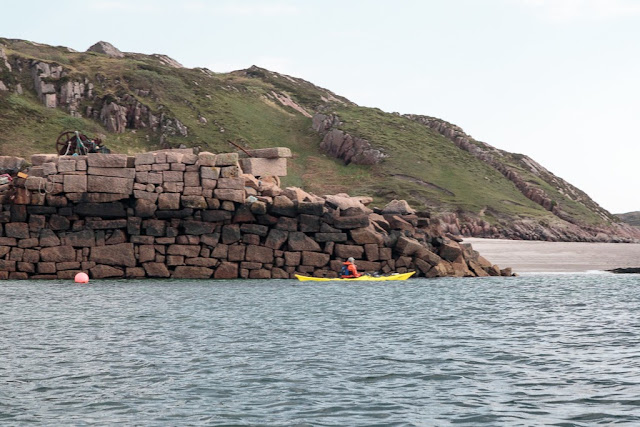
The Bull's Hole can be quite a brisk paddle if the tide is running strongly but we only had a slight current to contend with and soon arrived at Tormore Pier at the south end of the Hole. It was here that blocks of pink Ross of Mull granite were exported to build parts of Iona Abbey, University of Glasgow, Ardnamurchan, Heskier. Skerryvore and Dubh Artach lighthouses, the Jamaica and Kirklee bridges in Glasgow and Blackfriars, Holburn Viaduct and Westminster bridges in London, docks in Glasgow Liverpool and New York not to mention buildings and monuments further afield in New Zealand and USA. A tramway leads up from the pier to the quarry at Torr Mor.

Above Alan's head at the base of some low cliffs you can see the dark opening of Uamh nan Marbh, the cave of the dead, where coffins were left before final transport to Iona for burial. The cave is really only big enough for one coffin and has a ventilation window at the back.This was probably quite important as corpses were brought here from all over Scotland and some would undoubtedly be in an advanced state of decomposition by the time they got here.

 Due to the fresh N wind and the building N going tide in the Sound of Iona we decided to leave exploring the Abbey until the following morning but Donald nipped across the Sound of Iona in his F-RIB as we...

 ...continued south to Fionnphort and the ferry terminal. The ferry MV Loch Buie was just about to leave and had already lifted its ramp when two young women tottering on high heels and pulling heavy suitcases on wheels made their way slowly down the slip. The captain clearly thought more of women than St. Columba and lowered the ramp while they sauntered (rather too slowly I thought) down the slipway. Ian gave the captain a quick call on the VHF and he replied that we had plenty of time to cross in front of him before he left.

From Fionnphort  to Fidden the coastline consists of a delightful series of pink granite tors and offshore islands and reefs. Alan enjoyed a try of my Greenland paddle and...

...before long we could see Fidden farm at the end of our long day.

Sunday, November 15, 2015

A shadow at dawn on Little Ross Island.

 We rose before dawn on Little Ross Island. We had camped on the path between the...

 ...crumbling slipway on the west and the...

 ...crumbled east quay, which lies beyond the far tent. The stone store was built for the supplies landed for the lighthouse.

 We wasted no time in getting the kayaks loaded and...

 ...preparing breakfast which we ate as the...

 ...sun broke the horizon. We knew we would have a long hard day and would be lucky to arrive at our next camp by sunset but first we wanted to...

...explore Little Ross Island in daylight. As we set off ,the shadow of the lighthouse was cast upon the sunlit slopes of the Ree of Ross on the far side of The Sound. Maybe this his where Mr Brown of Knockbrex got the idea for his pillars?

Sunday, November 08, 2015

The follies of Knockbrex and a convenient cave.

 From the three priapic pillars of Knockbrex we set off along the...

...rocky Solway coast until we arrived...

 ...at a delightful stretch of shell sand backed by a castellated folly.

We stopped for a second time to...

 ...explore what was an early 20th century bathing house. A folly in Galloway is known as a "coo (cow) palace" and this was a good example with...

 ...the remains of a stone and iron pier extending into the Solway.

 The folly has a beautiful view over to Barlocco Isle and the distant mountains of the Isle of Man. It was built by James Brown who was a wealthy Manchester merchant. He retired to nearby Knockbrex House  in 1895. Until he died in 1920, he spent much of his fortune building a series of gardens, walls, buildings and follies around the estate.

The jagged reefs of this coastline were the scene of many shipwrecks but it was also used by smugglers who would have found...

...this to be a most convenient cave for concealing contraband from the customs cutters. For many years the entrance was concealed by a thick growth of ivy but a storm a few years ago tore it away.


The cave has a dry level floor and would make excellent shelter in a storm.

This part of the Solway was a lawless place not only frequented by smugglers but also by pirates. We decided to reenact walking the plank. Was this to be a folly on Ian's part?

Time was pressing on and the ebb tide was now in full swing so we made our way back to the boats to continue our exploration of the Solway by sea kayak.

Tuesday, April 28, 2015

Turning full circle at Smirisary with the sun on our backs all day.

 We continued north past the...

 ...ancient stratified rocks of Smirisary.

 We reached the most northerly point of our day at Rubha Ghead a' Leighe where...

 ...we turned towards the east, into the Sound of Arisaig. The distant bulk of mighty Roshven was turning pink with alpenglow.

The many crofts of Smirisary were sited on infertile land with little access to the sea. The inhabitants were cleared here by former estate owners who wanted the better land for sheep and deer. Although still remote by today's standards, Smirisary was at one time almost inaccessible. The road into Glenuig from the Fort William/Mallaig road was not built until 1966 and even then it was still a footpath from Glenuig to Smirisary! "The Spade among the Rushes" by Margaret Leigh describes living as a crofter in Smirisary in the 1940's and makes an insightful and enjoyable read.

 During our long day of travelling west, north and then then east, the sun had followed behind us so we enjoyed...

 ...the constant views like this one of Samalaman Island and Samalaman Bay without being dazzled.

The big house at Samalaman makes quite a contrast with the crofts.

 Gulls were pairing up for nesting on Samalaman Island as we passed between it and...

 ...the entrance to the sheltered bay.

 At the final wooded headland we had one final turn to make. For a brief time...

 ...we turned south into Glenuig Bay, past the public jetty, to our final destination...

...the Glenuig Inn. We arrived at just after sunset at high water so did not even have to carry the boats very far. We intended to stay the night and the first thing we did was to have a hot shower in our dry suits in Steve's excellent sea kayakers' washing and drying facilities!

After changing we made our way into the inn where we received a warm welcome and ordered pints of real frothy sports recovery drinks and bowls of prawn tails in garlic butter! From our early start at our camp site on the shore of Loch Shiel it had been an incredible day. One which we each agreed was one of the best sea kayaking days ever but our journey round the lands of Moidart was not over yet!