Showing posts with label Firth of Lorn. Show all posts

Saturday, May 16, 2015

The shortest sea kayak camping trip ever? Just 7km!

Mike and I  found ourselves with a spare evening in the Oban area, I was due to meet Tony the next day for a trip over to Jura. So we went to Ellenabeich on Seil and set off to arrive at a great wee camp site before sunset.

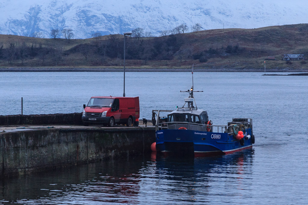
 All was quiet when we set off from the harbour which is sheltered by Easdale island.

The calm did not last long. As we went round the outside of Easdale harbour it was three hours after slack water. We had some fun as the full force of a spring ebb was running against the wind and swell. There are no photos on the next short leg as my attention was taken by the sea conditions. As I headed for our intended landing spot the skerries were a mass of breaking water. I could sense Mike hanging back as I went into a dog leg between two skerries. I shouted it would be calm inside...

 ...and so it proved to be. We slid into an almost mirror calm harbour of a former slate quarry.

You can see why these are called The Slate Islands. We landed on a slate beach. The crystals are iron pyrites or fool's gold. When you break a slate open they are bright gold but soon turn to rust.

As soon as I got my tent up and got changed, I went off looking for something...

...and I found it! In October 2004, when I last camped here, I hid a stash of logs I had bought in a garage in a little cave. Nearly eleven years later they were well seasoned and bone dry! We would have a fire later!

We now only had seconds to go before the sunset. Mike was able to run up the hill and catch it but I was a bit slower as my knees were a bit sore after the long drive and the rushing about.

Although I very nearly missed the sunset I was pretty pleased to just catch the sun as it slipped behind Mull.

From the ridge above our camp we had a great view of the Garvellachs and Mull .

We could just make out Colonsay on the horizon to the left of the Garvellachs.

The coast of Luing stretched away past Fladda lighthouse, Scarba and Jura to Islay some 50km away. The inlet to the left is the Cuan Sound and the tide rored through it all night!

 We stayed on the ridge as the sky above Mull turned to gold.
 
 As night fell we got the fire going and baked potatoes in the embers of my rediscovered logs as Venus shone brightly in the cold sky above.

The following morning dawned clear and bright, the tide was ebbing fast. As the old slate harbour empties completely, we wasted no time and were...

 ...soon packed and on the water for our...

...short return to Ellenabeich. Mike and I both agreed that though this may well hold the record as the shortest ever sea kayak camping trip, it had also been one of the best!

Thursday, February 26, 2015

All aglow in the Lynn of Lorn.

Our winter adventure was now nearing its end. The sun was well down as we continued our exploration of the sheltered waters of Port Ramsay at the NE end of Lismore.

 We went round the south end of Eilean Ramsay before...

 ...paddling through the skerries on its west coast on our way back to the NE point of Lismore.

Then we were in for a treat. The flood tide was  now running up the Lynn of Lorn and was being compressed in the narrow gap between Lismore and the Appin mainland where it was running at 2.5 knots. We took advantage of an eddy to carry us past the Lismore ferry pier then...

 ...down the long gravel spit to its south before enjoying a brisk ferry glide across to the island in mid channel. It certainly warmed us up!

East of the island, the tide dropped to 1.5 knots and I was able to get my camera out to capture this wonderful sunset glow in the sky above the Lynn of Lorn. Beyond the dark outline of Eilean Dubh, the distant Garvellachs were floating above the horizon.

We landed at Port Appin just after sunset and packed our things away in the gathering darkness and cold as a creel boat off loaded its catch. Although our winter trip was now over, we were glowing with memories.

The last day of our four day winter trip was a short 18 kilometres but it had been packed with interest: castles, history, industrial archaeology, natural history, islands, strong tides, paddle sailing, sunset, and good company, who could ask for more? If you look at the GPS track you can see where I stopped to take the photo of the sunset just before  the finish at Port Appin. The tide certainly didn't waste any time in carrying me NE!

Wednesday, February 25, 2015

Heavy industry and some calcareous considerations on Lismore, Loch Linnhe.

From Eilean nan Caorach we paddled to the NE point of Lismore at Rubh' Aird Ghainimh and entered the sheltered waters....

 ...of Port Ramsay as...

...the "Lady Fiona" (fast ferry for the workforce of Glensanda superquarry) slowed down to pass us then sped off across Loch Linnhe.

Lismore means "big garden" and it is a very fertile island due to the prescence of limestone. At the NE end it plunges steeply into the sea. This sea urchin had been left exposed by low tide. Earlier we had seen another carried off in the large beak of a great black backed gull. Its spiny calcareous shell would be no protection from being dropped onto rocks by a flying gull.

Above the tide line, the calcareous rock itself was interesting here. This is limestone tufa, a type of calcareous sinter. It is formed as carbonate minerals precipitate from water oozing out of the limestone rocks above.

We now paddled deep into the natural harbour of Port Ramsay and approached...

...the eponymous village, which is the main settlement on Lismore. It was established in the early 19th century to house workers for the lime kiln industry.

As we drifted between the islands that shelter Port Ramsay we spotted numerous divers.

By now it was well past time for second luncheon so we landed on Eilean Trenach where...

...enjoyed a wonderful view to the north while enjoying home made soup and a dram of 15y old Dalmore.

The air was wonderfully clear the snow covered Appin hills stood out against the wintry sky. It was hard to imagine that, for well over a century, this landscape would have been hidden behind black smoke and fumes belching from the numerous lime kilns scattered round the islands. Of course there is still heavy industry here. One of the World's biggest quarries, Glensanda, is just 6km away on the other side of Loch Linnhe. We visited Glensanda in 2010.

Wednesday, February 05, 2014

Remember to take your tide tables to Seil.

Gradually we crossed the Firth of Lorn and the Isle of Seil began to dominate the view ahead.  However, we were so enjoying the fine weather that we had not...

 ...been keeping a close enough eye on our transits and the big spring ebb carried us down the Firth of Lorn past the island of Easdale. It was now approaching midday and the forecast SSE F4 to F5 wind arrived. By now we were in the lee of the former slate worker's cottages on Easdale. The wind whipped across the flat water in Easdale Sound but we were not concerned. However, out in the open Firth of Lorn a steep wind against tide sea soon  built up. Our early start had been well worthwhile.

All too soon we landed on a slate beach at Ellenabeich and loaded the boats onto the trailer for the journey home. This corner is a recognised launch spot but whatever you do don't leave your car here or drive it on the grass. This will upset one of the local residents. There is plenty of parking just a short walk away.

This is a great part of the world for an overnight trip but it is equally suited to everything from day to multi week trips. The strong tides and variety of islands in the area (not to mention large car park) makes Ellenabeich on Seil one of premier sea kayaking embarkation points on the West Coast. Just don't forget your timetables.

We used the height of the spring ebb tide to take us SW down to the Garvellachs. We then ferry glided across the NE going flood, using it to carry us NNW to Loch Buie on Mull. The following morning we left Mull on the last of the NE going flood but were caught by an increasing SW going ebb as we approached Seil, which explains our "S" shaped course. In the area HW is morning and evenings at springs and midday and midnight at neaps.

Tuesday, February 04, 2014

Gentle undulations on an otherwise empty sea.

 In the middle of the Firth of Lorn the wind had dropped to nothing as we paddled east towards Seil. Away to the south lay...

 ...the Garvellachs upon which we had stood the previous day. Behind them the brooding bulk of Scarba lay between the two tide races of Corryvreckan and Grey Dogs.

The Isle of Seil lay before us with the mountains of the mainland rising beyond, some 41 kilometers distant.

As we admired the undulating ridge of Ben Cruachan (1126m), we were paddling over gentle undulations on an otherwise empty sea.

Monday, February 03, 2014

Not properly attired for the Firth of Lorn.


 As we paddled away from the cliffs of Mull's Laggan peninsula the wind gradually dropped. We had expected a rough crossing and so we had put our cags on. The salty sweat from our foreheads stung our eyes and it became difficult to see in the glare of the midsummer sun.

 As the heat of the day built on the long crossing, it was therefore with great relief...

 ...that we took off our cags and stashed them away.

As the sun rose high in the sky and the cliffs slipped away behind us, a glassy calm settled on the Firth of Lorn. there was not a breath of wind and not a sound disturbed the still air.

Friday, January 31, 2014

Gusty headwinds under the cliffs of Mull's Laggan Peninsula.

 We awoke on the shores of  Loch Buie on Mull to find that a light SE wind was sufficient to keep....

 ... the morning midges at bay. The weather forecast was for light and variable winds increasing to F4 to F5 S-SE winds by midday. Given that it was midsummer and sunny there was also the possibility of afternoon thermal winds increasing the wind even more. So we decided to make an early start and were on the water by 07:30.

We were in the lee of the Laggan peninsula and at first there was very little wind but a fair amount of swell was wrapping round Rubha na Faoilinn at the entrance to Loch Buie.

On rounding the point we were hit by a very gusty head wind from the SE which...

...was shrieking and swirling along the steep cliffs below...

...the steep cliffs of An Garradh. The gusts were so strong that they were lifting waterspouts off the surface of the sea and threatened to snatch the paddles out of our hands. As we put our heads down, our forward progress was slowed to less than 1km/hr.

The early morning sun was reflecting on the sea in front of us, which made it difficult to see the approaching gusts. The gusts were so unpredictable and ferocious that I did not risk using my Canon DSLR and so these photos were all taken with a little 2mp waterproof camera.

After an exhausting 4km paddle straight into the teeth of the wind, it was a relief to shelter in the lee of Frank Lockwood's Island. We were rewarded by a magnificent view of the cliffs on Mull's remote Laggan peninsula, which stretched away to the NE. Lying in the shelter of the little island we discussed our options. We wondered if the forecast F4-F5 winds had arrived early. If so they would make our 12 km open crossing of the Firth of Lorn rather unpleasant as they would be blowing over and against a big spring ebb tide. We battened down the hatches.... .