Showing posts with label Seil. Show all posts

Saturday, May 16, 2015

The shortest sea kayak camping trip ever? Just 7km!

Mike and I  found ourselves with a spare evening in the Oban area, I was due to meet Tony the next day for a trip over to Jura. So we went to Ellenabeich on Seil and set off to arrive at a great wee camp site before sunset.

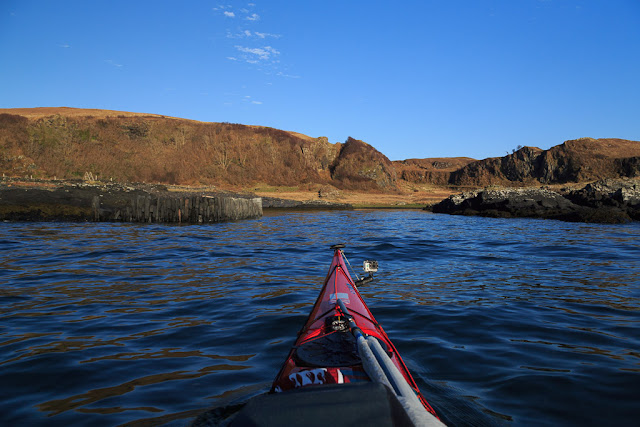
 All was quiet when we set off from the harbour which is sheltered by Easdale island.

The calm did not last long. As we went round the outside of Easdale harbour it was three hours after slack water. We had some fun as the full force of a spring ebb was running against the wind and swell. There are no photos on the next short leg as my attention was taken by the sea conditions. As I headed for our intended landing spot the skerries were a mass of breaking water. I could sense Mike hanging back as I went into a dog leg between two skerries. I shouted it would be calm inside...

 ...and so it proved to be. We slid into an almost mirror calm harbour of a former slate quarry.

You can see why these are called The Slate Islands. We landed on a slate beach. The crystals are iron pyrites or fool's gold. When you break a slate open they are bright gold but soon turn to rust.

As soon as I got my tent up and got changed, I went off looking for something...

...and I found it! In October 2004, when I last camped here, I hid a stash of logs I had bought in a garage in a little cave. Nearly eleven years later they were well seasoned and bone dry! We would have a fire later!

We now only had seconds to go before the sunset. Mike was able to run up the hill and catch it but I was a bit slower as my knees were a bit sore after the long drive and the rushing about.

Although I very nearly missed the sunset I was pretty pleased to just catch the sun as it slipped behind Mull.

From the ridge above our camp we had a great view of the Garvellachs and Mull .

We could just make out Colonsay on the horizon to the left of the Garvellachs.

The coast of Luing stretched away past Fladda lighthouse, Scarba and Jura to Islay some 50km away. The inlet to the left is the Cuan Sound and the tide rored through it all night!

 We stayed on the ridge as the sky above Mull turned to gold.
 
 As night fell we got the fire going and baked potatoes in the embers of my rediscovered logs as Venus shone brightly in the cold sky above.

The following morning dawned clear and bright, the tide was ebbing fast. As the old slate harbour empties completely, we wasted no time and were...

 ...soon packed and on the water for our...

...short return to Ellenabeich. Mike and I both agreed that though this may well hold the record as the shortest ever sea kayak camping trip, it had also been one of the best!

Wednesday, February 05, 2014

Remember to take your tide tables to Seil.

Gradually we crossed the Firth of Lorn and the Isle of Seil began to dominate the view ahead.  However, we were so enjoying the fine weather that we had not...

 ...been keeping a close enough eye on our transits and the big spring ebb carried us down the Firth of Lorn past the island of Easdale. It was now approaching midday and the forecast SSE F4 to F5 wind arrived. By now we were in the lee of the former slate worker's cottages on Easdale. The wind whipped across the flat water in Easdale Sound but we were not concerned. However, out in the open Firth of Lorn a steep wind against tide sea soon  built up. Our early start had been well worthwhile.

All too soon we landed on a slate beach at Ellenabeich and loaded the boats onto the trailer for the journey home. This corner is a recognised launch spot but whatever you do don't leave your car here or drive it on the grass. This will upset one of the local residents. There is plenty of parking just a short walk away.

This is a great part of the world for an overnight trip but it is equally suited to everything from day to multi week trips. The strong tides and variety of islands in the area (not to mention large car park) makes Ellenabeich on Seil one of premier sea kayaking embarkation points on the West Coast. Just don't forget your timetables.

We used the height of the spring ebb tide to take us SW down to the Garvellachs. We then ferry glided across the NE going flood, using it to carry us NNW to Loch Buie on Mull. The following morning we left Mull on the last of the NE going flood but were caught by an increasing SW going ebb as we approached Seil, which explains our "S" shaped course. In the area HW is morning and evenings at springs and midday and midnight at neaps.

Thursday, January 16, 2014

From the Slate Islands to the Isles of the Sea.

It was midsummer several years ago, when Jennifer, Phil and I met below the whitewashed cottages that fringe at the little harbour at Ellenabeich on the Isle of Seil.

The harbour  was built to service the slate industry, which once flourished in these islands. They were known as the Slate Islands or the "Islands that roofed the World".

We were sweating in the hot sun by the time we launched below the cliffs of Dun Mor that back the harbour. So it was with great feelings of lightness and anticipation...

...that we glided over the cool sea to the skerries of Easdale.

Beyond the swell breaking on the reefs of the Slate Islands lay our destination, the Garvellachs...the Isles of the Sea.

Tuesday, September 06, 2011

Seil Sound under threat.

We visit Seil and its Sound regularly. We have been three times in the last year. My first visit by kayak and sailing dinghy was in July 1967, so I do like the area a great deal.

This view is towards the NE from Bagh Lachlainn at the north end of the island of Luing.

On the east side of the Sound (on the right horizon) lies...

...the delightful little bay of Port na Morachd which is just to the north of...

 this band of trees and under the steep slopes of Dun Crutagain (273m).

I was dismayed when I learned from the Save Seil Sound campaign that a Polish company plans to build a huge fish farm consisting of 12 cages, each 32m  in diameter, covering an area of 4 football pitches on this very spot. There will also be a service barge 18m by 26m with a two storey building on top. When it is running it will contain 450,000 adult salmon and you can imagine the effect of the pollution and parasites which a farm of this size will release. Seil Sound is very enclosed and shallow and I am sure that the wild life will suffer even more than the view.

Speaking of the view, this is looking SSW down the Sound towards Torsa, Luing and Scarba.

This is looking NW towards Seil with the mountains of Mull behind. We have seen porpoises, seals, otters, herons, cormorants, shags, terns, guillemots, black guillemots, razorbills, oyster catchers, eider duck, geese, swans, eagles, buzzards and hen harriers here. I will be very sorry if this wild place is industrialised in this way.

If you wish to make a comment, either for  or against the proposed fish farm, to the Argyll and Bute planners you can do so here.

If you support the campaign to save Seil Sound, you can join them on Facebook here.

Sunday, February 13, 2011

Sea kayaking round Luing.

 Circumnavigation of Luing: a 32km day trip from Ellenabeich, Seil, January 2011.


18.2 km/hr in the Cuan Sound, between Luing and Seil.

The tide times in the Cuan Sound and the Grey Dogs (also the Corryvreckan) are influenced by low pressure Atlantic systems and can be difficult to predict within an hour's accuracy. However, in a high pressure system they are much more predictable, though times vary between springs and neaps.

The north and west going flood begins +0430 HW Oban (-0100 HW Dover)  at 7 to 8 knots at springs and +0515 HW Oban (-0015 HW Dover) at neaps.

The south and east going ebb begins -0145 HW Oban (+0515 HW Dover) up to 8 knots at springs and -0100 HW Oban (+0600 HW Dover) at neaps.

The time changes by 6.5 minutes each day between springs and neaps. The constant between HW Dover and HW Oban does vary, so most accurate times are calculated by using HW Oban times (though not if you have calculated HW Oban indirectly from HW Dover!!).

On the day, HW Oban was at 0749 and 2011 and it was 1 day after springs so the time had drifted 6.5 minutes from the spring time. So the north and west going flood started about 0749 + 0436 = 1225 and the south and east going ebb started at 0749 - 0139 = 0610. We were on the water by 0955.


The Grey Dogs were salivating, while awaiting our arrival.


Ferry gliding in the Grey Dogs.


A sting in the tail of the Sound of Shuna.


Toberonochy, what's the story?


The stirring sound of moving water in the Cuan Sound.


Darkness stole across the Isles of the Sea.


Saturday, February 12, 2011

Darkness stole across the Isles of the Sea.

The entrance of the Cuan Sound can be a bit bouncy as the flood tide jets out into the Firth of Lorn...

... but it soon flattened off as paddled up the west coast of Seil.

The sun was setting in the SW as we approached the village of Ellenabeich.

As we drifted north with the now gentle tide we looked back to Scarba, Lunga, the Black Islands and the Garvellachs.

The sun dipped behind the Garvellachs and darkness stole across the Isles of the Sea. Our voyage amongst the islands and the tides that rush between them was over.

Friday, February 11, 2011

The stirring sound of moving water in the Cuan Sound.

It was now three hours after the start of the spring flood tide and our course took us in a dog leg, round the north end of Torsa and into the Cuan Sound. We had told Phil that there might be a little slope (several feet or so) but there would not be any whirlpools (Phil has an unaccountable aversion to whirlpools).

At the entrance of the Sound, the skerry of An Cleiteadh, constricts and dams the waters before they accelerate and turn through a right angle into the main body of the Sound. I knew that Phil had got suspicious, when he asked "What's that roaring noise?" Jim explained it was just a little stirring of the waters and described paddling down "the V" to him as we all slid down the slope. As I was paddling quite hard to get my sinking stern out of a big rotating hole in the water, I overheard Phil say to Jennifer, "He can't fool me, that's a ****ing whirlpool!*"

Then we shot through the body of the Sound.

I know the photos look a bit tame, I obviously didn't risk my camera on the bouncy, swirly bits but the GPS showed we hit 18.2km/hr...

...just to the north of An Cleiteadh rock!

There was some more excitement at the exit of the Sound and we took a slight detour to savour some little overfalls. Both Jim and I got our faces wet.

*swirling whirlpool!

Sunday, February 06, 2011

The Grey Dogs were salivating, while awaiting our arrival.

It was a cold, grey, January day but the promise of spring tides took us to Ellenabeich on the Island of Seil. David, Jennifer, Jim, Phil and I launched our kayaks in the little harbour of this former slate mining centre.

The harbour at Ellenabeich is sheltered from the open Firth of Lorn by the island of Easdale which lies just over 100m across the Sound of Easdale. A little passenger ferry runs back and forwards for most of the day to serve the community that has grown up in the former quarrymens' cottages on the island.

Setting off down the Sound of Luing with Luing and Scarba on the horizon.

Our plan was to circumnavigate Luing using the ebb in the Sound of Luing then the flood in the Cuan Sound. It was spring tides with HW Oban at 0749 and 2011. Peak rate in the channels would be 9knots. So I calculated that in the significant channels the ebb (S and E going) would run until 1225 when the flood would start. Sunset was 1633. I wanted to get to the Grey Dogs for about 1130, which would allow for an hour's play before slack water. Because we were finishing in the Cuan Sound, I wanted to get back to Seil by dark (I also wanted to hit the Cuan at full belt at about 1530!) That meant leaving Seil at 1000. David and Phil arrived at my house in Glasgow bang on time at 0600 and we were on the water by 1000 sharp!


 It did not take long to reach the tiny island of Fladda, which sits right in the middle of the fairway of the Sound of Luing. Beyond Fladda, the bold outline of Scarba rose above Lunga and distant Jura.

Fladda lighthouse was built in 1860 by David and Thomas Stevenson. The wall surrounding the raised part of the island was built to give shelter to the keepers' vegetable garden!

We hardly had time to look at Fladda before the tides whisked us away at  15km/hr!

We continued at this rate down the Sound of Luing, towards the great bulk of Scarba under which the Grey Dogs were salivating, while awaiting our arrival......!