Showing posts with label folklore. Show all posts

Wednesday, January 03, 2018

Breaking the spell of the Cailleach Uragaig on the NW coast of Colonsay.

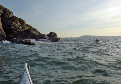
The only break in the rocky ramparts of the NW coast of Colonsay was at Port Ban but reefs at low tide prevent landing much of the time. Even if the swell allowed you land at HW, you would find yourself trapped by the surrounding cliffs. So we paddled on without a sideways glance.

W reserved our sidways glances for the amazing bird colonies which cover these inaccessible cliffs.

Predominantly the species were razorbills and guillemots but there were also plenty of puffins. The air above us was full of whirring wings and...

 ...the sea was covered with rafts of resting birds. Fulmars and kittiwakes were also nesting at the edges of the main colonies and the mournful but atmospheric cries of the kittiwakes echoed round the geos.

The incessant noise of the birds and the smell of the white guano deposits which contrasted with the yellow lichen on the steeper parts of the cliffs left us in no doubt that we were in the environment of the birds. There was no sign of the hand of man, not even a lobster pot.

 We were dwarfed by the scale of the place. It was very reminiscent of paddling round St Kilda. I have been on two boat supported paddling trips there and Ian has been on one. In many ways this was a more intense and close up experience as we had got here from the mainland (some 70km in our wakes) by ourselves.

We were well tired by the time we approached the bold headland of Cailleach Uragaig. Atop the headland rests the grim, grey visage of the Cailleach herself. The Cailleach Uragaig (The Hag of Colonsay) is a Celtic Goddess who has powers to shape shift herself so that she can appear as a hag, a mother or a virgin. She is a winter spirit who ushers in winter by washing her plaid in the Corryvreckan and she can often keep the arrival of spring at bay. On Colonsay she kept a young girl captive to steal her youth. She hid herself from the girl's angry lover by transforming herself into this rocky headland.

Tired sea kayakers always hope that the sands of Kiloran Bay will be just round the corner from the hag but they...
..are still  2km further on.

David was now getting very tired. It was 7pm and we had been paddling all day. David is well into his eighth decade and it is quite remarkable that he still has the stamina for such long trips.  He thought I was being very gentlemanly waiting behind with him but in truth I was not well and having difficulty keeping up with him!

 It really was a relief to paddle into Kiloran Bay where we intended to camp.

As soon as he got out of his kayaking gear David laid himself down on the machair and fell into such a deep sleep that we feared the Cailleach herself had enchanted him and that he might not awake for years! Fortunately we broke the Cailleach's spell, by opening a can of Guinness. The PSSSHT soon had David awake!

Read Ian's account here.

Thursday, February 14, 2008

The hand-less piper of Duntrune Castle.


Loch Crinan is guarded on its north shore by the austere greyness of the tower of Duntrune Castle. It dates from the 12th century and was a Campbell stronghold for many centuries but has been owned by the Malcolm family since 1792. It is reputed to be one of the oldest continuously inhabited buildings in Scotland and as such it is unfortunately not open to the public.

It is haunted by the ghost of a hand-less piper. He was a MacDonald who was captured in the early 1600’s. His life was spared, as he was known as a fine piper, but he was imprisoned with his pipes in a small room at the top of the tower. One day, from his high vantage point he saw his chief's (Coll MacDonald) galley approaching a Campbell ambush. He played a lament "Cholla mo Run, Seachain a Dun" or “My beloved Coll, avoid the castle”. The Campbells were so incensed by his warning that they cut his hands off so he would never play again.

Of course, there are often two sides to stories involving the MacDonalds and the Campbells. Coll had sent the piper as a spy into the Campbell Castle.

12/02/2008

Wednesday, January 16, 2008

Lions, geology and elves.


At the south east corner of the island of Great Cumbrae, in the Firth of Clyde, there is a peculiar rock formation (mimetolith) known as Lion Rock. It is composed of a very hard and fine-grained type of basalt only found on the island and is known as cumbraite. It is a volcanic dyke that dates from the relatively recent Eocene period. The dyke reappears on the other side of the Fairlie Roads near Hunterston power station. The deep water channel in the Fairlie Roads, which allows huge ore carriers access close to the shore, was cut by glaciers in the Ice Ages.

Of course the locals do not believe a word of this. Apparently the Lion was made by the bad elves. Elves are not known for their good sense and apparently they are terrified of lions. To this day, no elves can be found on the east side of Great Cumbrae though, if you know where to look, they are still quite populous on the west side.

12/01/2008

Saturday, August 11, 2007

Fingal's Cave


I have posted on Fingal's Cave before but as it is truly one of the wonders of the sea kayaking world, I hope you will forgive another visit.

Fingal’s Cave on the island of Staffa is the largest columnar basalt cave in the world. Even the roof is composed of end on hexagonal and pentagonal columns. The cave has a height of 20m above sea level but the depth below the water is also 20m! The cave stretches back for 69m and at its mouth is 13m wide. The vaulted ceiling and columns, like organ pipes, give the impression of a great natural cathedral.

Some say its name refers to the Celtic hero Finn MacCool, others to the Gaelic words for “fair stranger” which refers to the Norsemen. Whatever, this name first appeared in the 18th century. The old Gaelic name is An Uamh Bhin; “the Melodious Cave”.


The noise of a gentle swell in the back of the cave is particularly melodious but only God would know what it would sound like in the midst of an Atlantic storm.


The tourists on the “Island Lass” had come from Ulva Ferry on Mull. We provided part of their entertainment.

Of course Fingal's Cave is not the only cave on Staffa....

Thursday, February 22, 2007

Mackerel sky.


"Mackerel sky, mackerel sky - never long wet, never long dry. "

Is there any truth in this piece of folklore?

A mackerel sky is composed of patches of altocumulus cloud. It represents a layer of unstable and humid air which often follows a ridge of high pressure and precedes a warm front by about 400km. As warm fronts move about 50km/hr you can expect a change in the weather in about 8 hours. This was taken at 11am on our trip from Loch Sunart to Mull on 18/2/07. The wind picked up to force four from the SE by 12:00. By 14:00 the wind had increased to force 5 and it clouded over by 14:30. It was raining by 23:00.

On Saturday 17th February, when we were planning our trip, Scotland was under a ridge of high pressure and there was no wind. Sunday 18th dawned clear and still but the BBC forecast for Tobermory and Mull was for 17mph SE winds. The met office inshore forecast issued at 0600 UTC on Sunday 18 February 2007 for Mull of Kintyre to Ardnamurchan was:

Wind southeasterly 5 or 6, occasionally 7.
Precipitation: rain then showers.
Visibility: moderate or good.
Sea state: Moderate occasionally rough.

Although apparently sheltered, the Sound of Mull can be very rough especially in wind against tide conditions. LW Oban was at 12:35, 1 day before springs. Streams in the Sound of Mull change at HW and LW Oban. The flood flows to the NW and the ebb to the SE. When we crossed the Sound we had force 4 SE wind against the last hour of the ebb and it was rough in the middle. Although the wind was forecast to increase later, we enjoyed our stop at Tobermory as I knew that by that time the flood would have started and being with the wind, it would flatten the water. This is exactly what happened.


The white horses disappeared and the water flattened as the flood built up speed. We had a trouble free paddle back to the shelter of Loch Sunart.

Wednesday, February 14, 2007

Dunvegan Castle, Skye


Dunvegan Castle is unique in Scotland in that it has been inhabited nearly continuously by the one family, the MacLeods, for over 850 years. It was abandoned for only 80 years after the potato famine in the mid 19th century. It is situated in a sheltered inlet in Loch Dunvegan, which is a deep sea loch on the otherwise exposed north west coast of the Isle of Skye. The rocky knoll upon which it is built was originally an island but now it is linked to the mainland.

During the famine, many Highland chiefs led the good life while evicting their tenants and giving them "free passage" to far off places places such as Nova Scotia. In the case of the MacLeods, the 25th Chief also had had to abandon the ancestral home and lands and took his family to London where he found work as a clerk. It was not until 1929 that his second son returned, as an old man, to Dunvegan.

The 29th Chief, John Macleod died a few days ago. During his life he was criticised for attempting to sell the magnificent Cuillin mountains for £10 million pounds in order to repair the crumbling castle. I thought this rather unfair as, during his stewardship of the Cuillin, mountaineers had enjoyed unrestricted access when many other owners of Scottish mountains had done their best to impede access.

He is succeeded by his son, Hugh Magnus, who is the 30th Chief and now guardian of the Castle and its ancient relic, the Fairy Flag. This is a silk banner of Middle Eastern origin which dates from about 500 AD. Legend has it that it may be waved 3 times to save the Clan in times of trouble. So far it has been waved twice.


The magnificent Cuillin with salt water Loch Scavaig and fresh water Loch Coruisk at its feet. Skye is sea kayaking heaven.

Tuesday, January 30, 2007

The sad disappearance of Sammy seal.


Tonight on BBC Radio Scotland Rab Harrower, a safety inspector on the Forth Rail Bridge, reported that Sammy the seal (who frequented the rocks below the bridge and was a favorite with bridge men) has not been seen for eight days.


Large populations of grey seals breed on the shores of the Firth of Forth.


Looking SW up the Firth of Forth to the Rail Bridge.


Forth orca, photo by Rab Harrower

Rab expressed concern in case the arrival of a pod of 8 to 10 orcas in the upper Firth of Forth was, in some small way, connected with Sammy's absence. Rab managed to photograph one of the cetaceans from a boat. Others have seen the orcas gorging on young grey seal pups. These were born at the end of last year and are now learning to fend for themselves (somewhat unsuccessfully in some cases). Orcas have been seen in the Outer Forth at the Isle of May but never before so far up the Firth as the bridges.


The Isle of May on the horizon, from St Monans, Fife

It is possible that it is the same pod of orcas that were last year spotted devouring a flock of eider duck in Scotland's Northern Isles. In fact, orcas eat near anything that swims. Notwithstanding that recent orca video on Wendy's blog, orcas have not been reported as consuming many sea kayakers. However, the recent trend to black boats and black sea kayaking garb (courtesy of Reed) has me worried. Frankly, orcas scare the Willys out of me.


In my desire to appear as unseal-like as possible, I will stick to my all white boat, complete with Haida (Canadian native art) orca bow talismans and lucky orca vertebra mounted in the vertebra holder that P&H thoughtfully mould into their fore decks. I trust these will ward of the hungry orca: Lord of the Undersea World, Chief of the Ocean People. The Ocean People live in towns deep under the sea, they capsize the canoes of sea travellers and drag both canoes and occupants into the depths.

Poor Sammy. Please post any sightings of Sammy here and I will forward them to Rab and his team.

As a PS, the Firth of Forth is a great sea kayaking destination. On the Fife shore there are attractive harbour villages such as Crail and on the south shore there are dramatic coastal features leading to Bass Rock and St Abbs Head.


Crail harbour, Fife.

Saturday, January 06, 2007

Daft Anne's Steps, Hestan Island, the Solway Firth


Daft Anne's steps are a set of rocky pillars extending from the south of Hestan Island in the Solway Firth. In the Story of Hestan Island, published by Auchencairn History Society, Mark White gives the following account. Daft Anne was a person of weak intellect who lived in Auchencairn. In those days the tide in Auchencairn Bay went out further than today and it was possible (but not recommended) to cross from Balcary Point to the south side of Hestan Island at low tide. This saved a long trek round the north end of the bay to Almorness Point and the safer crossing to the north of the island. Needless to say, Daft Anne got drowned on the short crossing. The island has an automatic lighthouse perched on the top. It has two white flashes every 10 seconds and a range of 9 nautical miles.

We had great weather on our trip here in January 2005. I have just posted a full photo trip report over on the Scottish Sea Kayaking Photo Gallery. We saw blizzards of oystercatchers and two otters playing in the spring flood tide near Daft Anne's steps. The Solway is a great wintering area for many sea birds.

A rather distant otter with its head and tail just visible.

Thursday, November 09, 2006

The bottlenose dolphins of Gigha and the Brownie of Cara


Recent talk of community buyouts takes us south again to the islands of Gigha and Cara. They lie at the south end of the Sound of Jura off the west coast of the Kintyre peninsula. There is a pod of bottlenosed dolphins which are frequently seen in these waters. One has a distinctive lateral curve to the dorsal fin and I have also seen them 60km further north in the Sound of Luing.

Although Gigha and Cara are not far from the mainland, the waters off their southern points can be very rough as they are exposed to westerly swells from the Atlantic.


The only house on Cara is haunted by a spirit called the "Brownie". It pays to be polite and doff a cap and greet the Brownie on arrival. If this is done, the Brownie can be a helpful spirit who can tidy up and make sure kayaks are above high water etc. However, if you upset him or if you are a Campbell, then he can be very mischievous and hide things in places you have already looked for them or even wake you with a hard slap.


If you sit round a fire, you would be advised to leave an empty space for the Brownie....


The three Paps of Jura lie across the Sound of Jura from Gigha. From further north, there is a more anatomically correct view which shows only two Paps.

Monday, November 06, 2006

More from the cave of Mr Sawney Bean


The entrance to Sawney Bean's cave is at the foot of Bennane Head on the lower Firth of Clyde. It is in a fabulous, remote situation with the monolith of Ailsa Craig punctuating the horizon. At high tide, the cave is entered by a traverse on rocks above the sea, followed by a climb of about 10 metres to the entrance. As the walls of the cave are worn smooth it must have been created by the sea following the last ice age when sea levels were higher. The land had been depressed by the sheer weight of thousands of metres of ice. The ice had also worn away the ash cone of Ailsa Craig and transported erratic granite boulders from its volcanic plug as far south as Wales.


Grafitti pointing to the inner chamber of the cave where over 1,000 souls are reputed to have been murdered before being cannibalised by the Bean clan.


It was a welcome relief to escape to the open sea and sky.

Friday, November 03, 2006

A Kayaking Bean feast.


A trip to Bennane Head on the lower Clyde found us inside the cave and principal dwelling of a Mr Alexander Bean who frequented these parts in the 17th century. He was known as "Sawney" to his friends (most of his aquaintances had little time to develop friendship). Together with his brood of 48 butchers he is reputed to have cannibalised about 1,000 victims over a 25 year reign of terror. The Bean family were finally run to ground and the males were executed by amputation of the limbs and the females by burning. The walls of the cave have stood as silent witness to this horror for thee centuries. Today, they ran red with iron oxide, as if still bleeding in silent sympathy with those who had met their grisly end within. We found no femurs. Despite the ancient land of Alba having a past brim full of blood thirsty deeds, the historical veracity of Sawney Bean's place in Scottish history is in some doubt.


The coastline from Lendalfoot (where Mr Alastair Wilson of Lendal Paddles has a home) to Loch Ryan was a superb mixture of volcanic rocks, including pillow lavas, and huge shingle beaches. The section from Ballantrae south was a rockhopping paradise. The coast is commiting, being exposed to the NW Atlantic swells, and a force 4 to 5 SW wind developed as the day wore on. Entering Loch Ryan the Stenna Line HSS ferry threw up a 2 metre wake. We made sure we were well clear of the rocks but were nearly caught out by the rebound of her other wake which was reflected back across from the far side of the loch some time later.