Showing posts with label Mull of Galloway. Show all posts

Wednesday, December 17, 2008

What a carry on at Tarbet!


Made it! Our relief at rounding the Mull was palpable. We landed in west Tarbet Bay and there was a unanimity in our decision not to head further north to Port Logan, where we had left the shuttle car. The forecast was for force 4 to 6 winds gusting to 37 knots by evening but the front had obviously arrived early.


There are several places in Scotland called Tarbet or Tarbert. It comes from the Gaelic word Tairbeart. In modern Gaelic this means isthmus but its origin lies in "over carry". These isthmuses were where the Vikings carried their longships overland from one side of a peninsula to the other.


Olaus Magnus 1555

This often avoided a dangerous voyage round a headland but it was also a way of claiming land! The Vikings reached a truce with the Scots, which allowed them to rule any "islands" they could sail (or drag) their boats round!


Olaus Magnus 1555

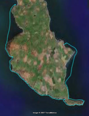
From a distance the Mull of Galloway looks like an island as the Tarbet is low enough to be under the horizon. The day was yet young so we decided to carry our kayaks Viking style over the 0.45km distance and 21m height of the Tarbet. It was hard work, as unlike the Vikings, we had set off unarmed and were so unable to persuade any locals to assist us in our endeavours.


The boats were soon on the beach of east Tarbert Bay but we needed some lunch before heading out again!

15/12/2008

Tuesday, December 16, 2008

Southern exposure round the Mull of Galloway.


The Mull of Galloway is a bold headland which juts out into the North Channel of the Irish Sea. It is Scotland's most southerly point. It is a magnet for sea kayakers due to its notorious nine tides!

Tony and I set off from the East Tarbet of the Mull of Galloway 2hrs and 30mins before the end of the east going flood. We planned to use a west flowing eddy that runs close into the cliffs. Unfortunately this eddy does not run round each of the many headlands on the Mull and we were prepared to battle round these into the teeth of the east going flood. The freshening SW wind began to make its presence felt. Cats' paws spread out on the water as the wind dropped over the cliffs.

We soon picked up an east going eddy which runs along the north coast of the Mull. It carried us effortlessly to the east point of the Mull.


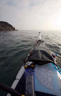
Here in the shelter from the wind, and out of sight of the race, we enjoyed a calm moment enjoying a view of the Isle of Man. Calm was not a word we would use again on this trip!


As we worked our way round the corner, the water became livelier...


... and the wind began to increase.


This photo was taken in the last of the calm water before we entered the race. The water then got a bit rough and I found myself quite unable to take further photographs....

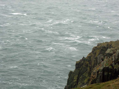
We were in the disturbed water from below the lighthouse to the entrance of West Tarbet bay. Most of the waves were only about 5 feet, crest to trough, but they were short, steep, breaking, very irregular and coming at us from all angles.

As the wind shrieks round their jagged ramparts and as the surf thunders at their base, no one can hear your screams far below the cliffs of the Mull of Galloway!

Close to the rocks the clapotis was fearsome but the tide was less strong. After being side surfed by several waves we kept away from the rocks as much as we could. As a result we found ourselves in the stronger adverse current further out. It took 40 minutes from the east to the west points of the Mull. It is only 2.5km so we actually managed to average 3.75km/hr. It really was sustained maximum effort all the way. The worst bit was 1.5km to the west of the lighthouse. My GPS showed I was going backwards at 1km/hr on several occasions before I got round that one! The maximum speed I hit was 14.5km/hr (while still paddling) in the eddy to the south of the lighthouse.

The wind was still increasing and any thoughts of continuing up the west coast to Port Logan were abandoned. We made for the shelter of West Tarbet Bay and prepared ourselves for a Viking style portage over the Tarbet ...

15/12/2008

Monday, December 15, 2008

Tempestuous seas!


I would like to extend a very warm welcome to Trans Atlantic readers of this blog from Newfoundland and Labrador! Thank you for the link Alison.

These hardy souls have to endure some of the most challenging sea kayaking conditions on the planet and are obviously envious of us Scots, sitting here in the balmy Gulf Stream!

However, I would like to point out that it is not all glassy calm seas and glorious sunsets! Somewhat embarrased by Alex's reference to "Tempestuous Seas" (greetings Alex :o) ), today Tony and I decided to salve some Scottish pride and go where the water is seldom glassy calm... the Mull of Galloway! After all, it is just about the shortest day, there was a windchill of minus 2C, a big spring tide and a force 4 to 6 SW wind, what better way to spend a few hours than rounding the Mull of Galloway?


15/12/2008

Sunday, February 24, 2008

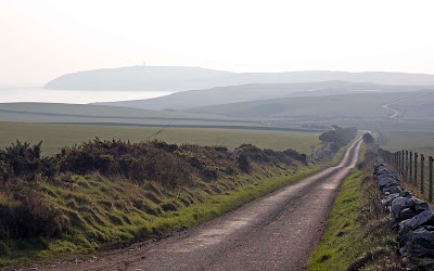
The long and winding road, to the Mull of Galloway


I might have mixed up my McCartney songs but you get the idea...

Despite being part of mainland Scotland, when you are travelling through the Rhinns of Galloway, you feel you are on an island and so must have fallen asleep on the ferry.


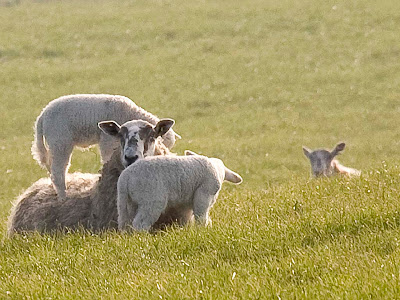
The lambing season starts early here, hinted at by palm trees being just about the most common garden plant in these parts. In the southern half of the Rhinns of Galloway, you are never more than 2.5km from the Gulf Stream warmed sea and so frosts are rare.


However, it is not always like this in winter. High on the Mull, Kennedy's Cairn commemorates a postman who died on this road while delivering the mail in a snowstorm .


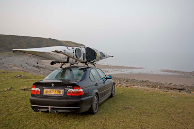
We left one car at East Tarbert to pick up later when we landed there. There is a road down to the old lighthouse boathouse and jetty.


You can get right down to the grass beside the boat house. The jetty was built to service the lighthouse before the road was built. If you look carefully at the top of the beach you can see a huge steel deck hatch that has been washed off a ship rounding the Mull in a storm.

17/02/2008

Saturday, February 23, 2008

End of a Mull of Galloway day.


We continued eastwards along the Mull of Galloway and came to a huge cave.


As we left the cavern in the gathering twilight, we caught sight of a waxing gibbous moon.


That reminded me of a total eclipse of the moon that was due at 3am on 21/02/2008. Since I had already got a great view and some photos on the last eclipse at 23:20 03/03/2007, I decided to give this one a miss!


Rounding the Mull of Galloway we encountered a brisk eddy which impeded our progress towards East Tarbert.


The chill February air caught our breath as the sun sank below Tarbert leaving us in darkness.

I have said this before, but you should come and paddle this amazing coast before the crowds come!

17/02/2008

Friday, February 22, 2008

Sea kayaking perfection at the Mull of Galloway.


When we entered the Mull of Galloway tide race we found ourselves travelling at 12km/hour when not paddling. Fortunately there was no wind or it would have been a real wild ride!


There are a couple of bays along the Mull that you can break out of the tide into. There are a variety of caves and stacks to explore.


As the sun went down we realised we would need to move on...


..to allow time to play on the eastern race beforer the sun went down.


Why do we go sea kayaking?

17/02/2008

Thursday, February 21, 2008

Winter sunset as we approach the Mull.


We left Rainbow Rock as the thin winter sun was sinking towards the south western horizon and the air was full of the mournful calls of wheeling gulls.


With each headland we felt the power of the tide increase until it was like a huge lazy river, pushing us ever faster and inevitably towards the Mull of Galloway.


The rocks turned red as the sun sank lower.


We were often tempted to break out of the tide and take a diversion through rocky channels.


At last the Mull of Galloway, surmounted by its lighthouse, lay before us. We would be rounding it at 3 hours after slack water and there was now no turning back....

Monday, February 18, 2008

Ocean Paddler #8 "Myths and tides of the Mull"


The Mull of Galloway.

Unfortunately there was not space in Ocean Paddler for the fact box to accompany the article: "Myths and Tides of the Mull" part one of a Rhinns of Galloway Trilogy. I will make sure there is room for the fact box in one of the remaining two articles. In the meantime, here is some information to help those planning a trip to this fantastic location.

The Mull of Galloway Essential Information.

Distance: 27km day trip.

Launch site: Drummore: NX141363. There is no toilet at the car park so stop at Ardwell NX109453 en route.

Landing site: Port Logan NX494094.

Getting there: From Glasgow, head south for Stranraer on the M77, then the A77. through Stranraer. Leave A77 on A716 for Ardwell then B7065 to leave shuttle car at Port Logan. 100 miles allow 2hours 30mins. Then take B7065/B7041 to Drummore 4.5 miles allow 15 minutes. If coming from the south or the east, head for Dumfries then west for Stranraer on the A75. Just before Stranraer, take the B0784 then A716 for Ardwell then B7065 for Port Logan. Dumfries to Port Logan is 60 miles allow 2 hrs.

Accommodation: For Hotel, B&B and self-catering accommodation: www.visitscotland.com. New England Bay Caravan Club Site NX120424, tel 01776 860 275, has beach access for kayaks.

Local weather forecast: BBC Radio Scotland (94 to 95 FM, 810 MW) Outdoors conditions forecasts are broadcast at 19.12 Monday-Friday, 06.58 and 18.58 on Saturday and 06.58 and 19.58 on Sunday.

Tidal constant: Mull of Galloway +0035 HW Dover; Drummore: +0045 HW Dover.

Tidal streams: Tidal stream information here that differs from the pilots is from personal observation and discussion with local fishermen. The pilots show that well south of the Mull of Galloway the E going stream (flood) begins at -0545 Dover and the W going stream (ebb) begins at +0020 Dover but close inshore, where kayakers will be, the east going stream begins about +0530 HW Dover and the W going stream about -0130 HW Dover. Spring rates exceed 9km/hr. From Port Kemmin to the Mull there is an E going eddy close inshore during the W going ebb, from about +0120 HW Dover. The interface with the main west going stream can be very disturbed.
To the west of the Rhinns of Galloway and close to shore, the S going stream (flood) begins +0425 Dover, the N going stream (ebb) begins -0135 HW Dover. There are overfalls at frequent places and after half tide (on both flood and ebb) counter eddies form close inshore. Spring rates at headlands exceed 12km/hr.

Tides on the day (24/03/2007): Our trip was midway between springs and neaps and we arrived off Lagvag, the east point of the Mull, at -0145 Dover. Note that Cooper and Reid suggest arriving slightly earlier than HW Liverpool (about HW Dover) if you do this, you will not round the Mull at slack water and you will face stronger eddies on the north part of the trip.

Warnings: This can be a serious trip if there is any wind against tide; here is a selection of descriptions from the pilots: one of the most dangerous points on the British coastline; heavy and violent race; the race at the Mull of Galloway is violent; passage can be hazardous on an outgoing tide in SW winds above force 4 and should not be attempted; very heavy seas off the Mull. Check tidal information with original sources and take account of conditions on the day.

Danger Area: Luce Bay is an active bombing range. If you keep inside the yellow buoys you should be well clear but if in doubt phone the range on 01776 888741.

Maps: OS Landranger 1:50,000 sheet 82; Imray Chart 1:150,000 sheet C62

Books: West Coast of Scotland Pilot, UK Hydrographic Office
West Coast of England and Wales Pilot, UK Hydrographic Office
The Yachtsman’s Pilot Clyde to Colonsay, Martin Lawrence
Firth of Clyde inc. North Channel, Solway Firth & Isle of Man, Clyde Cruising Club
Blazing Paddles, Brian Wilson
Scottish Sea Kayaking, Cooper and Reid

Useful website:
http://seakayakphoto.blogspot.com/search/label/Mull%20of%20Galloway

24/03/2007

Sunday, February 17, 2008

Winter sunset, playing in the Mull of Galloway race.


Today was just another day here at seakayakphoto.com. Can you imagine the hardship watching the winter sun set while playing in the tide race off the Mull of Galloway?


Earlier we had paddled the remote and seldom visited west coast of the Rhinns of Galloway. I had been so inspired by an article on paddling the Mull of Galloway, which is in the newly published Ocean Paddler issue 8, that Tony and I just went out and did it!


27km on a short winter day and we did not start paddling till 1130 am.

Just about as close to perfection as it gets!

17/02/2008

Monday, March 26, 2007

A perfect day to end up in 2000 Acres of Sky.


On Saturday we paddled to Port Logan, which featured in the BBC series "2000 Acres of Sky". The series was based on a fictional and remote island community called Ronansay which lay off the west coast of Skye.

Port Logan was originally called Port Nessock and in the 17th century attempts were made by the McDouall family to establish it as a ferry port for Ireland. They also built the Port Logan Inn which now makes a fine sea kayaking pub. (See here for what makes a good sea kayaking pub.)

The quay and Port Logan Light were built in 1830 by Colonel Andrew McDouall. The light is a conical stone tower with a platform for a lantern. It is not known when it was last lit but for sometime after that it had a bell, which was rung to guide local boats back in foggy conditions. A decent road to the village was not constructed until the early 20th century, so most of the village's trade and traffic depended upon the sea. A life boat station was built at Port Logan in 1866. It closed in 1932 as the RNLI lifeboat at Portpatrick, 18km to the north west, was motorised by then. The boat house is now the village hall which you can find near the quay.


We set off from Drummore and so had to pass one of the great headlands on mainland Britain. The Mull of Galloway is the most southerly point on Scotland. It juts into the Irish sea separating the Solway Firth from the North Channel between Scotland and Ireland. We were prepared for the strong tides and magnificent caves. What we were not prepared for was the stunning cliff coastline north west to Port Logan.

17/04/2007 lv asked "Do you have a panoramic photo of Port Logan?"

I do but it was shot in pretty flat light so it is not the best. Here it is...


I do not know where you stay but if you get the chance, you should visit Galloway. It is a wonderfully unspoilt region.

Saturday, March 24, 2007

Rainbow rock


Earlier today


A clue to rainbow rock's location. This cave is directly below one of the most prominent lighthouses on the Scottish mainland.

Friday, December 29, 2006

Gimme Shelter


Oh, a storm is threatning
My very life today
If I dont get some shelter
Oh yeah, Im gonna fade away
-"Gimme Shelter", Rolling Stones

These snails had gathered for shelter under an overhanging brick on the outer wall of the Mull of Galloway lighthouse vegetable garden. The wall is exposed to the prevailing wind and is perched on the cliff edge 80 metres above the surging tides below.


Lighthouses were built to guide mariners away from treacherous coasts to safe haven. I am not sure why we were attracted there on such a day as yesterday. The Mull of Galloway lighthouse was finished in 1830 and was built by George Stephenson. It flashes white every 20 seconds. Supplies originally came by sea and were landed at the tidal jetty at East Tarbert. It has been unmanned since 1988.

Like the snails, we did not brave the weather but sought shelter in the Crown Hotel in nearby Portpatrick. We will return to sea kayak the Mull of Galloway another day.

We mulled it over and went to the pub.


The Mull of Galloway lighthouse.


Kenny, Richard, Cailean and myself assembled above the Mull of Galloway tidal race. This is where the flood tide from the Atlantic is compressed as it rushes round the Mull to fill the Solway Firth and the north Irish Sea. When we arrived on 28/12/06, a force 5 SE wind was blowing against the tide. The inshore waters forecast was SE 3 to 4 increasing 6 to 8. It was 4 days after springs. The tidal constant at the Mull is +00:15 Dover. Slack water (close in) is about is about -01:30 Dover.

Dover times were: HW 04:28 LW 11:48 HW 17:11. The Admiralty tidal stream atlas predicted SE flood flows of: 0.5 knots at 11:11; 1.2 knots at 12:11; 2.8 knots at 13:11; and 3.5 knots at 14:11.


11:06


11:30


11:38


11:42

The cliffs are 80 metres high which gives some idea of the scale of the water disturbance.


13:03
As the flood progressed it swung round from flowing to the SE to a more easterly direction. As it did so, the race came in closer to the foot of the cliffs at the east end of the Mull.


It looked nothing like the sunny, calm conditions shown in Scottish Sea Kayaking fifty great sea kayak voyages. We beat a retreat to the pub. Kenny was very disappointed.