Showing posts sorted by relevance for query "05/05/2008". Sort by date Show all posts

Monday, May 12, 2008

A wee trip to the Garvellachs


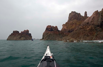
The Garvellachs (Rough Islands or Isles of the Sea) are a chain of magnificent small islands which lie at the mouth of the Firth of Lorn, where they are exposed to westerly Atlantic swells.

This is travelling SW down Eileach an Naoimh, Isle of the Saints.


On Sunday we had a fabulous day circumnavigating these islands. This is at the SW corner of Garbh Eileach, travelling NE.


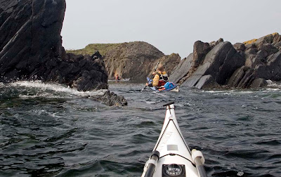
Some of the swells made an impression on us.

I must apologise for the grainy quality of these photos. I was using my Canon 5D but every so often I would need to put it away in a hurry. In my fumbling, I reset the sensor speed to 1600 ASA and did not notice....


Of course we did not go directly to the Garvellachs! Oh no, we went via the tide races of the Sound of Luing, the Gulf of Corryvreckan and the Grey Dogs. What a great part of the world to be a sea kayaker!

11/05/2008

Tuesday, June 10, 2008

Arrival at Loch Roag


The MV Cuma was due to leave for St Kilda on the afternoon of Saturday 31st May from Miavaig in Loch Roag on the west coast of Lewis. We were so excited that we did not want to miss the boat so we arrived on the Friday evening. We set off from Bhaltos to paddle round the many islands in the loch and find a camp site.


We paddled late into the summer night with an ever mounting sense of anticipation.

30/05/2008

Sunday, June 15, 2008

A Taransay Saturday sashay.


After an excellent dinner,we embarked from the Cuma at 8 pm using her RIB as a launching platform. Photo Jennifer Wilcox.


Nancy, Clark, Fiona B, John, Murty, Alan and Andy enjoying the long summer evening light on the south coast of Taransay.


This beach on Taransay is one of my favourite viewpoints.


The mixture of white shell sand, dark grey rocks and turquoise waters backed by distant mountains of Harris makes a fine view regardless of the weather conditions.


The shifting sand dunes of Taransay reveal all sorts of ancient buildings.

31/05/2008

Saturday, May 24, 2008

Corbiere lighthouse, Jersey


Despite strong NE winds Jersey canoe club laid on a superb days sea kayaking on the first day of the symposium.


Corbiere lighthouse on the sheltered SW side of the island was one of the destinations.


24/05/2008

Friday, May 16, 2008

The flooded quarries of Easdale


We left from the village of Ellenabeich on the island of Seil in the Firth of Lorne.


Mist hung lowout in the Sound of Luing to the south so we thoug w had eter check our maps. We also duoble checked our tide times as we were heading for the fearsome Gulf of Corryvreckan.


A short crossing took us to the island of Easdale. As it was high tide we were able to us the swells to carry us over the lip of the flooded quarry to enter the deep calm water within.


Photo by Jennifer Wilcox showing the surge of the swell.


After a little drift about the mist began to lift and we had a tide to catch!

10/05/2008

Tuesday, March 10, 2009

Dun Carloway


High on a hill above Loch Rog in Lewis an amazing structure seems to grow out of the ancient rocks. It is the Iron Age broch of Dun Charlabhaigh (Dun Carloway). It was built over 2,000 years ago.


Most of its stones have been plundered over the millenia for neighbouring buildings.


But there is still enough left to explore its double walled structure which contains a spiral staircase.


The plaque from Historic Scotland explains more.

06/05/2008

Monday, December 29, 2008

Port Appin dawn


Port Appin is a sleepy little village which nestles below the mountains of Appin which seperate Loch leven and Loch Creran on Argyll's rugged west coast. Port Appin was never a fishing port but it served as a stopping point in the 19th century for steamers travelling between Glasgow and Edinburgh via the Crinan and Caledonian canals.


Today it serves two small ferries. This is the Lismore which carries foot passengers across the Lynn of Lorn to the beautiful island of Lismore. In Gaelic, Lismore means the big garden. It is more fertile than many of the Scottish islands because of the presence of limestone rock. From 1800 till 1934 this was quarried and heated in lime kilns to produce lime for agriculture on the west coast and building in Glasgow.

The quarrying tradition in these parts started again in 1986 when the Glensanda quarry opened. It is one of Europe's biggest quarries and its granite rock was used to make the channel tunnel. Glensanda quarry is removing an entire mountain, Meall na Easaiche, on the Morven coast on the far side of Loch Linnhe, beyond Lismore. It is situated just behind the mountains in the sunshine in the photo above. Another ferry carries local workers from Port Appin across Loch Linnhe to Glensanda.


We were bound for a circumnavigation of Lismore and also chose to launch from Port Appin. We carried the boats over frost covered seaweed in the predawn light. Although we were still in freezing shade, there was a lovely pink glow in the sky reflected from the tops of the high mountains which were already in sunshine.


We planned a clockwise circumnavigation. It is 37 km and we knew that it would be dark before we finished as sunset would be about 15:34.

On 27/12/2008 HW Oban was at 05:35 and 17:49. The tidal constant at Port Appin is -00:05 Oban. It was one day before springs.

At the Lynn of Lorn south end (1 knot springs), the ebb (SW) starts at -01:40 Oban which was 16:09 on our trip. The flow (NE) starts at +04:45 Oban which was 10:20.

At the Lynn of Lorn north end (2.5 knots springs), the ebb (SW) starts at -00:15 Oban which was 17:35. The flow NE starts at +06:00 Oban which was 11:35.

On the NE going flood an eddy runs SW from the islands along the SE coast of Lismore so we reckoned we would have tidal assistance for most of the day.

27/12/2008

Sunday, July 20, 2008

The Sound of Islay


After disembarking from the ferry at Port Askaig, we wasted no time, in getting onto the water. We did not even stay to sample the ales of the Port Askaig hotel, whose beer garden conveniently overlooks this little jetty. It has been a licensed premises since the 16th century.

With the hills of Jura just a short distance away over the narrows, at 3 hours past the turn of the tide, the south going ebb was running strongly down the Sound of Islay. Even though it was neap tides, the current was sweeping past the mouth of the harbour and it was quite a sight to see a 3,000 ton ferry break out into the current. The combination of tide, wind and forecast made our decision to go south with the flow an easy one. We were on the water by 16:00 hours.


Although the spring rate in mid sound is 5 knots, we hit 10 knots in the current just outside the harbour. The wooded slopes of Dunlossit estate made a gentle introduction to the wild and remote east coast of Islay beyond. The south going ebb in the Sound of Islay starts at +05:15 HW Dover and the North going flood starts at -00:50 HW Dover. The spring rate is 5 knots.


We then made our way into mid channel to take maximum advantage of wind and tide. We averaged 12km/hour (6 knots) down the upper part of the Sound of Islay.


The tide slowed as we approached the entrance of the sound with Am Fraoch Eilean on the left and McArthur's Head on Islay straight ahead. The distant Kintyre peninsula can just be seen on the horizon. We now turned west and made for Islay's lonely eastern shores.


This map shows the GPS track of our route over the 4 days of our visit.

12/07/2008

Thursday, February 26, 2009

Sea kayaking the caves of Caolas Pabaigh (Kyles of Pabbay).


After lunch on the Cuma we launched in the shelter of Caolas Pabaigh a narrow body of water which separates Lewis from the island of Pabaigh Mor.


Both sides of the Caolas are riddled with caves such as this one on the Lewis side.


This monster is on the Pabaigh Mor side has amazing multicoloured rocks.


The booming at the back of the cave was deafening. Just as Tony and I were exiting, a rogue swell came in and I was surfed into the back of the cave again. I found this quite exciting as I tried to do a one handed stern rudder while holding my Canon 5D in the other hand.

05/06/2008

Tuesday, March 03, 2009

Tony's cave, Pabaigh Mor!


After lunch with LOMO MAN, we continued our exploration of Pabaigh Mor. Round a corner, Tony shouted "Come and see what I have found, it's a tiny little cave!" Clark hung back.


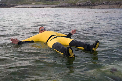
Then BOOOMPH!.... Tony bought a LOMO dry suit shortly afterwards!

Above photos by JLW.


After much entertainment we left Tony's cave and made our way out to the exposed north coast of Pabaigh Mor and its reef of Bogha Dubh....

05/06/2008

Monday, March 02, 2009

The Rise and Rise of Lomo Man!


Something strange began to happen to our mild mannered friend Andy. He began to run around madly looking for a telephone box. Unfortunately there was none to be found on the machair of Pabaigh Mor


Giving up his quest, Andy began to grunt and his facial features contorted.


His whole body began to inflate in size and adopt a turgidity we had not seen before.


Then as his body grew ever more erect, first one arm...


...then the other sprang out into the unmistakable pose of LOMO MAN! Although he wore neither cape nor pants over his trousers, our friend Andy had now transformed into one of the most feared of all the SUPER HEROES!


LOMO MAN caught sight of the ocean and with a final snort, he was off...


.. and like a newly hatched turtle, his priapic figure made a beeline for the water.


At last he was at one with the Ocean and then (hushed David Attenborough voice) he began cooing! A disturbance in the water occurred, at first we couldn't see what was happening...


...and then LOMO MAN emerged with a mate!

When you next visit Pabaigh Mor, keep a sharp eye open for little Lomolettes!

Needless to say, Andy's Lomo dry suit proved to be completely water and air tight during the gruelling transformation from mild mannered kayaker to LOMO MAN!

05/06/2008

Sunday, October 05, 2008

Gleann Einich in the Cairngorms by mountain bike.


Over the last 10 days I have sea-kayaked, windsurfed and mountain biked across Scotland from Galloway to the Grampians (using a car to get from location to location). It has been a fantastic outdoor experience.


Today we mountain biked deep into the heart of the Cairngorm mountains making our way to high ground through stands of the ancient Caledonian forest.


It is a high plateau with deep glacial valleys radiating out from its heart.


We made our way into the depths of Gleann Einich which is overlooked by the jagged ramparts of Sgoran Dubh Mor, 1,111m.

Magnificent!

05/10/2008