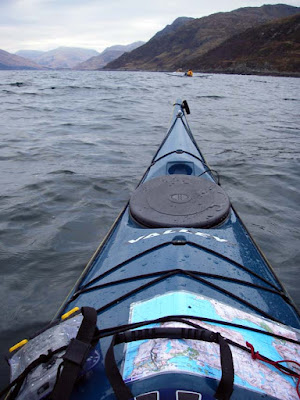
Imagine you are at the edge of the sea on a day when it is difficult to say where the land ends and the sea begins and where the sea ends and the sky begins. Sea kayaking lets you explore these and your own boundaries and broadens your horizons. Sea kayaking is the new mountaineering.
Wednesday, January 10, 2007
How is it? It's as bad as it gets.
West coast of Scarp
June 2006 was stormy off the west coast of the Outer Hebrides. We were out there in a 70 foot fishing boat and had to run for "shelter" in Loch Reasort.
Loch Reasort
At times like that I always think of the RNLI. Have a look at John's blog for details of their work. I have been a supporter of the RNLI for many years and I would urge all UK and Irish seakayakers to give their support. Today I received my copy of "The Lifeboat" the RNLI journal.
It tells of a dramatic rescue (a few days later than my photos above) which involved a Dutch 12m racing yacht. She was pitch-poled and flattened by a monster wave in winds exceeding force 9 about 25km to the north west of Barra at the south end of the Outer Hebrides. The skipper was injured, the shroud plates were damaged, her standing rigging loosened, the mast mounted electronics were damaged and the keel bolts loosened. He put out a PAN PAN call on the VHF requesting urgent assistance.
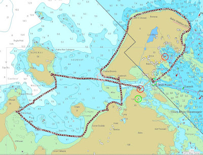
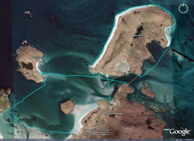
Stornoway coastguard picked up the call and requested the launch of the Barra lifeboat. She is the Edna Windsor a Severn class and Coxswain Donald MacLeod took command. He was really worried that the yacht would attempt to reach shelter through the treacherous Sound of Barra to the north but could not make contact with her. He decided he would need to take a shortcut up the east of Barra and through the Sound to head the yacht off. There are three routes through this sound and the best would depend on many factors. Donald called his father and asked if he could go over and advise which route he should take.
"Caimer a tha i?" (How is it?)
"Tha i cho dona 's chi thu I" (It's as bad as it gets.)
The lifeboat had to reduce speed from 25 to 5 knots as it slammed into 10 to 11m swells. Eventually they cleared the sound and were heading for the yacht's position at 12 knots when they realised their electronic navigation equipment had been damaged by the pounding and it was too rough to use paper charts.
Once they found the yacht, they guided her for the Sound of Sandray to the south of Barra. The treacherous nature of this channel is only exceed by that of its northern neighbour and it was vital the yacht followed the lifeboat closely. She was making 6 knots under her storm rig so the lifeboat had to slow to a speed that put her in danger. A monstrous wave slammed her over by 100 degrees plunging the wheelhouse under water and damaging her.
Recovering, she led the yacht to safety.
Sound of Sandray
Coxswain: Donald MacLeod, volunteer shellfish fisherman
Deputy 2nd Coxsawain: Ranald MacLean, volunteer tug boat captain
Mechanic: Angus MacNeil, RNLI full time
2nd mechanic: Lachlan Douglas, volunteer fisherman and builder
Crew: Iain Boyd, volunteer fishernan
Crew: Michael MacNeil, volunteer oil rig worker
Thanks guys!
Tuesday, January 09, 2007
Boreray enters digital age but is still isolated.
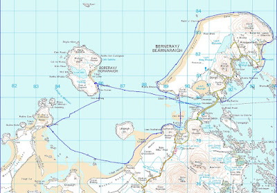
My very first post concerned a visit to Boreray. It is a beautiful island in a somewhat exposed position at the west end of the Sound of Harris in the Outer Hebrides. I also mentioned it in another post about clearing mink from the Western Isles.
Tonight I received an email from Jerry Cox who has been Boreray's sole resident since 1999. He told me about Boreray's website. I have no idea whether he has a satellite link to the internet like that on nearby Berneray or whether he has to leave Boreray and get access elsewhere. From the website, you can learn about the island and how Jerry makes a living from his croft which has a flock of St Kildan sheep. He also has a renovated croft house for rent. It has one of the most stunning views in the Hebrides. The only way of getting there is by kayak or Jerry's RIB. He warns "Please be aware that access involves a four-mile sea crossing in an open RIB with beach landing. Weather conditions may delay the start and/or finish of your stay!"
I would settle for a delayed departure.
Monday, January 08, 2007
A chilling winter warning.
In my post about winter paddling at Ayr yesterday, Squidink asked about the water temperature. By coincidence, Grazie who publishes Skoogle recently posted an index link to a post I made on the Sea section of the UK Rivers Guidebook forum last winter. I take the liberty of reposting here as cold water is probably the greatest threat to the safety of any sea kayaker.
A chilling winter warning.
December 2005. Regular readers of this forum will know of my concern for falling into cold water. I personally use a dry suit with pile/pertex underneath in winter if it is rough or a two piece bib with dry feet and a cag with latex wrist seals and a sealable neck in more moderate conditions. Under the two piece I use polartec aquashell garements which are made of micro fleece bonded to a breathable waterproof membrane equivalent to but much more comfortable than 3mm neoprene. I have practised falling in during winter and both of the above work.
However, I got a very bad shock last Saturday (at the end of December). My brother Donald did a lot of kayaking in the late 60's early 70's but had stopped until September when I took him out in my Alaw at Arisaig in September. He has had several major life events recently and he enjoyed the escape of kayaking so much he gave up smoking! I hadn't seen him since then till last weekend but he phoned very keen to go out again. The Accuweather upper Clyde sailing forecast was for a 6 mph northerly dropping to 3mph. The BBC forecast was for sun and 7 mph northerly winds.
I decided to go to Largs and take him across to the Cumbrae. I thought if the weather changed he could always get the ferry back. I decided not to bring my regular paddling partners Jennifer or Mike along as I wanted to be able to concentrate on Donald. We arrived at Largs in a flat calm just as the sun was coming up. We met Billy an experienced kayaker who was down to test his new paddle. We decided to head across to the Cumbrae ferry terminal.
I was very surprised how much weight Donald had put on since stopping smoking. I wished I had brought the Quest for him rather than the Alaw which had been a good fit in September. But we removed the hip shims, got the footplate right to the front and got him squeezed in and showed him how to release the nylon spraydeck.
FIRST MISTAKE
The Alaw was now too small for him. We should not have gone.
I had brought him a Yak salopette with velcro neoprene ankle seals and a Yak cag with velcro neoprene seals at wrists and neck. I had also brought my 3 mm neoprene shorty wetsuit and thermals for underneath but the wetsuit was far too small for him. He ended up with two Helly Hansen long johns, 1 Helly Hansen top with a micro fleece and a normal fleece under the Yak gear. I finished him off with Chota neoprene knee length boots, neoprene gloves and a neoprene cap. He complained he was too hot!
We were soon paddling over a glassy sea but a dark line on the horizon soon changed everything and we had a force 4 NW wind channelling straight down the Kyles of Bute meeting a spring flood tide.
Donald was really enjoying himself but I asked him if he would like to turn back. He definitely didn't!
SECOND MISTAKE
I should have turned back straight away as the weather was now out with his recent experience. As I have been sailing, windsurfing and kayaking at Largs since 1967, I had little excuse for not appreciating how local winds funnel and accelerate down through valleys in the hills and between the islands.
We were soon in the calm of the lee of Cumbrae and were enjoying a cup of hot soup. We were planning what to do next. I suggested heading south in the shelter of Cumbrae but the wind further out had now definitely dropped and Donald had caught a glimpse of the hills of Arran behind Cumbrae and fancied a quick look round the north of the island to get some photos.
Billy and I let him lead the way and told him we would turn back as soon as he felt uncomfortable. As we rounded the point, the wind was continuing to drop so we continued round.
We headed out from shore a bit to get the best view over to Arran. Unfortunately we had not gone much further when another dark squall line appeared on the horizon. This time we all decided to turn for the shore at the same time. But it was soon on us blowing about 4 to 5 and the seas built up very quickly. Donald found the following sea much more difficult and I saw him do a couple of successful low braces. I wondered if I should raft up with him.
THIRD MISTAKE. As soon as I saw him brace I should have rafted. As we approached the shore the waves steepened, he broached and fell in 190 metres from the shore.
He was disorientated and had the cold water gasp reflex but I was right beside him and got him to hang onto my bow. I got his boat emptied in seconds while Billy calmed him down. We then got him in between his boat and mine facing towards his bow. He was getting very cold and he was moving very clumsily. I have practiced getting big people into boats before and found the best way is between the hulls, arms over both boats, feet into cockpit and limbo forward. Donald got his legs into the cockpit but even with Billy and me on either side, he couldn't get his bum on the seat (a combination of being uncoordinated, weak and the seat back folding forward under his bum as the elastic was too stretchy).
A breaking wave washed over us and he was in again, looking even colder. I could see he was now mentally slowing down, his speech and movements were becoming uncoordinated. I looked at the shore it was just over 100m away. I shouted to Donald to grab the back of my boat (he had no strength left to get on the back deck of the boat) and shouted to Billy to keep an eye on him in case he couldn't hold on. I then paddled hard for the shore. The GPS data shows that it was only 7 minutes from the fall in to the shore.
He could hardly stand and the freezing north wind was blowing up the beach with no shelter and making him more hypothermic by the second (he had lost his neoprene ca)p. Now at last, some of the planning began to go right. I got him into my Vango emergency shelter. Billy and I got his wet clothes off and he put on the Buffalo pile and pertex jacket and trousers I always carry for such a situation. He then put the Yak suit and boots back on top together with a spare Lowe Alpine cap (fleece and pertex). With three of us in the shelter and three flasks of hot soup down our necks we soon had a warm fug but it was over half an hour before he got warm again.
Once he was warm enough he walked round the point to a sheltered bay on the east of the island and I towed his boat round. In the sun and shelter we had lunch washed down with more hot soup (we had 6 flasks between the 3 of us).
Donald (on the left) was soon back to form and even wanted to paddle back to Largs. We did have another spare change of clothing but he sensibly decided to take the ferry back and I towed his boat back to Largs.
What if we hadn't been near the shore? We would have to have used a scoop rescue (we had two hand pumps and a portable electric pump between us to empty the boat after this) but even with 2 experienced kayakers, we might have found it difficult to get him into the cockpit. Once he was in, one of us would then have needed to raft up with Donald while the other towed. (We have practiced this.)
What if we had not been able to self rescue? Well I had VHF, flares and EPIRB and Largs RNLI Inshore Rescue Boat station was only 2.6km away. But Billy and I (we are both doctors) were amazed at how quickly Donald developed symptoms of hypothermia (and he has much more natural insulation than a thin person). He could have been seriously hypothermic by the time outside help arrived.
Billy who was not any better dressed than Donald has now ordered polartec aquashell wear for under his cag and salopettes. The water in the Clyde is currently 11 degrees C and deep water off the West coast never gets warmer than 13 degrees even at the end of summer. In Spring it could have been even worse. The temperature in the West coast Scottish sea lochs is then only 6.5 degrees C even although the sun and air temp might tempt you to paddle in shirt sleeves.
In conclusion, learn from my three main mistakes above. Although we had a satisfactory outcome, prevention is always better than cure. Anticipate problems rather than react to them. Know that cold water is a killer.
It has not put Donald off sea kayaking but next time he will be in a dry suit, in a Quest and in a nice sheltered loch!
All the best for a happy and safe season in 2007.
Sunday, January 07, 2007
Auld Ayr
Auld Ayr, wham ne'er a town surpasses,
For honest men and bonie lasses.
-Tam o' Shanter. Robert Burns
Not very good photos today. The weather in the West of Scotland remains atrocious. David and I took the Aleut double out for a short afternoon paddle of 12km. We launched at Seafield at the south of Ayr beach and taking advantage of the spring tide paddled up the River Doon to the weir. We then paddled up the Ayr esplanade (the clapotis was vicious) to the mouth of the Ayr and paddled up to its weir. Negotiating the harbour mouth was a bit tricky what with the spring ebb holding up the swell entering from the Firth of Clyde.
The Auld Brig o' Ayr was built in 1232. It has outlasted several "New Brigs". In 1786 a new brig was constructed. Burns wrote a poem: "The Brigs of Ayr". In it, the Auld Brig prophesies to the New: "I'll be a brig when you're a shapeless cairn". TheNew Brig collapsed in 1877.
Saturday, January 06, 2007
Daft Anne's Steps, Hestan Island, the Solway Firth
Daft Anne's steps are a set of rocky pillars extending from the south of Hestan Island in the Solway Firth. In the Story of Hestan Island, published by Auchencairn History Society, Mark White gives the following account. Daft Anne was a person of weak intellect who lived in Auchencairn. In those days the tide in Auchencairn Bay went out further than today and it was possible (but not recommended) to cross from Balcary Point to the south side of Hestan Island at low tide. This saved a long trek round the north end of the bay to Almorness Point and the safer crossing to the north of the island. Needless to say, Daft Anne got drowned on the short crossing. The island has an automatic lighthouse perched on the top. It has two white flashes every 10 seconds and a range of 9 nautical miles.
We had great weather on our trip here in January 2005. I have just posted a full photo trip report over on the Scottish Sea Kayaking Photo Gallery. We saw blizzards of oystercatchers and two otters playing in the spring flood tide near Daft Anne's steps. The Solway is a great wintering area for many sea birds.
A rather distant otter with its head and tail just visible.
Friday, January 05, 2007
A matter of maps and rutters.
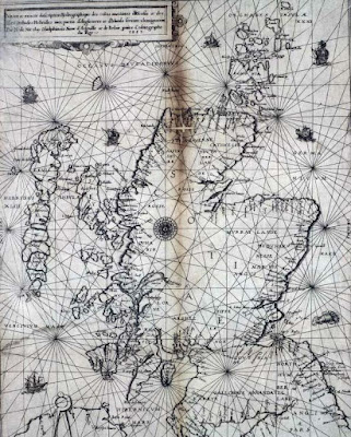
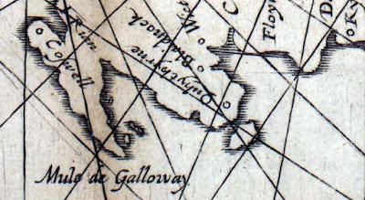
The Nicolay rutter was the first accurate chart and pilot for the Scottish coastline. (The word rutter comes from the French routier.) It was unsurpassed for accuracy for several hundred years. Those of you who know the Solway might question the island off Burrow Head to the east of the Mull of Galloway.
It is of course the Isle of Whithorn. Despite its name this is no longer an isle, but it was when the map was drawn. Even in the 18th century, there was still a channel at high tide and a smugglers' boat escaped the Excise cutter by sailing into the harbour and escaping through the channel while the cutter blocked the harbour entrance.
The rutter was created following an anticlockwise voyage round Scotland by King James V in 1540. The original manuscript was made by Alexander Lyndsay. It was made into a printed version in 1583 by Nicolas de Nicolay, a French map-maker. The National Library of Scotland has placed a digital copy on their website which can be zoomed to allow examination in detail.Only a few copies of the map survive and the BBC news reported that one is due to be auctioned on January 10th. I love looking at old maps and have a fair collection having inherited many old linen backed Ordnance Survey maps of Scotland (some from Victorian times) from by Grandfather. As the rutter is expected to fetch in excess of £20,000, I have decided not to place a bid on this occasion.
In addition to many paper maps and nautical charts I also have digital Ordnance Survey maps at 1:50,000 from Anquet maps. I bought all the 1:50,000 maps in the north half of Britain for £100. These can be viewed on the computer or dowloaded to a PocketPC. Unfortunately they can not be loaded into my Garmin mapping GPS unit but tracks from the GPS can be downloaded onto the computer and waypoints created in Anquet can be uploaded to the GPS. However, it is great for trip planning to be able to scroll seamlessly round the coast. You can print the map at the original size on A4 paper or you can zoom out to cram more coast onto your A4 or zoom in to make the area covered smaller but easier to read for older paddlers who do not wish to wear their reading specs.
Sometimes I laminate two maps back to back, sometimes I just keep them in the excellent Ortlieb map case.
For the Garmin GPSmap76cs I have two Bluechart regions:2EU006R and 2EUoo4R. These cost about £120 each. They cover from Corsewall Point to Spurn Head. As you zoom in on these you get more detail appearing as the product includes both large scale and small scale charts. They show the coast line in reasonable detail but very little on land. They are useful for showing water depth which can be a predictor for such things as turbulence in tidal channels. They also allow you to calculate tide times for a large number of ports. This works both on the computer and the GPS. Both Bluechart regions fit comfortably within the 115MB memory of the GPS.
For the Garmin GPSmap76cs to show contours on land and also more detail between HW and LW than the Bluecharts, I bought the Garmin Topo map of Scotland England and Wales for £130. This is based on the ordnance survey but has less detail of woodland, buildings etc but it does show roads. You cannot print from it and on the computer the size of the detailed screen is restricted. On the GPS unit it is very clear and is good for locating skerries, beaches and burns. The maps are large files so you have space to load only those of the general area you are heading for into the GPS, the whole country will not fit.
With regard to online maps, I like to use Streetmap in this blog to show the location of photos. It allows me to enter a grid reference from a paper map or Anquet computer map. Pasting the location url into a link in the blog allows readers to open the streetmap page then zoom and scroll.
Another good online "map" is Google Earth. This can even import GPS tracks. Once I have the Google Earth window on the computer screen I save the screen to memory. (On a PC: SHIFT+Prt Scr)
Not all of Scotland has such good photos as this but for those areas with good coverage Google Earth can allow you to explore for campsites and can even show shallows.
It would appear that an advantage of being invaded by the USA is that Google Earth resolution dramatically increases. Ultimately, military use is what has driven the development of maps and also GPS. The British Ordnance Survey had its roots in the Jacobite Rebellion of 1745. In 1746, after the defeat of the Jacobites at Culloden, King George II of Great Britain commissioned William Roy to survey the Scottish Highlands for military purposes. Roy's name is engraved on the door of the Ordnance Survey headquarters in Southampton. Two centuries earlier, James V of Scotland commissioned his rutter to help quell the troublesome Lords of the Isles. The map was so strategic that it was obtained by the English who commissioned Nicolay to make printed copies; one of which was obtained by the French. They used it almost immediately to avenge the murder of Cardinal David Beaton of St Andrews who had been murdered during the Scottish Reformation.
What would Lindsay have made of Google Earth?
On 9/1/2008 Mark added:
"There is another way to get contour information onto a GPS without buying the TOPO maps. The necessary files, Contours v2, can be downloaded for free from the SMC website. You still need the Garmin software to get them on to the GPS itself but they are a big improvement on the Garmin base map.
It seems to work as a sort of overlay on the base map. This leads to some oddities such as sets of contours appearing where the base map shows sea but as the contours tend to be more accurate I have found that helpful as a kayaker!
They were put together by Dave Storey who must have spent a lot of time on it.
Not sure if I can post links here but I will try. The files are at http://www.smc.org.uk/ContourMaps.htm and there is a very helpful set of instructions at http://www.paulmac.force9.co.uk/geo/index.html.
Mark"
Labels:
gear,
GPS,
history,
maps,
navigation,
people,
reviews,
technology,
tides
Sea kayaking foot wear: long term test.
These boots are made for kayaking, and that's just what they'll do
Are you ready boots?
Start kayakin'!
with apology to -"These boots are made for walking", Nancy Sinatra
This is a test with a difference. These shoes and boots have been tested through 18 months to four years of Scottish sea kayaking conditions. The idea for this test came to me at the 2005 Skye Sea Kayaking Symposium. The variety of footwear was incredible, from the flimsiest of flip flops to the most heavy duty divers’ boots and farmers’ Wellingtons! Generally sea kayakers can be divided into two sorts, those that like dry feet and those that don’t mind a bit of the wet stuff.
This test will consider the most suitable types footwear for wearing in summer with shorts, for wearing with trousers with ankle seals and finally for wearing with dry bottoms/suits with latex or Gore-Tex bootees. Carrying a loaded sea kayak is probably where sea kayakers are most likely to injure themselves so a grippy sole and some ankle support is just as important as keeping the wearers’ feet warm and sometimes dry. The test examines representative types of several different styles of footwear: yachting wellies, neoprene tight fitting knee boots, ankle boots (with and without zips), neoprene dinghy or windsurfing shoes, “wet” trainers and lastly “all terrain” sandals. It is in the nature of long-term tests that newer models have now replaced some of these. Although these have not been tested, inspection shows the changes to be largely cosmetic rather than of basic design, materials or construction. Although each brand might not be available throughout the sea kayaking world, there will probably be similar products available, after all, most seem to be manufactured in China. One way of looking at this review, is to ignore the brands and compare the type of shoes to see which might best suit your use and conditions.
Gill tall yacht boots £37.99.
Wellies of one sort or another are very popular with sea kayakers. These are made from natural rubber so do not dry them in the sun. They have removable insoles to aid drying and a calf tie to reduce water entry. They were very comfortable and remained dry if you could land in shallow water. They are lighter and closer fitting than most traditional Wellingtons. There was plenty room for size 10s in sea kayak cockpits and the heels were comfortable while paddling. As long as the calf ties were done up, the boots did not impede swimming or re-entry. This depends on how closely the boot fits your calf and they suited my bulky calves. Other manufacturers (such as Plastimo and Crewsaver) make boots with narrower uppers so it is worth shopping round to get a good close fit. The razor cut rubber soles were smooth but very sticky on most surfaces and, surprisingly, showed little signs of wear even after 3 seasons’ use, including lots of walks round camp to the nearest pub etc.. I was very happy with these until I had to land on the steeply shelving rocky east shores of the Uists and got wet feet in the deep water. Worn with dry bottoms/suits they do offer a lot of protection for latex bootees and are very easy to get on and off. They are not as warm as neoprene boots, but warm socks can either be used on their own or inside latex bootees. Overall they are very versatile. After three and a half seasons the rubber began to perish and leaks developed.
Chota Mukluks £65.00.
These are pretty unique. Up to the ankle they are like any neoprene ankle boot but the 3mm neoprene (which is super-stretchy, blind stitched and glued) extends up to just below the knee where a buckle and strap system tightens a smooth-skin lip to reduce water entry. The stitching remained completely waterproof. The soles are of moderate thickness and have a good grip but there is not a lot of foot and ankle support or protection on sharp and uneven ground. The heels are very comfortable when paddling. In warm conditions, wearing only shorts, these do keep your feet dry and launching is much easier than when using even tall cut Wellingtons. Only a drip or two gets in if a wave splashes over their tops. There is no problem with swimming but once you are back on land and if you are not wearing socks, your feet slip about a bit inside the boot. Dry suit users may not think they are necessary but they offer great protection for your bootees and in winter they are the warmest boots on test. They were very easy to get on and off. They are outstandingly comfortable and practical! After one and a half seasons there is no sign of wear.
Teva Omnium Pro £45.00.
These 3mm neoprene, zipper-less, ankle boots carry a great reputation among white water users. They are very close fitting and I bought one and a half sizes bigger than normal. They are the most difficult to get on and off. There is good ankle support as extra padding is sewn over where your ankle bones might press against the hull (more of use in a tight WW boat). The spider rubber sole is quite thin and carrying a heavily laden sea kayak over coarse shingle can hurt. The rubber grips wet and dry rock superbly but is lethal on wet, muddy grass, I took a very nasty fall launching at Port Appin in these. If you do not have dry bottoms your feet will get wet but they remain very warn and comfortable in all but the coldest conditions. They give good protection to latex bootees. You hardly notice them when swimming. These would particularly suit the larger footed paddler who is trying to squeeze into a small day boat. Apart from their grip on muddy grass, I can see why they are popular for WW use. Over a full season, they wore very well but early in their second season the neoprene tore along the line of stitches at the heel rubber.
Lomo Aqua Boot £21.00.
These boots were originally designed for diving but have proved to be particularly popular with sea kayakers. I could not believe the quality of these boots at this price. They are made of 5mm neoprene with a zip that (unlike some more expensive competitors) has a 3mm gusset behind. The zip makes putting the boots on and off much easier than zipper-less ankle boots. The gusset behind the zip stops sand and grit entering the boot and abrading your delicate, bare tootsies or your Gore-Tex or latex bootees. The boot was also high enough to protect the latter from the sun. The sole is thick and these boots are the most comfortable when carrying boats down sharp shingle beaches. There is also good foot and ankle support for uneven ground. The grip on wet rock is not quite so good as Teva Omnium Pro’s but is superior on grass and mud. The open cleats on the sole provide security on soft slippery surfaces but do not hold grit (which some other soles can carry into your boat). Overall these are excellent boots for carrying heavy boats up and down a variety of surfaces on shores and foreshores. These boots were very warm, even when we had to break the ice at the edge of a sea loch! Size for size they are a good bit bigger than some other boots. My size 10 feet and boots fitted in even small sea kayaks but I was squashed in my trusty old Dagger Redline. There were no problems swimming. After two seasons the only sign of wear was a metal puller breaking off one of the zips. A little loop of cord through the zipper soon had it working again. Even before taking price into consideration, these are the best all round boots of those I have tried. Not only that, they have now outlasted a pair of boots which were twice the price. The Lomo Aqua Boot is therefore a Best Buy
Climbing up to an old fort above a Hebridean beach. Sea kayaking footwear is not just for sitting comfortably!
Teva Gamma £49.99
These, trainer like, shoes are designed for use in the water. The uppers have mesh panels which let water in and out. There is a full lacing system, which gives great support to the foot but needs to be loosened right off if putting the shoe on over latex bootees in the winter. The insoles are removable for quick drying and overall these dried quickest of all the footwear on test. These shoes were best for carrying heavy boats. The soles gave the best overall grip on test and the cleats are wide enough not to trap grit and carry it into the boat. Mud does fill the cleats and then care needs to be taken. Like the Lomo boots, these were quite large on the feet and paddlers with big feet might find room is restricted in some smaller boats. In summer over bare feet these shoes were great, until you came across sand. The grains work their way into the shoe through the mesh and chafe your skin. Worn over bootees they do not offer the latex much protection from the sun and abrasion from sand was evident on its soft surface. In winter, even over latex bootees, they were cold compared with the neoprene boots. They did not impede swimming. Where these shoes really excelled was in coasteering! As such, they would be great to take along on camping trips for some rocky coastal exploration. After two seasons there was little sign of wear. They also make very good general purpose “trainers” for more general land based activity and would not look out of place in the local High Street. I have worn mine more often ashore than in the boat.
Coasteering in Jersey with Kevin Mansell.
Gill dinghy shoe £19.99.
These are made of 3mm neoprene with an elasticated insert on the top of the foot and are cut below the ankle (latest models are now cut slightly higher). The foot is well supported by a simple system of Velcro straps which is easy to adjust but there is no ankle support. This system prevents the foot moving about inside the shoe and gives a very comfortable firm fit for such a light shoe, particularly going down steep banks carrying a boat. They are very easy to get on and off. Although the sole is thin and has a very simple ribbed pattern, the shoes are remarkably grippy, especially so on wet grass compared with some of the other footwear. They were fine for carrying unladen boats on day trips but carrying loaded boats on sharp ground hurt. Using with bare feet in summer, they were very comfortable and gave enough warmth on the chillier days but they were too cold for winter use. Unfortunately, sand tended to get over the top causing the same problems as with the Teva Gammas. The higher cut 2006 model may be an improvement in this respect. None of the other boots caused problems when swimming but you can really SWIM in these shoes. I regularly swim off a rocky, barnacle covered shore and I found these highly suited to a pain free dip! After 3 seasons they are beginning to show signs of wear but are very good value.
Teva Terra Fi £59.99
These all terrain, water sandals certainly look the part but there is a large overlap all the way round the foot and I found I was not able to fit inside an Avocet wearing them. The sole is very rugged and heavy and the cleats tend to trap grit and mud. It gave very good grip on all surfaces except when attempting to climb steep rock! The foot beds of some other manufacturers’ wet sandals become slippery when wet but not on these Tevas. Your feet remain secure, wet or dry. The large straps give good foot support but it is still easy to knock your ankles if you are tempted into rougher ground by their AWD appearance. There is supposed to be a chemical treatment to stop the foot beds smelling after extended use with bare feet. It did not seem to work for me. Carrying heavy loads is easy, if the ground is flat but the go anywhere epithet met its nemesis on the steep boulder beaches of the Summer Isles. Fortunately, I had also brought a pair of hiking boots! These sandals are great in the summer on or (more likely) off the water but the straps take a long time to dry out. Sand does not seem to be a bother under the sole of the foot, as unlike the shoes, it escapes easily. However, sand trapped in the fibres of the straps is highly abrasive to feet and it makes sense to rinse them before walking any distance. Due to the weight and size of the soles, swimming is more awkward in these than in any of the other shoes and boots. They are expensive but I wore them nearly every day during the summer and there is little sign of wear after two seasons. They are not really suitable for wearing with dry bottoms with bootees.
Nemesis of the sandals, slippy round boulders in the Summer Isles.
Conclusions.
No wonder kayakers wear such a variety of types of footwear; each has advantages and disadvantages. Each type tested here has been a good buy but I have ended up using some more often for non-kayaking activities. However, this is a sign of versatility; I could not imagine nipping to the shops in the Mukluks but have done so in the Gill yacht boots, Teva Gammas and Terra Fis! Two boots stand out for touring use in Scottish conditions. First is the incredible value and all round performance of the Lomo Aqua Boot. At the other end of the price range, the year round comfort, practicality and warmth of the Chota Mukluk is also outstanding. Finally, what sort of sea kayaker am I? Well, I like dry feet!
Wednesday, January 03, 2007
Madonna of Knoydart
You're shelter from the storm
Give me comfort in your arms
-"Nothing really matters", Madonna
Paddling up Loch Nevis you come to the shelter of Inverie Bay with its isolated village backed by the Rough Bounds of Knoydart. As you round the headland, you are greeted by the open arms of the Madonna of Knoydart.
Knoydart was so remote that following the Reformation, when most of Scotland became Protestant, the Roman Catholic faith survived here in isolation and shelter. It is a great place for a winter paddle (this was last January) and it's got a pub!
Tuesday, January 02, 2007
The eye of the storm.
Southern Scotland has been lashed by New Year storms. They have caused widespread power cuts, cancelled New Year's firework celebrations and sea kayaking trips. We decided to go mountain biking in Galloway today.
The Eye is a 13 metre stone spire beside the Black loch in Galloway.
It was not just power lines that had been brought down.
We had a steep ascent of 500 metres.
Followed by a blast down a forest track to a section of public road. I got up to 54.3km/hr on the track.
Then more off road stuff on the Old (very old) Edinburgh Road.
It was wetter than sea kayaking. My one mistake was thinking I could keep up with my daughter and her friend! Good for burning off seasonal excess though!
Added 3/01/07:
The Eye is one of a series of sculptures that make up the "Art in the Galloway Forest Park" project.
Monday, January 01, 2007
Sea kayaking pubs: the Old Forge, Inverie
Sitting in the pub after our abortive Mull of Galloway trip, I reflected on more positive sea kayaking encounters with premises of a licensed nature. First to mind, came the Old Forge Inn at Inverie, Knoydart. Although it is on the Scottish mainland, there is no road in, so ferry or kayak trips are essential if you wish to sup their fine ales.
They do not seem to mind dripping dry suits.
These fine gentlemen, with whom we enjoyed passing a good part of a short winter afternoon in pleasant conversation, were dripping blood on the floor. They had just come off the hill where they had been gralloching deer. No one bothered about their drips either.
After some time, we made our way back down Loch Nevis to Mallaig where we arrived after nightfall.