Showing posts with label night paddling. Show all posts

Tuesday, July 20, 2010

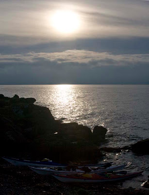
A final blaze and the sun was gone.


North of Bracken Bay we enjoyed a bracing paddle in the dying minutes of the day.


Behind us the sun had set behind the Heads of Ayr.


As we came into the shelter of the headland, the conditions moderated.


A final blaze and the sun was gone.


We paddled on into the darkness of a mid winter's night.

Wednesday, July 07, 2010

The end of a perfect day, in Loch Etive.


We drifted slowly, treasuring the moment and watching the sunset until the last red ember had cooled and there were only ash grey clouds on the western horizon.


Turning to the east again, we paddled deep into the confines of the "fjord like" Loch Etive.


The mountains and the darkness gradually hemmed us in until we were paddling in pitch darkness. A compass bearing took us back safely to the pier at Taynuilt. It was to be my last paddle before my knee operation in March but that is not why I treasure this paddle's recollection. Sadly, it was to be the last paddle with our friend Jim B. We will never forget him, his smile lightened the darkest night.

Wednesday, April 07, 2010

A night crossing of the Firth of Lorn by kayak.


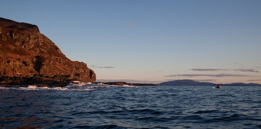
As we left Loch Buie and entered the Firth of Lorn we encountered a large swell rolling in from the Atlantic. In the distance we could see the rounded outline of Scarba on the far side of the Firth.
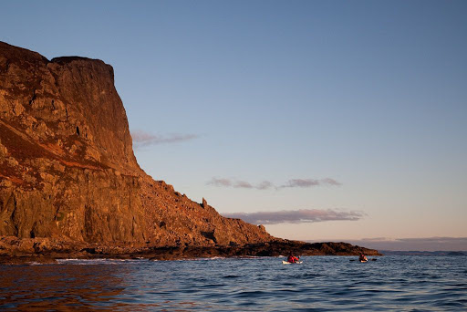

Once round the point, the swell subsided and we passed close under the mighty cliffs of An Garradh. Mull has a reputation among climbers for rotten basalt rock but these cliffs looked superb. I wonder if any climbers have been here? The cliffs were lit by a lovely warm light except for the tops which were in the shade of some low cloud on the western horizon.
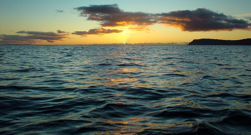

The sun set at 1715 and a cool NE wind began to get up.

In the fading light, we continued along the base of the cliffs and paddled inside of Frank Lockwood's island. This is no more than a flat skerry. Lockwood, 1846-1897, was Solicitor General of Scotland. He and the 21st MacLaine of Lochbuie were married to sisters and the two men became good friends. I suspect the island was named as a joke, Frank certainly would not have made much of a living from it.
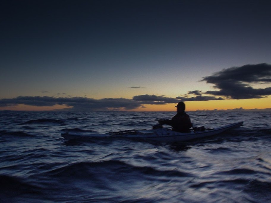

At 1735 the light was fading fast and we had started on the final 16km open crossing to Seil. The waves began to build as we became more exposed.

We hit a F3-4 45 degree headwind and an adverse 1 knot tide. Most of the crossing was by starlight and we could only feel and taste the waves. We eventually landed at 1940 (nearly two and a half hours after sunset) after covering a total distance of 44km.
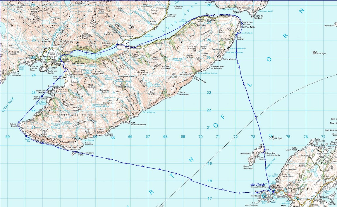

The GPS track shows where we took two brief breaks and were carried down wind and tide. After the second break we stopped maintaining a ferry angle to keep on the GPS bearing to Seil. We could see the lights of Easdale and just paddled straight for the them. You can see how the 1 knot tide and wind then carried us off course.

The backup plan, if weather turned before we left Loch Buie, was a rather decent B&B on Mull.

We do most of our paddling in winter on day trips so we are quite used to coming home in the dark. We are fair weather paddlers and so carefully watch the weather forecasts beforehand. I checked tide times and flows and marked up our maps with the details, I also checked the times the Colonsay ferry would cross our route and made sure we were not there!

For the crossing we had 5 head torches for the three of us and spare batteries, VHF radios and listened on 16 for the MSI weather broadcasts, EPIRB, rocket flares, daynight hand flares, laminated maps, compasses and mapping GPS. For most of the crossing we paddled three abreast for ease of maintaining contact.

We all had dry suits, goretex fleece lined mountain caps and pogies and carried spare neoprene gloves and balaclavas. Under the dry suit I wore Fourth Element Arctic gear which is a thick double fleece.

In case there was a problem after we left Loch Buie, we also carried spare Buffalo jackets and trousers and a 4 man bothy bag and foam mats to sit on. Spare food, water, stove, lighter, dry kindling, first aid kit and boat repair kit. If the wind did get up (we also had an ebb tide to contend with) and we could not get uptide and upwind to Seil, we could have made a run for the east coast of the Garvellachs and bivvied there or, if it was open, used the bothy on Garbh Eileach.

If the weather got right out of hand, we had short tow ropes with which we could have maintained a raft and run before it, towing a drogue. If real s**t had happened I could have let the EPIRB off but it would have had to be pretty bad to do that, after all I didn't let it off when I dislocated my knee on Gunna!

Saturday, March 27, 2010

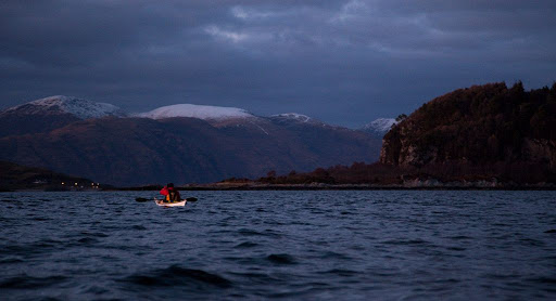
After sunset in the Lynn of Lorn.


The ebb tide carried us out of Loch Creran and into the Lynn of Lorn.


It was half an hour past sunset and the light was fading fast as the bubbling tide carried us by the pole marking Dearg Sgeir.


The air was so clear that we could see all the way down the Firth of Lorn past the distant mountains of Mull...


...but we now turned our bows to the NE. Only a few scattered lights on Lismore and the snowy summits of Morvern resisted the relentless approach of the darkness of the night.


The snowy summit of Ben Cruachan glowed softly in the night, beyond the wooded slopes of Clach Tholl, a former sea stack.


Ahead, the lights at the pier head at Port Appin told us that we would soon have finished another superb paddle.

Wednesday, January 27, 2010

Passing ships in the night.


From the Gantock Rocks we had to cross the main shipping channel in the Clyde on our return to Lunderston. To the south of us, the steady white flash of the Cowal mid channel marker showed us the area of highest risk. We put our head torches on and paddled at a steady 8km/hr across the 2.8km to the Lunderston shore.


The sun had set some time ago and the cold air gripped us as we made our way over the snow covered sands to the car park.


The dying embers of the day still glowed round the smokeless chimney of Inverkip powerstation. Its height and bright red aircraft warning lights make it the best marine navigation beacon on the Clyde. I will be very sorry when it is demolished to make way for a housing estate.


Just as we were wrapping up, the very business like offshore tug/supply vessel, MV Kingdom of Fife made her way down the channel at 10.5 knots. She was built in 2008 by Damen Shipyards of the Netherlands. She is 61.20m long by 13.50m beam and a gross tonnage of 1459.00t. We were quite glad to have cleared the channel before her arrival.


Altogether we had covered 30km on a lovely circular route in the Clyde. It proved a very variable route with lots of interest and the contrast between the docks at Greenock and the glaciated mountain confines of Loch Long was quite dramatic. Once again I am grateful to Jim and to Phil who lifted and laid both my kayak and myself.

Thursday, April 09, 2009

A Fyne cetacean sunset


We made our way steadily up Loch Fyne as the sun was setting. We could not resist stopping at this little shingle beach which was guarded by a ring of boulders.


Setting off once more, we were accompanied by a school of porpoises as we paddled up Loch Fyne. We knew we would not see the dolphins again that night as porpoises keep well clear of them.


As the day day slipped away...


...the sky and the sea turned to gold.


By this time the wind had died completely and...


...only our wakes disturbed the surface of the sea.


Even the courting eider ducks and oyster catchers fell silent and the only sound was the dripping of our paddles.


The embers of the wonderful day that been finally died away in the west and we finished our journey in darkness.

What a day!

19/03/2009

Tuesday, April 07, 2009

Night time in Troon harbour


In the darkness we swung round the outer harbour wall at Troon. The moon and constellation Plaedes could be seen behind the lighthouse.


From far out at sea, we had heard a strange roaring noise. It turned out to be a huge shredder which was chipping logs. This grab crane was feeding about 20 logs at a time into this tree slaughter-house. There was no fine end as bedroom furniture for these pine trees!


Recently we had seen a huge pile of logs on Portavadie pier. Perhaps it was these ones which were now being chipped. By shipping logs to Troon, the west coast roads are spared a lot of heavy timber lorry traffic.


We made paddled past the High Speed Ferry terminal and made our way into the inner harbour where the fishing fleet was unloading.


The welcoming lights of the Wee Hurry fish and chip shop can be seen on the quay. Fresh fish is cooked to order, it is well worth a visit. They serve a variety of seafood dishes including things like cullen skink soup, squat lobster-tails in spring rolls, battered langoustines and of course haddock and chips! For those with a more sophisticated palate, McCallum's Oyster Bar is right next door.


We then explored the rest of the harbour. At low tide a series of tunnels, linking the inner and outer harbour, are big enough to paddle through but do so on a falling tide! We then paddled past the Trent class RNLI lifeboat. In the distance multi coloured containers under floodlights marked the RORO freight ferry terminal for Ireland. This opened in 2001. In the 1960's this was a ship breaking quay and I remember destroyers and submarines meeting their end here.


Finally it was time to go home and we paddled round from the harbour back to the Ballast Bank. The lights of the rest of the returning fishing fleet stretched away into the darkness of the Firth of Clyde.

Please note this is a busy working harbour, even at night. Look up the P&O ferry timetable before you come and avoid ferry arrival and departure times. Fishing boats and yachts can arrive or leave at any time so keep a sharp lookout and have a bright white light on each kayak.

01/04/2009

Friday, January 25, 2008

Till a' the seas gang dry


"Till a' the seas gang dry." R. Burns

Leaving Bute we headed for the north tip of Great Cumbrae. The full spring tide of about 3km/hr was ebbing down the channel and the wind had swung round to the north. It was thirsty work what with the pub having closed some time before our arrival on Bute.


We eventually made landfall on the west of Great Cumbrae as sun sank towards the horizon behind an approaching front.


We took another break on the north east of Great Cumbrae before the final crossing to Largs marina. We had a small break as we let the MV Alainn past on her way to Largs


By the time we got back to the slipway at the marina it was nearly dark.


32km is not bad for a short winter day. Pity the pub was closed!

12/01/2008

Wednesday, December 19, 2007

Mysterious nocturnal "goings on" on Lady Isle.


The recent weekend weather in the West of Scotland has not been particularly conducive to sea kayaking. However, this week has been blessed with a high pressure system resulting in light winds, clear skies and hard frosts. Suffering withdrawal symptoms on one of the shortest days of the year, David, Gavin, Harvey, Tony and myself convened at the Ballast Bank in Troon on the Firth of Clyde. Our destination was Lady Isle which is only 4km away to the south west. Rumours were circulating of mysterious sounds, which locals had heard drifting over the bay from the direction of the island on still nights! We were set to investigate and report back to you, the reader, our findings.

How, may you ask, did we get caught out by darkness on such a short trip? Well we saw no daylight whatsoever. We set off at 8pm which was some four and a half hours after sunset! The temperature then was a reasonable -1.5C but when we returned at 10:30pm it had dropped to -5C.


Navigation was no problem due to the regular white flash (every two seconds) of the lighthouse which is situated in the middle of the island. This was built in 1903 in place of an unlit stone built tower. There is a smaller stone beacon nearby, which was built in 1776 at the same time as the stone tower. The Ayrshire ports were hazardous for sailing ships to enter in strong SW to NW winds. In these conditions ships could find safe anchorage in the lee of Lady Isle by lining up the two stone towers.

The night was clear with a near threequarter waxing gibbous moon. Mars, Orion, the Plough and Cassiopeia were prominent overhead but apart from the flash of the light, the island itself was just an indistinct shadow. As we approached we became aware of a curious bellowing and groaning coming from the island. The source of the mysterious sound was soon discovered. This is the mating season for grey seals and it proved to be in full swing. In the darkness we could see little of the actual events but the sounds were quite self explanatory. After a particularly prolonged roaring between two bulls, the defeated seal made off into the sea with a great splash. To Harvey's great concern he swam straight for us. To the recently defeated bull we might appear as slim and attractive newcomers that might succumb to his needs and desires (all 800lbs of them). We behaved as unseal like and as unfemale like as we could. Neither did we wish to rekindle his fighting spirit by giving more than a passing glance at the shadowy figures of the harem of females waiting for the master.

Last night we fortunately returned to shore as mere observers of, rather than as participants in, the ancient rituals which have been acted for countless generations under the winter moon on Lady Isle. Kayako intacto as they say.

18/1/2007


This photo shows Troon South Beach on 20/10/02. Last night we launched from the distant point. You can just see the lighthouse on Lady Isle at the left of the photo. There is a yacht to its left.

Sunday, February 04, 2007

A tale of two lighthouses.


"I heard you on the wireless back in Fifty Two
Lying awake intent at tuning in on you.
If I was young it didn't stop you coming through."
-Video killed the radio star. The Buggles.

Paddling in the pitch black last night I found my self humming the above song. In the darkness we were particularly grateful for the flashing light buoys that mark the Hunterston shipping channel. This was despite the reassuring glow and precise information about our location and speed from my GPS. This got me thinking about lighthouses such as the one above which is situated on a raised beach on the west coast of Little Cumbrae in the Firth of Clyde.

This magnificent building was constructed in 1793 to a design by Thomas Smith. The work was supervised by a Glasgow university student, Robert Stevenson, who was later to marry Smith's daughter.


The 1997 light is the square tower to the right of the 1793 model.

Sadly the light is no longer active. It was replaced by a simple concrete tower in 1997. The current light is a white flashing light with a period of 6 seconds. Despite its youth, this tower looked in worse condition than its venerable predecessor. Is this a story similar to the "Twa brigs o' Ayr"? Does anyone remember when you could get an electric kettle fixed? Nowadays many things things are not built to last. It seems this would include lighthouses. Has it been purposely built with a short lifespan because the Northern Lighthouse Board know something we do not?

Has GPS killed the lights?