Thursday, February 08, 2007

Dunagoil Iron Age hill fort, Bute


On our recent paddle back from Arran, we made landfall under the magnificently situated Dunagoil hill fort. Although man has been on Bute for 6,000 years, the fort dates from the Iron Age, about 2,500 years ago. The vitrified walls can be seen on the crest of the hill. The stones that compose the walls of the fort have been intensely heated until they have melted together. There is a similar vitrified fort on Eilean Buidhe, one of the Burnt Islands in the Kyles of Bute. Strangely, there are no vitrified forts in England or Wales.

Archaeological excavations have uncovered many artifacts which were used by the people who lived here. These included tools and moulds for the manufacture of iron weapons but also included more peaceful items such as weaving combs and jewellery.

Wednesday, February 07, 2007

Winter storms isolate the islands


Our recent calm crossing to Arran on MV Caledonian Isles has not been typical of this winter. Island communities in Scotland have been isolated for long periods when the ferries have been storm bound. Simon Willis's site recently carried remarkable pictures of the Corran ferry sailing, despite stormy weather, to maintain the link to communities on the isolated Ardnamurchan peninsula.

This week, the Daily Mail and the Independent have reported calls for a tunnel to be built connecting the Western Isles to the mainland. Suggested routes are either from Stornoway on Lewis to Ullapool (41 miles) or from Benbecula to Dunvegan (25 miles) on Skye, which already has a bridge link to the mainland. If this dream is realised it would transform access to the Outer Hebrides and make a link across the Sound of Harris even more vital.


Even in calm conditions, we felt a sense of isolation and commitment as MV Caledonian Isles steamed away from Brodick back to the mainland, an hour away.

Here are another couple of photos from our Arran trip taken with the little Sony DSC U60 camera.


This is an over the shoulder shot looking back at Tony, who is dwarfed by the scale of the sea and the mountains of Arran.


The sun is well set behind the mountains of Arran.

At maximum aperture, the shutter speed was only 1/25th second. I panned on Tony so he is reasonably sharp. The movement and slow shutter speed have blurred the background. Despite its imperfections, I like this photo because it brings back the chill and uncertainty of the approaching darkness. We still had an hour paddling back to the mainland.

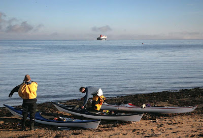
We sea kayakers are lucky, we can choose when to make our crossings, islanders and their provisions and exports cannot.

Sunday, February 04, 2007

A tale of two lighthouses.


"I heard you on the wireless back in Fifty Two
Lying awake intent at tuning in on you.
If I was young it didn't stop you coming through."
-Video killed the radio star. The Buggles.

Paddling in the pitch black last night I found my self humming the above song. In the darkness we were particularly grateful for the flashing light buoys that mark the Hunterston shipping channel. This was despite the reassuring glow and precise information about our location and speed from my GPS. This got me thinking about lighthouses such as the one above which is situated on a raised beach on the west coast of Little Cumbrae in the Firth of Clyde.

This magnificent building was constructed in 1793 to a design by Thomas Smith. The work was supervised by a Glasgow university student, Robert Stevenson, who was later to marry Smith's daughter.


The 1997 light is the square tower to the right of the 1793 model.

Sadly the light is no longer active. It was replaced by a simple concrete tower in 1997. The current light is a white flashing light with a period of 6 seconds. Despite its youth, this tower looked in worse condition than its venerable predecessor. Is this a story similar to the "Twa brigs o' Ayr"? Does anyone remember when you could get an electric kettle fixed? Nowadays many things things are not built to last. It seems this would include lighthouses. Has it been purposely built with a short lifespan because the Northern Lighthouse Board know something we do not?

Has GPS killed the lights?

Saturday, February 03, 2007

Incredible day (and night!) in Firth of Clyde


Leaving the beach at the mouth of rugged Glen Sannox at the north east corner of Arran in the Firth of Clyde.

We took the ferry across to Arran with the plan of paddling back to the mainland via the north of Arran, Bute and Little Cumbrae. We reckoned we would have a little twilight paddling.


Looking south west to Arran from Dunagoil Bay, Bute.


Paddling down the south west corner of Bute towards Garroch Head.


Rounding Garroch Head with the sun setting behind Arran. Still another 10 km to go!


Even in calm conditions, the tidal race of Garroch Head kicks up some movement in the water.


Paddling in the dark across the Hunterston Channel before moon rise.

After sunset a force three wind got up which managed to give some wind against tide turbulence in the channel. This was seat of the pants paddling. The next point of concern was crossing the Hunterston shipping channel. This is only 500m wide but is used by some of the biggest ships in the world. We had bright white lights, flares, stobe light, camera flashes and VHF but common sense tells you that a 300,000 ton bulk carrier is neither going to be able to stop or manoeuvre in a narrow channel, even if it was full daylight. We paddled for the red light that marked the port side of the channel and looked both ways very carefully. Seeing no ships we sprinted straight across to the green bouy on the far side of the channel. The buoys are very useful as you know big ships will do their best to keep between them. The buoys show where you are safe from big ships (but not of course from faster smaller vessels).


Our route was 32.5km.

The fog meant the ferry was about 30 minutes later than it should have been and we had to paddle slowly up to Glen Sannox behind the clearing fog. This lost time meant we had more night paddling than we had anticipated. We headed off to Bute (hidden by fog) on a compass bearing and using a GPS way point. Fortunately the fog lifted as we crossed. What a great day!

Glen Sannox


Mobile phone photo

Fog lifting from Arran just in time for 10 km crossing to Bute


The message below did not make it through to Blogger:

15:44 Bute


Mobile phone photo

Fog cleared on way over, building up for big sunset and moonrise. 12 km to Portencross

Heading for Arran


Fog is lifting sun coming through. We will be paddling back in moonlight.

Friday, February 02, 2007

Troon sunset


Down at Scott's restaurant in Troon marina for Dad's 80th birthday. He is looking well! What a sunset, followed by moon rise. Forgot camera so this is by email from phone. Arran looked fabulous. Tomorrow?