Showing posts sorted by relevance for query "04/04/2009". Sort by date Show all posts

Tuesday, April 28, 2009

The Nith bore


Leaving Glencaple, we entered the 2.5km straight channel, which is hemmed in by mud banks and connects the Nith to the sea at Airds Point. It was here that we expected to meet the Nith bore. It was 2 days after springs, on an 8.1m tide, so we expected a wave or two! It was 12:43. High water Hestan Island (0n the Solway) was due at 14:47 (HW Liverpool 14:21) We were drifting downstream with the river current at 8km/hr when all of a sudden the water ahead began to slope down towards us, its colour darkened and its surface was contorted with small ripples, then whumph! We were now travelling back towards Dumfries at 12km/hr. There was no broken water just a sudden change in velocity of 20km/hr! It was really quite disconcerting.

We were going to make nothing against the current on the right side of the channel, so we ferried across to the far side where the water was shallower. This and the help of an eddy allowed us to get another 500m towards the sea. We then ferried back to the right side of the channel where a series of piles created a little eddy from which we clambered onto the mud bank.


We dragged our kayaks up the steep mud and onto the merse above. We decided to have a lunch break and watched the tide rush by, filling the bay and covering the mudflats.


Just as suddenly as it had begun, the flood tide began to ease after only an hour.


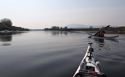
We were soon on the water again and clearing Airds Point. Criffel came into view with Carsethorn at its foot. Carsethorn is another of the ports of Dumfries.


Carsethorn lies on the long low peninsula on the horizon, it was still 6km away.

13/04/2009

Tuesday, November 06, 2007

The sad hulk and glorious past of the City of Adelaide


The sad hulk of the once proud City of Adelaide sailing clipper lies high above the flotsam and jetsam of Irvine inner harbour. She was built in Sunderland in 1864 and at one time held the record for the fastest sailing voyage between London and Australia. She has wooden planking over an iron frame and was built to carry both passengers and cargo. Two of the passengers, making a new life on her maiden voyage, were George and Annie Wilcox. (I am not sure if there is any family link.) Her first master was a Scot Captain David Bruce. Two of his sons were later to succeed him as master. All together she made 23 return voyages to Australia until she was sold in 1887 during the Australian depression.

In later life she spent nearly 50 years moored on the Clyde, in the centre of Glasgow, as the RNVR ship SV Carrick. She sank in 1991 and was later transferred to the Scottish Maritime Museum at Irvine. Unfortunately funds have never been found to restore her. A ray of hope exists as an Australian charity "Save the clipper ship City of Adelaide" is raising money for her restoration. The Australians recognize her crucial importance to the history of their country. It is estimated that 1.1 million Australians are descended from immigrants who made the long voyage to the other side of the world in the City of Adelaide.

Many people in Scotland have links with Australia. My brother emigrated to Melbourne and my wife's brother emigrated to Brisbane. We must go, probably in a Boeing 747. I wonder if any of them will still be around in 143 years?

Added 07/04/2009
Please see an update about the City of Adelaide here.

Wednesday, April 22, 2009

Red rocks at Kildonnan.


After a pretty late start on Sunday morning, we launched from the beach at Kildonan at half tide. The middle beach is composed of great slabs of old red sandstone. These sedimentary rocks were laid down when this part of Scotland lay on the equator. Their deep red colour still hints at the heat of ancient equatorial sunshine.


The ruined tower of Kildonan Castle sits on the cliff line of a raised beach. It was built by the Lords of the Isles but became a Royal Castle at the beginning of the 15th century. My careful framing of the photograph does not show that it is actually at the bottom of the garden of a private house.


We continued under the raised beach of Dippen Head. This is one of the few parts of Arran where the road does not hug the coast and it is a truly wild place.


Jennifer waited for us at Largybeg Point beyond which ...


... Holy Island came into view.


By the time we reached the dark red sands at the north end of Whiting Bay, it was time for a break. Jennifer went for a swim ...


... while David, Phil and I enjoyed a refreshing luncheon under the unaccustomed heat of the early Spring sunshine.

19/04/2009

Friday, April 17, 2009

In search of the Nith bore!


Easter Monday dawned fair over Fleet Bay in the Solway Firth.


Time for an adventure! I drove to Southerness where I met Mike and left a car before driving on to Dumfries. The farm land round Southerness plays host to thousands of overwintering barnacle geese from Svalbard archipelago, high above the Arctic Circle.


We were off in search of the Nith bore. The Nith is one of the few rivers in the world to have a tidal bore. As you can see in the aerial photo, a funnel shaped estuary concentrates and accelerates the incoming tide into a narrow river mouth. High tide at Hestan Island (further west on the Solway Firth) was at 14:47 BST and I reckoned that the bore would arrive in the narrow section of river mouth near Glencaple about 2 hours before this.


This photo was taken by Dr Werner Kissling in 1958. He describes it thus "At Glencaple, close to the mouth of the river Nith, on the north shore of the Solway the flood tide, under certain conditions, comes in as a bore which may move at a rate of five knots, or even more."


We couldn't wait!

13/04/2009

Wednesday, April 29, 2009

Sea kayaking Carsethorn to Southerness


Crossing the broad expanse of Drum Bay we approached Carsethorn .Having been denied white topped foaming Solway Steeds we now looked forward to some white topped foaming pints of Guinness in the waterfront beer garden of the Steamboat Inn. Sadly, our thirst went unslaked, not only were the no rooms, the Inn was closed!!!! Hopefully, it will reopen soon.


Chugging up and down, just off shore, the Leah Marie, MT117, was dredging for cockles. For most of the day the Carse Sands are dry land. They are only covered by water for a couple of hours at high tide. This little trawler from Maryport on the English coast of the Solway had to time her arrival with some precision. She is quite a new boat having been built in 2006 but it looks like she has a wood burning engine in there!


Quite thirsty we came to the Thirl Stane. At high tide you can paddle right through this natural arch into a delightful sandy cove behind. As it was, the tide was retreating quickly and we had to press on to our final destination Southerness.


Southerness is a rocky point which extends south into the sands of the Solway coast. The lighthouse is the second oldest in Scotland. It was commissioned in 1748 to encourage ships to use the ports of Carsethorn, Glencaple, Kingholm Quay and Dumfries.


The lighthouse is surrounded by water at high tide. It was heightened on at least two occasions but due to decrease in shipping traffic in the Upper Solway it was last lit in 1936.


The old village of Southerness is rather attractive with low cottages which seem to shrink into the ground to escape the winds that blast across the point. Unfortunately it has grown somewhat and is now surrounded by a huge caravan park. We chose not to stop at the pub.

All in all a thirsty 25km trip from Dumfries to Southerness but what a magnificent way to enter the Solway!

13/04/2009
Tuesday, April 07, 2009

Night time in Troon harbour


In the darkness we swung round the outer harbour wall at Troon. The moon and constellation Plaedes could be seen behind the lighthouse.


From far out at sea, we had heard a strange roaring noise. It turned out to be a huge shredder which was chipping logs. This grab crane was feeding about 20 logs at a time into this tree slaughter-house. There was no fine end as bedroom furniture for these pine trees!


Recently we had seen a huge pile of logs on Portavadie pier. Perhaps it was these ones which were now being chipped. By shipping logs to Troon, the west coast roads are spared a lot of heavy timber lorry traffic.


We made paddled past the High Speed Ferry terminal and made our way into the inner harbour where the fishing fleet was unloading.


The welcoming lights of the Wee Hurry fish and chip shop can be seen on the quay. Fresh fish is cooked to order, it is well worth a visit. They serve a variety of seafood dishes including things like cullen skink soup, squat lobster-tails in spring rolls, battered langoustines and of course haddock and chips! For those with a more sophisticated palate, McCallum's Oyster Bar is right next door.


We then explored the rest of the harbour. At low tide a series of tunnels, linking the inner and outer harbour, are big enough to paddle through but do so on a falling tide! We then paddled past the Trent class RNLI lifeboat. In the distance multi coloured containers under floodlights marked the RORO freight ferry terminal for Ireland. This opened in 2001. In the 1960's this was a ship breaking quay and I remember destroyers and submarines meeting their end here.


Finally it was time to go home and we paddled round from the harbour back to the Ballast Bank. The lights of the rest of the returning fishing fleet stretched away into the darkness of the Firth of Clyde.

Please note this is a busy working harbour, even at night. Look up the P&O ferry timetable before you come and avoid ferry arrival and departure times. Fishing boats and yachts can arrive or leave at any time so keep a sharp lookout and have a bright white light on each kayak.

01/04/2009

Wednesday, April 08, 2009

Alan's sunset view of Bute!


Alan, a recent addition to seakayakphoto.com team, as just sent this photo by MMS into Seakayakphoto Towers. He was disappointed not to be able to join our recent windy sortie to the Little Cumbrae at the weekend so he has headed off on a solo trip today and is camping on the Little Cumbrae tonight. He originally planned to go round Bute in two days but has changed his plans due to increasing swell. He is currently on the beach enjoying a whisky by the camp fire. I hope my text with tomorrow's forecast of force 6 southerly doesn't spoil the enjoyment of the moment.

His photo shows the south end of Bute with Arran and Kintyre in the distance.

Updated 09/04/2009:
Alan is now spending a second storm bound night on Little Cumbrae. Today ferry traffic on the Clyde was severely disrupted by winds of up to 37knots. Hopefully the wind will drop tomorow.

Monday, April 27, 2009

Quays, trawlers, geese and the White Steeds of the Solway.


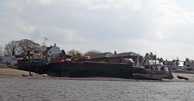
Making our way down the River Nith from the port of Dumfries, we came to Kingholm Quay.


Substantial boats can use Kingholm Quay at high tide. Petronella of Portsmouth is a converted beam trawler P673. She was built in Holland in 1964 and is 78 feet long. She worked out of Portsmouth then Shoreham before becoming unregistered in 2004.


Beyond Kingholm quay we caught our first sight of distant Criffel, 569m. Our destination Southerness, lies a further 8km south of Criffel's summit.


Huge flocks of wintering barnacle geese made an impressive sight as they flew from field to field, fattening themselves on spring shoots before their migration to Svalbard.


We now approached the quay of Glencaple on the long entrance to the Nith from the Solway. There is a warning in the Nith Navigation web site for boats not to anchor in mid channel as the Solway bore can flood in increasing in depth by 2 metres in 2 seconds!

In his History of the Burgh of Dumfries, 1867, William McDowall wrote:

"The Solway, into which the Nith flows, has peculiar characteristics, that render it quite a topographical study. Numerous currents meeting near its mouth keep up a perpetual conflict; and twice in every twenty-four hours the tidal flow, suddenly raised above its ordinary level, and rendered fierce by the tumult, seeks an outvent at the estuary, through which it rushes with a speed that is nowhere rivalled in the United Kingdom, or perhaps in the world. It hurries on, carrying a head four to six feet high, filling up the tortuous channels, and sweeping over the broad level beds of the Frith with a rapidity that has earned for its foam-crested billows the title of the White Steeds of the Solway."


Another old trawler Alison Louise, UK77, is tied up at the quay. She looks very battered and forlorn. She last operated out of Brixham but her days at sea are over. The smaller flat bottomed boat is the Askari, BA17 a scallop dredger. She can also be seen in Kirkcudbright and Girvan harbours.

The tide was due to arrive at any time. We could have waited for its arrival in the safety of the Nith Hotel but we chose to press on in search of the White Steeds of the Solway!

13/04/2009

Tuesday, April 21, 2009

To Arran via Ailsa Craig


We had originally intended going to Colonsay last Friday night but the easterly winds were up to 35 knots. The forecast for the Clyde on Saturday was for force 3 easterly and on Sunday force 3 southerly so we thought we would go on a little 42km trip to Arran via Ailsa Craig. We met at Lendalfoot on the south Ayrshire coast.


Of course the forecast wasn't quite right and we had a fresh northerly on Saturday. At nearby Campbeltown airport it got up to 19 knots. It made for a bumpy crossing and I thought that we would need to abandon our attempt on Arran. You can see from our track to Ailsa Craig where we got blown down wind on two occasions when the wind really got up.


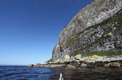
Instead, we decided to paddle round the Craig. On the sheltered southerly side we had amazing views...


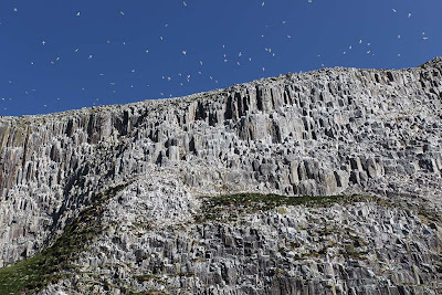
... of thousands and thousands of nesting gannets and....


... amazing rock architecture like here at Stranny Point.

18/04/2009

Friday, April 03, 2009
Nightfall over Lady Isle


Last Wednesday night we left work and the city behind.


We were bound for Lady Isle in the Firth of Clyde.


We launched from the Ballast Bank in Troon just as the High Speed Ferry from Northern Ireland came in. Fortunately the returning fishing fleet left smaller wakes.


They were also bound for Troon Harbour.


As the sun sank in the west, the light breeze dropped away and Lady Isle and the rocky dome of distant Ailsa Craig seemed to float on a sea of liquid gold.


The kink on our route on the way out was to slip behind the stern of the above fishing boat.

01/04/2009