Showing posts with label clouds. Show all posts

Wednesday, November 11, 2015

Erratic moments on the Mull of Ross, which should not be confused with the Ross of Mull.

Beyond Rumblekirn we rounded Point of Green before...

...paddling across the open mouth of Brighouse Bay.

The quality of the Solway light and the skyscapes were outstanding. A pod of leaping bottlenose dolphins added to the magic of the moment. Then a little breeze got up and allowed us...

...to complete the crossing with our sails up.

The east coast of Brighouse Bay at the Mull of Ross consists of razor sharp fangs of rock but there is one small breach, where we landed for a late afternoon luncheon.

The pebbles on the beach were a sight to behold. Most were of the local banded Silurian sandstone but here and there, there were erratics which had come some distance. The pink granite pebble is not local as Galloway granite is silver-grey. This one will have been brought here by glaciers during the Ice Age, possibly from the Ross of Mull. What a journey, from the Ross of Mull to the Mull of Ross!

What a view we enjoyed on our luncheon stop. We savoured the moment knowing that the day was coming to an end.

We climbed a little way up the Mull of Ross to make the most of the view but the lowering sun...

...called us back to the boats. We still had some way to go to Little Ross Island.

Friday, November 06, 2015

Setting off with a fair wind and tide on the Solway Firth.

The day dawned fair on Fleet Bay in the Solway Firth and as the line of clouds drew back to the SE we enjoyed some warm October sunshine.

Ian, Mike and I soon had our kayaks packed and at the water's edge. It had been our intention to paddle east to Sandyhills stopping at Little Ross Island and Hestan Island on the way. Unfortunately the firing range at Dundrennan was in use so we would not be able to pass. So we intended to do a there and back paddle as far as Kirkcudbright.

 It was a most marvellous start with a fresh tailwind and paddling...

 ...straight into the sun.

 The ebb tide was also with us and it seemed like no time at all until...

 ...we landed on Ardwall Isle for first luncheon.

We decided to climb to the top by way of the farm track which leads up from the beach. The farmer drives over from the mainland at low tide several times a year to cut the grass and bale it.


As we gained height we enjoyed a great view over the recently cut meadow to Murray's Isles Ravenshall Point and to Wigtown on the far side of Wigtown bay.

 There were plenty of brambles but almost no sloes.

From the summit we had a clear view back across Fleet Bay to where we had come from, the cluster of caravans under Ben John.

 The simple cairn at the summit of Ardwall Isle overlooks the grand...

 ...house at Knockbrex with its fields extending down to a little harbour.

Beyond Barlocco reef our way lay away to the SE, beyond distant Ringdoo Point.

For the full kayak stereovision experience follow Ian's blog which starts here.

Wednesday, August 26, 2015

An atmospheric crossing to Inchmarnock with a sighting of a fire rainbow.

 At 6pm we landed for a second luncheon on a little shingle bay to the north of Garroch Head. We had paddled to this point in shorts and tee shirts. We put our salopettes on, not because it was cold (it wasn't) but because we knew we would arrive at our destination on Inchmarnock about sunset and that is when the midges come out!

As we restored energy levels with a snack and a hot drink we enjoyed the most spectacular view across to Glen Sannox on Arran.

Back on the water we had an 11km crossing to our destination of Inchmarnock. We passed Dunagoil Hill which is topped by an Iron Age hill fort.

As we crossed Scalpsie Bay clouds began to gather but the horizon to the west was clear, promising a fine sunset.

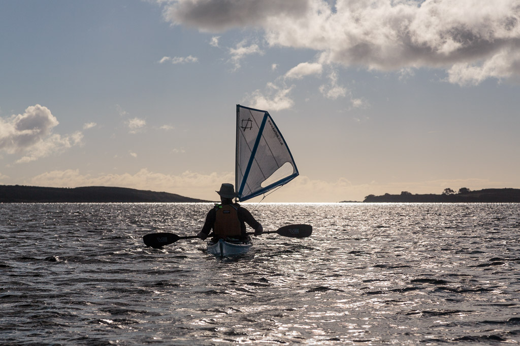
A little breeze got up as we passed...

...the fertile fields of Scalpsie farm on Bute which contrasted...

...with the rocky granite ridges of the Arran mountains on the other side of the Sound of Bute.

The sun was lowering towards the horizon as we...

...approached the south end of Inchmarnock. High in the sky we spotted cloud iridescence...

...which is not a commonly seen atmospheric effect. This is also known as a "fire rainbow" or a "rainbow cloud,"  It usually occurs in late afternoon on hot humid days.

The west coast of Bute is not easy to land on as at low tide there are a series of rocky reefs. It was near spring low water but we knew of a tiny gap in the reefs (about 8m wide). We arrived just after 8pm. This gully can be very difficult to launch from if there is any west in the wind. There are easier beaches at the south and north of the island. Although we had feared a midge attack we were pleasantly surprised that a little NW breeze stopped them flying.

Friday, August 21, 2015

Inchmarnock to the West Kyle.

We left the lovely but low lying isle of Inchmarnock floating on a wide expanse of limpid sea. It was...

...dwarfed by the high mountains of Arran on the far side of the Sound of Bute.

Our passage across the Sound of Inchmarnock was accompanied by a black throated diver which flew round and round us until it lost interest as we...

 ...entered the narrowing...

 ...confines of the...

...West Kyle of Bute.

We took a last look back at Inchmarnock before the last stage of our journey, which would take us on a winding route deep into the mountains where there would be no sign of an open horizon.

Tuesday, July 07, 2015

A quick blast down the Kyle to Rubha Dubh.

 We enjoyed some excellent paddle sailing in the West Kyle of Bute.

 The north end of Bute is a rugged place...

 ...but as we travelled south, the scenery became gentler with villages and farms. We decided to seek shelter from the north wind...

 ..in the delightful sheltered south facing bay at Rubha Dubh on the Bute side of the Kyle.

It was a great place to stop for first luncheon and...

...enjoy a great view to Ardlamont Point at the mouth of the West Kyle and the distant Arran mountains while clouds scudded across the blue sky.

Thursday, June 25, 2015

Carried away by the tide in the Sound of Jura.

When we left Lowlandman's Bay on the east coast of Jura, the flood tide was already running north through the Sound of Jura and would be our ticket home to Carsaig Bay on the mainland. We took a last look to the SE at the long peninsula of  Kintyre, which culminated in the Mull of Kintyre (at the extreme right of this photo) some 66km to the south.. The rocky mountains of Arran rose above the relatively low hulls of Kintyre. In the sky, streaks of gathering cirrus clouds fore told the wind that would arrive the next day.

As we travelled north, the view of the Paps of Jura became less anatomically correct with three (or even four) heaving above the horizon.

We passed the site of another Iron Age dun at the NE end of the peninsula, which nearly encloses Lowlandman's Bay.

To the NE, the Jura coast stretched away in a long succession of low headlands as far as the eye could see.

We followed the coast until we saw the wooded peninsula that marks the south side of Tarbert Bay where we had made landfall on Jura two nights previously. Then we struck out into the middle of the Sound of Jura to catch the full force of the tide.

 It was sad to be leaving Jura after such a rewarding but brief visit and once...

...the tide in the Sound caught us, it carried us quickly away.