Showing posts with label Sound of Arisaig. Show all posts

Friday, March 20, 2015

Eclipse in the Sound of Arisaig.

This morning dark low clouds obscured the skies above Glenuig. The fresh wind was blowing from the NW where the skies over Eigg and Rum appeared lighter. In order to try and see the eclipse we paddled out into the Sound of Arisaig. This photo was taken at was taken at 09:28. Unfortunately the clouds were too thick to see the sun and moon at maximum eclipse which was at 09:34.

But at 09:56 the clouds thinned, just for a moment. I whipped the 5D mk3 out and got three quick shots. It was a tad tricky getting a non waterproof full size DSLR out in the water conditions.

I now have three eclipses burned on my right retina, I just need to close my eye and I see them so clearly...who needs photos?

Friday, March 06, 2015

Glenuig expedition cut short after last sunset over Ardnamurchan.

 From Moidart we still had 4km to go till we got back to our setting off point at Samalan Bay near Glenuig. It would have been lovely to watch the sunset over Ardnamurchan from the beach at Port Achadh an Aonaich but it was getting cold and I began to feel rather unwell. I thought it was because I was feeling sick about my camera not working but...

There are many skerries and submerged reefs on the coast up to Smirisary but the swell and wind had both died away and we reached the headland at...

 ...Rubha Ghead a' Leighe without incident. To the east, the peaks of Rois-Bheinn, 882m, rose into a cold winter sky above Samalaman Island. It was a lovely sight but I turned back...

...to get this view of Ian and the setting sun which was heading for  the open Atlantic, beyond the tip of the Ardnamurchan peninsula.

We arrived at Samalaman in the gathering darkness to find the ladies of the Mallaig and District Canoe Club loading up after their outing in these beautiful waters. They were also staying at the Glenuig Inn and told Steve Macfarlane of our arrival. Steve kindly drove along with his trailer which was much easier to load than our cars!

Unfortunately I became very ill that night and was not even able to finish a delicious plate of prawns. I had developed 'flu which is still hanging over me 4 weeks later! Unfortunately I was not able to join Ian and Allan on the next two days paddling so you will need to read about them over on Ian's blog.

I was actually too ill to be upset at missing more paddling, anyway I had just enjoyed one of the most varied and best winter days ever! We might only have covered 26.5km but the scenery was stunning.

Sunday, March 01, 2015

Return to the Sound of Arisaig.

On the 6th of February, Alison and I drove north to meet Ian and Allan at the Glenuig Inn. We stopped for a break in some late afternoon winter sunshine on the shore of Loch Linnhe at Fort William.

There was not a breath of wind and FV Holly Rose OB158 was lying at her mooring perfectly motionless.

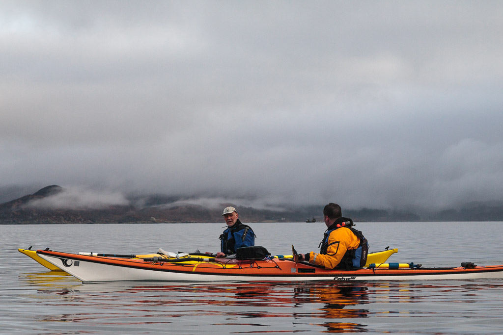
We arrived at the excellent Glenuig Inn just before dark but by the time we walked the dogs the sun was well set. We returned to the welcoming lights of the inn and enjoyed a tasty meal with Ian and Alan.

 The following morning we left Alison with my car and the dogs then drove for a short distance through the morning rush hour to...

...Samalaman Bay on the south shore of the Sound of Arisaig. It was not long after HW and the beautiful...

 ...white shell sands were not yet fully exposed.

A light smirr of rain was falling, the sort that soaks everything despite the small size of its droplets. To the NW there was a little brightness on the horizon but to the..

 ...east the clouds were well down on the hills. The branches and lichens on the sessile oak trees were dripping wet.

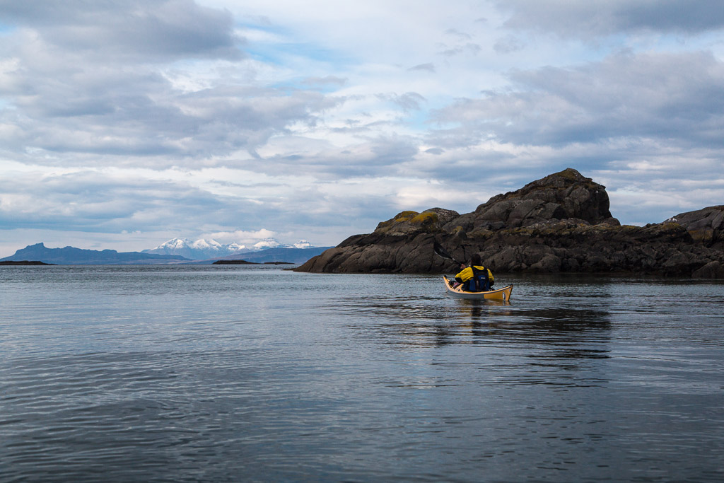
Then a remarkable thing happened. Alan and I had just set off when a gap appeared in the clouds...

 ...and we got a great view across to Eigg and...

...the snow streaked mountains of Rum behind.
 
 The north side of the Sound of Arisaig was still hidden by low cloud but...

 ..ever so gradually the clouds began to lift. As we approached...

 ...Rubha Ghead a' Leighe, the headland at the southern entrance to the Sound of Aisaig, the wind and swell..

 ...began to pick up and we enjoyed some fun in close proximity to the rocks by Ian's Inlet.

Having said that we did not inspect the rocks quite so closely as Ian had done on one of our previous visits and we all remained relatively dry!

Wednesday, January 08, 2014

Sea kayaking desktop wallpaper calendar 2014.

I wish a very Happy New Year and a great 2014 paddling season to all visitors to seakayakphoto.com. As way of a celebration of the last year and in anticipation of sea kayaking adventures yet to come, here is the 10th annual sea kayaking desktop wallpaper calendar from seakayakphoto.com. I apologise for its late arrival. Neither my computer nor myself have been in the best of health.

As in past calendars, all the photos were taken during the previous year (2013). Unfortunately I have not been paddling over the last 6 months so the choice of photos has been more limited than previous years. Nevertheless I have been able to choose photos from north and south of Ardnamurchan Point, the Inner Hebrides, the North Channel, the Firth of Clyde and the Solway Firth.


January.
The Little Cumbrae lighthouse in the Firth of Clyde proved surprisingly popular despite being in the depths of winter. We met friends from the Drumchapel and Clydebank Kayak Club there.

Link to 8:5 desktop 1920 x 1200.
Link to 4:3 desktop 2048 x 1540.

February.
Rubha Carrach is on the exposed northern coast of Ardnamurchan. This coast is not paddled as often as it should be. Most circumnavigators of the British mainland cross to Eigg or Rubh' Arisaig on their headlong dash north. Paddlers staying in the area are faced with a circumnavigation of the whole Ardnamurchan peninsula if they only have one car, or a very long shuttle (over very slow single track) if they have two cars.

Link to 8:5 desktop 1920 x 1200.
Link to 4:3 desktop 2048 x 1540.

March.
Glenuig Bay opens into the Sound of Arisaig and views extend along the Ardnamurchan peninsula and to Muck and the other Small Isles. One of the great joys of winter paddling is returning in the dark!


April.
The north coast of Rum in the Sea of the Hebrides is a wild place. This is the sad wreck of the Jack Abry II, a French trawler that ran on to the rocks here just before midnight on the 31st January 2011. Fortunately, despite a gale and the surrounding cliffs and mountains, all 14 men on board were airlifted to safety by the Stornoway coastguard helicopter.


May.
The Mull of Kintyre is a rather committing paddle. The tide was moving at  6 knots and even in benign conditions there was no landing for 25km. It sticks out into the North Channel which separates Scotland from Ireland. On this misty day there was no sign of Ireland and we felt like we were paddling round the edge of the World.

Link to 8:5 desktop 1920 x 1200.

June.

Kylie the dolphin can often be found near Ardlamont buoy at the
mouth of the the Kyles of Bute.
July.
Murray's Isles lie in the mouth of Fleet Bay on the Solway Firth. In early summer they host noisy colonies of cormorants and gulls. The cormorants need to keep a watchful eye on their eggs and chicks as the gulls swoop down on any unguarded nest. It is a wonderful experience to drift in the tide past the colonies in kakak and watch, hear and smell the constant activity.


August.
Nothing can be finer than paddling across the mouth of Loch Fyne on a summer evening.

September.
The surf beach at Machrihanish is exposed to the North Atlantic swell and extends for over 6 kilometers. It is probably wise not to surf a fully laden sea kayak in amongst the surfers. The dune system behind the beach is one of the largest in Scotland.


October.
Shoe Bay is easily missed as it is hidden in the skerries at the mouth of Loch Moidart. The name comes from the very soft sand which swallows footwear!


November.
The dramatic outline of An Sgurr is the highest point of Eigg in the Sea of the Hebrides.

Link to 8:5 desktop 1920 x 1200.

December.
This is the view to the Small Isles from the silver sands of Morar Bay.  The bay is shallow and tidal and in a westerly wind, steep breaking waves build up as the ebb tide rushes over sandbars. On this trip the wind was from the east and all was calm.

Link to 8:5 desktop 1920 x 1200.

Sunday, June 16, 2013

Caught on the wrong foot, retreat to Ardtoe.

Leaving the north channel of Loch Moidart we ignored the tempting sight of the Small Isles, Eigg and Rum and turned to the north where...

 ...we entered a turquoise lagoon where we...

 ...stopped for a well deserved second luncheon.

 We had intended continuing north and spending the night in a bothy in the Sound of Arisaig but two events changed our mind. The first was a phone call from my wife telling me that a family member was undergoing a life threatening major surgical operation. The second was the MSI weather warning on the VHF. It warned of imminent gales and heavy snow. Although we would have chosen a bothy in a relatively sheltered position in Loch Ailort, the medical news left me no option but to turn back. Ian is such a gentleman that he made it very easy to make the decision. We looked back wistfully to the mountains in the north but we both knew that we would return.

 We passed the hidden channel of the north entrance to Loch Moidart and the...

 ...the rocky ramparts of the west end of Eilean Shona before...

 ...rockhopping among the skerries and...

 ...channels to the hidden...

 ...sands of Ardtoe...

 ...which require maze solving skills...

 ...to finally find.

As a footnote, Ian and I faced blizzard driving conditions on our separate roads home and the March snows proved to be the worst of the winter with their drifts persisting well into April. Ian returned to his work at sea shortly but we will hopefully paddle again in late summer. Ian's account of this trip can be read here, here and here.

Friday, June 14, 2013

High and dry in Loch Moidart north channel.

At the east end of Shona Beag, the ebb tide was running strongly back down the south channel of Loch Moidart. once we rounded the end of the island we could see that the tide in the north channel was running east and joining the west flowing ebb in the south channel so I was pretty sure that the bar in the north channel would be dry.

My assumption was correct. High water in Loch Moidart was 08:54 and it was three days after springs. At 13:21 we were able to paddle right up to the causeway that the "road" runs over to Eilean Shona.

 Looking west down the north channel from the causeway.

Looking east up the north channel after the short portage across the causeway. For any future trips I am pretty sure that 3.5 hours either side of high water in Loch Moidart should see you through without a portage. No time was to be wasted, not even for a drop of The Singleton. We remained quite dry as we raced to beat the tide.

The north channel was emptying quickly and water was extremely shallow for a considerable distance below the causeway...

 ,...so it was a great relief to enter deeper water.


The Sgurr of Eigg acts as a focal point at the far end of the north channel which is...

 ...hemmed in by steep rocky slopes. We called this balanced rock "the Mushroom".

 The opening to the north channel is blocked by a series of low reefs and...

 ...green lagoons interspersed with...

 ...coral sand beaches.

Then we were clear, into the Sound of Arisaig with magnificent views to Eigg and the snow covered Cuillin of Rum beyond. Time for a swally *

* swally (n) a quenching of one's drouth.