Showing posts with label Mull of Oa. Show all posts

Saturday, October 15, 2011

Oa, what a beautiful day!

We really had found a piece of Paradise on the Oa peninsula of Islay. The bay was ringed by jagged stacks and the beach was backed by sheltering cliffs.

The turquoise sea was crystal clear and...

 ...the sands were washed by the gentle beat of the Atlantic surf.

 We gathered driftwood from the high tide mark and as...

...night fell, we warmed ourselves by the fire. Oa, what a beautiful day!


Friday, October 14, 2011

And they say there is no "Oa" in Paradise!

 From Laphroaig we had intended paddling across Caolas an Eilein to the island of Texa. However, the north wind was by now rather strong and we didn't particularly fancy getting blown past the Mull of Kintyre towards Ireland!

So we hugged the coast round to Port Ellen, where the MV Isle of Arran was lying at her berth. The wind was whistling out of Kilnaughton Bay. We used the lee of a series of skerries to hop half way across the Bay. Then Tony and I had to paddle across the exposed other half using a very high ferry angle and a lot of puff!

It was a relief to get into the shelter of the Carraig Fhada lighthouse. It was built by the Laird of Islay in 1832 to commemorate his wife who had died aged 36 years. We rested here for some time till we caught our breath...

...only to loose it again with the breathtaking beauty of the Mull of Oa (pron. Oh) coast.

 It was only 4pm but we had arrived in Paradise so...

...there was no point in going any further.

P.S. Tony mentioned the built in shower...

At the back of the beach, a burn cascaded over the top of the cliffs to form a natural shower. This was not just Paradise, it was Paradise with mod cons!


Tuesday, September 28, 2010

Who's been sitting in my chair?


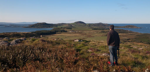
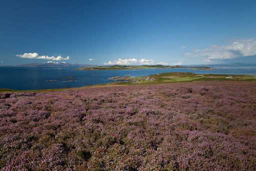
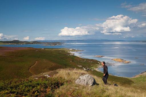
From Cara House, we made our way slowly up the spine of the Island towards the Mull of Cara. We looked back northwards over the blooming heather of Cara to a magnificent view encompassing, Jura, the Sound of Jura, Gigha, the Sound of Gigha and Kintyre.


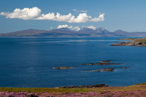
To the NW the Paps of Jura dominated the skyline while...


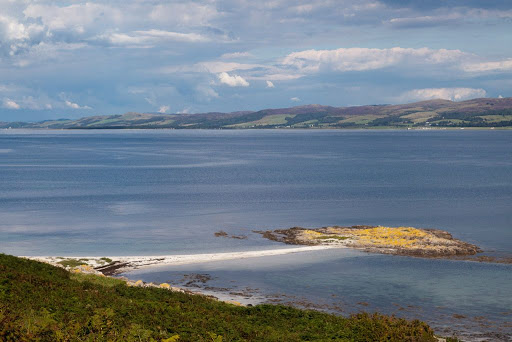
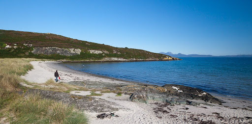
...to the NE the dazzling strip of sand, where we had luncheon the previous day, highlighted the Sound of Gigha.


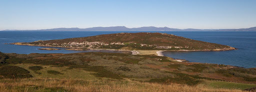
The final rise to the Mull of Cara took some time...


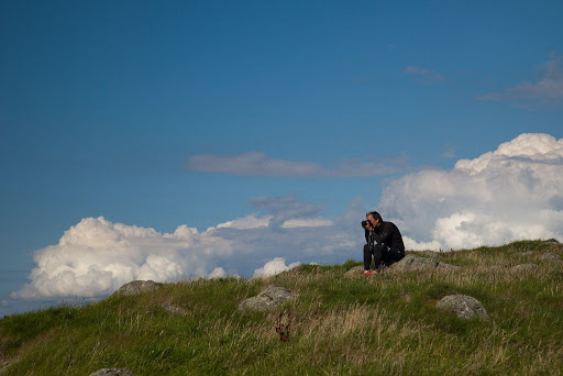
...and the summit gave a chance for a breather and a photo opportunity.


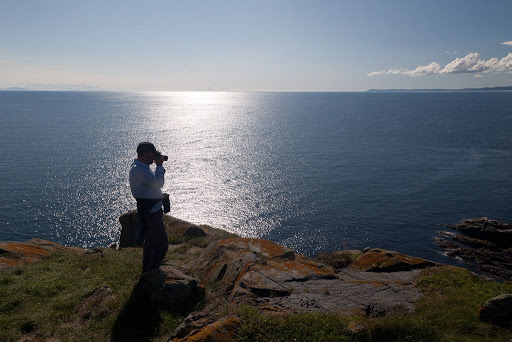
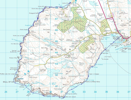
The rocks fell away steeply from the Mull of Cara and there was nothing but sea between us and the distant Mull of Oa, some 35km away to the SW. In 1756 a huge rockfall slid into the sea from the Mull of Cara. It was accompanied by a tsunami, which swept up the beaches of Cara washing all the coastal houses away. Some say it was a meteorite that struck the cliff.


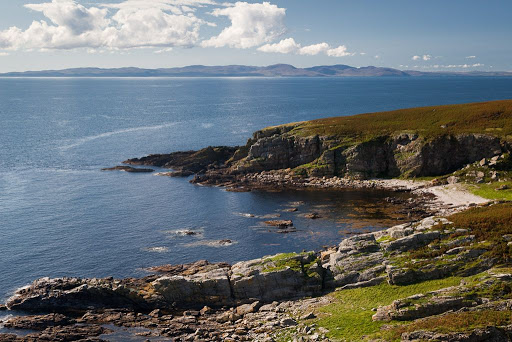
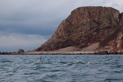
We looked down on the headland of Maol a' Mhor-rain, off which the tide race forms. All was quiet as the wind was light and it was near slack water. The bay was notorious for catching the bodies of sailors who were lost in these parts.


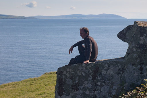
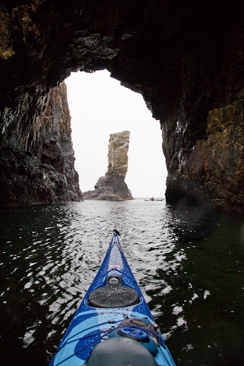
Just below the high rocks we came to the Brownie's chair. It only has one arm but that is apparently enough for the Brownie. Kintyre stretched away to its distant Mull in the south.

It was time to go, the chair's owner might be back!

Monday, September 20, 2010

Views from the north of Gigha.


The north end of Gigha is a wonderful wild place. Its highest hill is only 56m high but from its summit this lovely isle can be seen stretching away to the south with the Mull of Kintyre and even Ireland beyond.


To the west, over the peninsula of Eilean Garbh, Islay stretches away to the Mull of Oa.


To the east, the mountains of Arran rise above the Kintyre peninsula and the Sound of Gigha.


Back at sea level, the Paps of Jura...


lie above the enchanting beach of white shell sand...


...which links Eilean Garbh to Gigha.


We hiked back over the rough country of north Gigha to our camp.


As we broke camp and loaded the boats, the MV Isle of Arran...


...was already well on her way back to Islay.

It was time for us to go.

Monday, May 10, 2010

Sea kayaking round the Mull of Oa, Islay


A 26km paddle from Port Ellen to Kintra round the Mull of Oa Islay early March 2010.

Tidal streams 200m off the Oa peninsula at spring tides run at 4-5knots:
NW going flood begins HW Dover (11:31 on the day) overfalls off Rubha nan Leacan
SE going ebb begins -0610 HW Dover overfalls off Mull of Oa

However, we found that close inshore, the NW stream begins at least -0100 HW Dover.


A bottle nose dolphin off Sgeirean Buidhe.


Bottle nose dolphins


Soldier's Rock.


This was a day trip from Glasgow, made possible by a temporary late evening sailing from Port Askaig. I do not normally make such a rigid timetable but given the distances, ferry times and tide times it was essential. As it happened, we arrived at Kintra at 15:45 and used a taxi to recover the car. What a day!

I have mentioned both before but two really excellent sources of information on Islay are:

Armin's Islay Blog

Ron's Islay Weblog


This was the tidal atlas, marked up with the times for the day. We were there 2 days before springs.

Day return to Islay, please.

The most southern point of the Hebrides.

Oa what a beautiful morning, Oa what a beautiful day!

The SE coast of the Mull of Oa, Islay

The point of no return, Rubha an Leacan to Gob an Rubha Dhuibh, Oa, Islay

Sea kayaking with dolphins at the Mull of Oa

Going with the flow, round the Mull of Oa!

A glimpse of distant white shell sand promised a break.

Oa what a paradise!

The most southerly Gargoyles in all of the Hebrides

Oa speak no evil

Threading the Oa of a needle

All hail Soldier's Rock, Islay

What a geo on Oa!

End of an Islay day.

Oa, I'm so sorry about all the dreadfull puns.

Photo album map.

Saturday, May 08, 2010

What a geo on Oa!


Soldier's Rock was barely out of our minds before we discovered the NW headland of the Oa peninsula on Islay was riven with a series of deep geos culminating in this one. It stretched for 100m, deep into the rocks and culminated in a slight opening with a steep beach behind. A lazy three foot swell was running into the geo and crashing on the steep beach in dumping surf. The repeated low BOOOMPHS reverberated along the narrow channel. We chose not to risk landing in this isolated spot and turned carefully just on the edge of the surf line and made our way back out towards the light and the open sea beyond. The hail had turned to rain but by the time we emerged it had turned to snow carried by a cold wind from the north.

We were now only 2.5km from our end point at Kintra. We had planned to stop for a well deserved second luncheon at the delightful little Port Alsaig but despite being ravenous, we decided to press on in the snowstorm.


We landed below Kintra farm at the south end of the Big Strand. This beach is the biggest on Islay and its sands stretch away for over 8km along the east shore of Loch Indaal. We were ravenous but there was little shelter in this open place so we ate our sandwiches as the snow fell. Misha had the biggest sandwich bag and ate it all! We recounted the highlights of our day as the snow fell and the light faded.


"The dolphins were this close!"


"Get away!"

What another great trip... the only fly in the ointment was that my car was 7km away at Port Ellen!

Friday, May 07, 2010

All hail Soldier's Rock, Islay


Turning another corner on the west coast of Islay's Mull of Oa, we came upon the great sea stack of Soldier's Rock.


The rain turned to hail as we paddled below its layered faces...


...then entered a great cavern with windows in its roof.


Through one window, this waterfall cascaded into the cavern.


Once our eyes adjusted to the gloom, we saw an entrance to a smaller cave at the back of the main cavern.


We reversed our kayaks in and as...


...the vault of the cave's roof closed over our heads...


... it formed a perfect frame for the great stack in the bay beyond.


All hail the Soldier's Rock!

Thursday, May 06, 2010

Threading the Oa of a needle


Our exploration of the magnificent west coast of the Mull of Oa on Islay continued and we found ourselves in the bay called Bun an Easa. Roughly translated this means foot of the waterfall. On the map the burn which feeds the waterfall is called Sruthan Bun an Easa or little stream of the foot of the waterfall. The only apparent access to the shore of Bun an Easa was either over the waterfall or, perhaps more cautiously, by kayak as we did.


We both entered...


...and left Bun an Easa by this magnificent narrow slot!


A little after Bun an Easa we stopped and looked back to get our bearings. This is the view to the SW and the entrance to Bun an Easa is to the left of the distant headland.


Next, we came to another cave with a high window which in a storm will act as a blowhole.
I was able to paddle right through to the interior, which is lit by the window. However, once inside there was not enough room to turn, not even in a manoeuvrable kayak such as the Cetus! Its Gaelic name is Sraideag Alt nan Ron which might be loosely translated as narrow watery wynd of the seal.


We continued to wind our way through a maze...


...of tight places between stacks, cliffs and dykes. What a remarkable place.