Showing posts with label Great Cumbrae. Show all posts

Tuesday, February 12, 2013

We fair skelpit across The Tan,

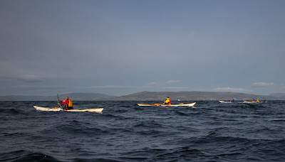
 We set off from the lighthouse on Little Cumbrae in a NE direction.

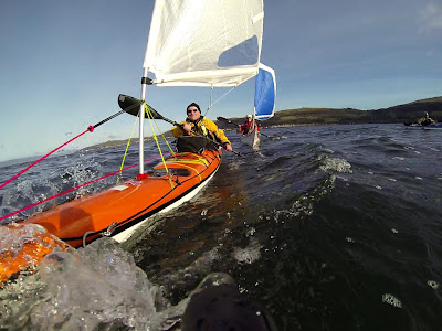
 The NW wind meant we were on a beam reach...

 ...and we found paddle sailing very much to our taste as...

 ..we fair skelpit across The Tan at 10-14km/hr, without breaking sweat!

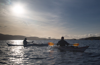
 It was a wonderful experience to have the cold wind and spray in our faces and the low winter sun...

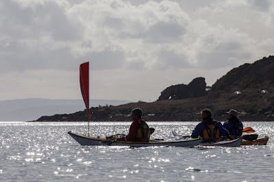
...on our backs. We were bound for the Eileans in Millport Bay...

...where it was near high tide and so the delightful little sandy beach was covered. We hauled the kayaks out onto the sea weed covered rocks for a well earned rest. 

Thursday, February 07, 2013

Sea Fever

I have not posted for a while. This has been partly due to the poor weather but mainly due to a painful dislocation of my knee, trying to lift my kayak some time before Christmas. It has been hard not going down to the sea for such a long time. Last Saturday the forecast was for F3 gusting F4 NW winds so we convened at Seafield on the south Ayrshire coast with the intention of paddling down to Culzean Bay and back. When we arrived, there were white horses to the horizon and waves were breaking high into the air at the base of the Heads of Ayr. My handheld anemometer showed the wind was F5-F6. When Tony left his house, just up the road, the temperature was minus 6C. We didn't much like the look of this, but we were so desperate to get out again that we turned round and headed north to more sheltered waters off  Largs, further up the Firth of Clyde.

 Here the conditions were much more to our liking. A light F3 NW meant we were off...

 ...paddle sailing at 10km/hr into a 1.5km/hr adverse tide.

We were bound for the Little Cumbrae island which...

...lies between Largs and the mountains of Arran beyond.

 We soon left the douce Victorian villas of Great Cumbrae behind and...

...set off across the Tan towards...

...the Little Cumbrae and its tiny satellite, Castle Island.

Thursday, January 17, 2013

Petition to save University Marine Biological Station

Anyone who regularly paddles to the Cumbraes on the Firth of Clyde must have seen these two vessels: the RV Actina and the RV Aora. In this photo they are tied up at Keppel Pier next to the University Marine Biological Station at Millport.

Sadly the University Marine Biological Station is threatened by closure. Scotland probably has more coastline than any other country of similar size. As a result our lives are influenced by the sea and in turn our actions influence the sea. Our survival depends on looking after the seas and to do so we need to understand them. The UMBS not only carries out research but has played a vital part in the education of very many marine biologists who have gone on to research across the World's seas.

As a taxpayer I can think of very many things I would like to see cut before the UMBS at Millport. If you are of a like mind, you can sign the petition here.

Wednesday, November 28, 2012

We set off in the general direction of Little Cumbrae.

We set off from Largs in the general direction of the  Little Cumbrae.

We had originally intended launching at Portencross, 9km south of Largs because the wind was forecast to be F3-4 SW, backing 4-5 SE increasing 6. When we arrived at Portencros,s the wind had already gone round to the south and was a fitful F4 gusting to 25knots. We decided to move up to Largs, which would allow a reach out to Little Cumbrae and back in a SE wind.

In the shelter of the Largs hills, the wind was a lot less than at Portencross (well beyond the cranes on the horizon). However, it had already gone round to the SE, which allowed us to lay the end of the Little Cumbrae on a very tight reach.

 As we approached Hunterston, Phil noticed...

 ...two new masts. They are anemometer towers to test the wind prior to building 3 huge (198.5m) test offshore wind turbines for the SSE company. About £180 per year of every UK electricity bill is used to subsidise building such monstrous devices.

As we drew level with the port no 9 buoy of the Hunterston Channel, off the south end of the Great Cumbrae, it was apparent just how much all the recent flood water had increased the flow of the neap ebb tide. It was now two and a half hours after HW and the tide was zipping past the buoy. With the increasing wind against the tide, we knew we would be in for a rough crossing to the Little Cumbrae....yippee!

Sunday, November 25, 2012

Vikings and IKEA bags at Largs.

 Yesterday we reconvened at Largs...

 ...less than a week after our last trip. We unpacked our IKEA bags for a trip to...

 ...Little Cumbrae island, which can be seen on the horizon on the left beyond the bulk of its bigger sister the Great Cumbrae.

Soon we were on the water below the Largs Pencil, which commemorates the departure of another group of seafarers from these waters...

...the Vikings. I am not sure if they had IKEA bags to help with their packing.

Saturday, November 17, 2012

Two shades of grey.

We rounded the north end of Big Cumbrae to be met by an incredible panorama of mountain and sea. Simon and...
 ...Alison have only recently taking up sea kayaking but they were both amazed by the incredible view over the south end of Bute to the distant mountains of Arran beyond.

One by one we set off in a southerly direction...

 ...along the west coast of the Big Cumbrae.

Colin's new Etain looked great with its subtle grey deck.

Unfortunately clouds of a less subtle grey gathered and obscured the sunshine just as we landed on a beach of pink sand for first luncheon.

Friday, November 16, 2012

Cue the Cumbraes!

Sunday dawned sunny with a chilly NW wind. The mountains of Arran rose above the Great Cumbrae Island but the recent snow had melted.

 Phil, Mike, Andrew, Colin,...

 ...Alison, Simon and I set off from Largs Yacht Haven...

 ...across the Largs Channel towards...

...the north end of the big Cumbrae. But first we had to wait in a queue. The ferry from Largs had beaten us to it and both the local sailing school and ourselves had to wait for the MV Loch Shira to clear the jetty.

Wednesday, April 04, 2012

How's your roll?

 Just beyond the heavy industrial land of Hunterston...

 ...we were back on a wild stretch of coast. The Three Sisters of Hunterston were formed during the current Holocene period, when brash ice erosion rapidly cut the cliff line as the land rose at the end of the last ice age. Once the ice melted, the land continued to rise but the rate of erosion slowed leaving a rock platform at the base of the cliffs. Caves in the cliffs were inhabited as the area was populated following the retreat of the ice. The stunning Hunterston brooch was found here in 1830. It dates from about 700AD and is finely worked in gold and silver with amber decoration.

As we approached the end of our paddle, Colin and Andrew were somewhat overheated from keeping up with the kayak sailors.

As we approached Portencross Castle, Andrew asked me "How's your roll?" As I was looking forward to it with some relish, I said that it had bacon, lettuce and tomato with a thin spread of mayonnaise. Then, as Mike, Phil and I landed, Andrew and Colin cooled themselves with lots of rolling and thrashing about in the icy water. I watched them as I munched my roll and I realised that sea kayaking encompasses a very broad church of activity.

The shift in wind from SW to NW and our choice of launch site in the SE meant that we sailed the whole of this 30km circumnavigation of the Cumbraes. Yes, paddle sailing your sea kayak is a whole heap of fun, even though it might lead to excommunication!

Monday, April 02, 2012

Paddling like lions round the Cumbraes,

 We proceeded down the Largs Channel towards the giant cranes of the Hunterston ore terminal.

On the way, we passed the stone "lion" (a weathered basalt dyke) on the south end of the Great Cumbrae.

High above paragliders were enjoying the  uplift above the Fairlie Hills.

At sea level we were still able to sail across the Tan, which separates the two Cumbraes.

 Colin and Andrew carried on paddling hard keeping up with the kayak sailors. They paused only until a motor sailor decided on which way to turn.

Finally the Firth opened out and we set off across the shipping channel to the Ayrshire side.

Sunday, April 01, 2012

The application of elbow grease to avoid a ferry glide.

 Refreshed by our stop we...

...continued up the west coast of Great Cumbrae island with Bute and Arran in the background.

 Mike and I swapped the Delphin and the Cetus MV and it was...

...not long until we rounded the north end of the island and entered  the Largs Channel which separates the east coast of Great Cumbrae from the town of Largs on the Ayrshire coast.

 We could now see all the way down the channel to the twin cranes of the Hunterston ore terminal.

The SW wind had now veered to the NW and we were able to continue sailing on the final leg of our circular course.

 However, we needed to apply a little elbow grease...

...to make sure we kept clear as MV Loch Shira (the Largs Cumbrae ferry) rapidly glided towards us.