Tuesday, April 14, 2015

Leaving Dalelia on the shore of Loch Shiel: tales of war, loss and peace.

We relaunched our kayaks and left the peaceful Green Isle of St Finan with its graves surrounded by...

 ...the loch, forests and mountains.

We were now in the shallow basin at the SW end of Loch Shiel. The loch side was now backed by green fields of Dalelia estate and...

...cattle made their way to the shore to drink.

 Dalelia estate lies on the NW shore and we passed some attractive mixed woodland in...

...which we spotted a tall stone cross, almost hidden by the trees. It is a war memorial erected by Dalelia's then owner, Lord Howard of Glossop, to his son. Lt. Philip Howard. Philip was only 23 years old when he died in action in France in 1918, near the end of WW1. His family's wealth could not protect him from the ultimate sacrifice and waste of war.

Of course other young men from this part of the highlands also died in WW1 but their families could not afford to erect a monument. However, their 13 names are listed on the war memorial at Acharacle village at the lower end of Loch Shiel. Philip Howard's name is not on it as he was from Glossop in Derbyshire. His father had wanted to build a memorial to his son and have it sited in Norfolk Square in Glossop but it was never built. Instead a memorial to all of Glossop's dead (including Philip) was erected in Norfolk Square and Lord Howard sited the personal memorial here on the shore of Loch Shiel.

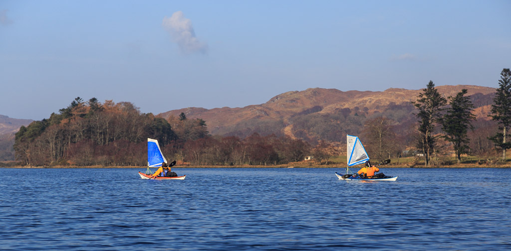
The breeze now meant we were making good progress while paddle sailing and soon we...

 ...passed Dalelia house at the centre of the estate. It was built by Alexander MacDonald as a tacks-man's house about 1795 and extended by Lord Howard in 1907 as a holiday home. In 1745 at the start of his ill fated rebellion, Bonnie Prince Charlie made his way to Dalelia over the coffin road (to St Finan's Isle) through the pass in the hills from the head of Loch Moidart. From Dalelia he was taken by boat to spend the night with Alexander MacDonald at Glenaladale before going on to Glenfinnan at the head of Loch Shiel to raise his standard the following day. This was the start of his ill fated rebellion to regain the British crown for his father.

From Dalelia Glenfinnan is 22 kilometres away (beyond the distant mountains to the left of Mike's head). This is the view that Prince Charlie would have seen at the start of his futile rebellion. It is also a view he would have seen nearly a year later as he escaped this way after the final defeat at the Battle of Culloden in 1746. Perhaps it is also a view that Philip Howard had also enjoyed before he went to war and his untimely death in France. Perhaps this why his grieving father built his memorial here rather than in Glossop. We were fortunate that we were leaving Dalelia on a peaceful voyage and were now reaching the end of our journey down Loch Shiel.

Monday, April 13, 2015

Ringing down the years, the bell of St Finan.

As we entered the dog leg in Loch Shiel we found that the way ahead was almost completely blocked by...

...the Green or St Finan's Isle, which is topped by the ancient stones of St Finan's chapel and the graves of the those who have inhabited these lands since mediaeval times. This narrowing of the loch is where the original glacier that cut Loch Shiel would have met the sea and melted, depositing its moraine.

We landed at the jetty where generations of mourners have landed to carry the coffins of their deceased up...
...the hill to the...

...graveyard at the top. Some of the older grave stones are simple boulders half buried in the grass while...


...other stones from the 18th century bear upright crosses, some of which are simply carved. Later stones are...

...not only taller but...

...some are elaborately carved. This one was erected by...

...the grateful parishioners of Reverend Charles MacDonald who died in 1894. He was also a local historian and author.

At the summit of the isle is St Finan's chapel. It was built in about 1500 by the chief of the Clanranald to  replaced an earlier wooden structure. It was abandoned in the late 1600's so was already a ruin by the time Bonnie Prince Charlie came this way in 1745 on his way to Glenfinnan at the head of the loch. Almost certainly the Prince would have stopped here and made his way up to the chapel. St Finan (the leper) was born in Ireland and is thought to have lived between about 520 and 600. Several places in Scotland and Ireland are named after him. He is not to be confused with the later St Finan (of Lindisfarne) who died in 661 after becoming Bishop of Lindisfarne.

Today the ruins are very peaceful and seldom visited. They are surrounded by the loch, forests and mountains of the lands of Moidart, Ardgour and Sunart from where the deceased were brought to be buried. At the east end of the chapel a simple slab alter survives. In a recess above it...

...is a carved stone cross. On the alter itself is a remarkable object. It is a Celtic seamless cast bronze bell. Amazingly it has been here for over a thousand years. Nowadays it is chained up but it is remarkable that it has survived the millennia without being plundered. Of course there is a dreadful curse attached to the bell and any one who stole it would regret doing so for every second of their few remaining days... During an internment the bell is taken down to the jetty and rung at the head of the cortège as they slowly make their way up to the waiting grave.


The bell has a remarkably clear and pure tone and as I rang it...

...deer on the far hillside broke off from their grazing, raised their heads and listened in the same way that countless generations of their ancestors must have done. We had lost all sense of time as we had explored the small isle, over an hour had passed since we landed. We were glad we were not headland to headland paddlers. Each of us felt a strong connection with the landscape and the generations of people who had lived and died here. We reflected on our own mortality and felt a deep joy in being able to experience such a place. Paradoxically we had never felt so alive than here in this place of the dead.

By coincidence St Finan's Saint's Day is the 18th of March, the very day we were there. Perhaps that may have added to the ambience we enjoyed though we did not know it was that day at the time.

We were still in no hurry as we made our way back down to the jetty where...

...we enjoyed a peaceful coffee break with the silvery song of a robin and the echoes of an ancient bell ringing in our ears.

Saturday, April 11, 2015

Blooming marvellous scenery, lead and iron in Loch Shiel.

We were still paddling in the mountainous part of Loch Shiel but...


...we came to the first major break in the mountains that line the SE shore, where the River Polloch flows into the loch from the broad Glen Hurrich. A coffin road descends into Glen Hurrich after crossing the mountains that divide it from Loch Sunart. The road was used to transport the deceased in the Sunart area for burial on an island further down Loch Shiel. In 1725 a lead mine was established high in the hills of the glen at Corrantee. This was still worked as recently as the 1980s. In 1745 workers at the mine "donated" gunpowder to Bonnie Prince Charlie's rebellion. At that time there were no roads into the area between Loch Sheil and Loch Sunart and all supplies to the miners and their families had to come in by sea. The Hanoverian parliament (and Hanoverian mine shareholders such as the Duke of Norfolk and General Wade) were so incensed by the theft of the gunpowder that they set up a naval blockade and the mining community died of starvation during the winter of 1745/46.

Back on the NW shore, the mountains gradually receded. The shore became less rocky and the beaches became longer and more frequent.

 At Rubha na h-Aird we came across this ringed plover in the shallows.

As the sun rose in the sky, a nice little breeze got up and our sails gave some gentle assistance.

Camas Drollaman is a large bay protected by this wooded headland and..

...this island just offshore.

 Rather logically the island is called Eilean Camas Drollaman and we enjoyed its wild...

 ...natural beauty.

However, all is not what it seems. Just below the trees on its western point are the remains of a bloomery. This was a primitive smelter for iron ore. I have no idea why it would have been built on such a small island rather than on the mainland. Perhaps the men who operated it wanted to keep the secrets of smelting iron away from prying eyes?

A little further to the SW the loch was narrowed by this peninsula. The beach was backed by sessile oaks and further progress down the loch would require taking a dog leg through the narrows.

Before leaving the mountainous part of Loch Shiel behind we took one last look back up the loch to the misty mountains of Ardgour.

Friday, April 10, 2015

Reflecting on history and the scenery at Gaskan, Loch Shiel.


Nestling at the SW end of Gaskan Wood is Gaskan cottage, all that remains of the hamlet of Gaskan. It was here that the MacDonald's built their birlinns (fast galleys powered by sail and oars) using the plentiful supply of oak. Later the forest was also used to manufacture charcoal which was shipped to the iron furnace at Bonawe on Loch Etive. This was 120km away down the River Shiel, into the sea and round Ardnamurchan Point which was quite a journey!

The author and naturalist Mike Tomkies lived in Gaskan cottage for nearly two decades in the '70s and the '80s. His book "A Last Wild Place" described the time he spent in this cottage at Gaskan which he called "Wildernesse".

SW of Gaskan the scenery was bathed in the golden light of early morning.

Below an area that had been cleared of trees...

...were the remains of an old dry stone sheep fold.

The water was so still that paddling near the shore was again quite disorientating.

Ian spotted a lovely little beach and although...

...we had not paddled far...

...we had seen so much that...


...a stop was called for so that...

...we could drink in more of the wonderful view and properly savour what we had seen.

Thursday, April 09, 2015

Eilean Comhlach, a surreal meeting place on Loch Shiel..


I was glad I had taken the trouble of stopping to clear the condensation from my camera lens because the combination...

..of mist and...

 ...early morning light created a surreal effect on the waters of Loch Shiel.

By this time Ian and Mike were just dots on the horizon and added scale to the scene.

 As the sun rose it gradually burned the mist off Gaskan Wood, which was just as well because...

,,,there was not a breath of wind to blow it away.

The cold grey mist still hung about the higher crags and contrasted with the warm rich russet browns of last year's bracken.

For some time my eye had been drawn down the loch to Eilean Comhlach which, with its reflection, made such a pretty picture. Its name could be isle of the meeting place, fellow warrior or suckling pig.  Several lochs have islands where warring chieftans met without fear of being ambushed by each other's men.

However, I resisted the temptation to be completely captivated by the isle and turned to face the way we had come.

 I was rewarded by this scene of mountains and mist closing in round the heads of the loch.

We had each been paddling in our own space but were all drawn to...

 ...paddle towards...

 ...the magical isle of Eilean Comhlach, where we regrouped and met.

We circumnavigated both it and its smaller neighbour.

 We lingered as long as we could but the...

 ...sun was now rising quickly and we had a long way to go. It was with some regret that we left Eilean Comhlach. We each agreed that it was already one of our most memorable days on the water and yet it was only 08:22!