Wednesday, December 11, 2013

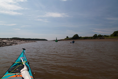
Coming and going and leaving a wake at Kirkcudbright.

Behind us, the wind was funneling through The Sound between Little Ross and the mainland and it was with...

 ...great anticipation that we launched the sails. We were soon averaging 9km/hr and hitting 19km/hr when planing on a wave. This return trip was going to be a much quicker than the outward trip, when both wind and tide were against us and we had averaged just 5km/hr.

We were making such speedy progress that we were leaving a definite wake behind us. It soon became apparent that Tony's Alaw Bach was planing for much shorter bursts than the Aries. We had noticed this previously in Fleet Bay and now Tony, Mike and myself have all replaced our Alaw Bachs with Aries kayaks. The Alaw Bach is a superb sea kayak but for some reason it is not so suited to paddle sailing as the Aries.

 As it was just coming up for high water we did not need to keep to the narrow buoyed channel which...

 ...was just as well as the scallop dredgers from Kirkcudbright were making their way out to sea, Proud as we were of our wakes we couldn't quite match the wakes of these stout vessels.

Approaching Kirkcudbright* harbour, we kept out of the fishing boats' way by keeping inside the end of the marina pontoon.

 Once past the marina we made a quick sprint for the slipway before the remaining fishing fleet departed.

We arrived exactly at high water and so the top of the harbour slipway was dry and not too slippy. If you use this slipway in the wet be careful as it is both steep and slippery. Just a few weeks later than our trip a man slipped and suffered a nasty head injury.

Tony's wife kindly brought the car round and we only had a few feet from water to car roof rack!

Although we had not been able to paddle round the coast past Abbey Head (due to the live firing at Kirkcudbright Range) we had a most enjoyable paddle of 18.4km in Kirkcudbright Bay and Little Ross was well worth a visit. The contrast between the enclosed tidal River Dee at Kirkcudbright and the lively conditions in Little Ross Sound at the mouth of the bay could hardly be greater. If you just wanted some park and play in the Little Ross Sound tide race choose a spring tide (HW will be about 1300 in summer) on the ebb against a S-SW wind. The nearest launch place to park easily is Brighouse Bay. It is an 8km round trip to the Sound and back. Take a folding trolley as the tide goes out in Brighouse Bay for 600m. Remember that this fun little race will carry you out into the main south west going Solway ebb which runs at 4 knots springs. This will take you to a fun filled rocky landfall at the Burrow Head tiderace, some 21km away across the mouth of Wigtown Bay.

* A phonetic note for non Gallovidians, Kirkcudbright is pronounced Kir-coo-bri. It means the church of St Cuthbert.

Tuesday, December 10, 2013

The view from the summit of Little Ross Island.

From the summit of Little Ross Island we looked west down to the waters of The Sound with the point of Fox Craig beyond. It is often instructive to view paddling conditions from above.

From sea level, just 20 minutes before, the wide angle lens made the conditions look much calmer than they actually were.

The tide race was swirling round the south end of Little Ross and this was wind with tide! This large yacht was making her way up to Kirkcudbright from the Isles of Fleet where she had spent Saturday night. She had reached down under foresail alone. Because there was live firing on the range she.had to pass within 200m of the SE shore of Little Ross so she started her engine and motor sailed in before hoisting her main once in the more sheltered waters of the bay.

This is the view east from Little Ross and all the sea and land in the photo is in the exclusion zone when the range is firing. In the middle distance, Gypsy Point marks the far side of Kirkcudbright Bay. In the far distance, Abbey Head is 7km away and the firing range extends a further 3km beyond it. Despite the wind, the noise of medium and large calibre firing travelled far over the water.The flood tide runs east along this coast and the ebb west. At springs the tide makes 4 knots in each direction.

As we did not want to paddle north up Kirkcudbright Bay against the 3.5 knot ebb tide (I stopped using my Greenland paddle for everyday use after the last time I did that!) it was now time to make our way back to our kayaks to catch the end of the flood. The lower light at the north end of the island is aligned with the lighthouse astern  to give a transit for boats to find the start of the buoyed channel up the River Dee to Kirkcudbright.

As we approached the store at the west quay, the Gallovidian III was still at anchor on range duty but the other recreational boats were already making their way up river to avoid the ebb tide.

Monday, December 09, 2013

Murder at Little Ross Lighthouse.

Near the west quay at the north end of Little Ross Island lies an old workshop and store. An old Alvis Stalwart 6WD amphibious vehicle was parked next to the store. We thought we would be safer crossing the Little Ross Sound and Ross Roads in our sea kayaks.

 From the store a track leads up to the summit of Little Ross, which is crowned by the lighthouse.

Half way up, on the east side of the track, some cottages and an old smithy are adjoined by a walled garden. The garden belonged to the principal lighthouse keeper.

The Little Ross lighthouse was the first built by Alan Stephenson and was lit on 1/1/1843. The light flashes white every five seconds.


It was the first lighthouse in the world to have a catadioptric design, which meant that the beam was focussed with both lenses and mirrors. At the time the famous physicist Lord Kelvin ranked it (along with the lighthouses at Rhinns of Islay and Buchan Ness) as one of the top three lighthouses in the World.

In 1960, the light was one of the very first manned lights to be automated. This was precipitated by the tragic murder of one of the keepers by his assistant. There is a moving first hand account by David Collin, one of the people who discovered the murdered man, on the Kirkcudbright community website.

Friday, December 06, 2013

The red flag is flying high over Kirkcudbright Bay.

 Although our destination was Little Ross Island....

 ...we paddled out through Little Ross Sound and past Fox Craig to...

 ...the open Solway Firth beyond.. There is a tidal anomaly in the Sound. During spring tides the current generally flows south in the Sound during both the ebb and the flood. You are almost guaranteed some interesting wind over tide conditions here in the prevailing SW winds. It was easy to see why the other boaters had stayed within Kirkcudbright Bay.

After some fun in the Solway we paddled back through the Sound and into the lee of the north end of Little Ross Island.

During the early part of the year this is a gull nesting colony but the chicks had all fledged and the rocks were deserted. Their guano and the smell well the only reminders of the frenetic bird  activity during the Spring.

We had noticed the MV Gallovidian III had been anchored a little way offshore. Her skipper Gary McKie upped anchor and motored across to within hailing range. The Gallovidian III is the Kirkcudbright Range safety boat. Gary hailed us to ask if we knew the range was being used for live firing. Over the AKA AKA AKA and Crump Crump of small and large bore firing, we reassured him that we did.

In fact Tony and I had originally intended launching from Abbey Burn Foot (at the east end of the range) and paddling west to Little Ross Island. However, the red flags round the range were flying and the access road was blocked.

Wednesday, December 04, 2013

A passing Romilly in Kirkcudbright Bay.

 As we approached Little Ross Island the wind began to increase and...

 ...many of the boats, that had passed us, either anchored in the lee of the island or turned back for Kirkcudbright. This beautiful balanced lug yawl caught my eye. Her solo helmsman quickly and expertly reefed her two sails for the sail back up Kirkcudbright Bay.

She is a 22 foot Romilly, a design by Nigel Irens. A particular feature is her freestanding carbon fibre masts and spars. Her name is Speedwell and her owner David Collin has sailed her out of Kirkcudbright Bay since 2000. Very nice indeed...almost enough to make me interested in boat owning again but I am not sure if a Romilly would survive...

...the White Steeds of the Solway, at a tidal mooring in Fleet Bay, due to her lying on her side when drying out.

Tuesday, December 03, 2013

The Devil's Thrashing Floor, the White Steeds of the Solway and the wrecks and carlins of Senwick Bay.

As Tony and I paddled down the wooded shores of Kirkcudbright Bay, we were sheltered from a brisk SW wind which was blowing offshore. The wind combined with the flood spring tide made for hungry work and it was time for first luncheon.  The tidal shallows here are called "The Devil's Thrashing Floor" and...

...they were the cause of many ship wrecks, such as that of the two masted sailing schooner Monrieth in 1900. Her wooden ribs can still be seen at low tide. When the wind bows against the tide in these waters conditions are right for the wonderfully named "White Steeds of the Solway" to make their appearance. These may be the Devil's steeds...

...but they can be fun!

However, all was calm this day and we soon came to the delightful sheltered  cove at Senwick Bay. It is not always thus, in 1887 the Preston brig "Just" was lost here as were the Whitehaven brig "Mary Isabella", the Harrington brig "Dido" and the Workington brig "Joshua" all in the same storm in 1822. The other name for Senwick Bay is Carlin's Cove. Carlin is the Old Scots word for a witch. You can just imagine the Thrashing Floor and Senwick Bay on that stormy night. The wind was shrieking through the doomed ships' rigging and the trees on the shore like a wailing banshee...

On this July day the cove was a real sun trap and we enjoyed a long break  as a succession of motor and sailing boats from Kirkcudbright made their way past us on their way out to sea.

All too soon it was time to take to the water again and Little Ross island slowly got nearer. Its lighthouse had been constructed in 1843 in an attempt to reduce the appalling loss of ships on the Devil's Thrashing Floor.

Monday, December 02, 2013

A distinct lack of malodour down in the Kirkcudbright mud.

This is another trip from my back catalogue. It was a glorious July day when Tony and I made our way down the muddy banks of the River Dee at Kirkcudbright on the Solway coast. We launched from Gartshore Park to the west of the town. Although the mud looks terrible , it was actually only 2 cm thick with relatively firm ground beneath. We had expected it to be foul smelling but it was not malodorous.

We launched 2 hours after low water so the flood was well established. We kept out the main current by paddling in the shallows and sticking to the inside of the bends. The tower marks what used to be the end of the Kircudbright sewage pipe. Fortunately a new marine outfall was built in 2006 and the sewage treatment works' effluent is now discharged about 10km away, under the sea at the mouth of Kircudbright Bay.

 Squabbling gulls were feeding at the rising margin of the tide which was...

 ...sweeping upstream. We could not yet see the sea beyond the muddy banks of the river channel.

 This old wooden fishing boat now lies above all but the highest tides but she has seen better days.

We paddled along the wooded shores of St Mary's Isle. The "isle" was the site of a priory dating back to the 12th century but nowadays it is just a secular peninsula. The channel between the isle and the mainland has long since silted up and the monks have long gone..

At last we caught sight of our destination. As the tide in the channel rose, Little Ross island and its lighthouse appeared over the mudflats.