Sunday, June 12, 2016

Erraid and Tinker's Hole

 We set off from Fidden campsite through a maze of...

 ..pink granite skerries.

Donald kept well out in his little RIB but we...

 ...were able to paddle through the shallows where the water was as clear as green glass.

We reached the rocky shore of Erraid. Alan is looking at the cottages which were built for the keepers of the Dubh Artach lighthouse and later the keepers of the Skerryvore lighthouse joined them when the Skerryvore shore station at Hynish in Tiree closed. The lighthouse engineer was Thomas Stevenson, father of the author Robert Louis Stevenson (more about him in the next post).

 High above Lorna on the skyline of Erraid, the white dome of...

 ...the lighthouse signal tower looks out over the  Sea of the Hebrides to the distant lights.


As we paddled round the pink granite shore of Erraid it was baking hot especially when we entered the narrow windless channel of the Tinker's Hole. Ian is down to a T shirt but was still too hot.

We caught up with Donald who had stopped on a tidal sand spit to photograph the signal station.

He passed us again as there is a deep channel through the gap.

 Tinkers Hole is a well known yacht anchorage as it is well sheltered given the otherwise exposed position of the Ross of Mull.

 We took our time as we were...

 ...in no hurry to leave...

 ...this magical place of cool green sea and...

 ...and warm pink rock but all too soon...

 ...we left the confines of Tinker's Hole and...

...exited onto the exposed south coast of Erraid.

Saturday, June 11, 2016

En route to Erraid and the Ross of Mull

The road and ferry trip to the Ross of Mull is a long way wherever you live on the mainland. Ian and I had talked about returning here for ages and on the 11th of May we finally set off in the company of Donald in his little RIB and Alan and Lorna. You will be able to follow this trip in trivision on Ian's blog here and Donald's blog here.

Donald and I met up in Oban for a coffee and a stroll before setting off. I wanted to photograph the various slipways near the main ferry terminal. The nearest is the Calmac slip for the Lismore ferry but there always seems to be a reserve ferry sitting in there.

The next nearest is the slip in the ice factory yard. I do not think you could offload a car here but if you arrived by ferry and wanted to launch or if you arrived by kayak and wanted to catch a ferry this might be possible. The RNLI Oban lifeboat is the RNLB "Mora Edith MacDonald" a Trent class boat.

 The public slip is furthest away. You might be able to avoid the busy Gallanach Road by trolleying round the path in front of the lifeboat station and through the ice factory yard to the ferry terminal.

 We walked back to the town past the fishing pier as we had some time.  This is OB151 FV Orion. the quayside restraunts were doing a brisk trade selling sea food platters to Chinese tourists who certasinly seembed to be enjoying the food and the sunny ambience of Oban.

 We had plenty of time and the first ferry to Mull was the MV Coruisk which has recently been transferred from the Mallaig Armadale run to Mull due to the explosion in traffic caused by the introduction Road Equivalent Tarriff which has meant the ferries (and the roads) are full of camper vans. If I was transport minister I would only allow camper vans on the road between the hours of 1 am and 4 am.

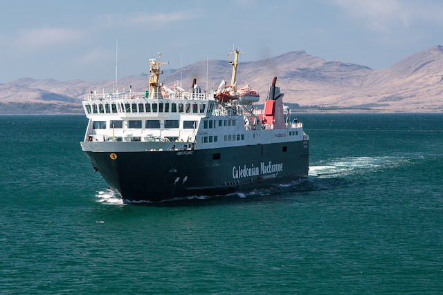
 We did not have long to wait until our ferry the MV Isle of Mull came in and soon...

 ...we were aboard. While we were loading, Marine Harvest's brand new 70m well boat the Ronja Challenger berthed at the ice factory quay.

 Soon we were off passing the north end of Kerrera where this rather splendid house is for sale for around a mere £1,000,000.

 The channel to the north of Kerrera is rather busy with shipping and the MV Isle of Lewis which serves Barra from Oban...

 ...came in as we were leaving closely followed by the returning

 ...MV Coruisk. As you can see a fresh NE wind was blowing.

 Half way to Mull we passed Lady's rock where Lachlan Maclean of Duart left his wife to die in 1527. She was rescued by a passing boat and he was later murdered by her brother.

 The bottom end of Lismore is marked by the Eilean Musdile lighthouse.

Then we passed Duart castle on Mull. If you are paddling rond the coast here it might be worth keeping further out. The water close to the coast is often very disturbed,

 Soon we landed and the ramp came down on Mull.

 The road to the Ross of Mull isost 60km of twisting single track, fortunately it was quiet and it was a magnificent drive through the mountains to Bunessan where we had arranged to meet the others. One option was to launch at Bunessan and camp at Market Bay on the north coast of the Ross of Mull but I had an updated weather forecast on the ferry which was for F5 northerly overnight which would make a difficult launch from Market Bay (a surf beach).

 We decided to camp at the excellent Fidden Farm camp site which has a fantastic view...

 ...over the skerries to the Sound of Iona.

 We wasted no time in carrying the boats one by one...

 ...down the dazzling white sand to the...

...sparkling water's edge. We were bound for the magical tidal island of Erraid.

Wednesday, May 25, 2016

Time stands still in Loch Sween

The mouth of Loch Sween is guarded by the grim walls of the remains of Castle Sween which...

 ...is one of the oldest stone castles in Scotland. I have used a great deal of artistic licence in the composition of these photos as nowadays the castle is besieged on all sides on land by serried rows of modern caravans. Little is known of the origins of the castle but it is believed to date from the late 12th century when it was built by a lord Suibhne in the Norman style. It changed hands many times before it was abandoned in the mid 17th century. However, so well was it constructed that time seems to have stood still for the castle over the last four centuries or so.

 The wind from the north had increased so we crossed to the loch's NW shore to gain some shelter. The offshore wind carried the heady coconut scent of the Kokatat yellow gorse bushes.

 Elsewhere the shore was bare rock and the perspective of this photo emphasised the linearity of this long ribbon like loch.

In places, the wind freed just enough to allow some close hauled paddle sailing and we crossed to the SE shore. Soon...

 ...we had left the entrance to the loch and the Sound of Jura far behind. We were beginning to get a sense of closure on our expedition to Jura and Islay.

We tacked across to the NW shore again and paddled inside Taynish Island where we passed Taynish bath house and jetty. 

 There was just a hint of the buds breaking in the deciduous trees of the Taynish nature reserve. We heard the contrasting calls of a willow warbler in the woods and a great northern diver on the water.

As we approached the end of our journey at Tayvallich the Shannick, the Jura passenger ferry passed on her way to Jura. two sea kayakers were hitching a lift for a trip across the Sound of Jura in much less time than we had just made.

We now turned west into the sheltered waters of the natural harbour at Tayvallich where...

 ...sheltered by the wind we unloaded the boats in warm spring sunshine before...

...shuttling across to Carsaig Bay on the Sound of Jura where we had left the other car. Beyond the NLV Pharos the north end of Jura beckoned. I seemed ages ago we had set off from this spot but in reality it had only been three days. That is what I like about a good sea kayak expedition, time seems to stand still and so many things get packed in to what is actually a very brief time.