Saturday, January 22, 2011

Mines a bacon butty in Lochaline!

As the flood tide carried us up the Sound of Mull we came to the little village of Lochaline, which nestles on the west side of a narrow inlet that is only 90m wide.

 The in going tide carried us through to Loch Aline at 7km/hr.

You need to be careful to keep out of the way of shipping in this very narrow and tidal channel. The Mull ferry, MV Loch Fyne passes through it nearly 30 times per day on her way to her slipway, which is inside the channel. MV Loch Fyne was built by Fergusons' of Port Glasgow in 1991. She is 54.2m long and can carry 36 cars. She originally served on the Kyle of Loch Alsh crossing to Skye but was moved to here after the Skye bridge was built in 1995.

Loch Aline is a beautiful loch with wooded shores but it has a hidden surprise. It is the site of an underground silica sand mine. It operated from WW2 until 2008 when it closed. The extracted silica is very pure and was loaded directly to ships. It was exported for the manufacture of optical glass.

We decided to land just inside the loch past the ferry jetty and the pier.

In the summer it is a bustling place. You can get water at the pier head.

But we were rather hungry. We were suffering from anaemia after the morning's midge attack. So we stopped at the excellent snack bar for freshly made bacon and egg sandwiches. Yum!

The Sound of Mull is very popular with divers and the Lochaline Dive Centre, just up the hill from the pier, offers accommodation, showers and a cafe with WiFi access. There is also a village shop and petrol station.

At the edge of the village, overlooking the Sound of Mull, you will find the Lochaline Hotel. It has a bar, which can be conveniently accessed from this little beach. Sadly it was still early in the day and the bar had not yet opened, so readers will need to wait for a review of its facilities after a subsequent visit by the thirsty staff of seakayakphoto.com.

Friday, January 21, 2011

Taking the Sound of Mull to the Next World.

The second day of our Morvern trip dawned still and calm but the peace of early morning (and our slumbers) was shattered...

...by the MV Clansman. She is the noisiest of the Calmac ferries at the best of times, as she burns the heaviest grade of fuel oil in her diesels. However, her crankshafts were just about to fail catastrophically and so the decibels this morning were deafening.

Unfortunately the racket had roused every midge in Morvern, as effectively as any luncheon bell. By now Phil was bitterly regretting his lack of protective attire. It is, after all, rather discomfiting to find that one's good self  is no longer top of the food chain.

It was with some relief that we found ourselves on the water and free from the local predators.

The Sound of Mull was like a full length mirror that wonderful morning...

...as it stretched away to near infinity, transporting us into another World.

The water of the Sound remained unruffled, until the flooding tide met with Ardtornish Point, which juts out from the Morvern coast. The modern lighthouse contrasts with the crumbling walls of Ardtornish Castle.

It was at Ardtornish that John of Isla, the first Lord of the Isles, died in about 1386. On the first stage of his journey into the Next World, his remains were carried away up the Sound of Mull by a fleet of birlins. Their destination was the distant and sacred Isle of  Iona. 

We paddled on in the wake of the Lords of the Isles.

Thursday, January 20, 2011

A bed of bluebells in the Sound of Mull.

From Glensanda quarry the wild and remote SE coast of Morvern continued for another 12 km...

...until we approached Rubha an Ridire...

...which marked the turning point of our route.

We now ran before the light wind, to the NW, up the Sound of Mull which separates the Island of Mull from the SW coast of Morvern.

It was getting late when we finally arrived at a curving beach at the end of our day.

The sun was setting as we prepared our evening meal on the shore.

Unfortunately as the sun went down, the midges unleashed their attack. David was fine in his jacket but Phil had forgotten his in the rush to pack. Not even a fine malt was able to fully restore Phil's equilibrium.

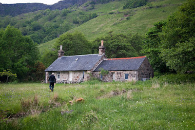
We went off to explore a nearby bothy...

...as a potential sleeping quarters. It was clean enough but someone had left some food and some well fed mice had pooed and peed everywhere. It did not smell too fresh so we decided to settle...

for camping on the bluebell meadow outside.

Wednesday, January 19, 2011

Between a rock and a hard place at Glensanda.

All too soon we had to leave the oasis of Kingairloch...

...and continue our exploration of the  Morvern coast.

We passed huge beaches of perfectly graded shingle.

After some time, we became aware of a curious noise, a bit like waves sucking shingle down a beach, but more sustained and more artificial.

We had found the Glensanda super quarry, the biggest in Europe. The noise we had heard was graded rock falling in continuous streams from shutes emerging from the mountain.

A whole granite mountain is being removed and the crushed rock transferred through tunnels to the shore, where it is graded before being loaded onto huge ships at the deep water terminal. There is no road access to Glensanda, everything goes in and out by sea. Few people have seen it or even know it's there, which is possibly why it slipped under the radar of environmental groups.

Standing on its lonely rock at the foot of a shrinking mountain, we came across Glensanda Castle. It was built in the late fifteenth century by the MacLeans. We are certainly leaving more of a mark on the landscape than our ancestors.

However, these two swans seemed oblivious to the quarry and we soon left both it and them in our wakes.

Tuesday, January 18, 2011

A missed luncheon after a detour to Kingairloch?

The SE coast of  Morvern is a wonderful place and we took our time savouring it. At first we paddled along a trackless wilderness...

...until we eventually came across signs of habitation again.

Loch Linnhe stretched away to the SW along an apparently unbroken line of cliffs...

...but eventually some breaks appeared like here at Camas na Croise.

Shortly afterwards we passed a narrow opening, which led into Loch a' Choire. Not being headland to headland types, we decided to enter the loch and explore further, even though it might mean missing luncheon!

At first the loch appeared to be a barren and inhospitable place...

...but towards the head of the loch, wooded slopes...

...and a smattering of buildings, announced our arrival at Kingairloch.

We landed at a little beach beside a jetty.

A wooded glade behind the beach looked like the ideal spot for a picnic. Would we have time for an alfresco luncheon in this paradise in Morvern? You will need to follow this link to discover our prandial arrangements in the wilds of Kingairloch.

Monday, January 17, 2011

Seakayakers, gypsies and bothy dwellers on Morvern.

This was a memorable trip that took place early in the month of June. Our aim was to circumnavigate the Morvern peninsula in western Scotland. It is very nearly an island being nearly surrounded by Loch Sunart to the north, the Sound of Mull to the Sw and Loch Linnhe to the SE. Only 11km of land lie between the head of Loch Sunart and Inversanda Bay on Loch Linnhe. We left a shuttle at the public slipway at Strontian. Phone the Community Moorings Committee  on the number on the noticeboard to say you would like to leave a car overnight. There is a Council "No Overnight Parking" notice to keep tavelling people and campervans away but an empty vehicle should not create any problems if left at the edge of the car park and not causing an obstruction.

We left the other car here behind Inversanda Bay. It's a lonely spot and I phoned the police in Strontian to see if there was any car crime in the area. He told me there was zero car crime. Sometimes travelling people (gypsies) camp at Inversanda. I have left my car next to another of their camp sites (2km further west) while climbing Beinn Garbh several times without any problems. I usually say hello and pass the time of day with them with them on the way past and have found them polite, hospitable and interested in where we were going. If you have a suspicious nature you could always leave a car at Corran Ferry.

What a great feeling it was to be out on the water with the prospect of 115km of paddling and two nights' wild camping! The mountains of Ardgour soon slipped away astern...

 ...as we got underway by both paddle and sail power!

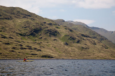
Morvern has few roads and it was a treat to explore its wild coast, which often tumbled steeply into the sea.

Behind us Loch Linnhe stretched away to Ben Nevis in the distance. The summit of the Ben was still streaked by snow.

After some time we came to a private bothy hidden in the woods behind the shore.