Showing posts with label wrecks. Show all posts

Thursday, February 20, 2014

The wreck of MV Captayannis, the Sugar Boat, and the sweet waters of the Clyde.

We had arrived at the wreck of the MV Captayannis. She was a Greek merchantman and on the night of 27/28th January 1974 she was anchored at the Tail of the Bank off Greenock. She was waiting to enter the James Watt dock to offload a cargo of raw sugar from Portuguese East Africa for Greenock's Tate and Lyle sugar refinery. I was staying in Glasgow at the time and I well remember the violence of the storm that got up that night. I could hardly walk from Hillhead underground station in Byres Road to Glasgow University's Dalrymple Hall, off the Great Western Road.

ShipSpotting.com
© Paul Strathdee
Paul Strathdee has posted this photo taken by Robin Wilson of MV Captayannis in 1973 over on ShipSpotting.com. It shows the Captyannis entering the James Watt dock in Greenock to discharge a load of sugar on one of her previous voyages to the port

During that wild night, the Captayannis broke free from her anchor and the storm drove her downwind towards the BP tanker, British Light, which was also lying at anchor. Before she hit the bow of the tanker the Capytayannis's hull hit the tanker's anchor chains, which gashed her hull beneath the waterline. The Captayaniss drifted on, leaving the tanker unscathed, but she was already sinking.

Captain Theodorakis Ionnis started the Capytyaniss's engines with the initial intention of running north to the shelter of the Gare Loch but the ship was sinking fast, so he ran her aground on a sandbank to the east of the deep water channel. Fortunately there was no loss of life.The tug Labrador and ferry MV Rover came alongside and all 29 on board were saved. The Capytayannis settled with a heel to port before tipping right over onto her port side. Due to an ownership/insurance dispute, no one claimed responsibility for the ship and she has lain on the sand bank ever since. Fortunately Captain Ionnis had run her well away from the shipping channels  and she does not pose a risk to shipping. Even at high tide she is still above water and her outline is now a familiar part of the Clyde seascape, where she is universally known as "the Sugar Boat".

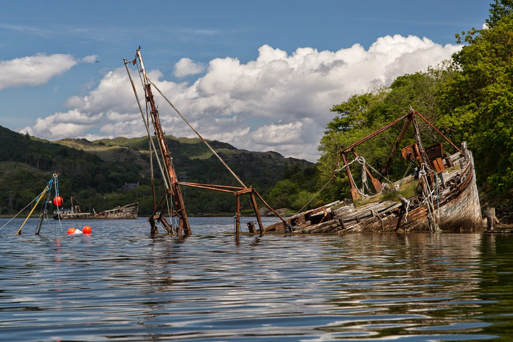
This photo (from another day) shows the bulk carrier MV SeaLand Performance (on the right) anchored at the Tail of the Bank. You can see the hull of the Captayannis in the distance, beyond her port side.

It was a strange feeling to be paddling along the deck of  ship from stern to bow. She is in surprisingly good condition as her hull points into the direction of the worst of the weather. However, her thinner deck plates have started to rust through. This hole leads down to the engine room and there was still a slight whiff of oil even after 40 years!

 Moving forward we came to her wooden decking which was...

 ...still in remarkable condition. The MV Captayannis was originally called the MV Norden and was built in Denmark in 1946. Sad though her wreck is, at least the Captayannis is still relatively intact. It is almost certain that her contemporaries have long since been broken up.


ShipSpotting.com
© PWR
Photographer PWR has posted this photo of her as MV Norden over on ShipSpotting.com.

We slowly worked our way forwards along her aft deck  and under the remaining shroud for her aft mast towards her...

...midships superstructure.

This windlass would originally have lifted cargo via the derricks attached to the mast.

This hatch's cover has long gone.

Near horizontal ladders lead up to what was once the upper decks of her superstructure.

Forward of the superstructure we came to the long foredeck. The submerged fore mast was still supported by three shrouds on her upper, starboard side.

At low tide it is possible to paddle inside her forecastle which is still topped...

...by mooring bollards.

At last we reached the bow where...

...the fine lines of the Captayannis's...

...stem could still be seen stretching away to her...

...stern some 127.4m away. She looked like a dead, beached whale from this angle but there was no sign of the fatal rips in her hull. These are deep under water on her port side. Her beam was 17.1m and she was about 2/3 submerged when we were there, so there was about 11m of water. However even at chart datum, there is still 7m of water.

As the tide swirled the brown waters of the Clyde round the Sugar Boat's  hull, we thought of that stormy night when the Clyde's waters had never been sweeter.

Tuesday, December 03, 2013

The Devil's Thrashing Floor, the White Steeds of the Solway and the wrecks and carlins of Senwick Bay.

As Tony and I paddled down the wooded shores of Kirkcudbright Bay, we were sheltered from a brisk SW wind which was blowing offshore. The wind combined with the flood spring tide made for hungry work and it was time for first luncheon.  The tidal shallows here are called "The Devil's Thrashing Floor" and...

...they were the cause of many ship wrecks, such as that of the two masted sailing schooner Monrieth in 1900. Her wooden ribs can still be seen at low tide. When the wind bows against the tide in these waters conditions are right for the wonderfully named "White Steeds of the Solway" to make their appearance. These may be the Devil's steeds...

...but they can be fun!

However, all was calm this day and we soon came to the delightful sheltered  cove at Senwick Bay. It is not always thus, in 1887 the Preston brig "Just" was lost here as were the Whitehaven brig "Mary Isabella", the Harrington brig "Dido" and the Workington brig "Joshua" all in the same storm in 1822. The other name for Senwick Bay is Carlin's Cove. Carlin is the Old Scots word for a witch. You can just imagine the Thrashing Floor and Senwick Bay on that stormy night. The wind was shrieking through the doomed ships' rigging and the trees on the shore like a wailing banshee...

On this July day the cove was a real sun trap and we enjoyed a long break  as a succession of motor and sailing boats from Kirkcudbright made their way past us on their way out to sea.

All too soon it was time to take to the water again and Little Ross island slowly got nearer. Its lighthouse had been constructed in 1843 in an attempt to reduce the appalling loss of ships on the Devil's Thrashing Floor.

Friday, August 30, 2013

Better Days #16 in West Loch Tarbert.

 Beyond West Tarbert pier we came across a graveyard of decaying...

 wooden fishing boats.

This one was FV Kreisker BA207, which was wrecked here about 1987. Their days of harvesting the oceans' bounty had long gone. In short they have seen better days.

We now came to where my friend had suggested we exit the loch to begin our portage across the isthmus into the Firth of Clyde. The West Loch Hotel and the road to Tarbert lay a short distance over a gently sloping grassy bank. It looked ideal, an easy exit with the prospect of a refreshing pint but the illusion was shattered when we paddled into a lagoon of raw sewage, which was bubbling out of the end of a sewage pipe. Yuk! We made a sharp exit.

Wednesday, August 28, 2013

A tale of two islands, one ferry and two captains.

 Eilean Eoghainn is a delightful small island set within the recesses of West Loch Tarbert in the Scottish county of Argyll. It is guarded by rocky ramparts but its...

 ...interior is a lovely wooded glade underset by bluebells. The dead trees make an ideal roost for the local heronry while...

 ...herring gulls nest on the rocks amongst red campions.

 We came to a little beach and pier,...

 ...these are in the grounds of Rhu House which would make an excellent B&B base to...

...explore the beaches and islands of lovely West Loch Tarbert. This island, Eilean da Ghallagain even has its own small beach. In 1960 the Islay ferry, the MV Locheil, sank just north of Eilean da Ghallagain. She had struck a rock further down the loch and was attempting to get to West Loch Tarbert pier near the head of the loch before sinking. Fortunately she came to rest on a mudbank, which prevented her sinking fully. There was no loss of life and even stock from the bar was rescued. MV Locheil was later salvaged and repaired. She continued on the run for another ten years... with a new captain.

Monday, March 25, 2013

A whiff of diesel with Rum on the rocks near Bloodstone..

As we left Kilmory Bay several fast fighter aircraft arced round the sky, disappearing round either side of the distant Skye Cuillin. Then this air support aircraft, G-FRAS, a Dassault Falcon-20C, leased from Cobham flew low overhead.

We continued round the coast of Rum but although there was almost no wind the swell was heaving at the base of the cliffs with a near constant roar. We were now paddling SW into the glare of the low sun. Something in the distance caught our eye but we could not quite make out what it was...

 ...until we approached the sad wreck of...

...the Jack Abry II, a French trawler that ran on to the rocks here just before midnight on the 31st January 2011. Fortunately, despite a gale and the surrounding cliffs and mountains, all 14 men on board were airlifted to safety by the Stornoway coastguard helicopter.

Initial attempts to salvage her failed when her engine room and fish holds were holed and flooded. Her fuel oil was removed but there was still a whiff of diesel in the air over two years later. The Marine Accident Investigation Branch report makes interesting reading and like many accidents it was caused by a chain of small events that led to the final grounding.

 This coastline became more and more dramatic until we turned a corner and...

 ...Bloodstone Hill reared up above our intended destination of...

 ...Glen Guirdil. Green agates are found in this rock. They contain little tiny red flecks of iron, and it is these that give the stone and the mountain its name.

The geology here is very complex, Bloodstone Hill lies at the boundary of granite and Torridonian sandstone. It is also covered with sedimentary conglomerate rocks containing igneous rocks from the eruption which formed the Cuillin of Rum. These sedimentary rocks are then covered with lava flows that are younger than the Rum eruption and which probably came from the later Mull eruption to the south. If you look carefully at the top slopes of Bloodstone Hill, you can see where these lavas have flowed over the top of the hill and started to run down ancient river valleys. The lava solidified before it got to the sea and has left steep escarpments.

Bloodstone is one of the finest rocks for making stone tools. Our ancestors have been visiting Rum to quarry bloodstone for at least 7,500 years; a camp with a heap of hazel nut shells has been carbon dated to that time. Bloodstone arrow heads and axe heads have been found at great distances from the lonely isle of Rum. These people worked and traded bloodstone 3,000 years before the first stone was laid in an Egyptian pyramid.

June 2006
I have twice before landed by sea kayak at Guirdil. Both occasions were in summer but one was very windy. We landed near high tide on banks of uprooted kelp.

June 2006
This is Guirdil bothy where Ian and I planned to stay for two nights. 

June 2006
The following day we hoped to circumnavigate Canna from here and return for the second night.

As we approached Guirdil we could see an inviting plume of smoke coming from the bothy chimney. This time it was about half tide and the swell was washing up over a boulder beach interspersed by studs of bed rock. We explored both sides of the beach but it did not look very inviting. We were concerned as the forecast was for the wind and surf height to increase the following day. Then two tall men emerged from the bothy. Both were dressed head to toe in camouflage gear... time for Plan B.

In life you need to create opportunities in which good luck might happen. Both Ian and I have a very flexible view to planning. We had allowed sufficient time to arrive at Guirdil and paddle somewhere else, we had brought tents and I knew of a good camp site on Canna, which we could reach by night fall...

Saturday, June 09, 2012

Hamilton Isle, between a rock and a hard place.

From the north end of Holy Island we gradually came out of the wind shadow of its mountains and picked up a fair breeze across the north entrance to Lamlash Bay. The Bay is sheltered by Holy Island and forms an excellent natural harbour. In the dark days of WW2 it often gave shelter to ships of both the Royal Navy and the Merchant Navy.

As we approached tiny Hamilton Isle (little more than a rock) we began to experience an uneasy swell coming from the north (despite the wind being from the south). The forecast was for the wind to veer to the NW and increase to F5-7 in the afternoon so we made the most of the fair wind while it lasted.

As we approached Clauchlands Point we began to see into the depths of Brodick Bay where our journey would shortly end. Several ships were anchored in the shelter of the Bay.

Before rounding the point, we stopped for a last look south towards Hamilton Isle. Mullach Mor, 314m, on Holy Island towered behind it. Arran only has three satellite isles, Holy Island (the largest), Pladda and Hamilton Isle (the smallest). Hamilton Isle used to be more accurately called Hamilton Rock.

On the 13 October 1891, a 58 ton wooden schooner, Elizabeth McClure, was wrecked on Hamilton Rock with three men aboard. She had been carrying coal, from Irvine in Scotland to Larne in Ireland, when she was caught in a violent F11 storm from the SW. Given this wind direction, it is possible that she had tried to seek shelter in Lamlash Bay and that her anchor had dragged as the storm increased.