Showing posts with label monuments. Show all posts

Sunday, May 22, 2016

An unarmed portage across the Tarbert of Jura

After landing at the head of the inner part of West Loch Tarbert, Jura our first priority was breakfast.

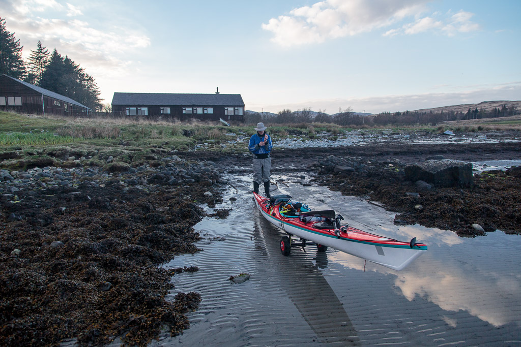
We then set off on the 1.9km crossing which is 26m high but involves 40m of ascent. I was using the prototype KCS Easy-Haul Harness (which I have already reviewed here) and Mike and Ian were using portage slings with short contact tow lines to attach the sling to the kayak. Straight away there was a disadvantage to using portage straps. Mike's was dry but we had used Ian's to extract the boats from the muddy waters of the loch and so Ian got a wet, muddy shoulder. As you can see you do not need to use your arms while towing your kayak on the trolley.

 My asthma was bothering me quite badly so I soon had to stop and take a breather but...

 ...there was no stopping Mike and he soon forged ahead.

 Ian and...

...myself made more leisurely progress and as you can see we did not need to use our arms.

Soon we were across the summit and down to the Island's main road which we followed for a brief distance until we came to the sign for Tarbert.

There was a much older sign nearby this standing stone has stood here for several thousand years. We were hardly pioneers of this route. There is also an early Christian chapel nearby where the bereaved carrying their dead to Oronsay and Iona would stop and pray for their safe passage and for the safe passage of the deceased into the next world.

At the Tarbert track turn off a new sign has been situated.

 Our progress to the beach was watched by two sturdy garrons which are used to take deer carcasses off the hill during the stalking season. Deer shooting is a major part of the island's economy.


There are many places in Scotland called Tarbert or Tarbet. The name comes from the Gaelic word Tairbeart. In modern Gaelic this means isthmus but its origin lies in "over carry" or "draw boat". Of course sea kayakers were not the first to portage their boats over the isthmus at Tarbert.  In about 1093 Magnus Barefoot, King of Norway, had made a truce with the King of Scotland that allowed him to claim possession of any land he could "sail" round. Of course he didn't necessarily use his own Vikings as labour. Unlike this Viking publicity picture, he "recruited" the unfortunate locals to do the drawing. Any that were too weak to pull were probably used as rollers under the boat. Unlike the Vikings, we had come unarmed and so had to draw our own boats across the isthmus.

Mention of the Vikings brings me back to the origin of the name Jura. I have already mentioned that three Viking words are thought by some to explain the name (the words for beast, deer and udder). In fact the name Jura predates the arrival of the Vikings by at least 150 years.  Ecclesiastical writing in AD 678 recorded what we now know as Jura as "Doraid Eilinn".

 We now arrived at the beach. Unfortunately it is a trap for rotting seaweed and unsuspecting sea kayakers.

Photo 17/4/2015
When Tony and I were last here a year previously it had not been too bad. This time it was on the retching side of bogging awful. We put drysuits and boots on to wade through the foul mass each of the six times it took to get the three boats to the beach. Two of us at the rear used a portage strap to take some weight off the wheels.

What a relief it was to wade into the clear waters of Tarbert Bay. We spent some considerable time cleaning the stinking glaur off our boots, suits and trolley wheels. However we were in no rush, the south going ebb was in full flow and we needed to go north! We were now back in the Sound of Jura.

Saturday, November 07, 2015

Prospects at the three priapic pillars of Knockbrex.

 From Ardwall Isle we left the confines of...

 ...Fleet Bay and started to make our way out...

 ...towards the more open waters of the Solway Firth until we were stopped in our tracks by...

 ...the priapic pillars of Knockbrex. There are three pillars and they...

 ...lead into the recesses of...

...Knockbrex Harbour.

Whatever their provenance, the priapic pillars provide plenty of perpendicular photographic prospects whatever the weather.

These photos were taken exactly 2 years before our visit and show more typical October weather.

Whatever, if you come to this part of the Solway do remember to visit the three priapic pillars of Knockbrex.

Read more about these erections here on Ian's blog.

Friday, November 06, 2015

Setting off with a fair wind and tide on the Solway Firth.

The day dawned fair on Fleet Bay in the Solway Firth and as the line of clouds drew back to the SE we enjoyed some warm October sunshine.

Ian, Mike and I soon had our kayaks packed and at the water's edge. It had been our intention to paddle east to Sandyhills stopping at Little Ross Island and Hestan Island on the way. Unfortunately the firing range at Dundrennan was in use so we would not be able to pass. So we intended to do a there and back paddle as far as Kirkcudbright.

 It was a most marvellous start with a fresh tailwind and paddling...

 ...straight into the sun.

 The ebb tide was also with us and it seemed like no time at all until...

 ...we landed on Ardwall Isle for first luncheon.

We decided to climb to the top by way of the farm track which leads up from the beach. The farmer drives over from the mainland at low tide several times a year to cut the grass and bale it.


As we gained height we enjoyed a great view over the recently cut meadow to Murray's Isles Ravenshall Point and to Wigtown on the far side of Wigtown bay.

 There were plenty of brambles but almost no sloes.

From the summit we had a clear view back across Fleet Bay to where we had come from, the cluster of caravans under Ben John.

 The simple cairn at the summit of Ardwall Isle overlooks the grand...

 ...house at Knockbrex with its fields extending down to a little harbour.

Beyond Barlocco reef our way lay away to the SE, beyond distant Ringdoo Point.

For the full kayak stereovision experience follow Ian's blog which starts here.

Friday, September 25, 2015

Return to Largs via the Midshipmen's Memorial, Great Cumbrae.

 The wind picked up again as we made our way up...

 ....the west coast of the Great Cumbrae.

At Tomont End at the north end of great Cumbrae we passed under the Midshipmen's Memorial. It's inscription reads:

"IN MEMORY OF MR. CHARLES D. CAYLEY AGED 17 YEARS AND MR. WILLIAM N. JEWELL AGED 19 YEARS MIDSHIPMEN OF H.M.S. SHEARWATER

TWO PROMISING YOUNG OFFICERS DROWNED BY THE UPSETTING OF THEIR BOAT NEAR THIS PLACE 17TH MAY 1844

THIS MONUMENT IS ERECTED IN TOKEN OF THEIR WORTH BY CAPTAIN ROBINSON AND OFFICERS OF THE ABOVE VESSEL"

Leaving Great Cumbrae we enjoyed a favourable wind as we crossed the channel to the AQyrshire mainland. In the distance, at Hunterston, we could see the coal terminal, the nuclear power station and the giant windmills. As is often the case when there is a wind, the windmills here and on the hills above Largs were not turning.

We landed at Largs marina almost exactly 24 hours after we had left. As always it seemed like we had been away several days. An overnight expedition to Inchmarnock is always a treat, especially when you have a tail wind all the way back!

Saturday, August 22, 2015

From the sublime to the ridiculous in the West Kyle.


As the two sides of the West Kyle of Bute gathered towards us we came to Kilmichael. In the field in front of the cottage there is a chambered cairn called St Michael's grave. St. Michael founded a church near by but this cairn predates the Christian era by about 2,000 years.

Just round the coast from the cairn is the ruin of this abandoned house. It was the ferryman's house for the ferry that ran from Kilmichael on Bute to Blair's ferry on the Cowal side of the kyle. Although the rocks look too inhospitable for landing, there is a little cut with a jetty just to the NW of the house. The ferry was established in 1769 and ran until 1940 when it was closed due to WW2 military operations and exercises in the area. The house was occupied until that time. The ferry man operated the premises as an inn called "The Bottle and Glass Inn". Unfortunately we had arrived well after closing time.


The Kames Hotel on the opposite side of the Kyle  was open but as it was such a glorious day we decided to stay in the sun for our second luncheon. Amazingly a southerly thermal wind picked up and gave...

...us a little assistance past Tighnabruich to Caladh Harbour at the north end of the kyle.

Then at the north end of Bute we passed blow two garishly painted rocks known as the Maids of Bute.

As you can see from this close up from our March trip, they look nothing like "maids". I doubt they will be as long lasting as the chambered cairn at Kilmichael.

After a short paddle through the tidal south channel at the Burnt Islands we arrived back...

...at the ferry terminal at Rhubodach just as the MV Loch Dunvegan was pulling away from the jetty. Our  four day trip from the Kyles of Bute to Loch Fyne and Inchmarnock was now over. Sadly the Scottish summer of 2015 seemed to coincide with those four days and it would be some time before we went on a camping trip again.

We took the Calmac ferry to Bute from Wemyss Bay then drove from Rothesay to Rhubodach. We covered 91km in 3 whole days paddling.