Showing posts with label mimetoliths. Show all posts

Saturday, November 21, 2015

The sound of heavy guns and a mushroom cloud rising over the Solway.


As we turned to the west we left Little Ross Island and the sound of heavy gunfire at the Dundrennan Range far behind.

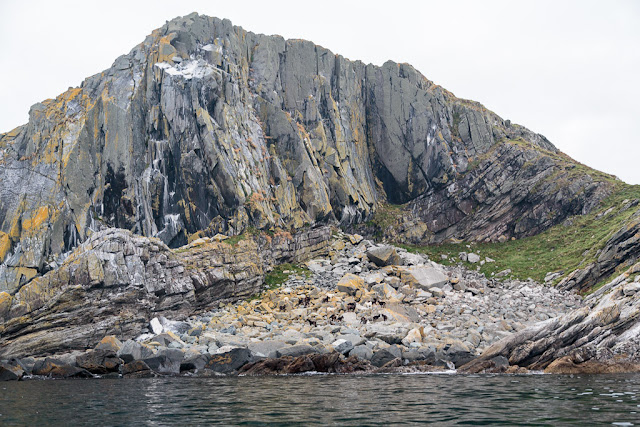
The dramatic cliffs, stacks and skerries of this stretch of coast make an amazing contrast to the sheltered wooded coastline, which we had just left in Kirkcudbright Bay.

 We were now sheltered from the north wind and the sun on the rocks made it feel almost balmy...

...though in the shade of the narrow passages it was already very cold. We came across...

...this lion rampant mimetolith as we emerged into the sunlight again.

More gunfire from the range accompanied our return to the open sea. Even though we were now some distance away, the reverberations of some particularly heavy rounds shook the channel walls and our chests.

Once clear of the cliffs at Fauldbog Bay we looked back to discover a huge mushroom cloud. What on earth were they firing?

 Beyond the boundaries of Brighouse Bay the breach...


 ....in the cliffs ended and the rocks reared up again.

  The wind swung round to the east and we benefited as it was no longer being broken up by the cliffs.

The wind assistance was most welcome as...

 ...we still had a long...

 ...long way to go. Once round Ringdoo Point we made for...

 ...Castle Haven Bay where we had left a stash of firewood.

The tide was dropping and the day was fading fast as we paddled into the bay. Our stash of firewood was actually a wooden pallet and we did not have long to demolish it. Ian broke the main timbers with a boulder before tackling the smaller pieces with a saw. I removed the nails so that they would not puncture our dry bags, which we attached to our back decks. The whole operation had taken just over 15 minutes but the bay had rapidly emptied. We really needed to press on. An 8m tide in the Solway goes out a long way...

Wednesday, October 28, 2015

The Old Man of the Mull of Logan.

At the Mull of Logan there are a number of hidden inlets which lead to the great rock arch called the Devil's Bridge. Phil, Tony and I had been before but as Maurice had not been before (and we had said nothing to him) he amazed when he found it.

 Those entering the recesses and passing under bthe arch do so under the baleful stone gaze of the Old Man of the Mull of Logan.

 We dallied for some time in this wonderful spot but the tide was still rushing north and we were now going to head south to Port Logan...

 ...against the tide.  There was no eddy on the SE side of the Mull but close in the tide was only running at 4km/hr compared with 9km/hr just a few meters out.

 Soon we were in quiter waters and the coast here has a maze of gullies many of them interconnecting. This arch is called Little Bridge.

 Further along we came to this old cabin before we arrived...

 ...in Port Logan Bay which is backed by the fertile fields of the Rhins of Galloway.

Our final obstacle was clearing the lines of the many fishermen who lined the old pier. Port Logan was originally called Port Nessock and in the 1
7th century attempts were made by the McDouall family to establish it as a ferry port for Ireland. They also built the Port Logan Inn which is sadly closed at the moment.

The quay and Port Logan Light were built in 1830 by Colonel Andrew McDouall. The light is a conical stone tower with a platform for a lantern. It is not known when it was last lit but for sometime after that it had a bell, which was rung to guide local boats back in foggy conditions. A decent road to the village was not constructed until the early 20th century, so most of the village's trade and traffic depended upon the sea. A life boat station was built at Port Logan in 1866. It closed in 1932 as the RNLI lifeboat at Portpatrick, 18km to the north west, was motorised by then. The boat house is now the village hall which you can find near the quay.

Our 24km trip from the East Tarbet round the Mull of Galloway, Crammag Head and the Mull of Logan is one of the finest paddles in Scotland. However, due to the tides it can be very serious if there is any wind.

Saturday, October 24, 2015

A meeting with the latter day Brownie of Cara at the Mull.

 When we woke on Cara on the third and last day of our trip the skies were overcast but there was no wind or swell which would make ideal conditions to round the Mull of Cara.

We set off round Cara in an anticlockwise direction which took us through the skerries on the island's NW coast.

 An unmistakable odour revealed a number of the island's large goat population.

As soon as we were out of the shelter of the skerries we encountered swell which is often a reason to keep well out but it was just about as flat as I have ever seen it.

Ian had not being expecting the Mull of Cara to be particularly impressive so he was delighted when we first saw its rocky profile.

 It was so calm we were able to paddle right into Dead Man's Bay to the west of the Mull.

 Ian was dwarfed by the scale of the rocks which had fallen from the Mull in a huge landslide in 1756. The resulting tsunami destroyed coastal houses on Cara, Gigha and the west coast of Kintyre as far north as West Loch Tarbert.

 We took it in turn to paddle out to get some good distance shots. It was slack water but when the tide is running against the wind here, photography would be the last thing on your mind.

 High above the sightless stone eyes of the Cara eagle gazed out to the Atlantic. For a time we had had the impression we were being watched and had caught an occasional sight of a small brown figure flitting from rock to rock. Was it the Brownie?...

 Then we say it. It was the alpha male goat of Cara. He was perched on a comfortable rock...


...high on the cliffs of the Mull...

...watching over his flock below. We paddled on leaving the Mull of Cara to the goats and the Brownie.

Sunday, October 18, 2015

Stoned on Gigha.

 From Poll Mor we approached Port na Cathrach on Gigha's exposed west coast. It has long been used for fishing, there are bait holes carved into the solid stone of the rocks near the old pier.

It was good to see the old pier was again in use by the Banff registered creel boat, BF42 Jewel (though her home port is Campbelltown).

Just beyond the pier lies the little sandy Port an t-Samhlaidh. On the hill behind the beach millstones were once carved out of the rock. A partly quarried millstone is still in situ.

 We then decided to circumnavigate the little island of Craro. The ownership of Craro includes the title The Baron of Gigha. This is currently held by Don Dennis who owns both Craro and Achamore House from where he runs his flower essence business. On Craro there is said to be a curious rock formation which is like a stone bull.

 We paddled all the way round Craro but found no obvious landing place so we set off...

 ...for Gigha again disturbing yet another otter on the way.

 There was no landing along the great rock wall of Cnoc Loisgte.

 Previously I have seen a pair of peregrine falcons here but today we saw only a large number of buzzards and a golden eagle.

 At last we arrived at Port an Duin were we...

 ...took a short break for luncheon on the shore below...

 ...the old water mill. I wondered if its mill stones had come from the quarry we had passed earlier. During our stop we were entertained by the silvery autumn song of a robin.

In the NE corner of Port an Duin a pile of stones form another rudimentary pier.

A pile of creels on the rocks suggest that this is another port that is being used by a fishing once more.

Tuesday, August 25, 2015

En route to Bute with Simian Rock and squadrons of shearwaters.

 We set off from the Little Cumbrae castle on what seemed like the first hot sultry afternoon of summer.

 The Arran mountains always delight and the sight of them rising...

 ...above the reefs of Gull Point  is always worth a photo.

 Little Cumbrae is composed of layers of lava flows from successive eruptions.

 Ian spotted this mimetolith high on the cliffs...Simian Rock.

 It was a spring tide so before crossing to Garroch Head across the south going ebb tide...

 ...we took a north going eddy to just before the lighthouse. This saves a lot of energy maintaining a high ferry...

...angle on the crossing. We enjoyed seeing porpoises and diving gannets but...

 ...the real treat on the crossing was seeing squadrons of shearwaters skimming the sea round us.

We were welcomed to Garroch Head by a very large grey seal.