Showing posts with label fog. Show all posts

Wednesday, April 17, 2013

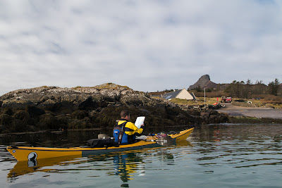
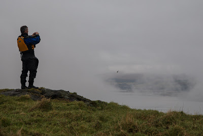
Smoke on the water, in the Sound of Eigg.

Ian and I found our kayaks had been untouched and were as we had left them at the Galmisdale shop and community centre. Facilities at the shop include a small restaurant, toilets, showers, wifi and a water tap.

 Our gear was rather damp so we let it dry in the sun as we moved the kayaks down the jett ready for our crossing to Muck, the last of the Small Isles..

There was a sea of fog to the north east though we could see the dark hill above Mallaig and the Distant mountains of Knoydart soaring into the clear air above.

 To the south west a similar bank of fog floated above the sea beyond Eilean Chathastail. We could see the Ardnamurchan mountains but there was no sign of the great peninsula.

According to the West Coast Pilot we would meet 3 knot tides in mid channel and 4 knots off the coast of Muck. It was spring tides and we would be in mid channel 3 hours after slack. The tide was running through the gap between Eigg and Eilean Chathastail like a river so with a last look at the chart we prepared to put in some hard work with a high ferry angle.

It was good to be on our way again and low lying Muck lay on the far side of a mirror calm Sound of Eigg.

To our left the fog banks had lifted allowing us to see all the way to distant Ardnamurchan Point.

Paddling along the south coast of Eigg we were rewarded...

...by a magnificent view of the Sgurr of Eigg, which we had been denied the day before.

We soon left the last house of Galmisdale behind and came to a...

...piece of coast with a dark secret.

Beneath the Sgurr are some sea caves that were cut when the sea was higher. The big one is Cathedral cave. Nearby a smaller cave, Uamh Fhraing (also known as the Massacre Cave) saw the death of almost the entire population of the MacDonalds who inhabited Eigg. In 1577, 395 Macdonalds hid in the cave from a group of raiding McLeods from Skye.They were found and the McLeods lit a fire at the only entrance. They all died and the corpses were left in the cave to rot. As recently as 1979 a human skull was found in the cave.

In those dark days in Eigg's past, it was not banks of fog on the water but smoke.

Saturday, April 06, 2013

Hatching a cracking plan on Eigg.

 We left Rum with the fog swirling round the foothills of the Cuillin.

Ahead in the murk the Island of Eigg lay 9km ahead of us and  for a long time we paddled using GPS, and compass. We were bound for Camas Sgiotaig at the north west end of the island.

 Eventually the mist lifted and we could make out the outline of Eigg...

 ...to the south west lay Rubha an Fhasaidh while...

 ...to the north east Sgorr Sgaileach...

... caught the sun.

 The silence of the open crossing was replaced by the crash and roar of the surf as we approached Eigg...

 Fortunately there was a pattern of bigger sets followed by a quieter period. So we waited for the right moment then...

 ...made a run into the beach. The spume was hanging heavily in the air and it was a relief...

 ...to be able to walk up the beach without having been trashed in the surf.

It was while we were having second luncheon on the rock slabs below the towering ramparts of Dunan Thalasgair that we hatched our plan. Our original intention had been to paddle down to the next sandy bay... Bay of Laig and leave the kayaks there and walk up to the B&B at Lageorna situated in the township of Cleadale.

Howeve,r the size of the surf breaking on the reefs made us concerned in case we were trapped by a rise in the swell overnight. So we decided to take advantage of the light wind and paddle all the way to the south of the island and leave the kayaks at the jetty in Galmisdale then walk the 7km back to Cleadale. The big advantage of this plan would be a guaranteed easy launch the following day and it would leave us close enough to Muck that a near circumnavigation would be possible before nightfall.

Friday, February 22, 2013

More on seeing the light and collecting taxes on the Little Cumbrae.


 We climbed up to the top of the cliffs where the Smith/Stevenson lighthouse stands but...

 ...we continued to climb the path which winds...

 ...up towards the summit of Little Cumbrae.

 As we approached the highpoint of the path we caught sight of the original Little Cumbrae lighthouse but...

 ...unfortunately there was no path to the top and I had a real struggle crossing the grass. Although I had set off about 20 minutes before the others they soon passed me.

 It is a simple round tower, 8.5m high and was...


 ...built by James Ewing in 1757. An open coal brazier was situated at its top and served as the source of light. It proved to be a profitable business as there was a tax on every ship, which passed on the way up the Clyde to Port Glasgow and Greenock. However, it had a voracious appetite for coal. The coal came from Rutherglen near Glasgow and was transported by horse and cart for 45km over the hills to Irvine in Ayrshire before being transferred to a boat for the Wee Cumbrae. It was then hauled by ponies another kilometre up to the 123m high summit. It was not exactly light work.

This plaque commemorates the bicentenary of the Cumray Lighthouse Act of Parliament which allowed passing ships to be taxed.

Inside the steps and the brazier platform have long disappeared. A resident peregrine falcon now enjoys the lofty ridge as a perch for...

 ...consuming its prey. Their bones litter the floor of the tower.

 It is a solidly built tower which should last for several more centuries. Some of the lichen colonies growing on its wall were probable over a hundred years old.

 Despite (or rather because of) its height it was often invisible to shipping as...

 ...it was frequently above the level of low clouds that frequently...

 ...swirl round the Clyde.

This is the view north to Millport on Great Cumbrae.

This is the view north north east to Largs and...

 ...this is the view east to the Hunterston nuclear power stations. You can clearly see the mushroom of cooling water in line with the two channel buoys.

This is looking south east to Portencross and...

...its castle.

 This is looking west towards Garroch Head on Bute. The paddock for resting the coal ponies is just below the lighthouse.

 Lastly this is looking NW to Kilchattan Bay on Bute, from where Ian had set off.

All in all the lighthouse proved to be a costly and fairly ineffective project. However, it served a useful function as it pioneered the collection of lighthouse dues on shipping entering the Clyde ports and led to the establishment of the next lighthouse built by  Thomas Smith and Robert Stevenson in 1793. It was situated at a much lower level and was lit by a more efficient oil lamp.


Thursday, February 21, 2013

A guide to healthy living on the Little Cumbrae.

 We set off across The Tan with...

 ...Portencross castle just visible through the mist.

 We were bound for the remote west coast of...

 ...Little Cumbrae island. This island is owned by a "charity" offering spiritual retreats to its many followers. The facts that the yoga is being pursued by the Indian tax authorities for tax dodging and that the Scottish branch of the charity has never filed a financial report to the Scottish Charity Register did nothing to lessen the deep spirituality we felt as we approached the mysterious island.

 Its summit was cloaked in mist as we...

 ...paddled south along its steep hillside until...

....we arrived below the Stevenson...

 lighthouse.

 We pulled into the ruined harbour for second breakfast.

Here yogmaster David gave us a lecture on healthy living through yog and pranayam and the benefits of moderate consumption. He warned us of the dangers of eating more than one egg at a time. As always we were only too happy to follow the words of the master. A master who pays his taxes: income tax, VAT and beer duty.