Showing posts with label fog. Show all posts

Friday, February 15, 2013

Misty morning melé in Millport!

It was a misty morning when we arrived at Largs on the Firth of Clyde. We had arranged to meet Ian in Millport Bay. Ian was going to cross over from Kilchattan Bay on the Island of Bute. Before I left, I checked ShipAIS as we would both need to cross shipping channels.  Fortunately there was nothing approaching the Hunterston Channel on our side of the Clyde but Ian had to contend with all 158,555 tons of the loaded tanker Yasa Scorpion which was heading up the Firth of Clyde Channel to Finnart.

After we loaded our gear, Phil went through the preflight check list, carefully counting to make sure he carried the requisite number of refreshment tins.

 Soon we were hitting the water, note where I left the spare pins for the Kari-tek Easy load roof rack!

The mist began to lift as we set off past the safe water buoy off the entrance to Largs marina.

We made good time down the Hunterson Channel past...

...the empty ore terminal.

The wind dropped as we crossed the channel to the Great Cumbrae.

Our arrival at the Eileans was greeted by these squabbling guard geese. They were not going to tolerate any landing on their turf.

However, we had raised Ian on the VHF and he was already at Millport, eating a hot sausage roll!

It was great to catch up and Ian had brought some really excellent Jura Superstition. Cheers!

Monday, April 16, 2012

All afloat on Brodick Bay

My next series of posts will record of our adventures paddling round Arran over a period of five glorious days at the end of March. For reasons too complicated to explain, the party on day one was not the same as on days 2 to 5!

 Phil David, Tony, Andrew and I convened at the...

 ...Ardrossan Ferry Terminal and loaded our kayaks onto MV Caledonian Isles.

After the full trucker's breakfast we disembarked at Brodick and watched as the Caledonian Isles quickly disappeared into the mist.

Andrew will shortly be sitting his 3* and wanted to get some experience of open crossings. Today would be ideal. We would be doing two crossings of about 10km on our way back to Ayrshire via Bute. The mist would also mean that we would be setting off into a featureless horizon with no sign of the other side until about two thirds of the way across. The spring tides would add to the mix!

 Phil was beaming from ear to ear as we set off across Brodick Bay.

Tony hasn't been out for a while and was catching up with several episodes of David's stories!

Brodick Castle was just visible through the haze and the Scots pines that now surround it.

Saturday, April 02, 2011

Keeping fast company on the crossing to Ailsa Craig.

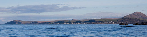
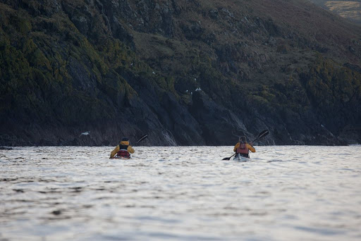
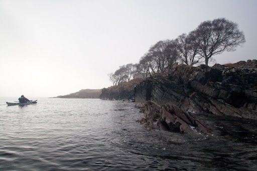
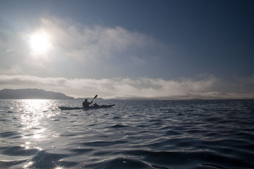
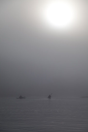
Last Sunday, Phil, Tony, Jennifer and I met at Lendalfoot on the Ayrshire coast. We were bound for Ailsa Craig, a huge monolith of granite, which is situated at the entrance to the Firth of Clyde, some 14km offshore.

The staff of seakayakphoto.com have a new honorary member. John Willacy is the designer of the Rockpool Taran, which has something of a reputation as a speed machine, especially with John aboard! John was in the area after a little paddle the day before and so he was keen to do some more paddling before returning to Anglesey. Of course John's idea of a little paddle is not necessarily the same as most people's. On Saturday he had broken the record for an unsupported crossing from Portpatrick in Scotland to Donaghadee in Northern Ireland. Then, he just paddled back over to Portpatrick again!

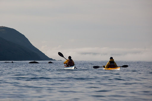
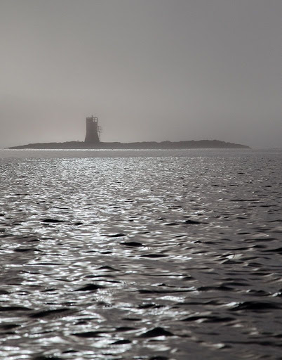
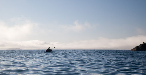
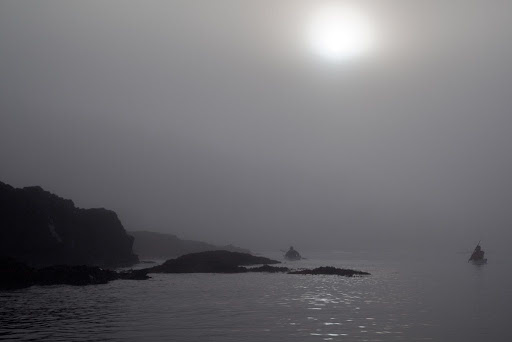
We set off into the mist on a bearing of 320 degrees, Ailsa was hiding in the mist.

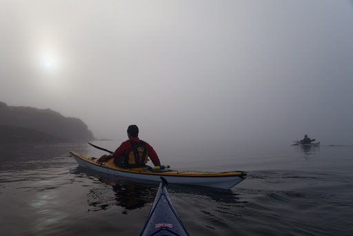
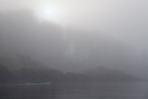
 It wasn't long until the Ayrshire coast was also swallowed in the mist and we were all alone at sea...

...well not quite alone. We heard the roar of the approaching high speed ferry, which leaves Troon at 10:05 for Larne in Northern Ireland.

It does the 110km crossing in just two hours and has a maximum speed of 41knots. Fortunately it usually goes down the far side of Ailsa Craig. But not always...

Saturday, February 27, 2010

Tony's special cave vision spectacles.


We left Ballantrae in beautiful early February sunshine. The bay and village were framed by Bennane Head and Knockdolian which in misty conditions could often be mistaken for Ailsa Craig. Many sailing ships found themselves foundering on the steep shingle shore instead of being in the deep water on either side of Ailsa Craig. To this day local seafarers call Knockdolian "False Ailsa Craig".


To the south banks of sea fog hid the south Ayrshire coast and the more distant Milleur Point.


Gradually the fog dispersed revealing a magnificent series of headlands receding into the distance and Loch Ryan.


Soon we were paddling below steep ramparts, deep in the shade of the low winter sun.


The cliffs have a number of caves at their base, inside one...


...this pair of black Guillemots were peacefully moulting into their adult summer plumage but turned their heads in amazement...


...when they saw Tony's special cave vision spectacles.

Saturday, February 06, 2010

Fleeting wraiths of fog in the Sound of Kerrera


We continued to paddle through swirling fog...


...until we drew level with the Sgeirean Dubha reef. The light shows two white flashes every 12 seconds. The present structure replaced the previous light on 11th January 2002.


Then, magically, the wraiths of fog seemed to melt away and the sun took command of the day.


As we approached the southern point of Kerrera the deciduous tree cover became less...


...and the landscape took on a wilder grandeur. Headland after headland rolled by in the sunshine but at sea the fog still held sway.


Then suddenly, the fog lifted and revealed the scattered necklace of the Isles of Lorn.


We had now arrived at Rubha Seanach and had a clear view to distant Insh Island. What would we find once we had turned west round the point?

Thursday, February 04, 2010

Black and white in the Sound of Kerrera


From Aradantrive Bay we paddled down the Sound of Kerrera to Heather Island. The fog seemed to suck all colour from the land and sea-scapes.


There was no wind to disperse the fog and glassy calm conditions reflected the sun, which occasionally broke through a thinner layer.


On the mainland side of the Sound, the Ardbhan Craigs rose into the mist. These steep cliffs with a raised beach at their foot were cut when the sea level was higher.


We arrived at Kerrera's jetty where the ferry, the MV Isle of Kerrera , was tied up. She is powered by two 75hp Honda outboards. The ferryman, Duncan McEachan, will go over to the mainland if an intending passenger turns a white board so that its black side faces Kerrera.

Wednesday, February 03, 2010

Better Days: the wreck of the Hyacinth


The Mull ferry's foghorn reverberated backwards and forwards between the unseen cliffs that back the Sound of Kerrera. At Ardantrive Bay we came across the sad remains of Hyacinth that was wrecked on the rocks after catching fire on the 28th April 1920. She was an iron motor drifter under the command of Captain Buchan. She was built in 1901 and was 21m x 6m with a gross weight of 39 tons.


Under the clear water we could still make out the lines of her barnacle encrusted keel and bulwarks and then, as we drifted in the ebb tide, she was lost in the fog.

Tuesday, February 02, 2010

The fog on the Lorn...


As we left Ganavan, fingers of cold, grey fog curled round us...


... like a shroud...


... distorting distance and muffling even the sound of the Mull ferry's fog horn.


Even the solid outline of Dunollie castle was softened to little more than an ethereal shadow emerging from the trees above the shore. Although there has been a fortified site here since the seventh century, the current fortifications date from the 1200's to the 1400's. The castle was the seat of the Lords of Lorn, the MacDougalls.


We followed the coast to the Dunollie lighthouse at the entrance to Oban bay. The light was established in 1892 and flashes twice every 6 seconds. There are white, red and green sectors. The lighthouse marks the narrowest part of the channel between the mainland and our destination, the island of Kerrera. The channel is only 200m wide but we could not see the far side. The Mull ferry has to navigate this channel and it was imperative that we should not impede it. We listened carefully to its foghorn. We decided that it was still a little way off and so we crossed quickly to Kerrera. We almost collided with its rocks before we saw them looming out of the fog. Behind us, the ship's tannoy advised drivers to return to the car deck for disembarkation.

Friday, August 01, 2008

Losts in the mists of the Mull of Kintyre


Tony and I were not the only ones rounding the Mull of Kintyre. Quite independently, Rab, Julia and Donald from the Drumchapel and Clydebank Kayak Club hit on exactly the same itinerary and timing as us!


Although the coast of the Mull of Kintyre is almost beach less, there are large areas of sand below low water. They gave the water a lovely luminous green hue.


There are actually two caves at...


....Uamh Ropa.


The heavy rain of the night before was cascading down from the heights above the mist and plunging into the sea.


Tony attempts to plot our position in the thick mist. Alternatively, keep the Mull close to on the port bow!

26/07/2008