Showing posts with label castles. Show all posts

Saturday, June 11, 2016

En route to Erraid and the Ross of Mull

The road and ferry trip to the Ross of Mull is a long way wherever you live on the mainland. Ian and I had talked about returning here for ages and on the 11th of May we finally set off in the company of Donald in his little RIB and Alan and Lorna. You will be able to follow this trip in trivision on Ian's blog here and Donald's blog here.

Donald and I met up in Oban for a coffee and a stroll before setting off. I wanted to photograph the various slipways near the main ferry terminal. The nearest is the Calmac slip for the Lismore ferry but there always seems to be a reserve ferry sitting in there.

The next nearest is the slip in the ice factory yard. I do not think you could offload a car here but if you arrived by ferry and wanted to launch or if you arrived by kayak and wanted to catch a ferry this might be possible. The RNLI Oban lifeboat is the RNLB "Mora Edith MacDonald" a Trent class boat.

 The public slip is furthest away. You might be able to avoid the busy Gallanach Road by trolleying round the path in front of the lifeboat station and through the ice factory yard to the ferry terminal.

 We walked back to the town past the fishing pier as we had some time.  This is OB151 FV Orion. the quayside restraunts were doing a brisk trade selling sea food platters to Chinese tourists who certasinly seembed to be enjoying the food and the sunny ambience of Oban.

 We had plenty of time and the first ferry to Mull was the MV Coruisk which has recently been transferred from the Mallaig Armadale run to Mull due to the explosion in traffic caused by the introduction Road Equivalent Tarriff which has meant the ferries (and the roads) are full of camper vans. If I was transport minister I would only allow camper vans on the road between the hours of 1 am and 4 am.

 We did not have long to wait until our ferry the MV Isle of Mull came in and soon...

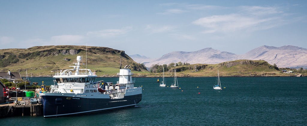
 ...we were aboard. While we were loading, Marine Harvest's brand new 70m well boat the Ronja Challenger berthed at the ice factory quay.

 Soon we were off passing the north end of Kerrera where this rather splendid house is for sale for around a mere £1,000,000.

 The channel to the north of Kerrera is rather busy with shipping and the MV Isle of Lewis which serves Barra from Oban...

 ...came in as we were leaving closely followed by the returning

 ...MV Coruisk. As you can see a fresh NE wind was blowing.

 Half way to Mull we passed Lady's rock where Lachlan Maclean of Duart left his wife to die in 1527. She was rescued by a passing boat and he was later murdered by her brother.

 The bottom end of Lismore is marked by the Eilean Musdile lighthouse.

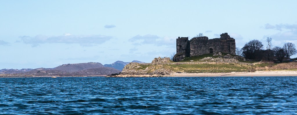
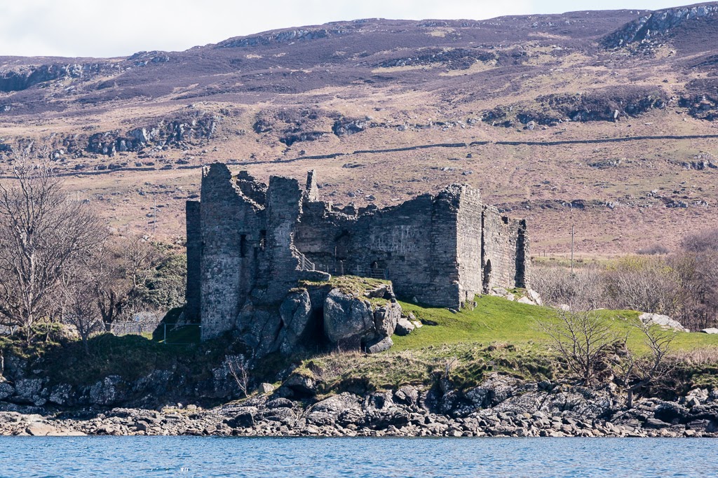
Then we passed Duart castle on Mull. If you are paddling rond the coast here it might be worth keeping further out. The water close to the coast is often very disturbed,

 Soon we landed and the ramp came down on Mull.

 The road to the Ross of Mull isost 60km of twisting single track, fortunately it was quiet and it was a magnificent drive through the mountains to Bunessan where we had arranged to meet the others. One option was to launch at Bunessan and camp at Market Bay on the north coast of the Ross of Mull but I had an updated weather forecast on the ferry which was for F5 northerly overnight which would make a difficult launch from Market Bay (a surf beach).

 We decided to camp at the excellent Fidden Farm camp site which has a fantastic view...

 ...over the skerries to the Sound of Iona.

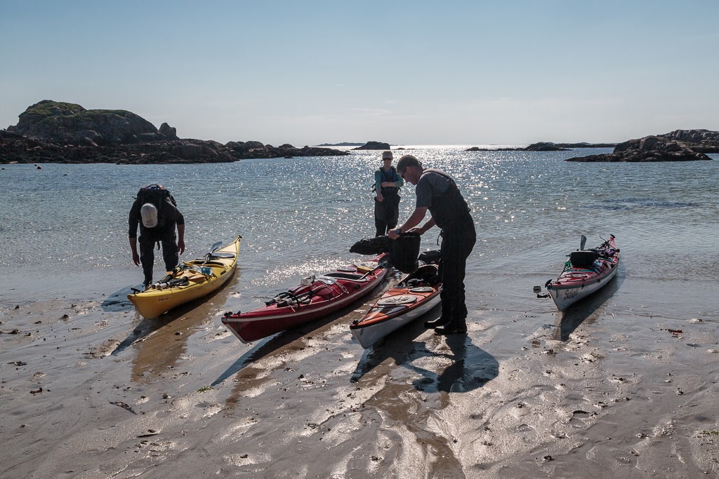
 We wasted no time in carrying the boats one by one...

 ...down the dazzling white sand to the...

...sparkling water's edge. We were bound for the magical tidal island of Erraid.

Wednesday, May 25, 2016

Time stands still in Loch Sween

The mouth of Loch Sween is guarded by the grim walls of the remains of Castle Sween which...

 ...is one of the oldest stone castles in Scotland. I have used a great deal of artistic licence in the composition of these photos as nowadays the castle is besieged on all sides on land by serried rows of modern caravans. Little is known of the origins of the castle but it is believed to date from the late 12th century when it was built by a lord Suibhne in the Norman style. It changed hands many times before it was abandoned in the mid 17th century. However, so well was it constructed that time seems to have stood still for the castle over the last four centuries or so.

 The wind from the north had increased so we crossed to the loch's NW shore to gain some shelter. The offshore wind carried the heady coconut scent of the Kokatat yellow gorse bushes.

 Elsewhere the shore was bare rock and the perspective of this photo emphasised the linearity of this long ribbon like loch.

In places, the wind freed just enough to allow some close hauled paddle sailing and we crossed to the SE shore. Soon...

 ...we had left the entrance to the loch and the Sound of Jura far behind. We were beginning to get a sense of closure on our expedition to Jura and Islay.

We tacked across to the NW shore again and paddled inside Taynish Island where we passed Taynish bath house and jetty. 

 There was just a hint of the buds breaking in the deciduous trees of the Taynish nature reserve. We heard the contrasting calls of a willow warbler in the woods and a great northern diver on the water.

As we approached the end of our journey at Tayvallich the Shannick, the Jura passenger ferry passed on her way to Jura. two sea kayakers were hitching a lift for a trip across the Sound of Jura in much less time than we had just made.

We now turned west into the sheltered waters of the natural harbour at Tayvallich where...

 ...sheltered by the wind we unloaded the boats in warm spring sunshine before...

...shuttling across to Carsaig Bay on the Sound of Jura where we had left the other car. Beyond the NLV Pharos the north end of Jura beckoned. I seemed ages ago we had set off from this spot but in reality it had only been three days. That is what I like about a good sea kayak expedition, time seems to stand still and so many things get packed in to what is actually a very brief time.

Sunday, November 22, 2015

The folly of not bringing a trolley to Barlocco.

 Well laden with wood, we paddled out of Castle Haven under...

 ...the watchful yellow eye of the local heron.

 The sun was sinking fast, almost as fast as the sea level and...

 ...despite our best efforts the bar which connects Barlocco Isle to the mainland had dried. Our destination at Barlocco beach (the one with the fort folly) was 320m away on the other side. We could paddle 2.5km round Barlocco but the carry would still be 250m. A trolley would have been most beneficial but as I already knew there was little fire wood on the beaches, I had advised Ian and Mike to leave the trolleys and bring wood instead. In retrospect we should have brought one trolley and only two of us should have brought logs.

Anyway the retrospectoscope is a very powerful instrument so we had no choice but to get on with it. We left our bags of wood at the bar and carried the three kayaks up the beach. That was 1km of walking and 1km of carrying! We discovered that burning logs is not the only way to get warm. We just managed to beat...

 ...the sunset which was truly magnificent.

 The Solway skies really are wonderful whatever time of day...

...but this sunset was something special to behold.

My knees were absolutely killing me after the carry so I dropped my things and set up my tent just at the top of the beach beside the folly. The ground was not exactly level but my knees were done and I didn't care.

Ian and Mike found a much better camp site just 150m further on. Ian then very generously went back to recover the logs during the best bit of the sunset. I was particularly pleased about this as I just could not face a fourth trip back down the beach and back.

 While Ian was doing this I took some more photos with...

 ...his camera so that he would not miss out on photographs to help remember the wonderful Solway sunset by.

On his travels Ian had also found two very large logs which he rolled into place. One provided a back for the fire the other provided a seat. I used one of our ignition aids (bag of barbeque coals) and got the fire going with one match.

 As the giant star Arcturus slowly set in the west behind the Sun, we roasted sweet potatoes and Ian rushed off to replenish the supplies of Jura, which had run perilously low. My knees began to feel better and we chatted long into the night. On the far side of Wigton Bay the lights of the Machar's villages twinkled as meteors streaked and satellites cruised through the myriad of stars in the Milky Way above.

Monday, November 09, 2015

Buzzing walls and more follies at Castle Haven.

 From the beach at Barlocco we continued SE towards Kirkandrews where...

...we were passed by two small shellfish boats. This one is "Irene K" A3 and her home port is Campbeltown. They had both been launched from road trailers near Kirkandrews. They seemed a long way from home.

On the way we passed Corseyard farm with its tower and model dairy. The tower is not an old castle, it is actually a water tower and the dairy is a veritable "coo palace". The farm was built by Mr Brown of Knockbrex who had retired there from the Manchester department store of Affleck and Brown.

 The light, clouds, wind and tide were Solway paddling at its best but yet again...

 ...we made a diversion, this time into Castlehaven Bay.

At the back of the bay lies the ruins of Castle Haven which was built during the Iron Age on a rocky promontory. It is thought that over 1000 years after it was built, the Vikings refortified the site as a "borg", giving rise to the name of the local hamlet of Borgue.

 We decided to land and explore further.

 We entered via the postern gate which leads down to the sea.

Castle Haven was excavated by Mr Brown of Knockbrex and James Barbour F.S.A.Sco in 1905 and they demonstrated that it had a galleried wall structure as is shown...

...in this plan which was made at the time and published in the Journal of the Society of Antiquaries of Scotland in 1907.

After the excavations were finished Mr Brown rebuilt some of the dry stone walls by adding height onto the existing foundations.

The doubled wall structure clearly seen in this photo is very typical of the brochs and duns found in the highlands and islands of Scotland. This makes Castle Haven the most southerly broch in Scotland. Most duns are circular but Castle Haven is D shaped as its sea edge follows the line of the vertically raised rock strata at the edge of the bay.

We were not alone. The air was full of the sound of buzzing bees who were gathering nectar from the climbing plants that were gradually choking the walls of Castle Haven.

Read more on Ian's blog here.