Showing posts with label Seil. Show all posts

Thursday, October 21, 2010

The Garvellachs from Seil


A 32km day trip round the Garvellach islands from Ellenabeich on Seil. August 2010.


the NW coast of Eileach na Naoimh.

Tidal streams from Insh Island to the north end of the Sound of Luing:
+0430 HW Oban (-0100 HW Dover) north-east going flood begins.
-0155 HW Oban (+0500 HW Dover) south-west going ebb begins.

The spring rate is 6-7 knots through the islands at the N end of the Sound of Luing. On the N going stream a strong tide race extends from Rhubha Fiola to Ormsa then past the SW side of Belnahua. Between the Garvellachs and the Black Islands the spring rate 2-3knots. On the west side of Lunga the spring rate is from 3-3.5knots. South of Insh Island, the spring rate is 1-1.5knots.

Eddys are frequent, especially round the north end of the Garvellachs.

On the day, it was 4 days after springs Oban HW 0915 LW 1531 HW 2138. We left Ellenabeich at 1015, the SW ebb had started at 0720. On the return we left Garbh Eileach at 1605, the NE flood had started at 13:45. We returned to Ellenabeich at 1757.

A rough crossing to the Rough Islands.

Sea kayaking under the west coast cliffs of Garbh Eileach.

A fishless lunch on Eileach an Naoimh.

Garvellachs rock face.

The great eagle of Eileach an Naoimh.

Return tickets for the Sound of Luing express.

Bear right at Belnahua!

An encounter with Loti on an uneasy sea.

A unobstructed view thanks to midges and shaggy dogs.


Photo album map. (Note that Google maps know nothing of the Garvellachs or Insh Island!)

Wednesday, October 20, 2010

A unobstructed view thanks to midges and shaggy dogs.


We passed by the south coast of Easdale...


...on our approach...


...to the little harbour at Ellenabeich, which nestles below the rocky slopes of Dun Mor, on the Island of Seil.


We called in at the Oyster Brewery Bar Restaurant for a Guinness and some excellent haddock and chips. Despite being crowded when we arrived, we got the best seats. We are not sure if it was the coincidental arrival of the Highland midge or David's shaggy dog stories that cleared the terrace...


...but the view south across the flooded slate quarry to Luing, Scarba and Easdale was marvellous.

On this occasion, we stuck to Guinness as our previous favourite local brew, Grey Dogs Strong Ale, was no longer available. At least we could see the view this time!

Tuesday, October 05, 2010

A rough crossing to the Rough Islands.


The weather forecast for the long weekend was pretty poor but there was to be a brief weather window on the Sunday. After an early start, David, Jennifer, Tony and I made our way up to the Island of Seil. Our plan was a dry trip to the Garvellach Islands that lie in the tides that sweep between Scarba and Mull. We were on the water in time to catch the 10:15 ebb express for the Garvellachs!


With Insh and Mull on the horizon, we had a brief dally with the reefs at the north end of Easdale...


...before the tide carried us at a steady 7-8km/hr towards the SW and Dun Chonnuil, the nearest island. Jura and distant Islay lay away to the SW.


The water was calm in the light winds, but Jennifer remembered the last time we were here...

...imagine a very rough sea at this point! My camera was firmly in its waterproof bag and it was even too rough to take a photo with the little one handed waterproof Sony! The ebb tide flows SW down the SE coast of the Garvellachs but when the tide is running at its maximum, an eddy flows NE up the NW coast of Dun Chonnuil. Where this meets the main flow there is very confused water. Our progress slowed from about 8km/hr with gentle paddling down to 2km/hr with vigorous paddling down the NW side of Dun Chonnuil. Bracing as they say!


Fortunately it didn't last long and we were soon in calmer water as we...


... approached the wooded slopes of the NE end of Garbh Eileach, the largest island, after which the Garvellachs take their name. It means the Rough Island.

Friday, April 09, 2010

Sea Kayaking round Laggan peninsula Mull via Lochs Spelve and Buie


A 44km paddle from Ellenabeich on the Island of Seil across the Firth of Lorn and round the Laggan peninsula of Mull via Loch Spelve, freshwater Loch Uisg and Loch Buie, February 2010. This route takes you through part of Scotland's Great Glen Fault, which just clips SE Mull. It involves two portages and two open crossings. Although this was a day trip, it would make a fantastic multi day expedition. From Glasgow it takes about 2hrs 45minutes to drive to Ellenabeich.

Tidal streams in the Firth of Lorn south of the entrance to Loch Spelve run at 2 knots springs
NE going +0515 HW Oban -0015 HW Dover
SW going -0105 HW Oban +0555 HW Dover

Tidal streams at Loch Spelve entrance run at 3.5-4 knots springs
Ingoing -0530 HW Oban +0125 HW Dover
Outgoing +0015 HW Oban -0515 HW Dover
Strong eddies and overfalls

Tidal streams off Frank Lockwood's Island run at 1 knot springs
NE going +0430 HW Oban -0100 HW Dover
SW going -0115 HW Oban +0500 HW Dover
W going eddy to Loch Buie during NE stream


Loch Spelve


Loch Buie

Google maps, short by an Insh!

Dark volcanic sands of Mull.

A Lorn view at luncheon

The Loch Spelve welcoming committee.

Loch Spelve and its mysterious pier.

A sea kayaking milestone on Mull.

Sea kayakers get fresh on Loch Uisg, Mull

Lochbuie, his highlanders and an admirable port.

The road to Loch Buie.

Sea kayaking at sundown in Loch Buie.

A night crossing of the Firth of Lorn by kayak.


Photo album map.

Wednesday, April 07, 2010

A night crossing of the Firth of Lorn by kayak.


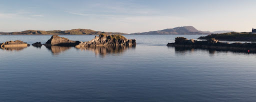
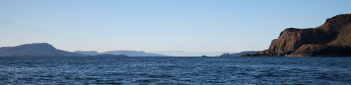
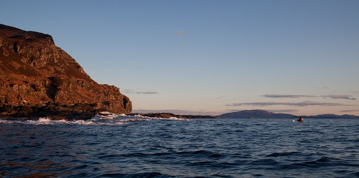
As we left Loch Buie and entered the Firth of Lorn we encountered a large swell rolling in from the Atlantic. In the distance we could see the rounded outline of Scarba on the far side of the Firth.


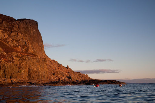
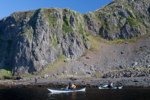
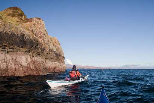
Once round the point, the swell subsided and we passed close under the mighty cliffs of An Garradh. Mull has a reputation among climbers for rotten basalt rock but these cliffs looked superb. I wonder if any climbers have been here? The cliffs were lit by a lovely warm light except for the tops which were in the shade of some low cloud on the western horizon.


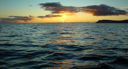
The sun set at 1715 and a cool NE wind began to get up.


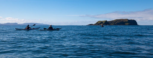
In the fading light, we continued along the base of the cliffs and paddled inside of Frank Lockwood's island. This is no more than a flat skerry. Lockwood, 1846-1897, was Solicitor General of Scotland. He and the 21st MacLaine of Lochbuie were married to sisters and the two men became good friends. I suspect the island was named as a joke, Frank certainly would not have made much of a living from it.


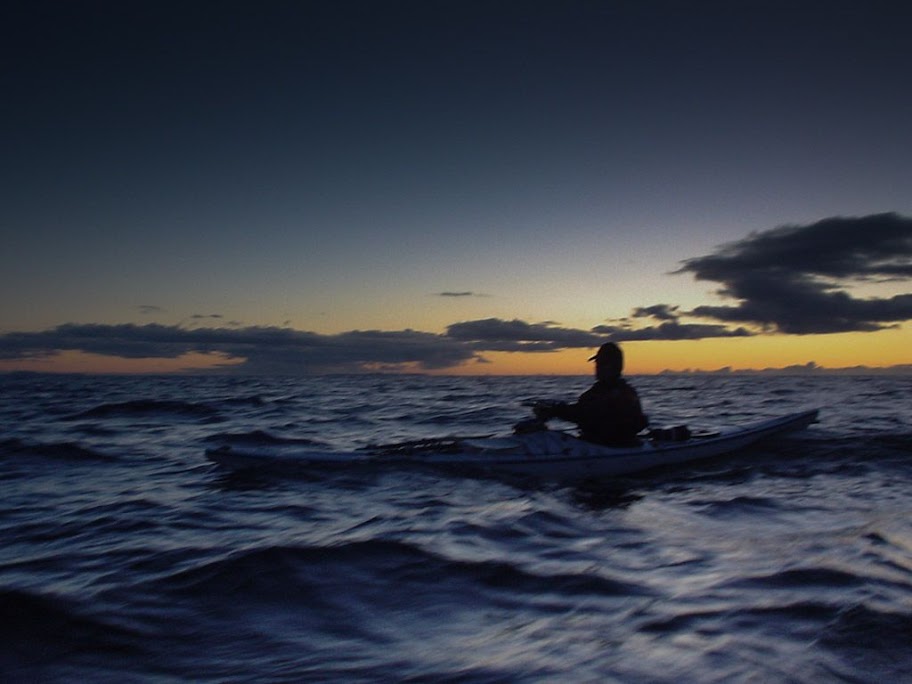
At 1735 the light was fading fast and we had started on the final 16km open crossing to Seil. The waves began to build as we became more exposed.


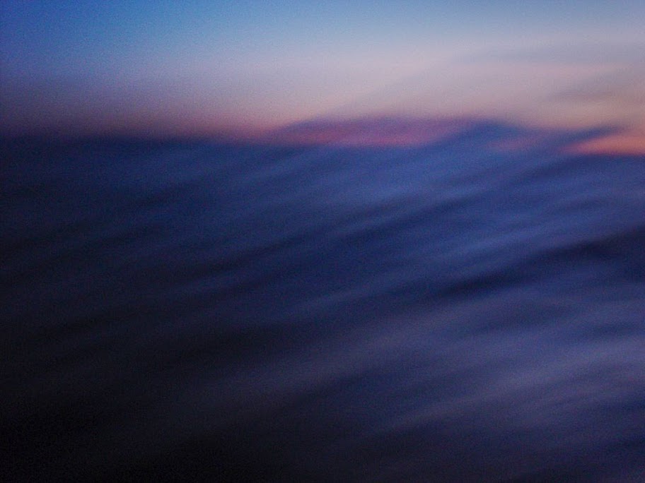
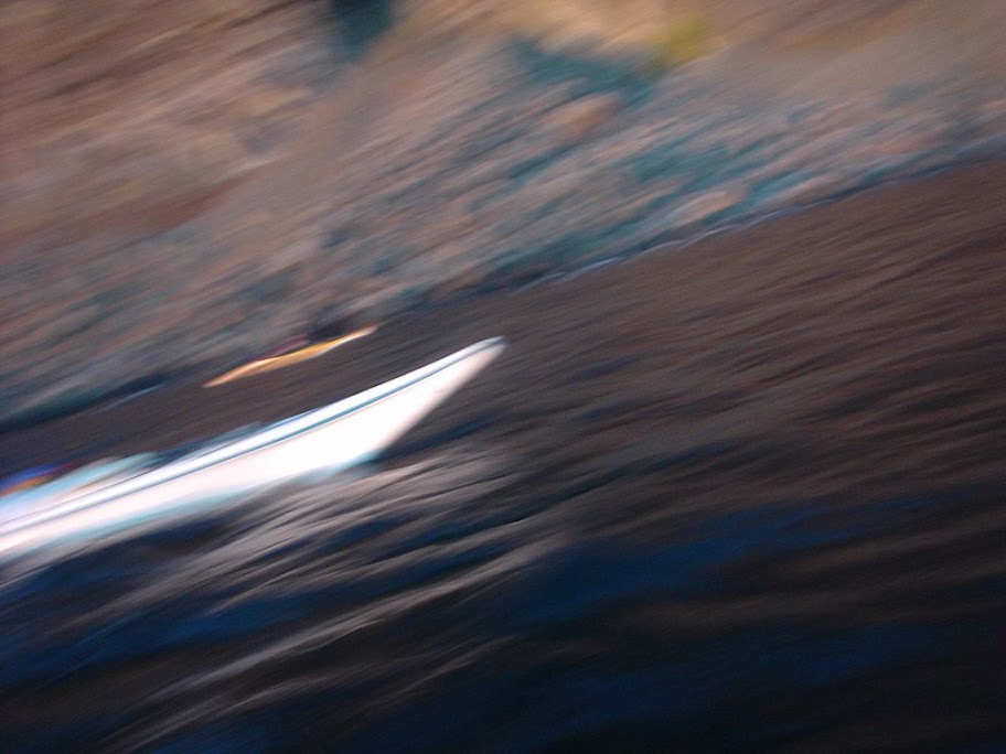
We hit a F3-4 45 degree headwind and an adverse 1 knot tide. Most of the crossing was by starlight and we could only feel and taste the waves. We eventually landed at 1940 (nearly two and a half hours after sunset) after covering a total distance of 44km.


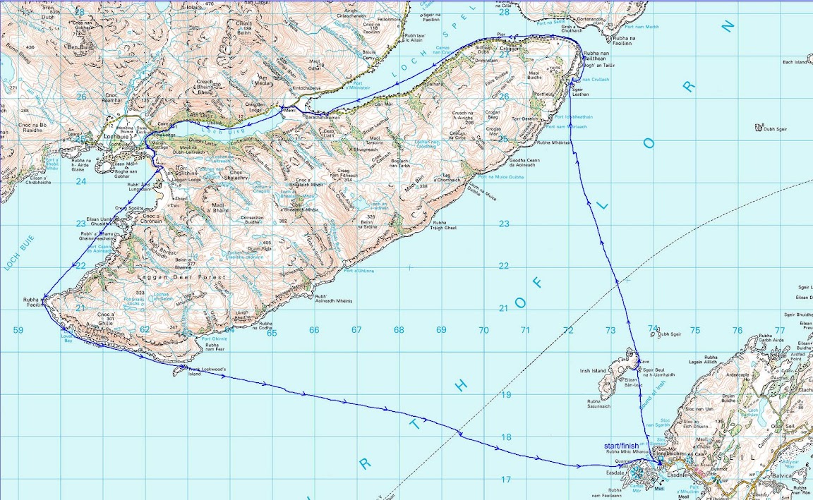
The GPS track shows where we took two brief breaks and were carried down wind and tide. After the second break we stopped maintaining a ferry angle to keep on the GPS bearing to Seil. We could see the lights of Easdale and just paddled straight for the them. You can see how the 1 knot tide and wind then carried us off course.

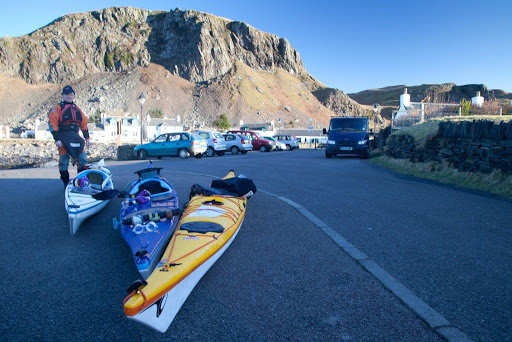
The backup plan, if weather turned before we left Loch Buie, was a rather decent B&B on Mull.

We do most of our paddling in winter on day trips so we are quite used to coming home in the dark. We are fair weather paddlers and so carefully watch the weather forecasts beforehand. I checked tide times and flows and marked up our maps with the details, I also checked the times the Colonsay ferry would cross our route and made sure we were not there!

For the crossing we had 5 head torches for the three of us and spare batteries, VHF radios and listened on 16 for the MSI weather broadcasts, EPIRB, rocket flares, daynight hand flares, laminated maps, compasses and mapping GPS. For most of the crossing we paddled three abreast for ease of maintaining contact.

We all had dry suits, goretex fleece lined mountain caps and pogies and carried spare neoprene gloves and balaclavas. Under the dry suit I wore Fourth Element Arctic gear which is a thick double fleece.

In case there was a problem after we left Loch Buie, we also carried spare Buffalo jackets and trousers and a 4 man bothy bag and foam mats to sit on. Spare food, water, stove, lighter, dry kindling, first aid kit and boat repair kit. If the wind did get up (we also had an ebb tide to contend with) and we could not get uptide and upwind to Seil, we could have made a run for the east coast of the Garvellachs and bivvied there or, if it was open, used the bothy on Garbh Eileach.

If the weather got right out of hand, we had short tow ropes with which we could have maintained a raft and run before it, towing a drogue. If real s**t had happened I could have let the EPIRB off but it would have had to be pretty bad to do that, after all I didn't let it off when I dislocated my knee on Gunna!

Sunday, March 28, 2010

Google maps, short by an Insh!


Back in early February, we found ourselves all ready for another adventure. After an early start, we were ready to launch at 0915 from Ellenabeich on the island of Seil in the Firth of Lorn.


We had in mind a bold route for a short winter's day. It would take us 44km across to the island of Mull into Loch Spelvie, portage into fresh water Loch Uisg then portage into Loch Buie. The final 24km leg would be done without landing and would involve crossing the Firth of Lorn at night with an ebb tide to contend with.


We chose to launch from the Easdale ferry slipway because of my bad knee. Normally we launch down a rocky beach from the large car park to the north of here. You do need to be quick to keep out of the way of the ferry as it only takes a few minutes to cross back and forwards.


We were bound first of all for the north end of the rocky little island of Insh. Sadly neither Insh nor the neighbouring Garvellachs and Slate Islands seem to be important enough to be shown on the otherwise excellent Google maps!!


Looking to the south west there was a wonderful prospect down the Sound of Insh. The bold outline of Scarba with the Slate Islands in front, then more distant Jura. Nearer at hand the Garvellachs with distant Islay behind then finally the steep eastern slopes of Insh.


As we approached Insh the ebb tide became stronger and we rested for a while in a kelp bed behind a shallow reef...


...before a final sprint, under the distant mountains of Argyll...


...took us to the rugged red rocks of Insh.

Google Maps really don't know what they are missing!

Saturday, November 01, 2008

The Sounds of Luing and Cuan


On leaving the Grey Dogs, we entered the Sound of Luing and made our way up the east coast of Lunga. This is one of the surviving houses. We then entered the maze of tidal channels between the north of Lunga and its neighbouring islands.


Returning to the Sound of Luing again, we started a ferry glide across the now flooding north going tide. We were headed for the island of Luing on the east side of the sound. Looking north we could see all the way up the Sound to Insh, Fladda with its lighthouse, Easdale and Seil.


Looking south down the Sound, the tumbling crags of Scarba were lost in the mist.


Working our way up the east shore of the Sound the tide accelerated us north past Dubh Sgeir with its light and the lighthouse of Fladda.


We found the MFV Rambling Rose tied up in the sheltered inlet of Cullipool. In 2001 she went to the rescue of a yacht which went aground in a force 8 August gale, the family were saved including their 18 month old baby. The Rambling Rose was a scallop dredger operated by brothers Eoghann and Alastair MacLachlan. The Scottish Government recently banned scallop dredging in the Firth of Lorn and she has been modified for prawn fishing.


Rounding the northern end of Luing, we paddled east into the Cuan Sound between Luing and Seil. We eddy hopped through the Sound against the west going flood spring tide.


Turning round, we blasted back down the Sound..


...until we were ejected into the Firth of Lorn. The Island of Mull provided a backdrop as we made our way back to our starting point at Ellenabeich on Seil.

What a fantastic weekend in the tides between these glorious islands.

31/08/2008

Friday, May 16, 2008

The flooded quarries of Easdale


We left from the village of Ellenabeich on the island of Seil in the Firth of Lorne.


Mist hung lowout in the Sound of Luing to the south so we thoug w had eter check our maps. We also duoble checked our tide times as we were heading for the fearsome Gulf of Corryvreckan.


A short crossing took us to the island of Easdale. As it was high tide we were able to us the swells to carry us over the lip of the flooded quarry to enter the deep calm water within.


Photo by Jennifer Wilcox showing the surge of the swell.


After a little drift about the mist began to lift and we had a tide to catch!

10/05/2008

Monday, August 27, 2007

The Oyster Brewery Bar, Seil


Tony and I are just back from a two day trip through the tide races of the Grey Dogs, Sound of Luing and Cuan Sound. It was incredibly thirsty work and our palates were dry as a bone by the time we reached sanctuary in one of the flooded slate quarries of the village of Ellenabeich on the Island of Seil. High above us, we spotted what could be an oasis of refreshment.


We scrambled out of our boats, leaving them moored as there was no beach, and made our way up to street level through a nice old lady's back garden (there are easier ways!). We came across not only a pub but The Oyster Brewery Bar which has an attached brewery; no wonder Tony is licking his lips!


The staff did not bat an eye lid as they took an order from two salty sea dogs dripping brine on the floor. We usually ask for Guinness but given that the brewery was next door, we thought it would be churlish not to order a pint of their finest. Our chosen brew was "Grey Dogs strong ale" in celebration of our recent passage through said tidal race. This race is very accurately depicted on the beer tap label.


We supped this delicious brew on the beer terrace which overlooks the Sound of Luing and brooding Scarba (to the north of which lies the Grey Dogs.) At this point I should issue a sea kayaking health warning. Grey Dogs is a highly intoxicating substance which only just avoids classification under the Dangerous Drugs Act. Our delicate constitutions are used to the mild effects of Guinness and I am not surprised that the establishment displays a safety notice about climbing on the balcony. Tony and I had visions of packs, of those driven barking mad by overindulgence, throwing themselves over the edge.

We decided to forego a hair of the dog and limit ourselves to one pint. So after a most enjoyable visit to this fine sea kayaking pub, we made our way very carefully back to the boats.


The water on the approach to the Cuan Sound was particularly rough and Tony and I were glad that we enjoyed our "Grey Dogs strong ale" in such moderation.

Monday, May 21, 2007

Timed to perfection but nearly marooned on Luing!


This was 19:03 on 11th May 2006.

We had just successfully executed a remarkable sea kayaking day trip from Glasgow. The night before, I had noticed (as you do) that the tides were right for a trip out through the Grey Dogs to the Garvellachs then back to Scarba, round its south end, through the Corryvreckan and back up the Sound of Luing. The snag was that Mike and I were working the next day and David was meeting an ex vet student friend from South Africa for their 40th year reunion dinner. Her flight got into Glasgow airport at 21:30pm that night. The only way to do this was to drive from the mainland over the Bridge over the Atlantic, onto the Isle of Seil then take the ferry across the Cuan Sound onto Luing and drive to Black Mill Bay and launch there. A quick Google search for the ferry timetable brought up the Calmac website which showed regular sailings into the late evening.

We had aimed to get the 19:35 ferry and I was just congratulating myself on having half an hour to spare when an awful fact gradually invaded the euphoria of an amazing day. If you look closely at the photo above you will note that there is no ferry!


On our drive to the jetty I had noticed something that looked very like a ferry moored in a bay 1.5km to the south. Somehow I had managed to blot this unwelcome observation from my consciousness. Any sea kayaker that can work the tides through the Dogs and the Corry must be able to read a simple ferry timetable! I dug the Calmac printout out of my map case and we should have had another 3 ferries to choose from right up till 22:05. Something was not right and I soon found out it was when I walked over to the small waiting room. The Cuan Ferry is run by Argyll and Bute council and on their timetable (which was nailed to the wall) it was quite clear that the last boat ran at 1805.

David took it very well. Not only had I bashed his car getting off the ferry that morning, now I had got us marooned on Luing for the night and his friend would be stuck at the airport. A more highly strung party would have started arguing and shouting but not us. In the absence of a nearby sea kayaking hostelry, we cracked open three cans of Guinness from our emergency rations. Sitting on a grassy knoll in the spring evening sunshine, we pondered our options. First we found that our mobiles had no reception. Then we wondered if David should paddle across and try and hire a taxi to take him to the airport.


Then suitably refreshed, I decided to check out the waiting room. I noticed a small yellow notice.

"In case of medical emergency, call this number."

Well I'm a doctor. And it was an emergency! So I phoned it from the coin box phone outside. It turned out to be a call centre in Liverpool and the girl knew nothing about Luing or where it was. I asked her for the ferryman's number but she said

"I can't do that but I'll get him to ring you back."

I looked at the ancient rotating dial phone. There was no number.

"There must be a number." she said.

David cracked open another Guinness to assist in the search for the elusive digits but there were none to be found. Then the girl had a brainwave:

"Give me your mobile number..."

"There is no point", I said, "none of our three mobiles are getting a signal."

I could sense I was stretching her incredulity. This city girl had probably never been out of cell phone range since she had been born. Indeed, her developing brain may have been partly modelled by mobile microwaves.

Then I had a brainwave:

"Just tell him to phone the Luing call box"

"What's the point of that? He wont know the number, there must be thousands of call boxes on Luing."

"You don't know Luing! Please, just ask him to ring the call box, I am sure he will know the number."

About 5 minutes later the phone rang, it was the ferryman. I explained our situation and he agreed to come but he said he would need to call his mate who lived some distance away. He would then need to use a dinghy to get down to the ferry and fetch it back up to Seil, pick up his mate then come across and pick us up. (Then he would need to repeat the process to get the ferry back to the mooring.)


MV Grey Dog

We were ever so pleased as when he arrived. He knew all about the mistake in the Calmac timetable and said there would be no charge for the crossing. We had already resigned ourselves to finding bed and breakfast accommodation on Luing, which would have cost us about £20 each so we gave them £60 for their trouble. They were very reluctant to accept it but we insisted. They were obviously prepared (and pleased) to be able to help, for only a thank you in return.

Fortunately the 105 miles on the road to the airport were quiet and we pulled into the airport pickup area just as David's friend was exiting the arrivals hall.

What timing, it's amazing what you can cram into a day!