Showing posts with label Mull of Kintyre. Show all posts

Tuesday, June 25, 2013

All quiet at the End of the World.

 The rain gradually eased as we approached...

 ...the rocky reefs of Rubha Chlachan on the Mull of Kintyre but the...

 ...speed of the tide was increasing and...

 ...we flew past the point at 10km/hr.

 At this point I noticed that my companions had fallen rather silent.

 I was not sure if their normal level of conversation had dried up due to the unaccustomed early start or whether it was due to...

...the imposing ambience of the situation as we approached Sron Uamha where the tide increased to 12km/hr (30 minutes after slack water on a neap tide!) and...

 ...we caught sight of a seemingly endless series of headlands stretching ahead. The End of World feeling was amplified...

 ...as we met the 1m Atlantic swells that rolled...

...steadily in against the tide from the open ocean to the west. The silence would last a little longer.

Monday, June 24, 2013

An early start for the Mull of Kintyre.

It was quite light at 04:5am when we got up on the second day of our Mull of Kintyre adventure. The reason for the early start was that the outgoing stream, close in to the Mull of Kintyre was due to start about 0630. It was neap tides and there was little wind forecast. I climbed a steep grassy and rocky bank to try and get mobile phone signal to confirm the previous day's forecast. Unfortunately I slipped on the way down and really badly sprained my right knee which had been operated on back in March 2010. The rather good news following this painful sprain was that there was not even a hint of my knee dislocating so full marks to the surgeon's skill!

Close to and west of Mull of Kintyre 5 Kn sp
Monday 3/6/2013                     
N going +0400 HW Oban                 (0240)0640
S going  -0225 HW Oban                  (1513)1248

N going -0230 HW Greenock           (0900)0630
S going  +0310 HW Greenock          (0900)1210


N going -0130 HW Dover                (0759)0629
S going  +0430 HW Dover               (0759)1229

 At 0515 a quick breakfast was consumed before loading...

 ...the kayaks. One great advantage of a camping trip on the Firth of Clyde during neap tides is that HW is in the evening and morning with low tide occurring during the night. So you do not have to carry the kayaks as far up the beach as for a spring HW which occurs in the middle of the night.

We were on the water at 0623...

 ...just in time to catch the tide, which would propel us round the Mull of Kintyre. The mist was well down and there was no sign of Ireland. Light drops of rain were falling as squadrons of early morning gannets were heading off round the Mull before us.

We soon passed Port Mean, which is the last landing for 23km if there is any swell. The Magicseaweed surf forecast was predicting 3 to 6 feet of surf at Machrihanish (the surf beach to the north of the Mull of Kintyre) so we were not expecting to be able to land on the only other "beach" on the Mull at Innean Glen. Effectively the Mull of Kintyre is like a 23km open crossing but the tide and the imposing scenery mean you will not experience a moment's boredom.

As we approached Borgadalemore Point, we were travelling at 8km/hr with hardly any paddling effort required. We were now committed to the Mull. There could be no turning back, it felt like we were paddling round the end of the world..

Saturday, June 22, 2013

An Art Deco landmark in the twilight at the Mull of Kintyre.

As we crossed Carskey Bay, on the east coast of the Mull of Kintyre, the wind dropped to nothing. Behind us, beyond Rubha MacShannaich lay the distant outline of Ailsa Craig, Sheep Island and Sanda.

Ahead the coast of Antrim in Northern Ireland merged with the lowering grey clouds. This was the last we would see of Ireland on this trip!

Above the bay, stood the sad remains of the art deco Keil Hotel. It opened in 1939 and during the war it was used as a Royal Navy hospital.  It was also a useful landmark for WW2 Atlantic convoys when all the lighthouses were extinguished. At certain times, the blackout curtains would be opened and the lights lit to guide expected shipping. It was also a welcome landmark for us as it meant we were nearly at our destination. After the war it reopened as a hotel but closed in 1990.

We arrived at our chosen campsite at 9:45pm, some 15 minutes ahead of schedule, despite that pesky headwind. This allowed us to get the tents up before it was completely dark.

Soon we had a roaring campfire going. We could hardly believe our adventure had begun so well and tomorrow, given fair weather, we would round the Mull of Kintyre. Slack water at the Mull would be at 06:40 am the following day, so we would need to have an early start!

Monday, June 17, 2013

Single ticket to Campbeltown please.

Calmac recently launched a new service from Ardrossan on the Ayrshire coast to Campbeltown on the distant (by road) Mull of Kintyre. It is a pretty limited service but the ferry that left at 1330 on Sunday and arrived at Campbeltown at 1630 looked interesting and avoided a crack of dawn start. We decided to leave our cars in the manned 24 hr car park at Ardrossan ferry terminal and buy single tickets to Campbelltown and paddle back to Ardrossan.

The girl at the check in desk was somewhat surprised, "You are the first people to buy single tickets. Most people want to come back from Campbeltown!"

We wheeled our kayaks on trolleys onto the car deck of the MV Isle of Arran and soon...

 ...we were steaming past Horse Island which lies off the entrance to Ardrossan harbour. Its distinctive now unlit tapered beacon was built in 1811 after many shipwrecks on the isle. It is 52 ft high and 19 ft square at ground level.

We ate an early meal on the ferry as the plan was we would paddle 28km south from Campbeltown (until about 10pm) that night. As the ferry approached the town's south pier we spotted the...

 ...slipway that we would use to launch.

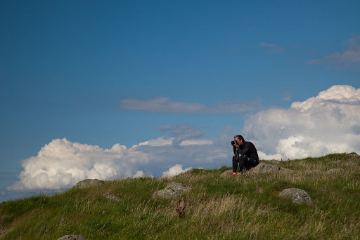
 When the call came for drivers to go to the car deck, Phil, Jennifer, Mike and I ambled down to our preloaded kayaks.

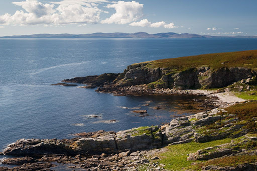
 We found the slipway without difficulty, and were on the water by 17:05. HW was at 20:19 so we did not think we would be ble to paddle between tidal Davaar Island and the mainland. This would add 2km to our route.

 The new quay is a very impressive development for a small place like Campbeltown. It was built for the wind turbine factory at Macrihanish but that is now closed. It is hoped that Campbeltown might be a base for the servicing of huge offshore winfarm developments off Islay, Tiree and in the Clyde. Of course the new Calmac ferry service uses it but after the ferry left, we four sea kayakers had pretty much to ourselves.

 Soon we left the Old Quay and...

 ...the douce villas of the wealthy Victorian merchants, fish merchants, boat owners, distillers and shipyard owners of this once thriving town. It grew in the days when commerce and travel were by sea but with the development of road transport it became just too remote and its wealth faded.  Perhaps the reintroduction of the ferry service will inject new life into this lovely corner of Scotland.

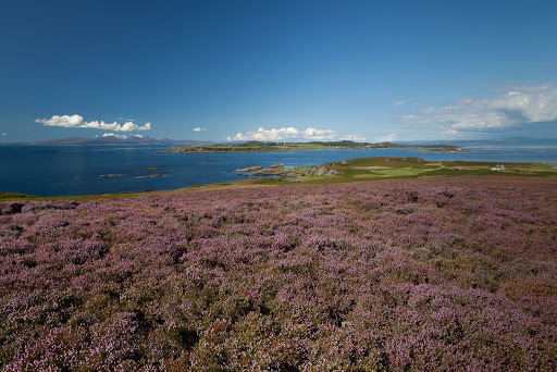
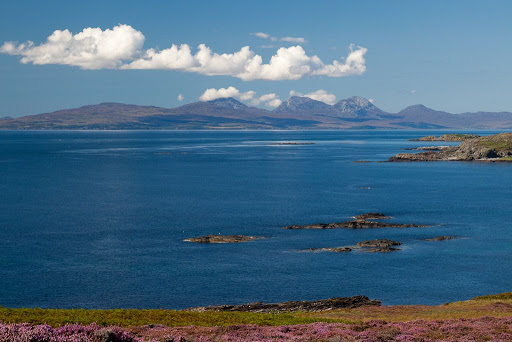
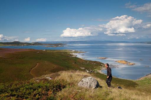
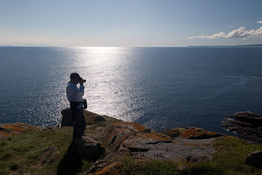
As soon as we were clear of the quays a decent west wind got up and we were surrounded by diving gannets. We hoisted sails and set course for Davaar Island at the entrance to Campbeltown Loch.

Tuesday, July 31, 2012

Long views from Ailsa Craig.

The path to the top of Ailsa Craig led us past the old castle which was a Catholic stronghold established to welcome the Spanish Armada to Scotland. Unfortunately the Armada never arrived though several of its ships escaped round the north of Scotland and some were wrecked elsewhere on the west coast.

I had warned Mike and Phil that it would take me some time to get up. The path was obscured in places by a thick growth of bracken and nettles but my walking poles were of great assistance though my shoulders ached afterwards.

The MFV Glorious from Girvan arrived with a load of tourists but they were much quieter than the lot she carried on our last visit!

 Mike was surprised how green the summit of Ailsa Craig was.

 We caught our breath at the summit. Unfortunately Phil discovered that his mobile phone did not care much for 12 year old Glenfiddich. His hip flask had leaked in his bag!

There was a stunning view from the top. Pladda and Holy Island could both be seen off the coast of Arran. We counted 21 fishing boats, mostly Belfast registered circling the Craig. MPV Minna was on fishery protection duty and shadowed the fleet.

 The rocky ridges of the Arran mountains rose high over the lower land in the southern half of Arran.

 Sanda, tiny Glunimore and Sheep Island could be clearly seen off the Mull of Kintyre.

To the east the Merrick rose majestically above the hills of south Ayrshire and Galloway.

Whoops, the tide was rapidly approaching the kayaks... It had taken me longer than expected to get up, time to go!

Tuesday, April 05, 2011

Some long views from Ailsa Craig.

On previous visits to Ailsa Craig we have gone in a high pressure system and the visibility has been poor due to haze. On this occasion, the atmosphere was crystal clear. To the ESE Girvan was very clear but in the middle of the photo, the summit of the Merrick was hidden in the clouds. The dip to the right of the photo is Glen Trool.

The view to the S showed Stranraer at the head of Loch Ryan with the Rhins of Galloway and its wind farm on the right.

A telephoto view to the W showed Sanda Island with the Mull of Kintyre behind. In the distance, flat topped Rathlin Island is 68km away off the north coast of Ireland, on the far side of the North Channel.

To the north, this view shows little Pladda Island (with its lighthouse) off the south coast of Arran and the pointed peak of Holy Island to the east of Arran. Right of Holy Island the view is all the way up the Firth of Clyde to the white villas of Dunoon. Beyond that, the snow streaked peaks are Ben Ime, The Cobbler and Ben Narnain in the Arrochar Alps. Ben Ime is 112km away. To the right of Dunoon, the dark island is the Little Cumbrae. To its right you can just make out the chimney of the Inverkip power station. The snowy mountain at the right edge of the photo is Ben Lomond.

Alan (see comments) asked "could I ask if you have a higher resolution photo of the Arrochar Alps, or was this photo already cropped?" This is the highest resolution I have with a 1:1 pixel ratio. It was a remarkably clear day. To the left of Ben Ime, which is the highest point on the horizon, you can see the dark slopes of Beinn Dubh Craig then to its left, the snow flecked ridge of Ben Oss. Lastly, to the left of Ben Oss, you can just see the fine peak of Ben Lui rising above a nearer flat topped ridge. Ben Lui is 1130m high and is 130km from Ailsa Craig, a long view indeed!

Although they don't show up well  on these low resolution photographs, we were surprised by the number of wind farms that had sprouted on the hills all round us. This regularly updated kmz file from weatherman22 will open in Google Earth and show the number of opened and proposed wind farms in the Scottish hills and mountains.

It was now time to make our way back down the steep path to the kayaks.

Tuesday, September 28, 2010

Who's been sitting in my chair?


From Cara House, we made our way slowly up the spine of the Island towards the Mull of Cara. We looked back northwards over the blooming heather of Cara to a magnificent view encompassing, Jura, the Sound of Jura, Gigha, the Sound of Gigha and Kintyre.


To the NW the Paps of Jura dominated the skyline while...


...to the NE the dazzling strip of sand, where we had luncheon the previous day, highlighted the Sound of Gigha.


The final rise to the Mull of Cara took some time...


...and the summit gave a chance for a breather and a photo opportunity.


The rocks fell away steeply from the Mull of Cara and there was nothing but sea between us and the distant Mull of Oa, some 35km away to the SW. In 1756 a huge rockfall slid into the sea from the Mull of Cara. It was accompanied by a tsunami, which swept up the beaches of Cara washing all the coastal houses away. Some say it was a meteorite that struck the cliff.


We looked down on the headland of Maol a' Mhor-rain, off which the tide race forms. All was quiet as the wind was light and it was near slack water. The bay was notorious for catching the bodies of sailors who were lost in these parts.


Just below the high rocks we came to the Brownie's chair. It only has one arm but that is apparently enough for the Brownie. Kintyre stretched away to its distant Mull in the south.

It was time to go, the chair's owner might be back!