Showing posts with label Irish Sea. Show all posts

Sunday, November 08, 2015

The follies of Knockbrex and a convenient cave.

 From the three priapic pillars of Knockbrex we set off along the...

...rocky Solway coast until we arrived...

 ...at a delightful stretch of shell sand backed by a castellated folly.

We stopped for a second time to...

 ...explore what was an early 20th century bathing house. A folly in Galloway is known as a "coo (cow) palace" and this was a good example with...

 ...the remains of a stone and iron pier extending into the Solway.

 The folly has a beautiful view over to Barlocco Isle and the distant mountains of the Isle of Man. It was built by James Brown who was a wealthy Manchester merchant. He retired to nearby Knockbrex House  in 1895. Until he died in 1920, he spent much of his fortune building a series of gardens, walls, buildings and follies around the estate.

The jagged reefs of this coastline were the scene of many shipwrecks but it was also used by smugglers who would have found...

...this to be a most convenient cave for concealing contraband from the customs cutters. For many years the entrance was concealed by a thick growth of ivy but a storm a few years ago tore it away.


The cave has a dry level floor and would make excellent shelter in a storm.

This part of the Solway was a lawless place not only frequented by smugglers but also by pirates. We decided to reenact walking the plank. Was this to be a folly on Ian's part?

Time was pressing on and the ebb tide was now in full swing so we made our way back to the boats to continue our exploration of the Solway by sea kayak.

Saturday, November 07, 2015

Prospects at the three priapic pillars of Knockbrex.

 From Ardwall Isle we left the confines of...

 ...Fleet Bay and started to make our way out...

 ...towards the more open waters of the Solway Firth until we were stopped in our tracks by...

 ...the priapic pillars of Knockbrex. There are three pillars and they...

 ...lead into the recesses of...

...Knockbrex Harbour.

Whatever their provenance, the priapic pillars provide plenty of perpendicular photographic prospects whatever the weather.

These photos were taken exactly 2 years before our visit and show more typical October weather.

Whatever, if you come to this part of the Solway do remember to visit the three priapic pillars of Knockbrex.

Read more about these erections here on Ian's blog.

Wednesday, October 28, 2015

The Old Man of the Mull of Logan.

At the Mull of Logan there are a number of hidden inlets which lead to the great rock arch called the Devil's Bridge. Phil, Tony and I had been before but as Maurice had not been before (and we had said nothing to him) he amazed when he found it.

 Those entering the recesses and passing under bthe arch do so under the baleful stone gaze of the Old Man of the Mull of Logan.

 We dallied for some time in this wonderful spot but the tide was still rushing north and we were now going to head south to Port Logan...

 ...against the tide.  There was no eddy on the SE side of the Mull but close in the tide was only running at 4km/hr compared with 9km/hr just a few meters out.

 Soon we were in quiter waters and the coast here has a maze of gullies many of them interconnecting. This arch is called Little Bridge.

 Further along we came to this old cabin before we arrived...

 ...in Port Logan Bay which is backed by the fertile fields of the Rhins of Galloway.

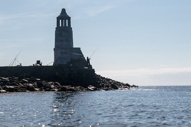
Our final obstacle was clearing the lines of the many fishermen who lined the old pier. Port Logan was originally called Port Nessock and in the 1
7th century attempts were made by the McDouall family to establish it as a ferry port for Ireland. They also built the Port Logan Inn which is sadly closed at the moment.

The quay and Port Logan Light were built in 1830 by Colonel Andrew McDouall. The light is a conical stone tower with a platform for a lantern. It is not known when it was last lit but for sometime after that it had a bell, which was rung to guide local boats back in foggy conditions. A decent road to the village was not constructed until the early 20th century, so most of the village's trade and traffic depended upon the sea. A life boat station was built at Port Logan in 1866. It closed in 1932 as the RNLI lifeboat at Portpatrick, 18km to the north west, was motorised by then. The boat house is now the village hall which you can find near the quay.

Our 24km trip from the East Tarbet round the Mull of Galloway, Crammag Head and the Mull of Logan is one of the finest paddles in Scotland. However, due to the tides it can be very serious if there is any wind.

Tuesday, October 06, 2015

The Mull of Galloway, Scotland's most southern coast.

From Lunnock Caave  we paddled towards Carrickcarlin Point which...

 ...lies below the Mull of Galloway lighthouse and its foghorn.

 A characteristic feature of the Mull of Galloway cliffs is the bright yellow lichen. In spring and early summer this is spattered by the white of the sea bird colonies guano.

 Carrickcarlin Point is one of the four most southerly points in Scotland.

 The south coast of the Mull runs east west and from Carrickcarlin Point in the east this is the view...

...to the west showing Lythe Mead, Gallie Craig and just the shoulder of Carrick Kee.

 I paddled out to get a decent view of...

 ...the lighthouse which is hidden from the base of the cliffs.

 Below the foghorn is the entrance to...

...Seals Cave which is big enough to drive...

...several double decker buses in. The depths of the cave were very colourful.

Lythe Mead lies directly below the visitor centre and unsurprisingly they claim this to be the most southerly point in Scotland.

This is the view from Lythe Meade back east to Carrickcarlin Point.

Beyond Lythe Mead there is a deep geo called Foxes Rattle. This is looking out at Lythe Mead and the stack Inchshannoch.

This is the head of the Rattle and...

...this is a cave in its north west wall.

The next headland we came to was Gallie Craig.

Beyond the Craig the tide was already running strongly towards the west.

This is the view from Gallie Craig looking back...

...towards Lythe Mead and Carrick carlin Point.

At the Gallie Heughs we got our last view back to the lighthouse which is hidden from view from...

...the fourth headland at Carrick-Kee. So which of these headlands is the furthest south? Well it is a close run thing but the sea was so calm I was able to touch each headland. These are the northings from my GPS unit:

Carrickcarlin Point   N54 38.026
Lythe Mead              N54 38.013
Gallie Craig              N54 37.999
Carrick-Kee              N54 37.989

So Carrick-Kee just makes it as the most southerly point in Scotland based on latitude. That is further south than the mouth of the River Tees on England's east coast!

Note that the OS grid north is canted with respect to true north and the most southerly point with respect to grid north may be different.

Beyond Carrick-Kee the interest continued with more cliffs...

...and caves.

At Carrickcorrie you will turn NW and see the north shore of West Tarbet Bay. When the west going stream is running along the south coast of the Mull of Galloway you will encounter an adverse SE going eddy at this point. If it is windy from the NW it can be hard work breaking through this.