Showing posts with label Dun. Show all posts

Sunday, June 26, 2011

Arrival at Hirta, St Kilda.

From Boreray and the Stacs, MV Cuma motored towards Hirta and Soay, which are the two largest islands in the St Kilda archipelago. The next two by size are Boreray and Dun. The cliffs falling from the summit of Connachair (at 430m, the high point on Hirta) are the highest sea cliffs in the British Isles.

As Cuma made her way round the east side of Hirta, we caught sight of the jagged outline of Dun.

The most easterly point on Hirta is Rubha an Uisge, "point of the water". You can see a waterfall tumbling into the sea (after our very wet start to the summer). When we were last here in 2008, there was no fall.

Dun is riddled by caves and tunnels and when  approaching from the NE, you can see through its great arch.

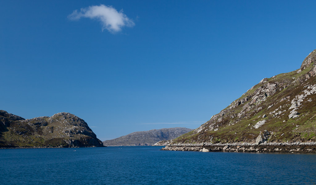
Dun is separated from Hirta by only a narrow gap.

We lined the bows of the Cuma in excitement, to catch our first sight of Village Bay.

The modern military base, which supports a radar station, is incongruous but does not dominate the scattering of stone built dwellings and storage cleits that rise behind it.

The first building we passed was used to store the feathers of sea birds for export. It dates from the late 18th century and so is older than...

...the alternate cottages from the 1830's and 1860's, which make up the village street. This was the most remote settlement in the British Isles, until it was evacuated in 1930 after thousands of years of habitation.

We had arrived on this archipelago of superlatives!

Thursday, June 23, 2011

Crossing to St Kilda, the islands at the edge of the World.

The morning of Sunday 12th June dawned fair and after an extensive Cuma breakfast, we took some air upon the deck to allow our stomachs to settle. Ken explained to the others how he had managed to hold on to the toast rack with the very last slice of toast!

Murdani listened intently to the weather forecast. It was not looking good at the end of the week and the wind this evening was forecast to get up to 19-25mph from the NE but drop on Monday before getting up again from the SW on Tuesday. Murdani decided to go for it. He was confident that Village Bay would provide a sheltered anchorage in a NE wind. The anchor was weighed and look how carefully the chain is cleaned of mud.

Soon we were heading for the Atlantic from within the confines of a narrow sea loch without an open horizon.

 The island of Scarp, with its dazzling white sand beach, was our gateway to the open ocean.

 Gordon was delighted we were heading WSW to St Kilda. The crossing from Scarp to Hirta is 87km! The empty Atlantic horizon stretched in front of us without a hint of the islands at the edge of the World.

Behind us, the west coast of Lewis fell away as the Cuma's bow rose to the Atlantic swells.

We chatted excitedly on the long crossing. Donald Thomson led the first return trip to by sea kayak to St Kilda 20 years ago in 1991. He modestly answered our many questions about such a bold trip. It turns out that Donald has made return trips to all the Scottish islands apart from one!

At first we could hardly distinguish St Kilda from the clouds but gradually the dramatic cliffs took form as they rose above the horizon. We then realized that these were the highest sea cliffs in the British Isles, big enough to generate their own weather system! From the left we saw Dun, Hirta, Soay, Boreray and Stac an Armin. We were humbled that our ancestors made this crossing and colonised the islands 4,000 years ago!

Our final approach would take us round the north of Boreray and Stac an Armin.

Wednesday, February 04, 2009

Stac Lee


Approaching Stac Lee, every ledge appears to have a thick layer of snow and the sky above seems to be full of swirling snow flakes.


As you get closer, you are confronted by one of the natural wonders of the World. The island is completely covered in noisy gannets. A fifth of the World's northern gannets breed on these isolated blades of rock.


Gannets are large birds with forward facing eyes. They dive from about 50m above the water and can plunge deep under the surface with folded wings in search of fish.


From the side, Stac Lee can be seen to be a thin blade of rock, 172m high. It is remarkable that a party of St Kildans survived here for 9 months (through a winter). They were marooned because a small pox outbreak on Hirta prevented their fellow islanders from picking them up after a bird hunting expedition. Soay is on the horizon.


Looking from the far side of Stac Lee, back towards Dun and Hirta.

03/06/2009

Monday, February 02, 2009

The sea cliffs of Hirta


On board the MV Cuma again, we were soon rounding the eastern ramparts of Oisebhal on Hirta. We were bound for Boreray and the stacs and thence to Harris.


The NE coast of Hirta has the highest sea cliffs in the British Isles. Behind the low lying Sgeirnan Sgarbh in the fore ground, rise the cliffs of Conachair 430m.


Looking back, the notched ridge of Dun shelters the Village Bay.


This is the Gap between Oisebhal and Conachair, down which the St Kildans lowered themselves in the hunt for fulmars.


As the Cuma pulled away from Hirta, Soay came into sight behind Mina Stac. Like the St Kildans 78 years previously we were now leaving Hirta. Our acquaintance had been short but nonetheless we knew we were now leaving a very special place in our wake.

03/06/2008 pm

Tuesday, January 27, 2009

The mysterious enclosures of An Lag, St Kilda.


As I entered the hidden hollow high above the village, the slope levelled off and I was drawn towards some large, stone walled enclosures.


From up here, there was no sign of the village or the bay far below. Only the distant Atlantic could be seen through gaps in the rocky ramparts of distant Dun.


After the enclosures the slope steepened towards the Gap between Oisebhal (293m) to the SE and Connachair (776m) to the NW. Lines of cleitean marched boldly up the slope and I was soon perspiring in the hot June sun as I rested by each.


Nearing the top, I turned to catch my breath. Then I saw for the first time, the true complexity and apparent randomness of the enclosures. At first, I thought they were sheep fanks (stone pens) but they looked like they were designed to keep animals out rather than in. The exterior of the walls is vertical but the interior is sloped. It is thought they were built relatively late in St Kilda's history, probably about 1830. No one really knows their purpose or why they were built in such a way but one theory is that they were to shelter growing vegetables and crops.

03/06/2008 am

Monday, January 26, 2009

Cleitean on the climb to An Lag, St Kilda.


Leaving the village street on St Kilda, I proceeded up the hill towards the head wall. On the way I passed more cleitean.


Some of them appeared to grow out of the slope of the steep ground.


Some had two roofs of slabs forming a handy storage space well above the ground and out of reach of animals.


Inside they were remarkably dry. There is evidence that the survival of Soay sheep is enhanced by their use of cleitean in winter


Once through the head wall of the village the ground steepened. Looking back, the view included the spread of Village Bay, with Dun behind, and the houses nestling round the crescent of its shore. MV Cuma remained at anchor but all the other tour boats had left in the face of the increasing southerly wind.


The steep ground gave way to an area of flatter ground which was not visible from below. It is called An Lag Bho 'n Tuath.

03/06/2008 am

Saturday, December 13, 2008

Introduction to Hirta, St Kilda.


The morning of 3rd June 2008 dawned with a freshening SW wind blowing across Village Bay on Hirta in the St Kilda archipelago. The forecast was for a force 7 and Murdani, the skipper, of the Cuma said he would like to leave by 14:00.


The Cuma's RIB shuttled us into the jetty on St Kilda as all the other boats left!


We were met by Bill Shaw, the friendly National Trust for Scotland ranger. He explained important Dos and Don'ts for our visit.


It was with some excitement that we ascended the steep stone flags which led up from the jetty..


With Dun in the background, Bill took some group photos before we started our explorations of this extraordinary remote place which has been inhabited for over 3,000 years!.

03/06/2008 am

Saturday, October 04, 2008

The great arch of Dun, St Kilda


We approached the great arch of Dun from the SW.


We were soon dwarfed by the sheer scale of the place and the tide was running out against us like a salty river.


Then as we entered the main portal we saw there were two exits to Village Bay. We chose the smaller one.


On exiting into the shelter of Village Bay we could have just headed for the Cuma and a hot shower. Instead we turned to the SE and rounded Gob an Duin, the most easterly point on Dun. Sadly I have no photographs as the wind against tide meant the point was quite lively. We then proceed up the coast of Dun and re-entered the SW portal of the great arch.


This was looking back through the NE portal as the others came through after me.


The flow of the tide had built up rather quicklysince our first transit of the arch....


and I was soon rejoining the others inside the arch again.

02/06/2008