Showing posts with label Ardnamurchan. Show all posts

Friday, April 19, 2013

Mucked about by the tidal information in the Sound of Eigg.

As Ian and I set across the Sound of Eigg towards Muck the ebb tide was already running like a river in the channel between between Eigg and Eilean Chathastail. We knew (from the Admiralty West Coast Pilot) that we would be in mid channel at the peak of a big spring tide that would be travelling at 3 knots to the SE, increasing to 4 knots as we approached the west coast of Muck. As a result we set off on a high ferry angle to the north but when we stopped in mid channel, the tide was only running at 0.6 knots!

 The marbled sky was reflected in a mirror sea. Between the two the Ardnamurchan peninsula stretched away as far as the eye could see. It was only 12 days previously that we had paddled that coast with Mike but it seemed such a long time ago.

 Gradually we cleared Eigg and the Rum Cuillin were revealed.

 In the distance Canna could be seen to the lefdt of Rum, some 30km to the NW.

 As we crossed the Sound of Eigg we slowly began to make out the Arnamurchan lighthouse at the end of the peninsula. It was silhouetted against Mull by a fog bank which was lying in the Sound of Mull.

 To port, Ben More on Mull rose above the lower Ardnamurchan Hills.

 To starboard the complete profile of Rum could be seen as we left Eigg behind.

 As we approached the west coast of Muck, we still expected to meet a significant tide but it never materialised. To the south the MV Loch Nevis was heading for the jetty at Port Mor on the south side of Muck.

 Given the highly favourable conditions (it was winter!) we decided to leave Port Mor till later and circumnavigate Muck in an anti clockwise direction..

...but first it was time to take first luncheon in the delightful bay of 
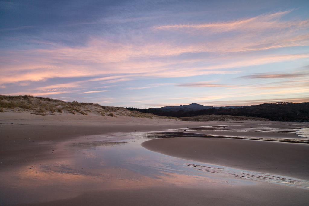
Camas na Cairidh, we had arrived on Muck. The machair to the right of the beach has a permanent composting toilet and in summer a yurt is erected, which can be rented from Isle of Muck farms. The tide was still ebbing and as it fell (leaving our kayaks high and dry) it revealed an old fish trap that had been built from a stone wall between rocky outcrops. Camas na Cairidh in Gaelic means "bay of the weir".

We enjoyed a superb view of Rum from our chosen luncheon spot. After warming homemade soup and bread, washed down by some 10 year old Jura or 12 year old The Singleton (I can't remember which, maybe it was both) it was time to make our way back down the rocks. There was just time to float the kayaks over the fish trap. As we waded through the pool behind the wall it was obvious that there was not a single trapped fish. Maybe it was because it was winter, maybe the seas are empty. Fish traps like this have been used for thousands of of years and in the past the seas were full of shoals of herring.

Saturday, March 09, 2013

Under a blood red sky at Cul na Croise.


Ian and I paddled out of Cul na Croise  bay towards the mountains of Eigg and Rum under a sky that gradually turned...

 ...to blood red.

As Mike paddled directly back to the shuttle car at Ardtoe, Ian and I sat in our kayaks and savoured the stunning sunset until it was nearly gone.

By the time we got to Ardtoe it was nearly dark with only a few embers of the long gone sun slowly fading in the south west sky.

The north coast of Ardnamurchan, Portuairk to Ardtoe (27.5km) proved to be a stunning but committing paddle. On the narrow single track roads, the shuttle took two hours to set up and another two hours to recover the car at Portuairk two days later. I am particularly grateful to Ian and Mike for the driving as I would have been unable to drive that distance on these roads, never mind paddle afterwards!

You can read another illustrated account of this Ardnamurchan trip on Ian's blog here, here and here.

Friday, March 08, 2013

Time was running out and we left the shifting sands to darkness.

 As we paddled SE towards Ardtoe and the sand dunes of Cul na Croise a chill wind got up as the sun began to set. We were now in deep shade but the summits of Beinn Resipol (845m) to the ESE,...

...Rois-Bheinn (882m) to the ENE and...

...the west end of Eilean Shona (199m) to the NE were still in the sunshine.

By the time Ian and I arrived at the dunes and...

...shifting sands of Cul na Croise the sun had set and we thought we had missed a great photo opportunity.

However by the time we had pulled the kayaks up the beach and...

...started to walk along the sands...

...it was obvious that the pink tinged sky...

...still gave a lovely light to the wet sands.

Out at sea the distant mountains of...

...Eigg and Rum were nearly silhouetted against the rosy sky.  

All too soon it was time to leave this lovely spot. Time was running out and we left the shifting sands to darkness.

Thursday, March 07, 2013

Ockle Point to Rubha Aird Druimnich, Ardnamurchan.

Paddling east, the next Ardnamurchan headland we came to was low lying Ockle Point.

Once we rounded Ockle we could see the final headland of the day in the distance. Rubha Aird Druimnich was sunlit and standing out against the dark slopes of Rois-Bheinn (878m) beyond.

 The sun was steadily sinking to the SSW and...

 ...Muck which was directly in front of Rum when we started was now lying away to the left.

 From Rubha Aird Druimnich, Eigg now lay directly in front of Rum.

 The convoluted folds of rock on Rubha Aird Druimnich were thrown into sharp relief by...

 ...the low winter sun.

We now turned SE for the final 5km. Ian and I hoped to make the shifting sands behind the beach at Cul na Croise before sunset. We tried... but we didn't make it.

Wednesday, March 06, 2013

A Viking boat burial with a view.

Leaving Fascadale, the SE wind had dropped considerably and we enjoyed the view to the Small Isles Rum and Eigg.

The coastline here was lower than further west but...
 
 ...inland rose to the rocky summit ridge of Ben Hiant, 528m.

 As we journeyed east the distinctive profiles of Rum and Eigg slowly slid past each other.

 A continuing feature of the north Adnamurchan coast is the sparsity of landing places.

Mike's skeg had jammed so we were pleased to find a small sheltered cove called Port an Eilean Mhoir...

 ...at the head of Swordle Bay. Whenever we find a landing place like this we know that it has been used by generations of travellers before us. It is always interesting to discover what archaeology lies in the immediate vicinity. In this case, there is a Viking boat burial, dating from the 9th or 10th century, just behind the beach.

We soon got Mike's skeg functioning again and...

...had time to appreciate the beauty of our surroundings.

 I loved the way the clouds seemed to radiate from the volcanic rocks of Eilean Mhoir.

We sat for a while...

 ...enjoying the view over to...

 Rum, Eigg and...
...Skye. It is humbling to think of the generations of mariners who have enjoyed this view, both before and after the Swordle Bay Viking last sailed these waters.