Imagine you are at the edge of the sea on a day when it is difficult to say where the land ends and the sea begins and where the sea ends and the sky begins. Sea kayaking lets you explore these and your own boundaries and broadens your horizons. Sea kayaking is the new mountaineering.
Wednesday, December 23, 2009
Crammag Head
After a wet launch at Rainbow Rock, we regrouped on the water while some pumped out their cockpits, which had filled with dumping waves.
The old WW2 coastguard lookout bunker announced our arrival at Crammag Head. The rocks here are hard pink granite and have been more resistant to erosion than the softer sedimentary rocks on either side. It is a popular area for sea anglers and rock climbers.
We now found ourselves under the Crammag Head Lighthouse. This was originally built by David A and Charles Stevenson in 1913. They built a simple tower without a lantern house on top. The current light is a replacement with a proper lantern and actually looks better than the utilitarian Stevenson design. It must have been installed after February 2008 when we last passed this way and saw the old light. The light flashes white every 10 seconds.
I later discovered that the new Crammag Head light was established just about the time of our trip in mid December 2009.
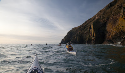
We rounded Crammag Head at 13:46, nearly an hour after the tide had turned against us. Close in to the rocks, we were not too bothered by the adverse flow. At peak tidal flow on the south going flood, a considerable race develops here, especially if it meets a prevailing SW wind.
As the winter sun slowly dipped to the SW, we started the final leg of our journey to Port Logan.
Tuesday, December 22, 2009
Transition from the terrestrial to the maritime.
Monday, December 21, 2009
The pot at the end of Rainbow Rock.
The beach at Rainbow Rock is a lively place...
...the stone cobbles have been worn smooth by constant wave action.
Even the bedrock has had hollows worn away by cobbles. We looked in several of these "pots" but there was no gold at the end of this rainbow...
...just the lovely gold lichens on its rocks.
Sunday, December 20, 2009
Picnic at Rainbow Rock!
Crossing Carrickahawkie Bay at 1225 we found an eddy to be running against us though inshore slack water was not due to 1253. In the last half of the ebb you will meet many counter eddies on this trip. In the distance we could see Crammag Head and ideally it would have been nice to get round before stopping for lunch. However, the stop after the Head at Portencorkie Bay is rather unpleasant. It attracts piles of rotting seaweed and garbage. It is not the sort of place for a seakayakphoto.com luncheon.
Tony and I had a plan! Just before Slew-whan Point there is an intriguing geological feature which we call Rainbow Rock.
Its real name is Broad Stone of Portdown and it has a steep cobble beach at its foot.
Landing here can be tricky but Tony and Jim provided sterling assistance in getting me out of my kayak...
...before helping the others...
...one by one.
Soon we were all safely ashore, with the kayaks above the surf.
We were now ready for our luncheon and what a spot!
Saturday, December 19, 2009
Taking in a Kindram or two on the Rhinns of Galloway
Long after we left the Mull of Galloway, we were still surrounded by its "nine tides", which are woven by an old witch. As we were paddling in the last 3 hours of the ebb, we met a strong counter eddy running east from Port Kemin.
We now crossed Carrickamickie Bay and...
...entered the West Bay of Slauchmorrie.
Now we found ourselves under...
...the great rock walls...
...of the Nick of Kindram.
Talking of Kindrams, David looked like he had enjoyed one or two Kindrams the night before!
Friday, December 18, 2009
Mull of Galloway to Gallie Craig
After the excitement of the Mull of Galloway tide race, we proceeded in a westerly direction, round Carrickcarlin Point.
Far below the lighthouse, our kayaks were dwarfed by the the yellow and ochre coloured cliffs. We paddled on under the gaze of pointing tourists...
...until we disappeared from their sight in the huge Seal's Cave hidden far beneath their feet.
From the lighthouse we wended our way...
...through a series of skerries towards the pointing rock fingers of Gallie Craig.
Thursday, December 17, 2009
Destination, the Mull of Galloway
The Mull of Galloway is the most southerly point in Scotland. It juts out into the strong tides that swirl round where the Solway Firth and the Irish Sea compress into the North Channel between Scotland and Ireland. It always takes longer to get there than you think. After Stranraer, the ferry port for Ireland, the roads are very narrow and slow and the final track down to East Tarbert is barely surfaced. Last Sunday, we left Ayr on the Firth of Clyde at 0800, dropped a shuttle car at Port Logan on the way and arrived at East Tarbert, 72 miles later. We were on the water by 1040. Our planned route was to tackle the 20km between East Tarbert, round the Mull of Galloway and up the west coast of the Rhinns of Galloway to Port Logan.
First we paddled east along the north side of the Mull. The current flows east here both on the flood and the ebb.
We were approaching the Mull at the end of the 3rd hour of the ebb and the current carried us towards the race with increasing velocity. This was another occasion when we crossed a sea kayaking Rubicon. We were already committed to rounding the Mull by the time we saw the lumpy water of the race on the horizon.