Showing posts with label photography. Show all posts

Thursday, July 01, 2021

29th April 2021 #6 another change of weather in Loch Hourn.


No sooner had we turned our backs to the wind and rain at the head of Loch Hourn than the wind dropped. Then the skies began to clear revealing the high rocky ridges of Ladhar Beinn to the west.

A light tail wind let me try the new prototype sail from Scottish firm KCS.

Seconds ago we had been battling into a winter storm, now we were paddling past a forest of birch and alder that was bursting into leaf. It was filled with the song of willow warblers and cuckoo's persistent calls echoed round the corries above.

We were now getting a bit hot as we had been paddling against the incoming spring tide. Fortunately as we neared the narrows, we picked up a helpful counter eddy. This carried us effortlessly the final kilometre to our intended camp site.

Not wanting the day to end, we stopped at a little rise to savour the view back up to the head of the loch. What a transformation. We hardly recognised the azure blue, sunlit waters as those which we had just paddled under a leaden grey sky.


We even got the tents up in the sunshine. Of course this was still Loch Hourn and that would not last... 


Thursday, June 24, 2021

29th April 2021 #5 Some hellish weather in Loch Hourn with some paradoxical dryness at Caolas an Loch Beag.

Donald had followed the north shore of Loch Hourn in his small F-Rib boat with 6HP motor. He had arrived at our intended camp site and pitched his tent before we arrived. He had just left to explore Inner Loch Hourn as we arrived. 

He didn't get far. As we approached the tidal narrows at Caolas Mor, we were hit by a violent squall from the east. Fortunately we were in the lee of the spit that nearly bisects the loch but it provided little shelter from the stinging alternate blasts of rain, sleet, hail and snow. It is just about the only time I have had to put the hood up on my dry suit. Some say the Gaelic origin* of the name Hourn means something like Loch Hell! We had hoped hell might have been a little warmer. 

* A great aunt who was a Gaelic teacher (she lived to 101 and did not learn English till she was 9), also had an interest in the literally hundreds of Gaelic place names in every small area.  These were passed on orally but are now mostly lost. She told me the most likely origin of the Anglicised Hourn was Shùirn, which among other things means flue or chimney. She thought that was because of the narrow twisting nature of the loch and she thought that maybe people associated flue with fire and fire with hell.

We pushed through the narrows against the last of the spring ebb and wind. It was clear we could go no further till the wind dropped. Even Donald in his small motor boat had been stopped by the wind. We landed on the exposed side of the spit for a rest. After the wind abated, the clouds cleared leaving the mountains behind us dusted with fresh snow. We set off for an exploration of Inner Loch Hourn.

We pressed on up the loch towards its head. We knew we could not reach Kinlochhourn at the end of the loch as it was low water springs and Loch Beag at the head of Loch Hourn nearly dries out.


The inner loch has scattered glaciated islands that mirror the shape of the mountains behind. 

We even got a couple of surprise shafts of sunlight before the wind picked up  and the... 

..the clouds and rain closed in again. It was pouring at the tidal narrows of Caolas an Loch Beag, which perhaps paradoxically, were almost dry in the spring low water. We had reached the end of our journey into the hell at the head of Loch Hourn. In the process we had discovered why this is the wettest place in Scotland.


Thursday, June 17, 2021

29th April 2021 #4 Let's do lunch at the lonesome pine of Loch Hourn.

When the squall passed the skies began to clear. This proved to be an ideal time to stop at a tidal island with a lonesome pine to sit under and...

...enjoy first luncheon in the sun. Unfortunately the squall appeared to have taken up permanent residence in inner Loch Hourn, our destination.

Refreshed by our break we continued east up the narrowing loch in a brief weather window. This of course proved to be short lived and...

... at times our view of the hills was lost completely.

We pressed on past Barrisdale Bay while fighting a head wind until...

...we took a welcome respite in the lee of some wooded islands that mark the entrance to the inner loch.

Thursday, June 10, 2021

29th April 2021 #3 Skyfall and rainfall in Loch Hourn.


As we paddled east along the south shore of Loch Hourn the mountains closed round us.

Loch Hourn is a flooded U shaped glaciated valley and in some places the mountains fall straight into the sea as here at Creag an t-Sagairt (roughly translates as pulpit rock).

On the north side of the loch, Arnisdale House was dwarfed by the foothills of Beinn Sgritheall. This was the inspiration for James Bond's ancestral home "Skyfall". It was built by Valentine Fleming, the father of Ian Fleming who wrote the James Bond books. Valentine's father was Robert Fleming who founded the eponymous investment bank. The family were not short of an odd bob (or odd job) or two.

All was deceptively quiet as we passed Eilean a' Phiobaire (Piper's Isle) but a storm was gathering. 

Within seconds the sky started to fall round our heads. The temperature plummeted as violent squalls of wind, rain, hail and sleet swept down from the high corries. We were in for a pasting.


Monday, May 24, 2021

29th april 2021 #2 Crossing the deep at the mouth of Loch Hourn.

From Camusfearna we followed the pine covered rocky coast of the Glenelg peninsula south until we came to the entrance of Loch Hourn.

This sea loch stretches deep into the mountains for 22km from its mouth on the Sound of Sleat. 

We set off across its entrance for the south shore while my brother in his little RIB "The Guppy" motored slowly up the north shore so as not to disturb us.

The NE wind dropped in the lee of Beinn Sgritheall, 974m, as we passed the halfway point at a shallow reef marked by a pole; Sgeir Ulibhe or Wolf Rock. Don't be fooled by the apparent shallow water, just to the south of the rock, the glacial trench that forms Loch Hourn is 189m deep. That is deeper than the Atlantic Ocean until about 100km west of the Outer Hebrides!

As we cleared the Glenelg peninsula, a magnificent view of the rocky Skye Cuillin ridge opened up to the WNW.

By the time we had crossed the mouth of Loch Hourn and...

...reached its Knoydart shore, it was well past time for second breakfast.


Sunday, May 23, 2021

29th April 2021 #1 A frosty start on the turquoise waters of the Sound of Sleat.

There had been a succession of heavy rain squalls throughout the night. We were awoken by the Camasfearna cuckoo's calls, which travelled over the channel from the mainland. When we emerged from the tents the sun was rising above the hills. The day dawned cold and clear with frost on the tents and the boats.

Ian and I shared breakfast together while the sun and an increasing NE wind dried the tents. You can read Ian's account of the trip starting here.

Cloud started streaming from the summit of Beinn Sgritheall (974m) which hinted at gusty conditions in Loch Hourn, our intended destination, at its base.

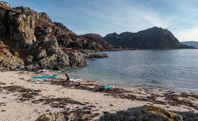
We  launched into the turquoise waters of the sandy bottomed shallows but...

...soon we were in the deeper ultramarine waters of the Sound of Sleat.

A fair breeze pushed us south towards the mouth of Loch Hourn.

My brother Donald was nipping ahead in his little 2.75m RIB with 6HP outboard. Every so often he would stop and video our progress. You can see his video of the trip here.
 

Wednesday, March 14, 2018

A fourth luncheon on the machair at Silver Sands

We stopped on the southern side of the Silver Sands of Smirisary and...

...made our way up the shore to the...

...closely cropped machair which backs the beach. Here, below a rapidly sinking sun, we partook of our 4th luncheon which we washed down with a not ungenerous snifter of 12year old Caol Isla.

After our comestibles had been suitably dwindled, it was time for a...

..post prandial perambulation over the machair to the headland where we took in the view to the Small Isles to the west and...

 ...to Rubh Arisaig and Skye to the north.

 We left Silver Sands and paddled north until we could...

 ...turn to the east and enter the Sound of Arisaig.

The sun was setting as we paddled on towards Glenuig Bay where we drew the boats up in the gathering darkness. Sadly there would be no further luncheons on this day.

Tuesday, March 13, 2018

The hidden isles and recesses of Loch Moidart

 We left Castle Tiorum and continued...

 ...our exploration of the South Channel of Loch Moidart. The wooded sides of Riska island fall steeply into the blue waters of the loch.

Our tour of the inner Loch Moidart continued past Eilean an Fheidh (deer isle) and...

...tiny Eilean na Craoibhe (tree isle). Normally we are in a desperate hurry here as we have  usually been rushing before the ebb tide dries the \North Channel. This time we were...

...in no hurry as we were waiting for the flood tide...

...to fill the the North Channel. It was most pleasing to round the east end of Shona Beag and see clear water stretching away down the channel towards the Sgurr of Eigg on the distant horizon..

We passed the long abandoned hamlet of Egnaig on the north shore. Its inhabitants had abandoned their homes long before the first road came to this part of Moidart in 1966. The road arrived well before grid electricity which did not arrive in Moidart until 1988!

The Sgurr of Eigg is a magnificent sight all the way down the north channel. It was formed when an ancient river valley was flooded with lava from the Rum volcano. The lava cooled quickly forming very hard pitchstone. The glaciers in the Ice Age then scoured away the softer rocks that had contained the river valley, leaving the Sgurr as it is today.

The north channel has a narrow entrance hemmed in by precipitous cliffs then...

....opens out into an area of reefs with coral sand beaches that are exposed at low tide.

As we left Loch Moidar,t a pair of sea eagles watched us from high on these cliffs.

Our bows turned north again. It was getting late in the afternoon and fourth luncheon was calling. Not far ahead we spotted the ideal place...