Showing posts with label geology. Show all posts

Tuesday, March 13, 2018

The hidden isles and recesses of Loch Moidart

 We left Castle Tiorum and continued...

 ...our exploration of the South Channel of Loch Moidart. The wooded sides of Riska island fall steeply into the blue waters of the loch.

Our tour of the inner Loch Moidart continued past Eilean an Fheidh (deer isle) and...

...tiny Eilean na Craoibhe (tree isle). Normally we are in a desperate hurry here as we have  usually been rushing before the ebb tide dries the \North Channel. This time we were...

...in no hurry as we were waiting for the flood tide...

...to fill the the North Channel. It was most pleasing to round the east end of Shona Beag and see clear water stretching away down the channel towards the Sgurr of Eigg on the distant horizon..

We passed the long abandoned hamlet of Egnaig on the north shore. Its inhabitants had abandoned their homes long before the first road came to this part of Moidart in 1966. The road arrived well before grid electricity which did not arrive in Moidart until 1988!

The Sgurr of Eigg is a magnificent sight all the way down the north channel. It was formed when an ancient river valley was flooded with lava from the Rum volcano. The lava cooled quickly forming very hard pitchstone. The glaciers in the Ice Age then scoured away the softer rocks that had contained the river valley, leaving the Sgurr as it is today.

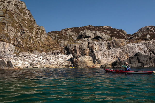
The north channel has a narrow entrance hemmed in by precipitous cliffs then...

....opens out into an area of reefs with coral sand beaches that are exposed at low tide.

As we left Loch Moidar,t a pair of sea eagles watched us from high on these cliffs.

Our bows turned north again. It was getting late in the afternoon and fourth luncheon was calling. Not far ahead we spotted the ideal place...

Sunday, January 14, 2018

A cold second breakfast at dead end beach, Jura

We woke on the morning of our fourth day of our trip round Jura and Colonsay on the machair of Shian Bay on the west coast of Jura. A cold NW wind was blowing  and it felt like spring had retreated to allow the return of winter.

As we had no intention of paddling through the Gulf of Corryvreckan against the west going flood tide, in wind over tide conditions, we wanted to arrive at the west end of the Corryvreckan at slack water before the east going ebb started. That was not until late afternoon and as the Corryvreckan was only 24km away, we had some time to kill. Unfortunately there was not a scrap of shelter on Shian Bay so, on the one morning we could have enjoyed a relaxed start, we had to get moving to keep warm.

We donned full winter attire and...

...Sam even had his pogies on. What a contrastv to the previous few days.

As we left Shian Bay the wind had just a little too much north in it to get our sails up which...

...pleased sail-less Sam. Then, as soon as we rounded the first headland (backed by huge raised beaches of cobbles),...

...the wind freed enough to get our sails up and we were soon making excellent progress up the...

...remote NW coast of Jura, which is always a delight.

In addition to the raised cobble beaches there are several levels of raised cliffs, which feature dry arches and caves and are interspersed by sand dunes. They represent the varying sea levels after the last Ice Age. The west coast of Jura is one of the geological wonders of the World but it gets hardly any visitors.

Our first stop was at Corpach Bay, some 7km further on from Shian Bay. Corpach Bay is backed by caves which were once used to store corpses from Argyll on their final journey to Iona for burial. Iona is 45km away on the horizon at the extreme left of this photo. Often sea conditions were too rough to complete the journey, especially in winter. One can imagine the smell in the caves come springtime when the mourners returned.

We needed some shelter for second breakfast and, not fancying the caves, we spotted a dry sea stack at the back of the beach.

This provided excellent shelter for a most convivial second breakfast. We were all in excellent spirits as we were in no hurry and had no dead to bury.


Monday, June 05, 2017

You may rue the day you meet the giant bothy rat and adders of Ruantallain.

On the second day of our trip to Orondsay and Colonsay we woke before dawn and were breakfasting by the time the sun rose above the hills of Jura.

 It is always exciting setting off to a new island and neither Sam, Maurice nor...

 ...Ian had been before but David and I had circumnavigated Oransay and Colonsay from Islay and returned via Jura in September 2009.

We set off across the mouth of West Loch Tarbert leaving Glenbatrick and Lord Astor's summer house...

 ...far behind.

 A fair wind soon carried us...

 ...across to Ruantallain.

Ruantallain was an ancient stopping off place on the voyage across to Oronsay. Our ancestors often had to leave the corpses of  their dead here, if it was too rough to cross. The corpses were left in the Corpachs or "dead caves"  at the foot of the raised sea cliffs behind the beach. Along the cliff faces, the dark entrances to the caves were like the empty eye sockets of the skulls within.

Not far from the shore lies the ruined farm stead of Ruantallain, which was finally abandoned in 1947. One half of the cottage with the tin roof is a  locked estate refuge the other is an unlocked simple estate bothy. Tony and I had intended staying here here in  June 2007 and David, Jennifer, Phil and I again considered it in September 2009. Our present little party had wondered why I did not consider staying here the previous evening. They were about to find out!

Tony and I were well tired when we arrived late in the day in 2007. The door creaked open and we let a little light into the gloom within. Two red eyes glared at us from the chair. It was a huge bothy rat. With great presence of mind Tony grabbed a log from a wood pile at the door and thew it at the rat. Any normal bothy rat would have bolted for its hole but this one charged at us. We fled to the shore. Where we pitched...

 ..our tents on the rather stony grass above the high tide mark.

It did not take long to discover that Ruantallain was a vipers's nest, literally hoaching with adders. Of course in the evening and morning these cold blooded creatures are less likely to slither away form your approach and are more likely to strike if you have not noticed them in time.

Now David knew all about the bothy rat and adders of Ruantallain, so like me he hung about the shore. The others thought I was prone to exaggeration and set off to the bothy discover for themselves... Well only Sam made it as far as the bothy. As soon as Ian and Maurice had left the beach they came across a coiled viper in the strike position. That was it, they went no further and reappeared on the beach with some undue haste. David and I nodded sagely at one another.

It was now time to set off from Jura across the sea to Oronsay and Colonsay. Fortunately our party had survived both rats and adders and so remained complete. We did not need to leave any dead in the Corpach of Ruantallain.

You can also follow this trip on Ian's blog here...

Tuesday, June 21, 2016

Saint Columba's tears on Iona

On the second day of our trip to the Ross of Mull and Iona we awoke  to a splendid morning at Fidden. Actually we had been awake for some time. There was an order to the ornithological choir that entertained us through the night. The drumming of the snipe had started before we went to bed only to be followed by the rasping repetitive call of the corncrake which was interrupted only by the equally repetitive call of the cuckoo at first light but thankfully dawn brought the more subtle calls of the meadow pipit and skylark. It was wonderful.

 We set off across the Sound of Iona with the Abbey of Iona on the horizon. Iona is a place of pilgrimage for hundreds of thousands each year. Most pilgrims think that it was St Columba (521 to 597) who first brought Christianity to Scotland when he landed in Iona from Ireland in 563. However, this is nonsense as the earliest Christian relic in Scotland is the Latinus stone at Whithorn in Galloway. It dates from about AD 450. Whithorn was established by St Ninian (c.360-c.432) in 395 which predates the introduction of Christianity to Ireland. Columba had been effectively exiled to Scotland after copying St Finian's Latin bible and starting the Battle of Cúl Dreimhne which resulted in  the death of 3,000 people. However, the religious settlement founded by St Columba on Iona went on to serve as a beacon of Christian learning and spread enlightenment through both Scotland and Ireland. Indeed the famous Book of Kells in Ireland which is described as "Ireland's greatest cultural treasure and the world's most famous medieval manuscript" was actually made in here in Iona in Scotland!

Starting in 795 Iona suffered repeated sacking by the Vikings and some monks escaped with the Book to Kells in Ireland. What is less well known is that in 1204 the bishops of Tir Eogain and Tir Connail and the abbots of Derry and Armagh sacked Iona and razed it to the ground as they resented its continuing influence over the church in Ireland and its popularity as a religious shrine for pilgrims. They wanted the pilgrim business for their own shrines so they then spread propaganda that Iona had been a simple satellite of the church in Ireland and this misconception has lasted down the centuries, particularly in Ireland.

Whatever your reasons for visiting Iona you will fall in love with the place as soon as you set foot there. We landed on on this glorious shell sand beach on the SE coast.

We could not resist beachcombing and I was delighted to find two cowries and a small pebble called a "St Columba's tear". It is green translucent serpentine marble. They are quite hard to find these days as every visitor to Iona wants to find a piece.

Ian has the best eye for cowries I know...this was his haul!

It is not just the Iona marble that is green...

...the seas round the dark rocks of Lewisian gneiss are also...

...luminous green.

This pink boulder of Ross of Mull granite is an erratic, brought across the Sound of Iona by ice during the Ice Age. This is not the only place we have encountered an erratic from the Ross of Mull. We recently found one on the Mull of Ross on the Solway coast.

Thy dark grey of the Lewisian gneiss on the...

...south coast of Iona is quite a contrast to the pink granite of the Ross of Mull which is less than 3 miles to the east. We came to a gully where lighter metamorphic rocks have been forced through the surrounding gneiss. This is the Iona marble which was quarried and used in the building of churches across the world. Rusting machinery can still be seen above the rocks.

The complex and varied geology of Scotland...

...is one of the reasons it is so good for sea kayaking.

We had now reached the southernmost point of Iona at Rubha na Carraig-geire (headland of the sharp pinnacle) where...

...we turned to the west and came upon Port na Curaich (port of the coracle). This is where St Columba is reputed to have first set foot with 12 companions on Iona in 563. He reputedly climbed a knoll and looked back towards Ireland. When he had reassured himself that Ireland could no longer be seen he turned his back to that land and settled on Iona where he would atone for his previous sins with a life of piety.

Sunday, June 12, 2016

Erraid and Tinker's Hole

 We set off from Fidden campsite through a maze of...

 ..pink granite skerries.

Donald kept well out in his little RIB but we...

 ...were able to paddle through the shallows where the water was as clear as green glass.

We reached the rocky shore of Erraid. Alan is looking at the cottages which were built for the keepers of the Dubh Artach lighthouse and later the keepers of the Skerryvore lighthouse joined them when the Skerryvore shore station at Hynish in Tiree closed. The lighthouse engineer was Thomas Stevenson, father of the author Robert Louis Stevenson (more about him in the next post).

 High above Lorna on the skyline of Erraid, the white dome of...

 ...the lighthouse signal tower looks out over the  Sea of the Hebrides to the distant lights.


As we paddled round the pink granite shore of Erraid it was baking hot especially when we entered the narrow windless channel of the Tinker's Hole. Ian is down to a T shirt but was still too hot.

We caught up with Donald who had stopped on a tidal sand spit to photograph the signal station.

He passed us again as there is a deep channel through the gap.

 Tinkers Hole is a well known yacht anchorage as it is well sheltered given the otherwise exposed position of the Ross of Mull.

 We took our time as we were...

 ...in no hurry to leave...

 ...this magical place of cool green sea and...

 ...and warm pink rock but all too soon...

 ...we left the confines of Tinker's Hole and...

...exited onto the exposed south coast of Erraid.