Showing posts with label portage. Show all posts

Sunday, February 19, 2017

Where the river ends and plunges to the sea.

 It is difficult to say where Loch Shiel ends and the River Shiel begins but...

by the time you arrive at the triple arches of Shiel Bridge (1935) the current leaves you in now doubt that this is now the river.

Slightly downstream is the older single arch bridge built by Thomas Telford in 1804. In higher flows a little rapid forms just out of sight and downstream of the bridge. On opur last visit we could hear it roaring.

On this occasion it was like the proverbial millpond.

The Shiel is an important salmon river and the season runs from early May to end September. As we were here in Mid October we had the river to ourselves.

Unlike the majority of Scottish rivers there is no weir or dam to control water levels. On our last visit the river level was as high asa the fishing platform hand rails.

The river winds through some magnificent countryside. Gentle riffles signify the presence of...

...shallow shingle raspids.

The autumn colours were stunning.

As we were due to arrive at low tide  there would be about a 3m drop over the final rapid to the sea so we decided to portage...

...through the lovely deciduous trees that line the river.

Ian's orange deck was particularly harmonious with the fallen autumn leaves.

The rapid was not nearly so fearsome as on our last visit, however a nasty eddy can catch the unwary here and with loaded sea kayaks we were happy to leave this section un-run.

After a diversion to see the Falls of Shiel, it was but a short stroll till we caught sight of the sea in the sheltered waters of Loch Moidart,

For the full stereo vision experience read Ian's account here...

Sunday, May 22, 2016

An unarmed portage across the Tarbert of Jura

After landing at the head of the inner part of West Loch Tarbert, Jura our first priority was breakfast.

We then set off on the 1.9km crossing which is 26m high but involves 40m of ascent. I was using the prototype KCS Easy-Haul Harness (which I have already reviewed here) and Mike and Ian were using portage slings with short contact tow lines to attach the sling to the kayak. Straight away there was a disadvantage to using portage straps. Mike's was dry but we had used Ian's to extract the boats from the muddy waters of the loch and so Ian got a wet, muddy shoulder. As you can see you do not need to use your arms while towing your kayak on the trolley.

 My asthma was bothering me quite badly so I soon had to stop and take a breather but...

 ...there was no stopping Mike and he soon forged ahead.

 Ian and...

...myself made more leisurely progress and as you can see we did not need to use our arms.

Soon we were across the summit and down to the Island's main road which we followed for a brief distance until we came to the sign for Tarbert.

There was a much older sign nearby this standing stone has stood here for several thousand years. We were hardly pioneers of this route. There is also an early Christian chapel nearby where the bereaved carrying their dead to Oronsay and Iona would stop and pray for their safe passage and for the safe passage of the deceased into the next world.

At the Tarbert track turn off a new sign has been situated.

 Our progress to the beach was watched by two sturdy garrons which are used to take deer carcasses off the hill during the stalking season. Deer shooting is a major part of the island's economy.


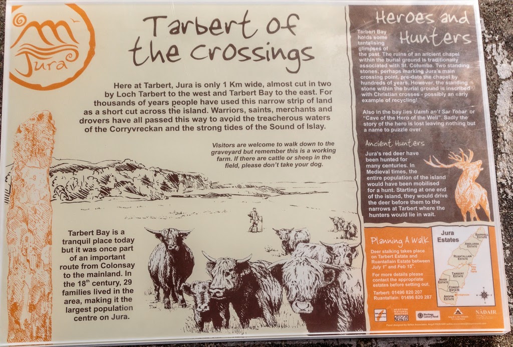
There are many places in Scotland called Tarbert or Tarbet. The name comes from the Gaelic word Tairbeart. In modern Gaelic this means isthmus but its origin lies in "over carry" or "draw boat". Of course sea kayakers were not the first to portage their boats over the isthmus at Tarbert.  In about 1093 Magnus Barefoot, King of Norway, had made a truce with the King of Scotland that allowed him to claim possession of any land he could "sail" round. Of course he didn't necessarily use his own Vikings as labour. Unlike this Viking publicity picture, he "recruited" the unfortunate locals to do the drawing. Any that were too weak to pull were probably used as rollers under the boat. Unlike the Vikings, we had come unarmed and so had to draw our own boats across the isthmus.

Mention of the Vikings brings me back to the origin of the name Jura. I have already mentioned that three Viking words are thought by some to explain the name (the words for beast, deer and udder). In fact the name Jura predates the arrival of the Vikings by at least 150 years.  Ecclesiastical writing in AD 678 recorded what we now know as Jura as "Doraid Eilinn".

 We now arrived at the beach. Unfortunately it is a trap for rotting seaweed and unsuspecting sea kayakers.

Photo 17/4/2015
When Tony and I were last here a year previously it had not been too bad. This time it was on the retching side of bogging awful. We put drysuits and boots on to wade through the foul mass each of the six times it took to get the three boats to the beach. Two of us at the rear used a portage strap to take some weight off the wheels.

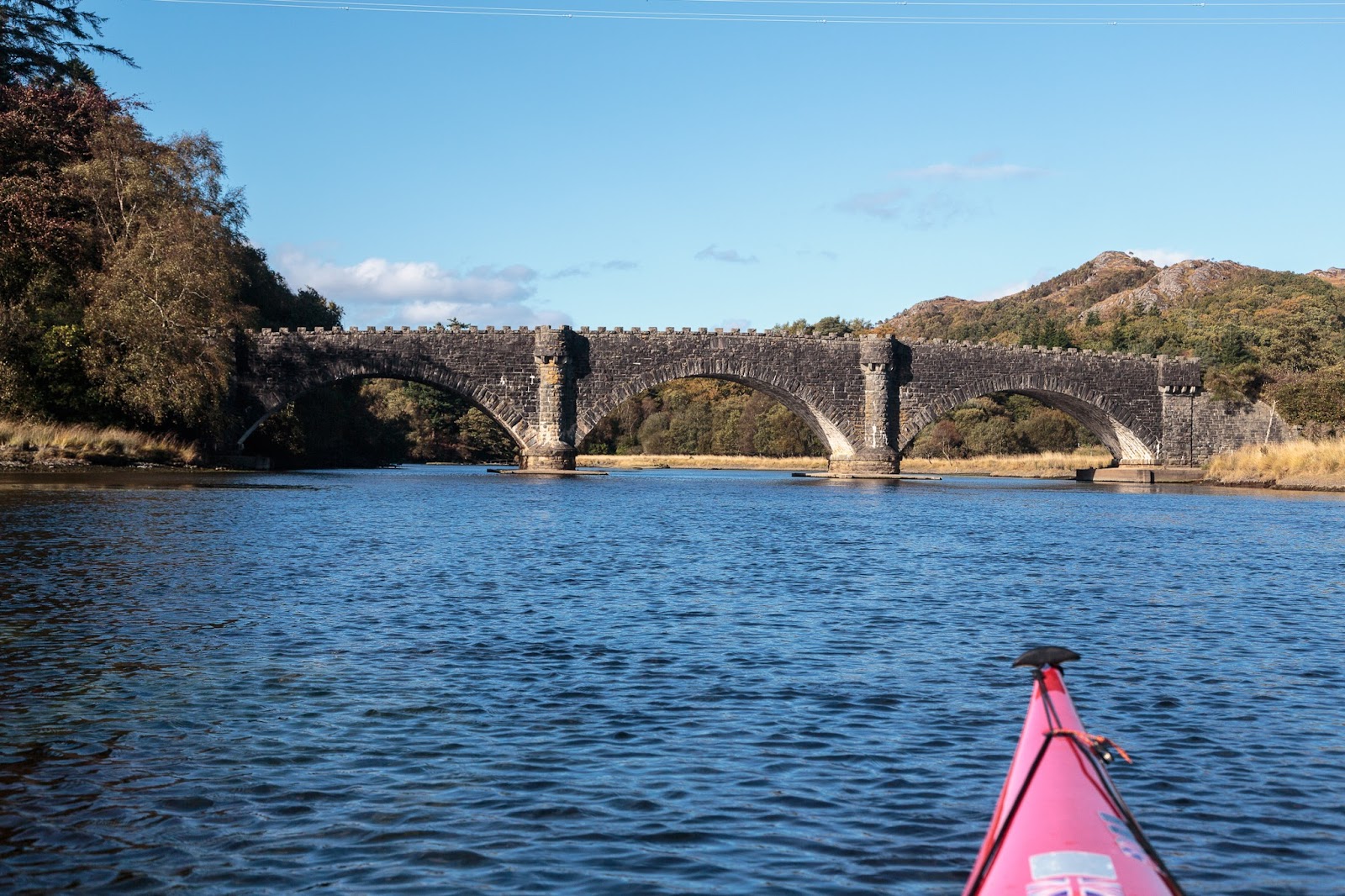
What a relief it was to wade into the clear waters of Tarbert Bay. We spent some considerable time cleaning the stinking glaur off our boots, suits and trolley wheels. However we were in no rush, the south going ebb was in full flow and we needed to go north! We were now back in the Sound of Jura.

Sunday, November 22, 2015

The folly of not bringing a trolley to Barlocco.

 Well laden with wood, we paddled out of Castle Haven under...

 ...the watchful yellow eye of the local heron.

 The sun was sinking fast, almost as fast as the sea level and...

 ...despite our best efforts the bar which connects Barlocco Isle to the mainland had dried. Our destination at Barlocco beach (the one with the fort folly) was 320m away on the other side. We could paddle 2.5km round Barlocco but the carry would still be 250m. A trolley would have been most beneficial but as I already knew there was little fire wood on the beaches, I had advised Ian and Mike to leave the trolleys and bring wood instead. In retrospect we should have brought one trolley and only two of us should have brought logs.

Anyway the retrospectoscope is a very powerful instrument so we had no choice but to get on with it. We left our bags of wood at the bar and carried the three kayaks up the beach. That was 1km of walking and 1km of carrying! We discovered that burning logs is not the only way to get warm. We just managed to beat...

 ...the sunset which was truly magnificent.

 The Solway skies really are wonderful whatever time of day...

...but this sunset was something special to behold.

My knees were absolutely killing me after the carry so I dropped my things and set up my tent just at the top of the beach beside the folly. The ground was not exactly level but my knees were done and I didn't care.

Ian and Mike found a much better camp site just 150m further on. Ian then very generously went back to recover the logs during the best bit of the sunset. I was particularly pleased about this as I just could not face a fourth trip back down the beach and back.

 While Ian was doing this I took some more photos with...

 ...his camera so that he would not miss out on photographs to help remember the wonderful Solway sunset by.

On his travels Ian had also found two very large logs which he rolled into place. One provided a back for the fire the other provided a seat. I used one of our ignition aids (bag of barbeque coals) and got the fire going with one match.

 As the giant star Arcturus slowly set in the west behind the Sun, we roasted sweet potatoes and Ian rushed off to replenish the supplies of Jura, which had run perilously low. My knees began to feel better and we chatted long into the night. On the far side of Wigton Bay the lights of the Machar's villages twinkled as meteors streaked and satellites cruised through the myriad of stars in the Milky Way above.

Tuesday, May 19, 2015

The Jura portage, a miracle, an udder and the 177th Law of the Universe.

The key to our weekend trip to Jura and Islay lay in the timing of the strong tides in the Sounds of Jura and Islay and the fact that Jura is nearly bisected by...

...West Loch Tarbert in the west and Tarbert Bay in the east. The connecting isthmus is only 1.9km wide and 26m high. I had last portaged across here in 2007 but since then increasing knee dislocations a nasty accident to my knee, major operations to both knees and shoulder surgery and a few other health problems had prevented a return. However it was now payback time for the countless hours of physiotherapy. I was very much looking forward to returning to old haunts on Jura and Islay. The best places to read about Islay (and Jura) are Armin Grewe's IslayBlog.com and Ron's Islay Blog

It does not take a rocket scientist to work out that if you have taken advantage of the ebb tide to travel down the Sound of Jura to Tarbert, you are not going to arrive at hight tide! Indeed it was strangely reassuring to observe that the tide was distinctly low on our arrival thus confirming the 177th Law of the Universe did indeed still apply.

 The first part of the beach was hard firm sand and proved easy enough then you come to a deep layer of rotten sea weed at the high tide mark which is hard going. Fortunately it was not as extensive as on previous visits. From the top of the beach to the track to the wooden cabins is the worst bit. If you were on your own you might need to unload to get across this bit.

The two of us managed fine and after a short time we were on what passes as the main road on Jura. We saw no vehicles and no people but...

..this standing stone showed that we were not the first people to  come here. Deer were everywhere though. Some people think Jura got its name from an Old Norse word for deer or another Old Norse word for...

...udder, though I can't imagine why. However, neither Old Norse origin really stands up to close scrutiny. Ecclesiastical writing in AD678 recorded what we now know as Jura as "Doraid Eilinn". This was over a hundred years before the Vikings arrived in these parts and sacked Iona Abbey in AD802.

 It might be just 26m to the summit of the watershed between the West Loch Tarbert and Tarbert Bay but I was well and truly knackered (but also elated) to reach the summit. Tony punched the air in delight when he saw that the tide on the west side was not too far out.

The descent was not much easier. This was a smooth bit. much of the track has been repaired with a particularly coarse grade of hard core with lumps the size of bricks to snag wheels. On my last crossing I was using the KCS original trolley. This had to be used to return and rescue two other kayaks which had broken trolleys. The KCS was the best of the bunch at that time but it was not perfect. It was narrow and had a tendency to topple over on sideways slopes. It also sometimes twisted under the kayak and the kayak would crash down onto the wheels. On this occasion, I was testing the new KCS Expedition trolley. You can also read Ian's thoughts on the trolley here. The KCS Expedition trolley survived the challenge of the Tarbert portage unscathed as did my knees. A tribute both to KCS and my surgeon.

It was with some relief that I reached the head of West Loch Tarbert. In truth the portage is no big deal for anyone of reasonable fitness. However we were trying to beat the setting sun and I felt a great sense of achievement in being able to do what seemed quite impossible as recently as November 2013 (when I had my second knee operation). Miracles do happen.

The sun had already set. We still had our dry suits to put back on and paddle for a further 3km through the tidal narrows until we arrived at our accommodation for the night....