Showing posts with label piers. Show all posts

Wednesday, April 15, 2015

The end of winter and the end of the loch, in Loch Shiel.


We now entered the shallows near the mouth of Loch Shiel. The sandy bottom was visible most of the way across the loch except for a narrow channel in the middle. There was complete silence except when some...

 ...loud Canada geese honked by.

 Looking back up the loch, the mountains now seemed a very long way away.

 For the first time since leaving Glenfinnan we caught sight of a group of houses,...

...the village of Arachacle with its jetty lies at the west end of the loch. Before the modern roads were built this was a very remote place. In 1893 David MacBrayne ran the first weekly launch service on the loch to connect Arachacle and Glenfinnan. This was replaced by a larger steamer, Lady of the Lake, in 1898 by Lord Howard of Glossop, who owned Dalelia estate. It linked up with the mail coach service from Fort William to Arisaig.

The current boat service is operated by Loch Shiel Cruises from end of March until beginning of October. The MV Sileas spends the winter at Moss, on the opposite side of the loch from Acharacle.

We had an enjoyable chat with Jim Michie who has run Loch Shiel Cruises since 1998. He was getting the MV Sileas ready for her annual inspection prior to her summer season. She was built in 1940 at Rosneath as a harbour launch for the Royal Navy. She is 52 feet long and built very strongly of double diagonal teak on oak frames. and Jim told us a little about her history. In the summer her trips from Glenfinnan would be an excellent way to see the loch if you do not have a boat of your own.

Leaving Jim in the warm spring sunshine we realised that we had passed imperceptibly from the loch to the river, from the mountains to the lowlands and from winter to spring. The current in the River Shiel was now carrying us towards the sea.

Monday, April 13, 2015

Ringing down the years, the bell of St Finan.

As we entered the dog leg in Loch Shiel we found that the way ahead was almost completely blocked by...

...the Green or St Finan's Isle, which is topped by the ancient stones of St Finan's chapel and the graves of the those who have inhabited these lands since mediaeval times. This narrowing of the loch is where the original glacier that cut Loch Shiel would have met the sea and melted, depositing its moraine.

We landed at the jetty where generations of mourners have landed to carry the coffins of their deceased up...
...the hill to the...

...graveyard at the top. Some of the older grave stones are simple boulders half buried in the grass while...


...other stones from the 18th century bear upright crosses, some of which are simply carved. Later stones are...

...not only taller but...

...some are elaborately carved. This one was erected by...

...the grateful parishioners of Reverend Charles MacDonald who died in 1894. He was also a local historian and author.

At the summit of the isle is St Finan's chapel. It was built in about 1500 by the chief of the Clanranald to  replaced an earlier wooden structure. It was abandoned in the late 1600's so was already a ruin by the time Bonnie Prince Charlie came this way in 1745 on his way to Glenfinnan at the head of the loch. Almost certainly the Prince would have stopped here and made his way up to the chapel. St Finan (the leper) was born in Ireland and is thought to have lived between about 520 and 600. Several places in Scotland and Ireland are named after him. He is not to be confused with the later St Finan (of Lindisfarne) who died in 661 after becoming Bishop of Lindisfarne.

Today the ruins are very peaceful and seldom visited. They are surrounded by the loch, forests and mountains of the lands of Moidart, Ardgour and Sunart from where the deceased were brought to be buried. At the east end of the chapel a simple slab alter survives. In a recess above it...

...is a carved stone cross. On the alter itself is a remarkable object. It is a Celtic seamless cast bronze bell. Amazingly it has been here for over a thousand years. Nowadays it is chained up but it is remarkable that it has survived the millennia without being plundered. Of course there is a dreadful curse attached to the bell and any one who stole it would regret doing so for every second of their few remaining days... During an internment the bell is taken down to the jetty and rung at the head of the cortège as they slowly make their way up to the waiting grave.


The bell has a remarkably clear and pure tone and as I rang it...

...deer on the far hillside broke off from their grazing, raised their heads and listened in the same way that countless generations of their ancestors must have done. We had lost all sense of time as we had explored the small isle, over an hour had passed since we landed. We were glad we were not headland to headland paddlers. Each of us felt a strong connection with the landscape and the generations of people who had lived and died here. We reflected on our own mortality and felt a deep joy in being able to experience such a place. Paradoxically we had never felt so alive than here in this place of the dead.

By coincidence St Finan's Saint's Day is the 18th of March, the very day we were there. Perhaps that may have added to the ambience we enjoyed though we did not know it was that day at the time.

We were still in no hurry as we made our way back down to the jetty where...

...we enjoyed a peaceful coffee break with the silvery song of a robin and the echoes of an ancient bell ringing in our ears.

Thursday, February 26, 2015

All aglow in the Lynn of Lorn.

Our winter adventure was now nearing its end. The sun was well down as we continued our exploration of the sheltered waters of Port Ramsay at the NE end of Lismore.

 We went round the south end of Eilean Ramsay before...

 ...paddling through the skerries on its west coast on our way back to the NE point of Lismore.

Then we were in for a treat. The flood tide was  now running up the Lynn of Lorn and was being compressed in the narrow gap between Lismore and the Appin mainland where it was running at 2.5 knots. We took advantage of an eddy to carry us past the Lismore ferry pier then...

 ...down the long gravel spit to its south before enjoying a brisk ferry glide across to the island in mid channel. It certainly warmed us up!

East of the island, the tide dropped to 1.5 knots and I was able to get my camera out to capture this wonderful sunset glow in the sky above the Lynn of Lorn. Beyond the dark outline of Eilean Dubh, the distant Garvellachs were floating above the horizon.

We landed at Port Appin just after sunset and packed our things away in the gathering darkness and cold as a creel boat off loaded its catch. Although our winter trip was now over, we were glowing with memories.

The last day of our four day winter trip was a short 18 kilometres but it had been packed with interest: castles, history, industrial archaeology, natural history, islands, strong tides, paddle sailing, sunset, and good company, who could ask for more? If you look at the GPS track you can see where I stopped to take the photo of the sunset just before  the finish at Port Appin. The tide certainly didn't waste any time in carrying me NE!

Tuesday, February 24, 2015

The quicklime industry on Eilean nan Caorach.

We paddled down the east coast of  Eilean nan Caorach (Sheep Island) and arrived at a beach backed by a cottage, a store house, an...

 ...old pier and three lime kilns. Limestone from the hillside behind the kilns has been quarried away.  The industry lasted for over a hundred years from about 1800.

 The islands in this part of the Firth of Lorn are rich in Dalriadan limestone and this was roasted in the kilns to produce quicklime which was stored...

...in the roofed building on the left of this photo, before being taken away in boats.

The whole operation was run by two families who lived in these cottages.

The  building with the blue doors (behind the quicklime store) was a smithy.

The oldest kiln is now in a pretty unstable state.

A ramp leads up to the top and limestone rubble was dropped into the kiln from...

...above onto a grate below which the coals were lit and then roasted for several days.

The coal was stored in this open walled enclosure behind the quicklime store.

The jetty was used to bring in coal for the kilns and take the quicklime out for agricultural and building purposes. The reef in the middle of this photo is actually a ballast bank where boats dumped ballast before taking on quicklime. At one time there were 24 locally owned smacks which carried coal, limestone and slate. The last was the "Mary and Effie" which was owned by Captain Alan MacFadyen who traded these waters in her until the late 1940's.

The two newer kilns are lined by brick rather than rough stone.

This rowan tree presumably had a sheltered start to life.

This is the view from the top of the kilns to the north towards Shuna and the Appin hills.

This is the view to the south  The island just beyond the ballast bank is called Inn Island. Many people think that there was once an inn there but it is called this because it was leased together with the Port Appin Inn which can be seen at the foot of the wooded slope on the mainland. InnIsland was originally shown as Island Imachar on the Appin Estate map. The Garvellachs can just be seen on the horizon to the right of centre.

We returned to the base of the Kilns. The largest  is still in pretty good condition and Ian and I crouched down to make our way inside to...

...the main brick lined kiln chamber.

The coal store now shelters an old Mirror dinghy, a kayak and a deflated inflatable all of which have seen better days.

Sunday, February 15, 2015

Good companions under a Strontium blue sky.

On the third day of our winter adventure we had originally planned to drive to the head of Loch Etive. However, when we had passed the minor road end on the drive north through Glen Coe it was completely blocked by snow. The day's forecast also promised heavy snow by the afternoon. Staff in the hotel told us that the road over to the head of Loch Sunart was clear so we decided to go there!

From Ballachuilish the quickest way involves a ferry across the Corran Narrows. The ebb had already turned and was streaming past the end of the jetty. It can get very rough here with wind against tide!

 The Corran Lighthouse was built in 1860 by Thomas and David Stevenson.It was automated in 1898.

 We had a short wait as the ferry was still at the Ardgour side.

 The main ferry is the MV Corran. She was built in Hull and entered service in 2001. The relief ferry lying at mooring is the MV Maid of Glencoul. She was built in Ardrossan and entered service on the Kylesku route in 1976.  She remained there until the Kylesku bridge was built in 1984 when she was transferred here to the Corran route..
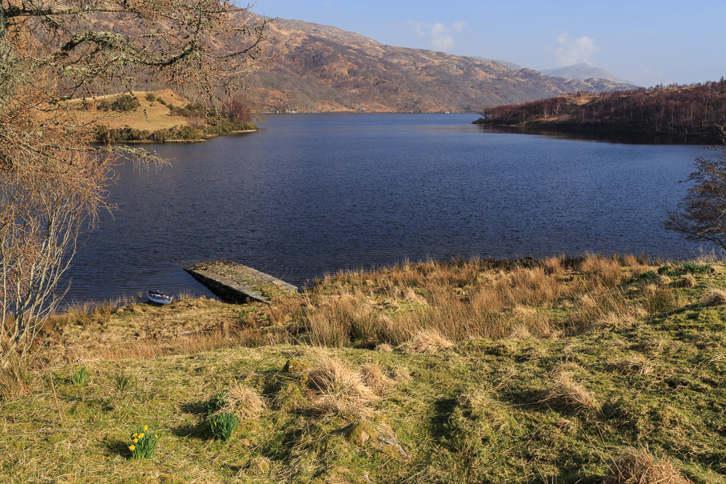
 We drove to the Strontian slipway at the head of Loch Sunart. The element strontium was discovered here.

The day already looked better than forecast. This is the view east up Glen Tarbert to the distant Glen Coe hills from which we had just driven. The summit of the glen is 117m above sea level but at the end of the last Ice Age when sea levels where higher, Loch Sunart connected to Loch Linnhe through Glen Tarbert making what is now the Morvern peninsula an island, in fact one of the Hebrides! In 2010 we paddled round Morvern, shuttling across Glen Tarbert with the cars.

We had taken the chance and texted local paddlers Simon and Liz the previous evening. Ian and I were delighted when they agreed to come. We had not all paddled together since the filming of Sea Kayak with Gordon Brown Volume 2 in 2011.

In no time we were off and right on time...

...the clouds cleared leaving a Strontium blue sky!

I love paddling on the Scottish sea lochs in the winter. Here we were surrounded by snow...

...covered mountains and we would need to paddle 46 km before we reached the open sea!

The view was equally good looking back up the loch.

The bold slopes and ridges of Garbh Bheinn 885m rose high above the head of the loch. Looking at its snowy slopes reminded me of my late friend Dr John Tolmie who died in a climbing accident at the end of March 2014. John and I had been climbing the direct start to the Great Ridge of Garbh Bheinn on 11th August 1999 when all went dark, there was a near total eclipse of the sun!

Although about half my paddling is on my own, I much prefer sharing my time outdoors with like minded folk.

I had a great chat with Simon as he has recently also bought a Canon 5D mk3. I did notice he did not produce it on the water though! Mind you his is not off to Canon UK for repairs! I hope I get it back soon!