Showing posts with label monuments. Show all posts

Friday, July 24, 2015

Reviresco in Loch Fyne

Today Kilfinan is a remote and wild landscape but...

www.canmore.org.uk (You will need to create an account to see the mapping)

...place an archaeological map over today's map and you will discover this area was once a near metropolis. There was an ancient dun or hill fort on...

 ...the hill to the north of the beach so we decided to climb up to it...

 ...passing clumps of spotted orchids on the way.

Today the remains of the dun are largely two semi circular walls about 30m across and not much above ground level, which date from the Iron Age. They were built by Celtic people in pre-Roman times. However, the site was inhabited until late mediaeval times with a succession of wooden buildings. It became known as Caisteal Mhic Eoghainn (Mac Ewan Castle) and was the base for the Ewan of Otter clan. There were multiple, unrelated MacEwan clans in Scotland and the Ewans of Otter and their land became subsumed into the Campbell clan after their last chief, Swene Mac Ewen, died in 1493.

There is a stone memorial with...

...a brass plaque on which the clan motto "Reviresco" is displayed. This means grow green (or young) again.

Well the former Mac Ewan lands have grown green again even though that branch of the clan died out. The castle certainly had a commanding position. This is the view down Loch Fyne and this is the view...

...view up Loch Fyne. The building by the shore is a 19th century salt house. Salt was needed to preserve the prodigious numbers of herring which were once found in the loch. Other herring were preserved by smoking...the Loch Fyne kipper. One branch of my family came from here and my great great grandfather MacCallum was a herring fisherman. His sons followed him but the fish ran out and they had to fish further and further afield. My great, great uncle was washed overboard and lost at sea in the Southern Ocean.

Loch Fyne herring drifters by William Lionel Wyllie (1851-1931)

The traditional Loch Fyne herring fishermen used sail and oar powered boats and drift nets but the introduction in the mid 19th century of steam trawlers (based in Tarbert and Campbeltown) increased the overfishing and there was bitter rivalry between the two types of fishermen. Violence ensued and the Royal Navy had to station HMS Porcupine (a 3 gun wooden steamer built in 1844) on the loch to keep the peace. My great grandfather gave up the sea and moved to Glasgow where he got a job with the Caledonian Railway company.

Tuesday, May 19, 2015

The Jura portage, a miracle, an udder and the 177th Law of the Universe.

The key to our weekend trip to Jura and Islay lay in the timing of the strong tides in the Sounds of Jura and Islay and the fact that Jura is nearly bisected by...

...West Loch Tarbert in the west and Tarbert Bay in the east. The connecting isthmus is only 1.9km wide and 26m high. I had last portaged across here in 2007 but since then increasing knee dislocations a nasty accident to my knee, major operations to both knees and shoulder surgery and a few other health problems had prevented a return. However it was now payback time for the countless hours of physiotherapy. I was very much looking forward to returning to old haunts on Jura and Islay. The best places to read about Islay (and Jura) are Armin Grewe's IslayBlog.com and Ron's Islay Blog

It does not take a rocket scientist to work out that if you have taken advantage of the ebb tide to travel down the Sound of Jura to Tarbert, you are not going to arrive at hight tide! Indeed it was strangely reassuring to observe that the tide was distinctly low on our arrival thus confirming the 177th Law of the Universe did indeed still apply.

 The first part of the beach was hard firm sand and proved easy enough then you come to a deep layer of rotten sea weed at the high tide mark which is hard going. Fortunately it was not as extensive as on previous visits. From the top of the beach to the track to the wooden cabins is the worst bit. If you were on your own you might need to unload to get across this bit.

The two of us managed fine and after a short time we were on what passes as the main road on Jura. We saw no vehicles and no people but...

..this standing stone showed that we were not the first people to  come here. Deer were everywhere though. Some people think Jura got its name from an Old Norse word for deer or another Old Norse word for...

...udder, though I can't imagine why. However, neither Old Norse origin really stands up to close scrutiny. Ecclesiastical writing in AD678 recorded what we now know as Jura as "Doraid Eilinn". This was over a hundred years before the Vikings arrived in these parts and sacked Iona Abbey in AD802.

 It might be just 26m to the summit of the watershed between the West Loch Tarbert and Tarbert Bay but I was well and truly knackered (but also elated) to reach the summit. Tony punched the air in delight when he saw that the tide on the west side was not too far out.

The descent was not much easier. This was a smooth bit. much of the track has been repaired with a particularly coarse grade of hard core with lumps the size of bricks to snag wheels. On my last crossing I was using the KCS original trolley. This had to be used to return and rescue two other kayaks which had broken trolleys. The KCS was the best of the bunch at that time but it was not perfect. It was narrow and had a tendency to topple over on sideways slopes. It also sometimes twisted under the kayak and the kayak would crash down onto the wheels. On this occasion, I was testing the new KCS Expedition trolley. You can also read Ian's thoughts on the trolley here. The KCS Expedition trolley survived the challenge of the Tarbert portage unscathed as did my knees. A tribute both to KCS and my surgeon.

It was with some relief that I reached the head of West Loch Tarbert. In truth the portage is no big deal for anyone of reasonable fitness. However we were trying to beat the setting sun and I felt a great sense of achievement in being able to do what seemed quite impossible as recently as November 2013 (when I had my second knee operation). Miracles do happen.

The sun had already set. We still had our dry suits to put back on and paddle for a further 3km through the tidal narrows until we arrived at our accommodation for the night....

Tuesday, April 14, 2015

Leaving Dalelia on the shore of Loch Shiel: tales of war, loss and peace.

We relaunched our kayaks and left the peaceful Green Isle of St Finan with its graves surrounded by...

 ...the loch, forests and mountains.

We were now in the shallow basin at the SW end of Loch Shiel. The loch side was now backed by green fields of Dalelia estate and...

...cattle made their way to the shore to drink.

 Dalelia estate lies on the NW shore and we passed some attractive mixed woodland in...

...which we spotted a tall stone cross, almost hidden by the trees. It is a war memorial erected by Dalelia's then owner, Lord Howard of Glossop, to his son. Lt. Philip Howard. Philip was only 23 years old when he died in action in France in 1918, near the end of WW1. His family's wealth could not protect him from the ultimate sacrifice and waste of war.

Of course other young men from this part of the highlands also died in WW1 but their families could not afford to erect a monument. However, their 13 names are listed on the war memorial at Acharacle village at the lower end of Loch Shiel. Philip Howard's name is not on it as he was from Glossop in Derbyshire. His father had wanted to build a memorial to his son and have it sited in Norfolk Square in Glossop but it was never built. Instead a memorial to all of Glossop's dead (including Philip) was erected in Norfolk Square and Lord Howard sited the personal memorial here on the shore of Loch Shiel.

The breeze now meant we were making good progress while paddle sailing and soon we...

 ...passed Dalelia house at the centre of the estate. It was built by Alexander MacDonald as a tacks-man's house about 1795 and extended by Lord Howard in 1907 as a holiday home. In 1745 at the start of his ill fated rebellion, Bonnie Prince Charlie made his way to Dalelia over the coffin road (to St Finan's Isle) through the pass in the hills from the head of Loch Moidart. From Dalelia he was taken by boat to spend the night with Alexander MacDonald at Glenaladale before going on to Glenfinnan at the head of Loch Shiel to raise his standard the following day. This was the start of his ill fated rebellion to regain the British crown for his father.

From Dalelia Glenfinnan is 22 kilometres away (beyond the distant mountains to the left of Mike's head). This is the view that Prince Charlie would have seen at the start of his futile rebellion. It is also a view he would have seen nearly a year later as he escaped this way after the final defeat at the Battle of Culloden in 1746. Perhaps it is also a view that Philip Howard had also enjoyed before he went to war and his untimely death in France. Perhaps this why his grieving father built his memorial here rather than in Glossop. We were fortunate that we were leaving Dalelia on a peaceful voyage and were now reaching the end of our journey down Loch Shiel.

Monday, April 13, 2015

Ringing down the years, the bell of St Finan.

As we entered the dog leg in Loch Shiel we found that the way ahead was almost completely blocked by...

...the Green or St Finan's Isle, which is topped by the ancient stones of St Finan's chapel and the graves of the those who have inhabited these lands since mediaeval times. This narrowing of the loch is where the original glacier that cut Loch Shiel would have met the sea and melted, depositing its moraine.

We landed at the jetty where generations of mourners have landed to carry the coffins of their deceased up...
...the hill to the...

...graveyard at the top. Some of the older grave stones are simple boulders half buried in the grass while...


...other stones from the 18th century bear upright crosses, some of which are simply carved. Later stones are...

...not only taller but...

...some are elaborately carved. This one was erected by...

...the grateful parishioners of Reverend Charles MacDonald who died in 1894. He was also a local historian and author.

At the summit of the isle is St Finan's chapel. It was built in about 1500 by the chief of the Clanranald to  replaced an earlier wooden structure. It was abandoned in the late 1600's so was already a ruin by the time Bonnie Prince Charlie came this way in 1745 on his way to Glenfinnan at the head of the loch. Almost certainly the Prince would have stopped here and made his way up to the chapel. St Finan (the leper) was born in Ireland and is thought to have lived between about 520 and 600. Several places in Scotland and Ireland are named after him. He is not to be confused with the later St Finan (of Lindisfarne) who died in 661 after becoming Bishop of Lindisfarne.

Today the ruins are very peaceful and seldom visited. They are surrounded by the loch, forests and mountains of the lands of Moidart, Ardgour and Sunart from where the deceased were brought to be buried. At the east end of the chapel a simple slab alter survives. In a recess above it...

...is a carved stone cross. On the alter itself is a remarkable object. It is a Celtic seamless cast bronze bell. Amazingly it has been here for over a thousand years. Nowadays it is chained up but it is remarkable that it has survived the millennia without being plundered. Of course there is a dreadful curse attached to the bell and any one who stole it would regret doing so for every second of their few remaining days... During an internment the bell is taken down to the jetty and rung at the head of the cortège as they slowly make their way up to the waiting grave.


The bell has a remarkably clear and pure tone and as I rang it...

...deer on the far hillside broke off from their grazing, raised their heads and listened in the same way that countless generations of their ancestors must have done. We had lost all sense of time as we had explored the small isle, over an hour had passed since we landed. We were glad we were not headland to headland paddlers. Each of us felt a strong connection with the landscape and the generations of people who had lived and died here. We reflected on our own mortality and felt a deep joy in being able to experience such a place. Paradoxically we had never felt so alive than here in this place of the dead.

By coincidence St Finan's Saint's Day is the 18th of March, the very day we were there. Perhaps that may have added to the ambience we enjoyed though we did not know it was that day at the time.

We were still in no hurry as we made our way back down to the jetty where...

...we enjoyed a peaceful coffee break with the silvery song of a robin and the echoes of an ancient bell ringing in our ears.

Monday, April 06, 2015

Reflections on Loch Shiel. All is not what it seems; shown the water and across the water.

As we proceeded down Loch Shiel in the early evening, the waters of the loch became...

 ...even calmer.

It was down this loch the Prince Charles Edward Stuart the "Young Pretender" to the British throne made his way after the defeat of the Jacobite army at Culloden in 1746. He knew he was safe here. MacDonald of Glenaladale, on the NW shore of the loch was a staunch Jacobite. George II's soldiers hunted Charles down ruthlessly but despite a £30,000 reward, none of the Highlanders who sheltered him betrayed him. In 1746 the Highlands were in turmoil, a long way from the calm of the loch today. The Jacobite cause was complex. It was not just a simple Scottish/English or Highland/Lowland or Catholic/Protestant divide but it led to the destruction of the traditional Scottish Clan system and the clearing of the many small communities that populated the Highland glens. Even the wearing of tartan was banned and it was not until over a century later that Sir Walter Scott and Queen Victoria re-popularised Highland culture and the wearing of tartan became acceptable again..

There was no sign of spring in the rugged mountain slopes though...

 ...the snows had receded to the high corries.

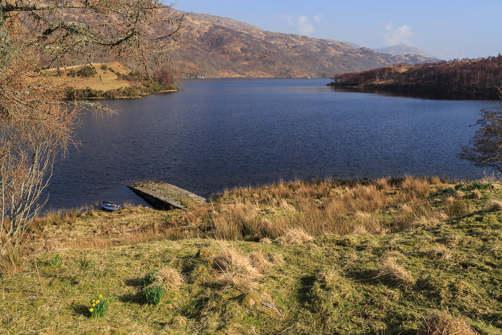
As we paddled steadily down the loch...

...we passed many headlands...

 ...backed by deciduous woodland.

 Their rocks had once been polished by ice but...

...were were now reflected by the calm water.

It was quite disorienting paddling close to the shore, sometimes it was not easy to say what was up and what was down!

 There were surprises round every corner such as...

 ...Eilean Dubh and if you did not look back, you might miss...

 ...some lovely beaches.

 The only sign of man's influence was the forestry track on the SE shore.

 The striking thing about the symmetry in Loch Shiel was that...

 ...sometimes....

...the reflections were...

 ...more vivid than the reality.


We had been paddling in silence for some time. Each of us was immersed in our own thoughts.

 At last I turned back and looking at the now distant head of the loch, realised how far we had come.

 It was definitely time for an early evening tea stop.

We found a delightful beach just north of Glenaladale to stretch our legs and take a refreshment. We were of course deep in the Highlands of Scotland where "tea" does not necessarily come from a bush.

Oh no! We are talking of refreshment that comes from the barley. Ian produced a flask of cask strength Linkwood. Liquor of this strength requires to be "shown" a little water to bring out its full flavour and avoid numbing the palate.

Where better to get some water to show to the whisky than the crystal clear waters of Loch Sheil? In true Royal Navy tradition, we remained seated during our toasts. As it was a Tuesday, we toasted ourselves, our expedition and our friends, in that order. In times gone by, the MacDonalds of Glenaladale would have toasted the "King over the Water" i.e. the Young Pretender, Bonny Prince Charlie. If they were at a function where they had to give the Loyal Toast to the Hanovarian King George, they would pass their glass over their finger bowl as the said "The King!" In so doing the whisky passed "over the water" before they drank it. Thus although they pretended to toast King George, this was a secret sign that their loyalty lay instead with the King over the Water.

After 1746 so many people did this that even the Hanovarians realized what was going on and such was the fear of another uprising that finger bowls were banned from formal functions where the Loyal Toast was to be given. Jacobites quicky developed a new sign, they passed their hand over the top of their glass before drinking. Again this symbolised "over the water". It was not until after Edward VII came to the throne in 1902 that he felt the Monarchy was by then secure enough to allow finger bowls to placed on formal tables again.

Alexander MacDonald of Glenaladale was a Jacobite descendent of the MacDonalds who had sheltered Bonny Prince Charlie in Loch Sheil. For many years he wanted to build a monument at the head of Loch Shiel to commemorate where Bonny Prince Charlie raised his standard at the start of the 1745 Rebellion. It was only after the significant part played by Scottish infantry and cavalry regiments in the defeat of Napoleon at Waterloo in 1815 that Hanovarian concern about another Jacobite rebellion had eased and he was finally given permission. Unfortunately he died before it could be completed.

The design was a simple tower with a statue of "a highlander" on its top. MacDonald had to swear that the statue was of a simple and "anonymous highlander" and to this day the exhibition at the National Trust for Scotland visitor centre tells the same story. However, modern day Jacobites such as A Circle of Gentlemen and the 1745 Association know differently.

UnkownHighlanderStatue
Photo by Kutsa from Wikipedia of the statue of the "Anonymous Highlander" on the top of the Glenfinnan monument.

This is no Anonymous Highlander! The tower is high so most people cannot make out the detail of the statue. It is worth looking through a pair of binoculars. Then just look at the fine tailored jacket, the fold of cloth on the left shoulder to represent the common Highlander's untailored plaid (the Feileadh-mhor), the wig, the feather in the bonnet that represented the chief in battle and the Star of St Andrew on his left breast. This is a statue of Bonnie Prince Charlie himself! Here is a contemporary description of the Prince by John Home, a Hanovarian, when the Prince entered Edinburgh after leaving Glenfinnan:

"He was in the prime of youth, tall and handsome, of a fair complexion; he had a light coloured periwig with his own hair combed over the front: he wore the Highland dress, that is a tartan short coat without the plaid, a blue bonnet on his head, and on his breast the star of St. Andrew."


William Mosman - Prince Charles Edward Stuart, 1720 - 1788. Eldest son of Prince James Francis Edward Stuart - Google Art Project
From Wikipedia, this is the portrait of Bonnie Prince Charlie as he arrived in Edinburgh by William Mosman painted ~1750.  It  hangs in the National Gallery of Scotland.

In Loch Shiel, all is not what it seems. On the beach at Glenaladale, where the MacDonalds once trod, we gave the toast slàinte mhòr! (great health!) This too is not what it seems. At first it looks like a variation of the common Gaelic toast  slàinte mhath (good health) but it is also a Jacobite toast with a hidden meaning, "health to Marion", which was a code word for Bonnie Prince Charlie! With a code name like that , was he a cross dresser? Well, yes he was. While on the run from Hanovarian troops in 1746 he escaped from Benbecula dressed as Flora MacDonald's maid!

To this day Jacobite sympathisers gather at Glenfinnan Monument on the 19th of August each year and raise a toast to the statue of Bonnie Prince Charlie at the top of the tower, "Slàinte mhòr!"