Showing posts with label ferries. Show all posts

Thursday, March 03, 2016

Absent, gone, about to go, reprieved, arrived and Google Photos app is worse than a Google car crash.

Absence: Well it has been a little while since I posted on my blog  Seakayakphoto.com and I have been off the water for over four months. I have not been well for some time but am fortunately now recovering. I consider myself rather fortunate as many have health problems from which there is no recovery. I do have a backlog of things I have meant to post so will shortly start with those.

During my absence some things have gone and some have been reprieved or arrived.

Gone:  Mark Rainsley's renowned SouthwestSeakayaking blog has been retired though he is still very active on Facebook. Here is an archive link to his former blog. I am sorry to see it go because Facebook is not indexed and it is difficult to find older posts. Thanks for many informative and entertaining posts Mark.

Gone: Sadly Lulu, a member of the British Isles only resident orca pod, was washed up dead on a Tiree beach.  Her fluke had become entangled in fishing gear and she drowned. I have seen this pod twice, once to the north of the Cairns of coll and once off  Rubha an Dunain on Skye. They have not reproduced for many years and the loss of an adult female does not bode well for the pod's survival.

About to Go: Picasa Web Albums. This was the free photo hosting service by Google. This hosted photos in Blogger blogs like this one. If you uploaded photos directly from Blogger they would be posted in an album that would grow to 500 photos then a new album would start. You could also upload photos directly to Picasa Web Albums and create more meaningful albums of any size. Links from photos in these albums could be posted directly into a Blogger post as in the photos on this page. The demise of Picasa Web Albums has been predicted since the launch of Google + Photos some years ago. Google are so determined to get rid of Picasa Web Albums that they have excluded it from Google searches.

Gone: The Troon Larne high speed ferry which ran during the summer season has been axed. I have used this ferry in the days that it went into belfast rather than Larne so I will miss it.

The HSC Express has been sold to a Swedish company for operation between the island of Gotland and the Swedish mainland.

However, it will make the 22km crossing between Ailsa Craig and Arran somewhat less exciting as the ferry blasted across this route four times per day at 42 knots!

Reprieved: The Ardrossan Campbeltown ferry operated as a pilot summer service from 2013 to 2015 after which it was rumoured that it would be axed.

It was served by the MV Isle of Arran which will thankfully continue the Thursday to Sunday service. Even better news is that the service will now be permanent (as these things can be).

Arrived: Late in 2015 Google Photos replaced both Picasa Web Albums and Google + Photos. It would be marvellous if the third incarnation of a Google photo storage app was a progressive improvement but it is not. For any serious photographer it takes away any control of compression and it lacks all of the indexing and tagging that Picassa Web Albums allowed. It is also so slow that it is like using an old dial up modem .Google Photos is a truly horrid app, it is worse than a Google Car crash.

Plus: One good thing is that all your personally created albums in Picasa Web Albums have already been ported over to Google Photos.

Minus: The bad news is that they have been compressed on the way over. A typical photo in my blog like the one below is 1024x683 pixels.

This one (which is stored in Picasa Web Albums) was reduced in size and saved from the original camera RAW file in Lightroom as a jpg file with 70% compression. The compressed file was 207KB in size. By the time it was transferred to Google Photos it was further reduced to 90KB. That degree of reduction might be fine if you upload an uncompressed original but when a file is compressed twice the results are not good. I am not going to post the Google Photos version as I really do not like it and it spoils my memory of this beautiful sunset.

Minus: I suspect the photos have not only been compressed but have also been "improved" ("auto enhanced" in Google speak) by altering the exposure, contrast, saturation etc. Maybe I am fussy but the compressed, improved photos  have that garish "turn up the picture" look that someone who has just discovered the sliders in Photoshop might produce.

Minus: The Blogger photo albums of 500 photos which are stored in Picasa Web Albums have not been ported over to Google photos.

Minus: The coding is bloated. This is the link for a photo in Google Photos:

https://lh3.googleusercontent.com/Y41QDpD6aZHubgWQGq8MXJz7qstXiUwFtkwb8eR4krXZhmmbqtfG5tP_YT8ZB8KgzIoDwAZbMRmwPJBburJGhQ3xKccb2e_vcMJO5oHOo_E2genKZIZOIpPky9mwBfEh87pgALdS5eeEayXHFmTX1zbLmEdl33BLmJTifCt3KTAAhvOX-BNkojfh2T85cTb3e1lFOgyl0ELYxRIHZqkB1nJiFdgXKOgOdcjmNU4oDJBSvxgS5OcwKTD6dnlWcA_dgxWj1M7eXwi4FxYJT2nXlmiAdgu1f61zU9z9yE400J4Yq37zSOyIKtBHNIqKC4rLAPIieXKS99Ad6fRNqCRlW6D68W95HQImC9TEa6ndLwU8EvlMOx-CJtRl2p6haGn4viL7uzRZyDcVGAdF30nsbu_glKzPrFqFLiCHX8sd84xG9c_kTx5tCn5eFMIB_sDU3jBGQQYTA5c_Efv4XPb4M0AaaXI8P_8Qtek39Tgx0Pq_5FdeSHAjqxV1V1kVwLcD5rYdL_7c8LnFb5rD1JVuXzlkBR4P7JmLVPo_BhrGpNtCTT3CJU6P3kWmbpwu7eFt=w1024-h683-no

No wonder Google Photos is so slow. In comparison this is a link for the same photo in Picasa Web Albums:

https://lh3.googleusercontent.com/-1XXVgV-XJEY/VtiItTRLxtI/AAAAAAAAw5k/RVhRUSIrsog/s1024-Ic42/20160228-IMG_0989DEW100.jpg

Not only is the "old and redundant" code more compact (!!!) it also contains the original filename and note the "s1024" which allows you to set the maximum size of the downloaded photo (in this case 1024 pixels) which is very useful if you want to paste a photo into a post in a forum that restricts the size of photos.

When Google programmers resort to bloatware like this it is little wonder the Google car crashed. Indeed if the roads were filled with Google cars there would almost certainly be the mother of all traffic jams! Having said that, if Google Cars are as fast as Google Photos then the collisions will not be so much a crash, they will be more like the kiss of a down feather landing gently on the floor.

Lastly if you think it is unfair to criticise a "free" app, it is of course not free at all. Google sifts through all your stuff and targets you with advertising which you pay for in the things you buy. Despite it being several years since my knee operations and my retirement my browsing experience is still filled with adverts for knee potions and retirement investments. Even worse the day after I emailed my mother's brother to say that she had not long to live, I was targeted with adverts for funeral plans and directors. Thank you Google. No doubt I will now be bombarded with adverts for pick me ups and health tonics.


Monday, October 26, 2015

A series of coincidences on our leaving Cara and Gigha.

 We enjoyed a leisurely first luncheon on the white shell sands of Port Sgiathain on the south west coast of Gigha. (Perhaps it was only second breakfast because I cannot recall if any essence of Jura was consumed.) We were in no hurry as we wished to use the ferry slipway at Tayinloan to recover our kayaks. Having no desire to inconvenience the ferry or experience the unleashing of its ramp we planned our our crossing so that it would coincide withe the ferry's departure from Tayinloan. This meant that it would overtake us on our crossing of the Sound of Gigha so we kept a sharp lookout behind.

The rumble of engines soon announced the passage of the MV Loch Ranza but we were well to the south of her course. For the first time Ian caught a clear sight of the Paps of Jura and I regailed him of the trip Tony and I had made to Jura back in April. So that's another future trip sorted!

 Gradually Gigha, the Paps of Jura and...

...Cara with its white sands, Mull and Brownie slipped astern as we approached...


 ...Tayinloan on the Kintyre side of the Sound.

 We had only the briefest of stops, while the ferry finished loading, during which we had time to admire...

 ...the creel boat Kyra OB469 before...

 ...the Loch Ranza departed with another cheery wave from her captain.

 As the ferry motored her way back to Gigha...

 Ian and I landed on the slipway and strolled back to the cars for our kayak trolleys. It had been a truly laid back and delightful trip and we savoured our last moments on the west coast of Kintyre. We were in no particular hurry and decided to enjoy the delights of Jessie's Ferry Farm Tearoom before heading on our way. Coincidentally Ian and I both chose the daily special, wild boar with chorizo burgers which were literally immensely satisfying! Ian and I now faced equally long drives to diametrically opposite parts of Scotland. Ian to Grampian in the NE and myself to Galloway in the SW. Amazingly we each arrived safely within 10 minute of each other. What a coincidence! But this was not the only coincidence on this trip. I had set my iPod onto shuffle play and remarkably the second song which came on as I was driving north on Kintyre towards West Loch Tarvert was by Paul McCartney and Wings. No it wasn't Mull of Kintyre, with its mist rolling in from the sea (of which we had seen plenty). It was Helen Wheels, which recounts one of the McCartney family trips from their farm on Kintyre to London in their trusty LandRover which they called "Helen Wheels". I am pretty sure that the Brownie of Cara would not know how to hack an iPod shuffle play order....or would he?


Altogether we had enjoyed two half days and one full day paddling 51km round Gigha and Cara. It was probably about my 10th sea kayaking trip but Ian's first. Like me, he plans to return but I do not think that is a chance coincidence!

Wednesday, October 21, 2015

Crisis on Gigha (or gie us a lobster).

As we set off through the skerries to round the north end of Gigha, the Paps of Jura put in a very brief appearance. A rumble of engines...

 ...announced the passage of the MV Finlaggan on route from Islay to Kennacraig.

 The NE coast of Gigha is dominated by two very large fish farms but...

 ...the views round East Tarbert Bay are still very fine.

 As we passed Port nan Corran (port of the point of land running far into the sea) we saw yet another small creel boat moored in its shelter. Its creels were stowed well above high water mark, the significance of which would hit us later...

 The east coast gets more interesting again at the bold rocks of Ardminish Point. In the distance we could see the sun glowing behind the Mull of Kintyre. Indeed as we were shrouded in grey, my wife was basking in the Indian summer sunshine on the Solway.

We now entered Ardminish Bay and timed our arrival so that we could cross behind the MV Loch Ranza...

 ...as she departed for Tayinloan on Kintyre. The captain gave us a cheery wave from the wheelhouse.

Beyond the ferry jetty lay our destination, The Boathouse where we had dined so well on our last visit. Its door was open and we were salivating with the thought of a brace of juicy Gigha lobsters! Unfortunately as we drew closer we saw that the sign said

"0 Gigha lobsters left, closed till next season."

We had missed it by one day!!! AAARRRGH! So we just had to sit on the picnic table and eat our own wraps with hummus, cheese, olives and grapes. Healthy enough but not in the same league as fresh lobster!

So all was not well on Gigha but we survived. The island is now owned and run by the community but all is not well with that either. Debt has increased but on the positive side so has the population, housing stock and employment. I do hope things work out.

Thursday, October 15, 2015

A foggy crossing to Gigalum and why I never go to sea without GPS.

Back on the first of October much of Scotland basked under the blue skies of an Indian summer. Ian and I decided on a short notice camping trip of two nights to Gigha and Cara. When I arrived at Tayinloan on the Kintyre mainland there were stunning blue skies but as Ian arrived thick mist rolled in from the sea. The very stuff that Paul McCartney wrote about when he was staying in his farm just down the road. We decided to take tea and cake at the excellent Ferry Farm Cafe which is adjacent to the ferry car park.

Well fortified, we set off into the fog on a 5km crossing of the Sound of Gigha. I regularly paddle in fog on the Solway and Ian and I have paddled together from Rum to Eigg in thick fog so we didn't think twice about it. I had plotted a waypoint into my GPS that would take us on a course that diverged south of the ferry route by 60 degrees. I had set it for the isle of Gigalum at the south end of Gigha as it would cross the Flat Rocks the Wee  Rocks and Gigalum Rocks on the way. This would expose us to the minimum danger of shipping as anyone with a draught of more than a few inches would keep well clear of these rocks in fog. The ferry captain did ask us about our plans as he was concerned in case he ran us down. However, he was reassured when he heard our plans. Of course both the wind and tide would carry us off course but I had set my GPS to give the bearing from our current position to the waypoint on Cara. As we crossed if the bearing dEcreased we went lEft and if it Increased we went rIght.

Half way across, the mist thinned just for a moment and we were lucky to experience this wonderful fogbow.

We caught sight of something in the mist. The fog magnifies everything and Ian thought it was an island with trees but it was just Gigalum rock with some cormorants on it. We were bang on course and Ian called the ferry captain on the VHF and let him know our exact position. We could hear his engine rumbling well to the north.

 Shortly afterwards we arrived at Gigalum and...

...a hazy sun put in a brief appearance as we paddled through the amazing Gigalum skerries. There was no chance of getting run over in the fog here. Many very experienced sea kayakers are disparaging of GPS and never use it. Pn the contrary, I never go to sea without a GPS (actually I have two, my phone is a backup). Of course on this crossing I was also using my compass, map, ears, nose, sense of what the wind was doing (and the smells it carried) and sense of what the tide was doing. I suspect that some of those who chose not to use GPS do so because they have not taken the effort to learn how they work and understand their advantages and disadvantages.

Saturday, August 22, 2015

From the sublime to the ridiculous in the West Kyle.


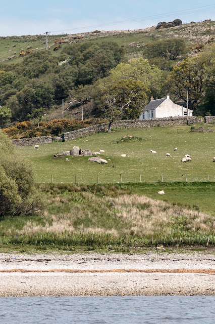
As the two sides of the West Kyle of Bute gathered towards us we came to Kilmichael. In the field in front of the cottage there is a chambered cairn called St Michael's grave. St. Michael founded a church near by but this cairn predates the Christian era by about 2,000 years.

Just round the coast from the cairn is the ruin of this abandoned house. It was the ferryman's house for the ferry that ran from Kilmichael on Bute to Blair's ferry on the Cowal side of the kyle. Although the rocks look too inhospitable for landing, there is a little cut with a jetty just to the NW of the house. The ferry was established in 1769 and ran until 1940 when it was closed due to WW2 military operations and exercises in the area. The house was occupied until that time. The ferry man operated the premises as an inn called "The Bottle and Glass Inn". Unfortunately we had arrived well after closing time.


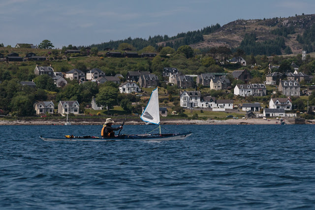
The Kames Hotel on the opposite side of the Kyle  was open but as it was such a glorious day we decided to stay in the sun for our second luncheon. Amazingly a southerly thermal wind picked up and gave...

...us a little assistance past Tighnabruich to Caladh Harbour at the north end of the kyle.

Then at the north end of Bute we passed blow two garishly painted rocks known as the Maids of Bute.

As you can see from this close up from our March trip, they look nothing like "maids". I doubt they will be as long lasting as the chambered cairn at Kilmichael.

After a short paddle through the tidal south channel at the Burnt Islands we arrived back...

...at the ferry terminal at Rhubodach just as the MV Loch Dunvegan was pulling away from the jetty. Our  four day trip from the Kyles of Bute to Loch Fyne and Inchmarnock was now over. Sadly the Scottish summer of 2015 seemed to coincide with those four days and it would be some time before we went on a camping trip again.

We took the Calmac ferry to Bute from Wemyss Bay then drove from Rothesay to Rhubodach. We covered 91km in 3 whole days paddling.


Thursday, August 20, 2015

Seals and boats on the east coast of Inchmarnock.

As we paddled up the east coast of Inchmarnock we came to the abandoned farm at Midpark. 

On the shore below Midpark lie the sad remains of the wooden ferry MV Dhuirnish. The Dhuirnish was built as a turntable ferry in 1956 for J & A Gardner Ltd. who operated the Taynuilt/Bonawe route across Loch Etive until the service closed in 1966. In 1967 the Bute Ferry Co. Ltd. bought her, removed the turntable and fitted a bow ramp. They operated her on the Colintraive/Rhubodach crossing in the Kyles of Bute where she carried six cars at a time. During the Great Storm on the 14th January 1968 she sank at her mooring in Colintraive. She was raised and re-entered.service the following summer. She remained on the crossing until June 1971. By September 1971 she had had two further owners but it is not known how she ended up on Inchmarnock.

Further north we came to the modern farm buildings and slipway at  Northpark where the MV Marnock was moored. She was built on Bute in 1999 for the Inchmarnock Estate who...

 ...rear a pedigree herd of Highland cattle here.

It was now too hot for our dry suits so we landed near the north of Inchmarnock to disrobe.

 No sooner had we landed than an inquisitive group of about 30 common seals surrounded us.

 The water looked so inviting that I joined them for a quick swim.

This fellow was not for moving, despite the interest shown by his fellow members of  the Welcome to Inchmarnock committee.
 Feeling much cooler we  continued on our way towards...

 ...the north of the island where...

...a large rocky spit  makes a good place to land to explore the north of the island. It was near here where the stone cist containing the 4,000 year old remains of the "Queen of the Inch" were found.