Showing posts with label North Channel. Show all posts

Tuesday, February 28, 2012

Michelin starred pow wow at Knockinaam

We had been paddling along the remote Rhinns of Galloway peninsula for what seemed ages. Our stomachs were groaning with hunger pangs. 

At last we came across a break in the previously relentless rocks, Port of Spittal Bay. We have several times passed this spot without stopping. There appeared to be a house standing a little way back from the beach. We started drooling with the thought that perhaps we could beg some morsels of food.

On this cold January day, the North Channel tide race was pumping on the horizon. There was a little shore break in the bay...

...and it was good to feel our feet on the beach of coarse, grey sand and shingle.

Weak with hunger, our faltering steps took us up the beach towards the isolated house...

...we opened the creaking door and stepped inside. We were warmly greeted and told we were to be the only guests at the Knockinaam Lodge hotel that night. We were told a previous resident had been Sir Winston Churchill, who held several secret meeting here with President Eisenhower during the dark days of WW2.

Even better, we discovered that the hotel has a restaurant (though it only has a solitary Michelin star). Despite there just being just the two of us, Tony Pierce the chef, put on the full menu. We dined exceptionally well that night then slumbered in the warm, comfortable room with the waves crashing on the shore as a lullaby.

Sunday, April 24, 2011

The Mull of Logan

 In the middle of a sunny spell in April, the day dawned grey and drizzly at Portpatrick in SW Scotland. Tony and I met Jim (fresh from Skye) and Mark and Heather Rainsley who were visiting the area. Mark was keen to get some photos of Scottish coastal fortifications and Dunskey Castle fitted the bill!

We were headed south with the flood tide for the Mull of Logan, some 16km to the south. There is some excellent rock hopping on this stretch of coast.

Rounding Money Head, I put my sail up and nipped off to Ardwell Bay in front of the others as there was a nice little wind.

On the horizon some blue sky appeared...

...as the others came in to land.

Mark and Heather seemed to be enjoying their visit to Grey Galloway.

Despite the recent heatwave (it was 22C in Galloway the day before) the water temperature was only 6C. It was interesting to note that we all wore dry suits etc, unlike the recreational sit on top paddlers in Fleet Bay who were out in shorts and T shirts!

We didn't tell Mark about the Devil's Bridge arch at the Mull of Logan and let him go round the corner first. All we heard was "WOW!".

 At this point Tony and I took our farewells of the others. They were paddling on to Port Logan and lunch in the hotel before a taxi back to Portpatrick for the cars.

Tony and I now caught the ebb tide tide going north. There was still a force 3-4 northerly wind.

We knew there would be some excitement with wind against tide at Money Head, Knockienausk Head and Tandoo Point. We were right and got our faces wet, before facing the Easter Holiday crowds at Portpatrick!

Tuesday, April 05, 2011

Some long views from Ailsa Craig.

On previous visits to Ailsa Craig we have gone in a high pressure system and the visibility has been poor due to haze. On this occasion, the atmosphere was crystal clear. To the ESE Girvan was very clear but in the middle of the photo, the summit of the Merrick was hidden in the clouds. The dip to the right of the photo is Glen Trool.

The view to the S showed Stranraer at the head of Loch Ryan with the Rhins of Galloway and its wind farm on the right.

A telephoto view to the W showed Sanda Island with the Mull of Kintyre behind. In the distance, flat topped Rathlin Island is 68km away off the north coast of Ireland, on the far side of the North Channel.

To the north, this view shows little Pladda Island (with its lighthouse) off the south coast of Arran and the pointed peak of Holy Island to the east of Arran. Right of Holy Island the view is all the way up the Firth of Clyde to the white villas of Dunoon. Beyond that, the snow streaked peaks are Ben Ime, The Cobbler and Ben Narnain in the Arrochar Alps. Ben Ime is 112km away. To the right of Dunoon, the dark island is the Little Cumbrae. To its right you can just make out the chimney of the Inverkip power station. The snowy mountain at the right edge of the photo is Ben Lomond.

Alan (see comments) asked "could I ask if you have a higher resolution photo of the Arrochar Alps, or was this photo already cropped?" This is the highest resolution I have with a 1:1 pixel ratio. It was a remarkably clear day. To the left of Ben Ime, which is the highest point on the horizon, you can see the dark slopes of Beinn Dubh Craig then to its left, the snow flecked ridge of Ben Oss. Lastly, to the left of Ben Oss, you can just see the fine peak of Ben Lui rising above a nearer flat topped ridge. Ben Lui is 1130m high and is 130km from Ailsa Craig, a long view indeed!

Although they don't show up well  on these low resolution photographs, we were surprised by the number of wind farms that had sprouted on the hills all round us. This regularly updated kmz file from weatherman22 will open in Google Earth and show the number of opened and proposed wind farms in the Scottish hills and mountains.

It was now time to make our way back down the steep path to the kayaks.

Tuesday, November 30, 2010

Sea kayaking desktop wallpaper calendar, December 2010.

December, resting at Rainbow Rock, Rhins of Galloway, after an exciting trip round the Mull!

The seakayakphoto.com December desktop wallpaper calendar (in a variety of screen resolutions) is available for download here.

Tuesday, April 20, 2010

Sea kayaking from Portpatrick to the Mull of Logan


A 33km paddle from Portpatrick to the Mull of Logan and back in late February 2010.

Tidal streams in the North Channel, close inshore between Corsewall Point and the Mull of Galloway, run at 5knots springs of Black Head and to the south of it, north of Black head: 4knots off Craig Laggan and 2.5knots off Corsewall Point. Expect to find counter eddies in the bays especially in the last 3 hours of the stream.

NW going ebb -0250 HW Greenock -0130 HW Dover
SE going flood +0310 HW Greenock +0430 HW Dover

There are races SE of Crammag Head and off Mull of Logan, Money Head and Morroch Bay.

In mid channel the streams begin +0130 after the coastal streams.


The Old Man of the Mull of Logan keeps an eye on the Devil's Bridge.


Sunset behind the Portpatrick lighthouse.

Potted pheasant at Portpatrick

Going with the flow on the Rhins of Galloway

A Galloway snow squall warning

Where will we take luncheon today?

Any port in a storm #2

Slack water in the North Channel.

The Old Man of the Mull of Logan.

We four represented the sum of human activity in these parts.

What happens after you test a P&H Cetus LV?

Have you ever heard of Knockienausk Head?

The bright lights of Portpatrick


Photo album map

Monday, April 19, 2010

The bright lights of Portpatrick


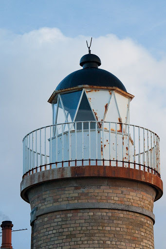
Arriving back at Portpatrick, we noticed an unusual thing about the lighthouse. All the panes in the lantern house towards the sea were blacked out by metal shutters, very strange....


...it turns out that after Portpatrick lighthouse was decommissioned in 1900, the villagers, who had no street lights, turned the lantern towards the shore (and the village) and then switched off the flashing mechanism so that the lamp shone continuously onto the village. This "street light" worked well until 1905 when the Lighthouse Board sold the lamp and its mechanism to Ceylon (now Sri Lanka). I wonder if the Board only found out about the street light after 5 years of lighting bills?


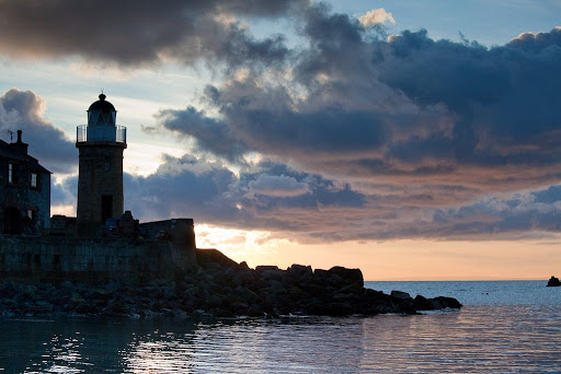
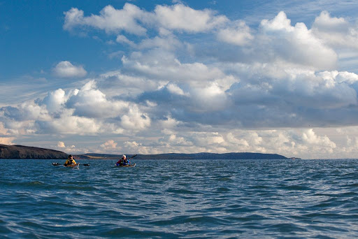
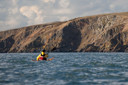
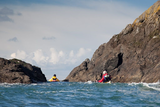
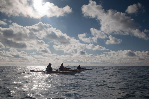
The observant reader will note that between this photo and the last, some considerable time has passed. What was the the explanation? Had we been transfixed by the undoubted beauty of Portpartick's harbour?

Actually not....when we returned to Phil's car, we discovered that the injured pheasant had made itself quite at home. The once prim interior of Phil's Honda was now like an unkempt hen house. We were stunned that one bird could create so much mayem. Looking at the situation, I felt David's diagnosis of a RTA was wrong. This bird clearly had a severe bowel problem, there was not an inch of surface untouched by bird droppings. Not only that, it was obviously moulting in preparation for the breeding season, there were feathers everywhere. If this was not enough, the ungrateful bird had clearly taken a dislike to the scotch broth mix (the purchase of which had so delayed the morning's departure) and expressed its displeasure by emptying the entire contents of the packet and then scattering them throughout the interior of Phil's car.

Phil is not often given to alliteration but he said quite firmly "I want the ******* pheasant out my car!" There was only one thing for it, in order to placate Phil, David had to buy a round of Guinness over at the Crown Hotel. The pub was crammed but the service was quick and a roaring fire secured a 10/10 for this conveniently situated sea kayaking pub!

I am very grateful to Tom for kindly providing this link of what happened to the pheasant, once David got it back to his veterinary surgery.


When we emerged from the pub, the distant lights of Ireland were twinkling on the horizon. What a great way to end another fantastic outing!

Sunday, April 18, 2010

Have you ever heard of Knockienausk Head?


The tide built up as the afternoon wore on...


...and we sped past Money Head.


To the west we could just make out the coast of Northern Ireland and to the east...


...we passed under the cliffs of Gull Rigging and indeed there were a few gulls getting ready to nest on its ledges.


From Knockienausk Head we looked back to headland after headland on the Rhins of Galloway coast. Thanks to tidal assistance, we had rounded quite a few of them on two occasions today!


The sun began to sink rapidly to the horizon above the distant hills surrounding Belfast Lough and we were nearly back in Portpatrick. We had so enjoyed paddling this remote coastline with so many strange names.

Saturday, April 17, 2010

What happens after you test a P&H Cetus LV?


The P&H Cetus LV looked good on the sands of Ardwell Bay.


While we were engaged upon our luncheon, the tide race had built up off Money Head in the foreground. Portpatrick lay 12km away under the distant transmitter mast beyond Tandoo Point in the distance.


Several people have emailed asking when I am going to publish the results of our test of the P&H Cetus.


Tony really enjoyed paddling it...


...but the test has been published...


in issue 20 of Ocean Paddler magazine.


I will post a copy of the test here...


...once the next issue of OP is published in 2 month's time.


Until then you will just need to take our word for it that it is a damn fine sea kayak.


At the end of the test Tony ordered a Cetus, which is more appropriate to his weight than the LV.

Friday, April 16, 2010

We four represented the sum of human activity in these parts.


After dallying at the Devil's Bridge, it was now time to retrace our wakes and turn north. We were running with the tide again and were blasted through the narrow gap between Otter Rock and the Mull of Logan.


Incoming swells against the tide made for joyous paddling conditions in the February sunshine.


Once round the Mull, we were grateful for all the tidal assistance we could get. Our destination, Portpatrick, lay beyond the most distant headland. As far as the eye could see, not a single building broke the long line of headlands, bays and cliffs.


Out to sea the horizon was empty and devoid of ships of any size. We four represented the sum of human activity in these parts.


This was a heavy burden to bear and made us feel quite peckish. So we nipped into the shelter of...


...Ardwell Bay for a second luncheon and toast the adventure with the remainder of Phil's Glenlivet malt whisky!