Showing posts with label Galloway. Show all posts

Tuesday, November 10, 2015

A couple of Rumblekirns and much friction between Scotland and England.

 We left Castle Haven with a fair wind, a...

 ...following tide and the sun sparkling on the shimmering Solway sea.

Passing Kirkandrews we saw the trailers and launch site of the two Campbeltown fishing boats we had seen earlier.

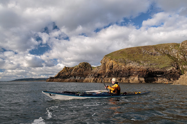
We had left the granite rock of the Galloway hills far behind and were now paddling past layers of Silurian sandstone which had originally been formed at the bottom of the Lapetus Ocean when Scotland was situated near the equator.

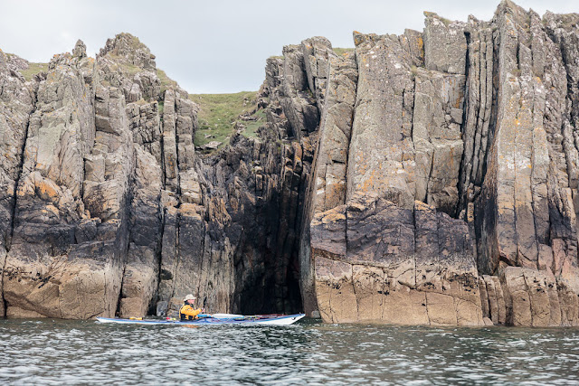
As England collided with Scotland the horizontal layers on the ocean floor were folded up and many became vertical such as here at Rumblekirn. A Rumblekirn is a cave with a blowhole at its back.

Below half tide this coast is a maze of reefs with sharp fangs of rock formed by the vertical strata ready to rip the bottom out of any boat. The steamship Ormsa stranded near hear in 1907 but the coast is literally littered with the wrecks of wooden 19th century smacks, sloops and schooners.

Above half tide you can paddle into Duncan's Cave and behind the nearby Little Pinnacle but we had to settle with a...

 ...view from further out.

Dove Cave can be entered only at high tide and these cliffs are indeed home to rock doves. There are also a pair of peregrine falcons here though we did not see them (We would see another peregrine further round the coast).

 Once we rounded Borness Point we left the Isles of Fleet behind and ahead we could see...

 ...the coast of Cumbria in England which was 40 kilometers distant with the hills of the Lake District rising behind.

 We came to a second Rumblekirn and could see through the blowhole at its back.

We paddled into a deep geo behind Rumblekirn and could see where the blow hole exited but could not approach due to the low tide.


The walls of of the geo were impressively vertical as they soared upwards towards the sky. Who would have thought that there had been so much friction between Scotland and England? 


Wednesday, October 28, 2015

The Old Man of the Mull of Logan.

At the Mull of Logan there are a number of hidden inlets which lead to the great rock arch called the Devil's Bridge. Phil, Tony and I had been before but as Maurice had not been before (and we had said nothing to him) he amazed when he found it.

 Those entering the recesses and passing under bthe arch do so under the baleful stone gaze of the Old Man of the Mull of Logan.

 We dallied for some time in this wonderful spot but the tide was still rushing north and we were now going to head south to Port Logan...

 ...against the tide.  There was no eddy on the SE side of the Mull but close in the tide was only running at 4km/hr compared with 9km/hr just a few meters out.

 Soon we were in quiter waters and the coast here has a maze of gullies many of them interconnecting. This arch is called Little Bridge.

 Further along we came to this old cabin before we arrived...

 ...in Port Logan Bay which is backed by the fertile fields of the Rhins of Galloway.

Our final obstacle was clearing the lines of the many fishermen who lined the old pier. Port Logan was originally called Port Nessock and in the 1
7th century attempts were made by the McDouall family to establish it as a ferry port for Ireland. They also built the Port Logan Inn which is sadly closed at the moment.

The quay and Port Logan Light were built in 1830 by Colonel Andrew McDouall. The light is a conical stone tower with a platform for a lantern. It is not known when it was last lit but for sometime after that it had a bell, which was rung to guide local boats back in foggy conditions. A decent road to the village was not constructed until the early 20th century, so most of the village's trade and traffic depended upon the sea. A life boat station was built at Port Logan in 1866. It closed in 1932 as the RNLI lifeboat at Portpatrick, 18km to the north west, was motorised by then. The boat house is now the village hall which you can find near the quay.

Our 24km trip from the East Tarbet round the Mull of Galloway, Crammag Head and the Mull of Logan is one of the finest paddles in Scotland. However, due to the tides it can be very serious if there is any wind.

Tuesday, October 27, 2015

Catching the tide from Crammag Head to the Mull of Logan.

This is a return to where I left off our Mull of Galloway trip.

After rounding Crammag Head a little breeze got up and we fairly sped up the North Channel with both tide and wind assistance.

Portencorkie is really the only beach north of West Tarbet and funnily enough each has a huge gas tank. These were washed of a cargo ship in a storm. The beach does trap any detruis and I have only stopped here once so...

 ...we pressed on round...

 ...Laggantullach Head and...

 ...past Clanyard and Port Logan Bays. We stayed out in the tide and made rapid progress towards...

 ...the Mull of Logan, our second Mull in one day.

The flood tide was running like a river at 9km/hr, fortunately the light wind was with the tide otherwise it might not have been as calm as this.

We broke out into a calm eddy behind the Mull. Tony Phil and I knew what to expect. Maurice was in for a surprise...

Thursday, October 15, 2015

Taking the tide from Slocheen Slunk to Gabarunning, Rhins of Galloway.

As we approached the Broadstone of Portdown on the west coast of the Rhins of Galloway we decided to stop for...

 ..first luncheon at what we call Rainbow Rock. It has a steep...

 ...cobble beach and even in calm conditions there always seems to be some swell but...

 ...it makes a really great place to stop.

 You can see why we call the Broadstone Rainbow rock!

During our luncheon the tide continued to build and when we rounded...

 ...Slew-Whan Point it was already...

 ...running like a river.

We took a breather in the slack water in the recesses of Sloucheen Slunk and when we had negotiated the right angled bend we emerged into the day again and took a last look back...

 ...at Slew-Whan Point.

 The next headland was Gabarunning and we sped through the gap on a tide that was vrunning at 11km/hr until...

 ...we were rushed passed the next headland at Crammag head with its lighthouse and WW2 lookout post.

 Rather than fight against the eddy north of Crammag Head...

...we stayed out in the tidal stream which was still at 10km/hour for as long as we could. We were rather grateful there was no wind as it can get a tad bouncy round these parts!

Wednesday, September 30, 2015

All calm in the Lunnock Cave at the Mull of Galloway.

The 16th dawned to be one of the few sunny, calm days in August. It was ideal for a trip to the Mull of Galloway.

Tony and I dropped a shuttle car at Port Logan on the west coast of the Rhins of Galloway then met Phil and Maurice at the East Tarbet. Inshore, the west going ebb starts at -1:30 HW Dover. HW Dover was at 13:10 so slack water was at 11:40 and we launched bang on time at 11:10.

The NE side of the Mull is a grassy slope and gives very little warning of the dramatic rock architecture beneath the lighthouse just 500m away on the other side of the peninsula.

The waters of Luce Bay to the NE were calm unlike a previous visit when we hit the Mull at maximum tidal flow!

 We rounded the critical point at Lagvag at slack water and entered the Lunnock Cave...

...for a celebratory exploration. If you do get caught out in the Mull of Galloway tide race, the Lunnock Cave would make a marvellous place to wait for calmer conditions as the...
.
...vicious eddylines at its mouth kill the swell.