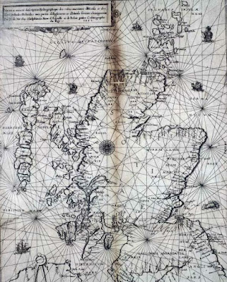
The Nicolay rutter was the first accurate chart and pilot for the Scottish coastline. (The word rutter comes from the French routier.) It was unsurpassed for accuracy for several hundred years. Those of you who know the Solway might question the island off Burrow Head to the east of the Mull of Galloway.
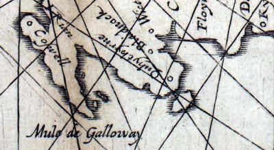
It is of course the Isle of Whithorn. Despite its name this is no longer an isle, but it was when the map was drawn. Even in the 18th century, there was still a channel at high tide and a smugglers' boat escaped the Excise cutter by sailing into the harbour and escaping through the channel while the cutter blocked the harbour entrance.
The rutter was created following an anticlockwise voyage round Scotland by King James V in 1540. The original manuscript was made by Alexander Lyndsay. It was made into a printed version in 1583 by Nicolas de Nicolay, a French map-maker. The National Library of Scotland has placed a digital copy on their website which can be zoomed to allow examination in detail.Only a few copies of the map survive and the BBC news reported that one is due to be auctioned on January 10th. I love looking at old maps and have a fair collection having inherited many old linen backed Ordnance Survey maps of Scotland (some from Victorian times) from by Grandfather. As the rutter is expected to fetch in excess of £20,000, I have decided not to place a bid on this occasion.
In addition to many paper maps and nautical charts I also have digital Ordnance Survey maps at 1:50,000 from Anquet maps. I bought all the 1:50,000 maps in the north half of Britain for £100. These can be viewed on the computer or dowloaded to a PocketPC. Unfortunately they can not be loaded into my Garmin mapping GPS unit but tracks from the GPS can be downloaded onto the computer and waypoints created in Anquet can be uploaded to the GPS. However, it is great for trip planning to be able to scroll seamlessly round the coast. You can print the map at the original size on A4 paper or you can zoom out to cram more coast onto your A4 or zoom in to make the area covered smaller but easier to read for older paddlers who do not wish to wear their reading specs.
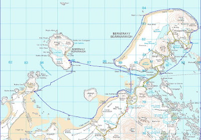
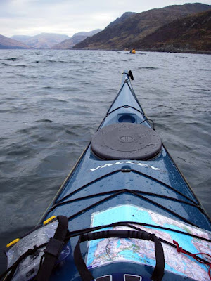
Sometimes I laminate two maps back to back, sometimes I just keep them in the excellent Ortlieb map case.
For the Garmin GPSmap76cs I have two Bluechart regions:2EU006R and 2EUoo4R. These cost about £120 each. They cover from Corsewall Point to Spurn Head. As you zoom in on these you get more detail appearing as the product includes both large scale and small scale charts. They show the coast line in reasonable detail but very little on land. They are useful for showing water depth which can be a predictor for such things as turbulence in tidal channels. They also allow you to calculate tide times for a large number of ports. This works both on the computer and the GPS. Both Bluechart regions fit comfortably within the 115MB memory of the GPS.
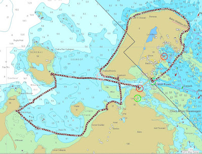
For the Garmin GPSmap76cs to show contours on land and also more detail between HW and LW than the Bluecharts, I bought the Garmin Topo map of Scotland England and Wales for £130. This is based on the ordnance survey but has less detail of woodland, buildings etc but it does show roads. You cannot print from it and on the computer the size of the detailed screen is restricted. On the GPS unit it is very clear and is good for locating skerries, beaches and burns. The maps are large files so you have space to load only those of the general area you are heading for into the GPS, the whole country will not fit.
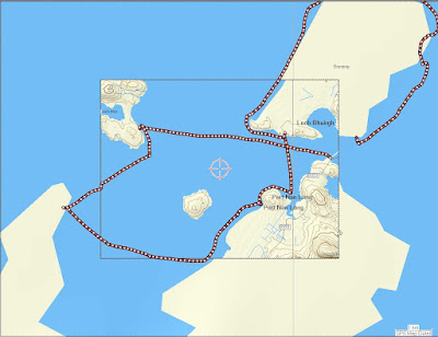
With regard to online maps, I like to use Streetmap in this blog to show the location of photos. It allows me to enter a grid reference from a paper map or Anquet computer map. Pasting the location url into a link in the blog allows readers to open the streetmap page then zoom and scroll.
Another good online "map" is Google Earth. This can even import GPS tracks. Once I have the Google Earth window on the computer screen I save the screen to memory. (On a PC: SHIFT+Prt Scr)
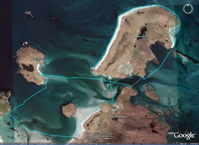
Not all of Scotland has such good photos as this but for those areas with good coverage Google Earth can allow you to explore for campsites and can even show shallows.
It would appear that an advantage of being invaded by the USA is that Google Earth resolution dramatically increases. Ultimately, military use is what has driven the development of maps and also GPS. The British Ordnance Survey had its roots in the Jacobite Rebellion of 1745. In 1746, after the defeat of the Jacobites at Culloden, King George II of Great Britain commissioned William Roy to survey the Scottish Highlands for military purposes. Roy's name is engraved on the door of the Ordnance Survey headquarters in Southampton. Two centuries earlier, James V of Scotland commissioned his rutter to help quell the troublesome Lords of the Isles. The map was so strategic that it was obtained by the English who commissioned Nicolay to make printed copies; one of which was obtained by the French. They used it almost immediately to avenge the murder of Cardinal David Beaton of St Andrews who had been murdered during the Scottish Reformation.
What would Lindsay have made of Google Earth?
On 9/1/2008 Mark added:
"There is another way to get contour information onto a GPS without buying the TOPO maps. The necessary files, Contours v2, can be downloaded for free from the SMC website. You still need the Garmin software to get them on to the GPS itself but they are a big improvement on the Garmin base map.
It seems to work as a sort of overlay on the base map. This leads to some oddities such as sets of contours appearing where the base map shows sea but as the contours tend to be more accurate I have found that helpful as a kayaker!
They were put together by Dave Storey who must have spent a lot of time on it.
Not sure if I can post links here but I will try. The files are at http://www.smc.org.uk/ContourMaps.htm and there is a very helpful set of instructions at http://www.paulmac.force9.co.uk/geo/index.html.
Mark"
There is another way to get contour information onto a GPS without buying the TOPO maps. The necessary files, Contours v2, can be downloaded for free from the SMC website. You still need the Garmin software to get them on to the GPS itself but they are a big improvement on the Garmin base map.
ReplyDeleteIt seems to work as a sort of overlay on the base map. This leads to some oddities such as sets of contours appearing where the base map shows sea but as the contours tend to be more accurate I have found that helpful as a kayaker!
They were put together by Dave Storey who must have spent a lot of time on it.
Not sure if I can post links here but I will try. The files are at http://www.smc.org.uk/ContourMaps.htm and there is a very helpful set of instructions at http://www.paulmac.force9.co.uk/geo/index.html.
Mark
Thank you Mark for these excellent links. Even people who already have the Garmin Topo maps will find the contour maps useful as they are not limited to the ridiculous small Topo maps scrolling window when looking at them on the computer.
ReplyDelete:o)