Tuesday, March 03, 2015

Birlin about Castle Tioram with Julius Caesar in Loch Moidart.


When we rounded the north end of Shona Beag there was very little water left in Inner Loch Moidart. We had hoped to paddle round the east side of Eilean an Fheidh (deer island) but there were only inches of water left so...

...we paddled down its north side then...

...followed the deeper water along the south shore. It was here that we caught sight of Tioram (pron. cheerum) Castle. I always associate Tioram Castle with the birl of the bagpipes because on my first visit,  there was a piper playing at the foot of the castle wall. He was not a local, in fact he was on holiday from Nova Scotia! The sound of the pipes echoing from the castle walls and the misty cliffs round lonely Loch Moidart was spine tingling. I nearly expected to see the Young Pretender himself being carried up the loch in a birlinn.

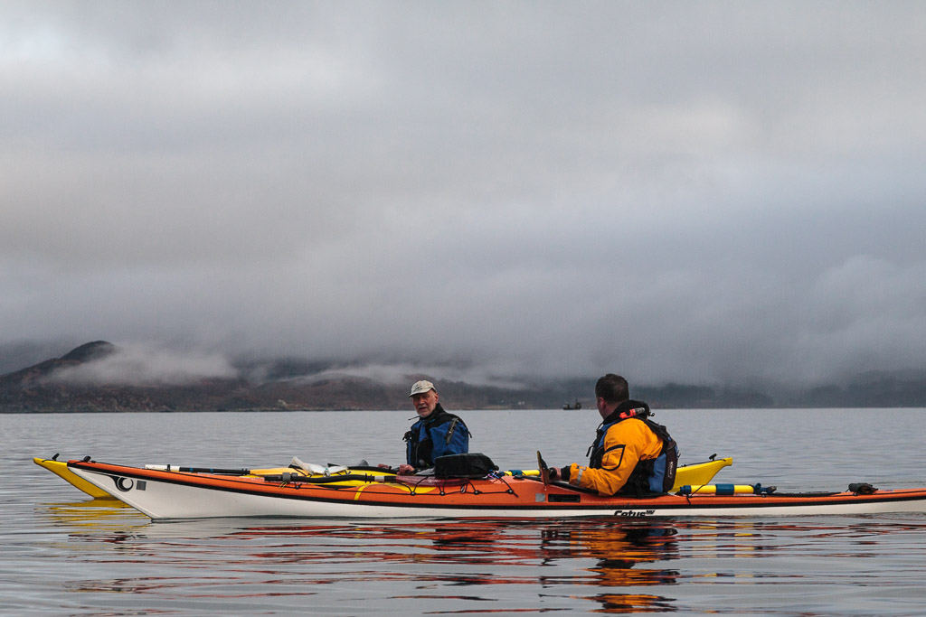
Back to the present, the scenery was amazing which was just as well as our energy levels were seriously ebbing. This was unsurprising since we had replaced first luncheon with a stiff paddle against the tide.

The ebb tide pulled us steadily through the gap...

 ...between the shore and Sgeir Srath Luinga. It did birl us about a bit but in the most gentle way.

The ebb then carried us under the grey walls of Castle Tioram, which sits on a tidal island on the south shore of Loch Moidart. It was the ancestral home of  Clan Ranald from the 14th century. The family owned the castle until the early 20th century, though it has been a ruin since  the early 18th century. The castle currently belongs to a Scottish businessman, Lex Brown, who has been in a long battle with Historic Scotland to restore the building to a habitable state.

Unfortunately a 300 year battle with the elements means that the castle will need a bit of doing up!

We landed on a little beach to the NW of the castle island. No doubt it was from here that Clan Ranald birlinns set off to raid neighbouring clans. Celtic birlinns are similar to Viking longships but predate them by about 800 years. Julius Caeser described Celtic birlinns in detail and reported them as being superior to Roman galleys in his book the Gallic Wars Book 3 (56 B.C.E.).

Namque ipsorum naves ad hunc modum factae armataeque erant: carinae aliquanto planiores quam nostrarum navium, quo facilius vada ac decessum aestus excipere possent; prorae admodum erectae atque item puppes, ad magnitudinem fluctuum tempestatumque accommodatae; naves totae factae ex robore ad quamvis vim et contumeliam perferendam; transtra ex pedalibus in altitudinem trabibus, confixa clavis ferreis digiti pollicis crassitudine; ancorae pro funibus ferreis catenis revinctae; pelles pro velis alutaeque tenuiter confectae, [hae] sive propter inopiam lini atque eius usus inscientiam, sive eo, quod est magis veri simile, quod tantas tempestates Oceani tantosque impetus ventorum sustineri ac tanta onera navium regi velis non satis commode posse arbitrabantur. Cum his navibus nostrae classi eius modi congressus erat ut una celeritate et pulsu remorum praestaret, reliqua pro loci natura, pro vi tempestatum illis essent aptiora et accommodatiora. Neque enim iis nostrae rostro nocere poterant (tanta in iis erat firmitudo), neque propter altitudinem facile telum adigebatur, et eadem de causa minus commode copulis continebautur. Accedebat ut, cum [saevire ventus coepisset et] se vento dedissent, et tempestatem ferrent facilius et in vadis consisterent tutius et ab aestu relictae nihil saxa et cautes timerent; quarum rerum omnium nostris navibus casus erat extimescendus.

"For their ships were built and equipped after this manner. The keels were somewhat flatter than those of our ships, whereby they could more easily encounter the shallows and the ebbing of the tide: the prows were raised very high, and, in like manner the sterns were adapted to the force of the waves and storms [which they were formed to sustain]. The ships were built wholly of oak, and designed to endure any force and violence whatever; the benches which were made of planks a foot in breadth, were fastened by iron spikes of the thickness of a man's thumb; the anchors were secured fast by iron chains instead of cables, and for sails they used skins and thin dressed leather. These [were used] either through their want of canvas and their ignorance of its application, or for this reason, which is more probable, that they thought that such storms of the ocean, and such violent gales of wind could not be resisted by sails, nor ships of such great burden be conveniently enough managed by them. The encounter of our fleet with these ships' was of such a nature that our fleet excelled in speed alone, and the plying of the oars; other things, considering the nature of the place [and] the violence of the storms, were more suitable and better adapted on their side; for neither could our ships injure theirs with their beaks (so great was their strength), nor on account of their height was a weapon easily cast up to them; and for the same reason they were less readily locked in by rocks. To this was added, that whenever a storm began to rage and they ran before the wind, they both could weather the storm more easily and heave to securely in the shallows, and when left by the tide feared nothing from rocks and shelves: the risk of all which things was much to be dreaded by our ships."


This is a photo a a small, modern recreation of a birlinn. We saw it at Corrie in Arran in March 2008.


We enjoyed a combination of first and second luncheons under the castle walls and so we birled out an extra generous dram of Jura...

... before we birled our way...

...back to the boats.


Monday, March 02, 2015

A missed luncheon and a close call in the North Channel.

From the Sound of Arisaig we turned south past the abandoned village of Smirisary  and along the wild Moidart coast.

We were thoroughly enjoying the more lively waters which we found out with the shelter of the Sound.

We paddled past the magnificent...


 ...white shell sand tombola beach, backed by machair, at Port Achadh an Aonaich. The Gaelic means "port of the field of the steep place". It would have been a magnificent place to stop for first luncheon, whatever were we playing at?

Well the steep profile of Eilean Shona should give a clue. We hoped to circumnavigate this bold and rocky island, which sits in the mouth of Loch Moidart. However, we faced a slight impediment. It is a tidal island and the narrow north channel of Loch Moidart dries to reveal 1.7km of soft, glutinous, stinking mud. HW had been at 07:45 and it was already 10:45, three hours after HW! Not only that it would take nearly another hour to paddle the North Channel up to the causeway at its shallowest part!

So we passed by the delightful sands and machair and set off on a stiff paddle, trying to beat a falling tide in an emptying channel! You will note that Ian is looking resplendent in mango in his new Kokatat Expedition drysuit. There was not a hint of perspiration on his brow. Despite our exertions, his suit was so breathable he hardly noticed he was wearing it.

This brings me to a sad story about my own Kokatat dry suit. It was lying on my couch at home, some 150 miles away. I had not being feeling very well when I packed and I had clean forgot it. Fortunately Ian still had his old dry suit in his car and he kindly lent me it. What a difference  though, it was a true boil in the bag experience!

At least there was still water as far as we could see.

We kept out of the main ebb by sticking close to the rocky walls of the channel, almost as close as the limpets and barnacles!

Amazingly we were able to paddle right up to the causeway. where we arrived at 11:25. Water was pouring through the rocks of the causeway towards us but we were not out of the woods yet. The water east of the causeway disappears faster than snaw aff a dyke especially at springs (which it was).

After a short portage over the causeway, we had to walk the kayaks through the shallows for 120 metres on the far side. Fortunately,the ebb tide was with us and we escaped the clutches of the evil mud with minutes to spare.

Sunday, March 01, 2015

Return to the Sound of Arisaig.

On the 6th of February, Alison and I drove north to meet Ian and Allan at the Glenuig Inn. We stopped for a break in some late afternoon winter sunshine on the shore of Loch Linnhe at Fort William.

There was not a breath of wind and FV Holly Rose OB158 was lying at her mooring perfectly motionless.

We arrived at the excellent Glenuig Inn just before dark but by the time we walked the dogs the sun was well set. We returned to the welcoming lights of the inn and enjoyed a tasty meal with Ian and Alan.

 The following morning we left Alison with my car and the dogs then drove for a short distance through the morning rush hour to...

...Samalaman Bay on the south shore of the Sound of Arisaig. It was not long after HW and the beautiful...

 ...white shell sands were not yet fully exposed.

A light smirr of rain was falling, the sort that soaks everything despite the small size of its droplets. To the NW there was a little brightness on the horizon but to the..

 ...east the clouds were well down on the hills. The branches and lichens on the sessile oak trees were dripping wet.

Then a remarkable thing happened. Alan and I had just set off when a gap appeared in the clouds...

 ...and we got a great view across to Eigg and...

...the snow streaked mountains of Rum behind.
 
 The north side of the Sound of Arisaig was still hidden by low cloud but...

 ..ever so gradually the clouds began to lift. As we approached...

 ...Rubha Ghead a' Leighe, the headland at the southern entrance to the Sound of Aisaig, the wind and swell..

 ...began to pick up and we enjoyed some fun in close proximity to the rocks by Ian's Inlet.

Having said that we did not inspect the rocks quite so closely as Ian had done on one of our previous visits and we all remained relatively dry!

Friday, February 27, 2015

Good news for Saturn.

This time last year, three and a half months after my last knee operation, my first paddle took me to the Gareloch. At the Rosneath breakers yard we came across MV Saturn which had been laid up since 2011. It looked like she was doomed.

Saturn was the last of three Streaker class CalMac ferries that ran on the Clyde. She was launched at Ailsa Shipyard in Troon in 1977. Her sister ships Juno and Jupiter were scrapped in 2011 at Rosneath and Denmark.

The Orcadian newspaper has carried some good news for Saturn. She has been sold to Pentland Ferries and will be refurbished and used to carry freight traffic across the Pentland Firth and round the Orkney Islands.

Thursday, February 26, 2015

All aglow in the Lynn of Lorn.

Our winter adventure was now nearing its end. The sun was well down as we continued our exploration of the sheltered waters of Port Ramsay at the NE end of Lismore.

 We went round the south end of Eilean Ramsay before...

 ...paddling through the skerries on its west coast on our way back to the NE point of Lismore.

Then we were in for a treat. The flood tide was  now running up the Lynn of Lorn and was being compressed in the narrow gap between Lismore and the Appin mainland where it was running at 2.5 knots. We took advantage of an eddy to carry us past the Lismore ferry pier then...

 ...down the long gravel spit to its south before enjoying a brisk ferry glide across to the island in mid channel. It certainly warmed us up!

East of the island, the tide dropped to 1.5 knots and I was able to get my camera out to capture this wonderful sunset glow in the sky above the Lynn of Lorn. Beyond the dark outline of Eilean Dubh, the distant Garvellachs were floating above the horizon.

We landed at Port Appin just after sunset and packed our things away in the gathering darkness and cold as a creel boat off loaded its catch. Although our winter trip was now over, we were glowing with memories.

The last day of our four day winter trip was a short 18 kilometres but it had been packed with interest: castles, history, industrial archaeology, natural history, islands, strong tides, paddle sailing, sunset, and good company, who could ask for more? If you look at the GPS track you can see where I stopped to take the photo of the sunset just before  the finish at Port Appin. The tide certainly didn't waste any time in carrying me NE!

Wednesday, February 25, 2015

Heavy industry and some calcareous considerations on Lismore, Loch Linnhe.

From Eilean nan Caorach we paddled to the NE point of Lismore at Rubh' Aird Ghainimh and entered the sheltered waters....

 ...of Port Ramsay as...

...the "Lady Fiona" (fast ferry for the workforce of Glensanda superquarry) slowed down to pass us then sped off across Loch Linnhe.

Lismore means "big garden" and it is a very fertile island due to the prescence of limestone. At the NE end it plunges steeply into the sea. This sea urchin had been left exposed by low tide. Earlier we had seen another carried off in the large beak of a great black backed gull. Its spiny calcareous shell would be no protection from being dropped onto rocks by a flying gull.

Above the tide line, the calcareous rock itself was interesting here. This is limestone tufa, a type of calcareous sinter. It is formed as carbonate minerals precipitate from water oozing out of the limestone rocks above.

We now paddled deep into the natural harbour of Port Ramsay and approached...

...the eponymous village, which is the main settlement on Lismore. It was established in the early 19th century to house workers for the lime kiln industry.

As we drifted between the islands that shelter Port Ramsay we spotted numerous divers.

By now it was well past time for second luncheon so we landed on Eilean Trenach where...

...enjoyed a wonderful view to the north while enjoying home made soup and a dram of 15y old Dalmore.

The air was wonderfully clear the snow covered Appin hills stood out against the wintry sky. It was hard to imagine that, for well over a century, this landscape would have been hidden behind black smoke and fumes belching from the numerous lime kilns scattered round the islands. Of course there is still heavy industry here. One of the World's biggest quarries, Glensanda, is just 6km away on the other side of Loch Linnhe. We visited Glensanda in 2010.