Monday, June 02, 2014

A lot of hot air and blowing your own trumpet on Pladda.

 As we walked round the silent lighthouse buildings we came across this sign.

 An old door opened to reveal...

...an amazing clockwork mechanism which was...


...surprisingly delicate given its function to control....

 ....the blasts from the mighty foghorn which could be....

...rotated on a semicircular track to point to all quarters of the approaches to the Firth of Clyde.


It has been left at pointing at....

 ...Ailsa Craig some 19km away to the south where a...

...similar horn points north to Pladda.

Fortunately for us the fog horn has been long silent and the northerly air stream had brought not fog but great clarity of air with it.  In the distance to the SW lay the coast of Antrim in Northern Ireland. Little Sanda lay off the long Kintyre peninsula and the SW corner of Arran framed the view.

?
Thrift was also growing here in any available crack in the walls. Its pink flowers matched the faded...

...red oxide painted tanks which once...

 ...contained the compressed air to operate the horns. The first fog horn was installed in 1876 and was an American siren design powered by a hot air engine. This was later replaced with the current fog horn which worked into the 1970's. It was driven by Kelvin diesel engines which required starting with petrol. It must have been quite good fun starting the beast but I would imagine the novelty wore off after no more than the first minute or two.

We felt rather pleased with ourselves for taking time out to explore Pladda it proved to be time well rewarded. Our little group seem to lack that headland to headland urge which would have missed this exploration out.

My next post will look at the abandoned keepers's cottages.

Sunday, June 01, 2014

Pladda lighthouse, a lighthouse dynasty, "Treasure Island" and the birth of sea kayaking.

 From the little harbour on Pladda we made our way up the path to the lighthouse. There is a cottage and ...

...a store just above the harbour.

Even the store has the most beautiful stonework.

 Nowadays the store is home to nesting house martins.

From our elevated position we could see how effective the little harbour is, even when exposed to NE winds. We have previously arrived on Pladda to camp at this time of year but the whole island is covered in nesting birds, mostly sea gulls, so on that occasion we moved on to the Seal Shore private camp site at Kildonan.

Pladda is not very high and soon we were on the plateau leading to the light.The walls contained the keepers' gardens for growing essential vegetables.

 Nowadays the vegetable plots are filled with coarse grass. Thrift, plantains...

  sea campion and lichens are growing on the once whitewashed walls.

Pladda is a very different island.from precipitous Ailsa Craig on the horizon. However, each has a lighthouse.

 Pladda lighthouse was one of the first to be built in Scotland. It was completed in 1790 and together with the Little Cumbrae, Mull of Kintyre and Copeland (Northern Ireland) lights marked the approaches to the Firth of Clyde.

 The south side of the lighthouse is a surprise. There is a second lower light. This was added shortly after the main light was tower was built because in those days lighthouses did not have a flashing mechanism to identify them.  Pladda with its double light could therefore be easily identified from the other Clyde lights. In 1901 this lower tower was made redundant when a flashing light was added to the main tower. The light flashes white three times every thirty seconds.

 These lovely bronze plaques are found at all the Northern Lighthouse Board lights.

Pladda was automated in 1990 and recently the traditional lantern and lens have been replaced by a couple of solar powered LED lights strapped on either side of the gantry at the top of the tower.


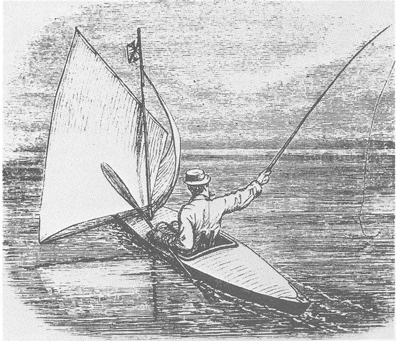
Pladda main light was built by engineer Robert Smith and his apprentice built the smaller tower a few years later. His apprentice was Robert Stevenson who was both his stepson and son in law. Thus was born the great Stevenson lighthouse dynasty. One of Robert Smith's Stevenson descendants was his great grandson Robert Louis Stevenson. RLS trained as an engineer but decided on a life as an author and is particularly remembered for "Treasure Island" and "Kidnapped". Some of the locations in Kidnapped are based on time RLS spent with his father on Erraid off Mull during the construction of the Dubh Artach light. RLS loved the sea and had a small boat in which he enjoyed coastal voyages. He and a friend bought Rob Roy canoes after reading "A thousand miles in the Rob Roy Canoe" by John Macgregor. In 1876 RLS and his friend Sir Walter Simpson set off on a voyage in through the waterways of Belgium and France. RLS published the account of their trip as "An Inland Voyage" in 1877.

A Rob Roy Canoe as used by Robert Louis Stevenson of the Stevenson lighthouse dynasty.

Follow Ian's account of our trip here.

The next post will be a look at the Pladda foghorn.

Saturday, May 31, 2014

No plod to Pladda!

 From Whiting Bay we enjoyed a downwind blast with...

 ...Mike and I having our sails up.

Until we got to Largybeg Point  (where we caught sight of Ailsa Craig) Ian managed to keep up by paddling hard while Mike and I were only doing paddling lite!

Between Largybeg Point and Dippen Head the wind got up to the extent that even without paddling, the kayaks with sails drew too far ahead. Mike and I dropped sails but we still enjoyed a fair bit of assistance on the way to our next destination, the isle of Pladda.

As we crossed the Sound of Pladda and approached Pladda with its prominent lighthouse, I could resist no more and whipped the sail up. I drew ahead of Mike and Ian again.

By the time we got to Pladda we were filled with the exhilaration of the perfect weather conditions. We were really glad we had decided to circumnavigate Arran anticlockwise and so get the wind as a tailwind.

With a NE wind blowing straight from Dippen head to Pladda, I had wondered if it might be tricky landing in the little lighthouse harbour, which is on the north of Pladda. We needn't have concerned ourselves. The harbour had been cleverly constructed and...

...once through the narrow entrance we were in perfect shelter. It was now time for an explore but there was also a decision to make. If the wind was forecast to ease the following day, we would push on round the south coast of Arran and camp in the SW corner ready for a crossing to Davaar Island off the Kintyre coast the next day. However, the forecast for the next day proved to be for NE F4-5 increasing F5-6 so any thought of crossing the Kilbrannan Sound was forgotten. This gave us some time in hand, so we decided to explore Pladda on foot then go out into the tide race on its southerly side before landing at Kildonan Hotel for a pub lunch. We then planned to stay in the commercial camp site next to the hotel and so would have time for a walk in the afternoon before retiring to the hotel again for dinner. The complexities of route planning in a changeable forecast can be challenging but we felt we had a plan...

Friday, May 30, 2014

The "hoody" crow of Whiting Bay.

From the middle of Lamlash Bay we enjoyed a fantastic view of Arran's rocky ridges.This view shows Beinn Nuis 792m, Beinn Tarsuinn 826m and A'Chir 745m.

The south entrance of Lamlash Bay was a bit stirred up by the tide in places but...

 ...soon we were in the shelter of Kingscross Point.

 The great sweep of Whiting Bay seemed a great spot to land for...

...a second breakfast, which we enjoyed at a bench on the grass above the reddish sands. Unfortunately a local crow managed to get into Mike's day hatch. Although the Guinness proved to be crow proof, packets of cheese and smoked sausage proved no barrier and the crow made off with Mike's forthcoming luncheon. We chased the crow off several times but it returned each time. It was a real neighbourhood hood. It was at this point that I formulated a plan to take luncheon in the Kildonan Hotel...

Thursday, May 29, 2014

The Inner Light, Stairway to Heaven and Pie in the Sky on Holy Island.

The view north from Holy island  was stunning. In the middle distance on the left is Hamilton Isle and Clauchlands Point on Arran. Above the point in the distance is Ben Ime, The Cobbler and Ben Narnain while on the right the summit of Ben Lomond rises above the Little Cumbrae island. The summit of Ben Ime is 81km away from Holy Island but two sea lochs of the Firth of Clyde; Loch Fyne and Loch Long extend  on either side of the mountain. The Firth of Clyde is a big place and it would take a long time to explore it.

We set off down the remote east coast of Holy Island with a fair wind,...

...full sun and a sparkling sea.

The wooded north soon gave way to...

...steep grass covered slopes and cliffs.

The geology here is very interesting. 250 million year old Permian red sandstone is covered with a thick sill of 55-60 million year old dolerite. The hard layer of igneous rock above protected the soft sedimentary rock below from the glaciers of the Ice Age.

Today the red sandstone is eroding as each time we pass there seems to be fresh rock fall. This would not be the best place to camp.

As we approached the accurately named Pillar Rock, we came to the Holy Island Outer Light. It was built in 1905 and was the first square lighthouse built by the Northern Lighthouse Board. It was automated in 1977. I flashes white every 20 seconds.

Turning the south end of Holy Island we entered the calm of lee of the island from the NE wind.

On the slopes above are built a series of retreats for the monks. They were designed by architect Andrew Wright and cots about £5 million to build in the mid 1990's. The winding path that leads to the highest retreat is truly a stairway to heaven.

We now approached Holy Island's second lighthouse which is appropriately called the Inner Light. The last time I was on Holy Island one of the volunteers told me that some women had been meditating inside for 17 years. As regular readers of this blog will know, we like landing and exploring lighthouses but given the current residents' wish for seclusion, we were happy to leave them to their splendid isolation.

The Inner Light guards the southern entrance of the great natural harbour of Lamlash Bay. It has been used by the Vikings, the Lords of the Isles and the Royal Navy in both World Wars. The Inner Light flashes green every three seconds. It was built in 1877 by David and Thomas Stevenson and was automated in 1977. We left Holy Island and paddled across Lamlash Bay with its wonderful view of the Arran mountains to the north.

As we left the beautiful Holy Island in our wakes, I reflected on the ownership of the Scottish Islands. Recently we have visited islands owned by absentee landlords (Sanda), resident working landlords (Muck) , community buyouts (South Uist, Eigg, Gigha), government quangos (SNH) (Rum), charities (NTS) (Canna), and religious orders (Little Cumbrae, Holy Island). Perhaps surprisingly I found the island of Muck, which has a resident and working landlord, to be the happiest.

Holy Island is where a branch of my ancestors lived and worked and today it is a peaceful and environmentally sound place under the stewardship of the Tibetan monks of the Samye Ling monastery in Dumfriesshire. The regenerating natural woodland full of birdsong is a delight. However, I found it in some ways a rather sterile and unreal place. In a way it is elitist, with those in retreat being supported by the time labour and money of volunteers. It is therefore not self sustaining like the Island of Muck. Those in retreat may think they are escaping from the outside world but they are just as dependent on it as you or I. Lastly it is not a real community at all. There are no children. So despite Holy Island being the land of my ancestors, give me Muck any day. It is a living island.