Friday, September 06, 2013

Paddle sailing away in the clear air at the end of a long day.

Once we left the shelter of East Loch Tarbert we entered the wide mouth of Loch Fyne, which is the longest sea loch in the Firth of Clyde and indeed the whole of Scotland. The view out of the loch across the expanse of the Sound of Bute to the rocky ridges of the Arran mountains was stunning. As we entered open waters a breeze picked up and we hoisted our sails.

We were bound for Skate Island some 6km away across Loch Fyne.

After some exhilarating paddle sailing in the wonderful clear evening light we...

...reassembled by the Skate Island (Sgat Mor) lighthouse.

I think Phil's smile will save any lengthy further description of the crossing!

Thursday, September 05, 2013

Lost buoys and a green ferry in East Loch Tarbert.

It was nearly 5pm before we left the cove at Port Ban on the north side of East Loch Tarbert. As we left, two local boys in a boat were scouring the coastline and collecting lost fishing buoys. 

We now paddled out towards the mouth of East Loch Tarbert but had to keep clear of...

...the ferry from Portavadie which was making its way in.The Tarbert to Portavadie route is one of the more recent of the Scottish west coast ferries as it was established in 1994. This is the MV Isle of Cumbrae has been the main vessel on the route since 1999 and she can carry 18 cars at a time. She is due to be replaced by the new MV Lochinvar which was built at Ferguson Shipbuilders at Port Glasgow on the Clyde. The Lochinvar is powered by diesel electric hybrid technology with Lion batteries which will make it one of the most efficient ferries in the fleet..

As we approached the mouth of East Loch Tarbert the mountains of Arran came into view. The air was crystal clear and we prepared for a wonderful crossing.


Tuesday, September 03, 2013

Sea kayaking again in East Loch Tarbert.

We had now reached the most northerly point in our rather circuitous return trip from Campbeltown to Ardrossan. After portaging the isthmus at the north end of the great peninsula of the Mull of Kintyre, we...

 ...found ourselves back in Firth of Clyde waters at Tarbert. After the sweated hard work of the portage it was such a relief to be floating weightlessly on the cool water of East Loch Tarbert.

The Tarbert fishing fleet can use either the fish quay in the East Loch or the quay in the West Loch. This can save a long voyage round the Mull of Kintyre or through the Crinan Canal. SD Omagh is an Admiralty Fleet Tender operated by the private firm Serco Denholm on behalf of the Royal Navy Support Services for the naval dockyards on the Clyde.

As we left the inner harbour the beauty of Tarbert's situation was revealed. The distant hills lie on the far side of West Loch Tarbert from which we had portaged. Tarbert Castle stands over the village. It is open to the public and is a wonderful vantage point from which to view the village and its loch. The castle was greatly reinforced by King Robert the Bruce in 1325.

 It was too nice to leave Tarbert, so we landed for an extended luncheon in the delightful Port Ban bay.

By the time we had finished lunch it was low water and we faced our second portage of the day back to the water. Our Karitek portage straps proved very useful.


Monday, September 02, 2013

Tidal planning on an (unarmed) portage from West Loch Tarbert to East Loch Tarbert.

It was almost high water and we were able to paddle very near to the head of West Loch Tarbert.

High water in West Loch Tarbert is very variable as it opens into the sea in an area affected by an amphidrome. As a very rough guide, local HW is -0200 HW Oban at springs and -0500 HW Oban at neaps. This means that the tide is approximately 26 minutes earlier each day between springs and neaps. We were 4 days before springs and HW Oban was 17:18 so local HW in West Loch Tarbert was 17:18-(02:00+01:43) = 13:35. We arrived at 13:35 and the tide was indeed just turning.

We found ourselves close to the road but a surprisingly steep bank rose up from the high water mark.  To get there we had to wade through particularly soft and sticky mud. Then we discovered the "grassy" bank was actually a thicket of nettles and brambles. It took four of us to man handle each loaded kayak diagonally up the slope. In the 30 minutes it took to get the kayaks to the road, the tide had disappeared, leaving a huge expanse of oozing mud. My advice for this portage is to exit 1km further back down the loch at the slipway by West Tarbert pier.

As it was my left shoulder and left knee that were troubling me, I had to do my share of the lifting with my right side down the slope and carrying the kayaks.This meant we needed to get the kayaks onto the road facing the wrong way. We then had quite a wait until the road was quiet enough to get them safely turned towards Tarbert. There is a lane marked off for pedestrians but there is no kerb and if two lorries pass each other in opposite directions there is very little room. It is essential to make sure your trolley wheels are correctly aligned to prevent the kayak wandering out into the road behind you,

The summit of the 1.6km portage is 22m above sea level and it was on this slope that I realised I would need to see a surgeon for my sore left shoulder.

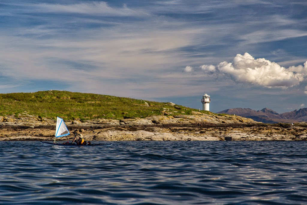
It was a great relief to start the descent into Tarbert and the Firth of Clyde. We certainly would not be breaking any speed limits as we were averaging just 2.2km/hr.

Tarbert was busy with holiday makers but there was room to park our kayaks along the quayside beside the old slipway, which is blocked off by a plastic barrier as it is in poor repair. (It was easily moved.)

On seeing Tarbert harbour, Jennifer said "Oh no the tide is out!"

An old fisherman, who was interested in our story, said  "Aye, when the tide is in at the west loch it is oot at the east loch. If ye dinna ken afore, ye ken the noo!" 

We spent 35 minutes resupplying in the local Co-op supermarket and eating an ice cream.

The tidal constant between West Loch Tarbert and East Loch Tarbert (which is a recognised secondary tidal port with tide tables freely available) is approximately +1 hour neaps and +3.5hours springs. HW in East Loch Tarbert was actually at 11:53 and by the time we launched it was 15:44, nearly 4 hours after HW. Fortunately the bottom of Tarbert harbour was firm enough for our trolley wheels but if the tide had dropped much further then it would have been soft mud.

Not counting the 35 minutes shopping, the total portage from afloat to afloat had taken 2 hours and 9 minutes. Given our 30 minute struggle to get the boats up the bank from the head of the loch, it would probably have taken the same time to have trollyed the kayaks the extra 1km from the West Tarbert slipway and its easier exit.

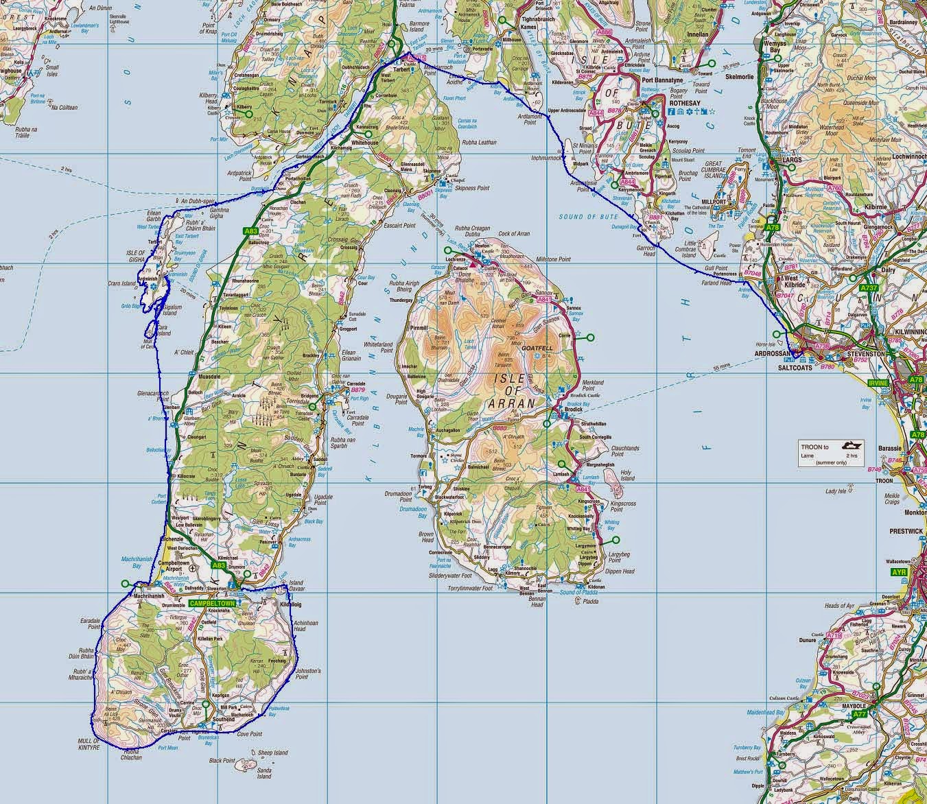
There are many places in Scotland called Tarbert or Tarbet. The name comes from the Gaelic word Tairbeart. In modern Gaelic this means isthmus but its origin lies in "over carry" or "draw boat". Of course sea kayakers were not the first to portage their boats over the isthmus at Tarbert.  In about 1093 Magnus Barefoot, King of Norway, had made a truce with the King of Scotland that allowed him to claim possession of any land he could "sail" round. Of course he didn't necessarily use his own Vikings as labour, he probably "recruited" the unfortunate locals.Unlike the Vikings, we had come unarmed and so had to draw our own boats across the isthmus but we were now back in the Firth of Clyde.

Friday, August 30, 2013

Better Days #16 in West Loch Tarbert.

 Beyond West Tarbert pier we came across a graveyard of decaying...

 wooden fishing boats.

This one was FV Kreisker BA207, which was wrecked here about 1987. Their days of harvesting the oceans' bounty had long gone. In short they have seen better days.

We now came to where my friend had suggested we exit the loch to begin our portage across the isthmus into the Firth of Clyde. The West Loch Hotel and the road to Tarbert lay a short distance over a gently sloping grassy bank. It looked ideal, an easy exit with the prospect of a refreshing pint but the illusion was shattered when we paddled into a lagoon of raw sewage, which was bubbling out of the end of a sewage pipe. Yuk! We made a sharp exit.

Thursday, August 29, 2013

Time for a sharp exit at West Loch Tarbert Pier.

We planned to reach the head of West Loch Tarbert near high water as we planned to exit the loch near its muddy head and portage our kayaks over the isthmus to East Loch Tarbert on the Clyde. I had originally planned to exit here at West Loch Tarbert Pier where there is a public...

 ...slipway, which I had sussed out in December 2011. However, I was persuaded by a friend who had come this way last year that there was a much better exit 850m further up the loch. Well I will come to that but in the meantime, let me just say that if you come this way and plan to portage the isthmus to East Loch Tarbert, EXIT HERE.

As it was, we paddled past the busy pier towards the head of the loch. The towing vessel Mary M was tied up, she spends most of her time on the Clyde. Unlike us she would need to return to the Clyde by motoring round the Mull of Kintyre. At 7m wide she is nearly 1m too wide for the Crinan Canal further north. West Loch Tarbert is the homeport for trawler Fionnaghal, TT104, built in Berwick upon Tweed in 1989. She was tied alongside  Campbelltown based Silver Spray III, TT77. She was built in Stromness in 1986 and is licenced for prawns and scallops.

Wednesday, August 28, 2013

A tale of two islands, one ferry and two captains.

 Eilean Eoghainn is a delightful small island set within the recesses of West Loch Tarbert in the Scottish county of Argyll. It is guarded by rocky ramparts but its...

 ...interior is a lovely wooded glade underset by bluebells. The dead trees make an ideal roost for the local heronry while...

 ...herring gulls nest on the rocks amongst red campions.

 We came to a little beach and pier,...

 ...these are in the grounds of Rhu House which would make an excellent B&B base to...

...explore the beaches and islands of lovely West Loch Tarbert. This island, Eilean da Ghallagain even has its own small beach. In 1960 the Islay ferry, the MV Locheil, sank just north of Eilean da Ghallagain. She had struck a rock further down the loch and was attempting to get to West Loch Tarbert pier near the head of the loch before sinking. Fortunately she came to rest on a mudbank, which prevented her sinking fully. There was no loss of life and even stock from the bar was rescued. MV Locheil was later salvaged and repaired. She continued on the run for another ten years... with a new captain.

Tuesday, August 27, 2013

A busy waterway at Kennacraig.

 We approached the pier at Kennacraig cautiously. It was 12:22 and the ferry was not due to leave until 13:00 but they do sometimes fit in extra sailings... So we went along the shore and before heading out past her stern noticed 3 things. 1. the MV Finlaggan was securely moored.. 2. They had not started loading the long queue of cars and lorries. 3. We were being watched from the bridge. So...

 ...we nipped round her stern without delay. The MV Finlaggan is one of the newer ferries in the Calmac fleet. She was built in Poland in 2011 specifically for the Islay route but she also provides winter relief for the Skye/North Uist/Harris route. She is 90m long with a gross tonnage of 5,209 tons and can carry 550 passengers and 85 cars.

 Once past Kennacraig we still had to keep a sharp lookout for other maritime traffic...

...such as FV Silver Lining III (TT37), a 16.6m wooden scallop dredger that was heading out from the quay at West Tarbert at the head of the loch. Her home port is Kilkeel in Northern Ireland and she was built in 1973.

Monday, August 26, 2013

A fair wind in West Loch Tarbert.

The weather forecast had been for a force 3 to 4 NE wind. This would have been a most unwelcome headwind in West Loch Tarbert. However, we were pleasantly surprised when a delightful tail wind picked up. I was especially pleased as my left shoulder was now "clicking" painfully with every stroke. It was a relief to hoist the sails and let them take some of the strain.

 We soon left the open sea and Gigha far in our wakes.

The enclosed nature of West Loch Tarbert was in complete contrast to the exposure we had experienced off the Mull of Kintyre earlier in the trip. As the shores of the loch closed round us we came across enchanting coves and...

 ...beaches backed by wooded slopes.

We trailed our fingers in the shallow, warm, clear waters as the sails carried us on towards the only sign of human activity... the Islay ferry, MV Finlaggan berthing at the Kennacraig ferry terminal.

Friday, August 23, 2013

The ferries of West Loch Tarbert.

No sooner had we entered West Loch Tarbert than we came across a long stone pier.

This is the remains of the Portachoillan ferry, which was a passenger ferry across the mouth of the loch to Ardpatrick on the west side.

It was operated by a rowing boat from at least the 19th century until it ceased in the 1930's. The 1856 Admiralty chart (surveyed in 1849) clearly marks it.

 After leaving Portachoillan we left the open sea behind us and entered...

 ...the wooded confines of West Loch Tarbert.

 We chose to paddle in very shallow water as the loch is very narrow and...

 ...a rumble of engines behind us announced...

 ...the return of the MV Finlaggan. We knew we were safe in the shallow water. Although the loch is 700m wide at this point, the deep water channel is only 130m wide, so the ferries do not have much room.

Although West Loch Tarbert is sometimes busy with ferry traffic, the main road to Campbelltown does not follow the shore and so it is mostly a quiet and very beautiful location for sea kayaking. The ferry passed  the ancient walls of Dunsmore castle on the north side of the loch . The tower house is now a ruin but it was the seat of the McMillan clan chiefs in the 17th and 18th centuries.

The MV Finlaggan soon passed by on its way to Kennacraig and we were left to enjoy the loch in peace again.