Monday, June 27, 2011

An evening paddle in the lee of Dun.

The forecast was not looking promising, the wind was due to increase 5-6 from the NE, imminently. We launched from the Cuma at 6pm...

...and made for the Dun Gap in beautiful evening sunshine.

The wind and the tide were whistling through the Dun Gap as I looked back past Giasgeir, in mid channel, to Oisebhal (293m) on Hirta.

Mostly it was sheltered in the lee of Dun but there were some vicious down draughts round the headlands and one of the party capsized as a rogue swell broke over a skerry. Donald soon performed a rescue but our team mate was wearing a two piece and got bitterly cold, despite being given two extra jackets, hat and gloves. Please excuse the blurred photo, it was a bit bouncy, I was trying to see if I could offer assistance and I was desperately trying to obey director Simon's "Exit stage left" command, as he was filming the whole proceeding!

 Ian and I felt quite snug in our dry suits. We now paddled into the tunnel...

...that cuts right through An Faing

then turned hard right to go through another much smaller tunnel that leads through to the inlet of A'Chlaisir.

Some of the party then entered the cavern that connects right through to the opposite side of Dun at Seilg Geodha. There was too much swell coming through for us but Gordon got right through and back again. It was impressive seeing him being spewed back into the dark cavern on the top of a 2m wall of white water that shot out of the narrow slot!

We now continued towards the SE point of Dun...

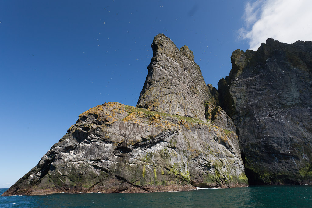
...under towering and sometimes overhanging cliffs.

As we approached Giumachsgor we could see the tide race that was sweeping past the point of Dun. Either we could get through the arch or we would need to return by the Dun gap, we would not be going round the point!

We felt the full force of the wind once we were round Giumachsgor. We ferry glided across wind and tide to the SE wall of the arch. I just managed to hold station here. The tide was rushing through against us as was the wind, which was gusting through and lifting the surface off the sea. Gordon paddled forward into the mayhem and managed to get through to the far side. From my position, I could see through the arch into Village Bay, where he turned on the top of a large wave. He then surfed into the arch again and dodged the reef in its middle. It was an incredible demonstration of paddling skill. No one followed him through. Unfortunately the one photo, I risked taking, was of my spray deck, so you will need to wait and see the video from Gordon's deck mounted cam. I am sure this will make it into the final version of the second "Sea kayaking with Gordon Brown" DVD, which Simon is currently editing.

We returned to Hirta through a very windy Dun Gap. The crossing to the pier was quite bumpy as it was exposed to the wind and the swell that had quickly built up. Behind us, the setting sun lit up the top of the outlying stack of Levenish in a warm glow but we were now deep in the shade of the cliffs of Dun and Hirta. We securely tied our kayaks to the pier railings then Gary ferried us in the RIB back to the Cuma. We enjoyed a well deserved meal at the end of a fantastic day and went to bed early. It was a disturbed night as the Cuma rocked uneasily in the swell, her timbers creaked and the wind whistled through her rigging.

Sunday, June 26, 2011

Arrival at Hirta, St Kilda.

From Boreray and the Stacs, MV Cuma motored towards Hirta and Soay, which are the two largest islands in the St Kilda archipelago. The next two by size are Boreray and Dun. The cliffs falling from the summit of Connachair (at 430m, the high point on Hirta) are the highest sea cliffs in the British Isles.

As Cuma made her way round the east side of Hirta, we caught sight of the jagged outline of Dun.

The most easterly point on Hirta is Rubha an Uisge, "point of the water". You can see a waterfall tumbling into the sea (after our very wet start to the summer). When we were last here in 2008, there was no fall.

Dun is riddled by caves and tunnels and when  approaching from the NE, you can see through its great arch.

Dun is separated from Hirta by only a narrow gap.

We lined the bows of the Cuma in excitement, to catch our first sight of Village Bay.

The modern military base, which supports a radar station, is incongruous but does not dominate the scattering of stone built dwellings and storage cleits that rise behind it.

The first building we passed was used to store the feathers of sea birds for export. It dates from the late 18th century and so is older than...

...the alternate cottages from the 1830's and 1860's, which make up the village street. This was the most remote settlement in the British Isles, until it was evacuated in 1930 after thousands of years of habitation.

We had arrived on this archipelago of superlatives!

Saturday, June 25, 2011

Evolution of the species on Boreray.

After sweeping round Stac an Armin we aproached Boreray from the NE. What a superlative sight! It was like a great stegosaurus rising up from the ocean. We half expected to see pterodactyls swooping round its rocky pinnacles...

...but they had all evolved into gannets!

Murdani now took the Cuma through the narrow gap between Boreray...

...and a pair of small unnamed stacs which lie between Boreray and Stac an Armin. The chart encouragingly annotates this channel "no passage, even for boats"...

...but Murdani has fished for crabs and lobsters in these waters sine the '60's and  knows these waters better than any chart maker! We wondered why Murdani stayed in the Cuma's wheelhouse...

We were also astounded by the number of gannets. These are very hungry birds that have a highly efficient digestive system, to cope with the prodigious amount of fish they catch...

 Liz, Simon and...

...Calum all wore wide brimmed hats.

All were agreed, it was as well that despite 2,500million years of evolution, elephants have not learned to fly like gannets

It was humbling to see so much teeming bird life. They lived in a city in the sky..

...each pair guarding  their own piece of ledge.

 Cuma now motored close in to Stac Lee, with Boreray behind.

Sadly our encounter with the stacs was nearly over, the scale stunned our senses. It was a long time before I could get both Stac Lee and Stac an Armin in the same shot...

...and even longer before I could squeeze Boreray in as well. Archaeologists have recently found signs of permanent buildings and agriculture on the steep slopes of Boreray dating back to the iron age!

Friday, June 24, 2011

The gannets of Stac an Armin.

 The Cuma slowed as we approached the north end of Boreray. We were silenced by this view between Boreray and Stac an Armin. Stc Lee is partly hidden by the dark cliffs of Boreray, Hitra is in the distance with Stac Soay and Stac Biorach between it and Soay, then Stac an Armin.

Telephoto shot of Soay.

At 196m high, Stac an Armin is the highest sea stac in the British Isles. The St Kildans harvested seabird each summer. They built 80 cleits and a bothy on the rock. Three men and eight boys spent 9 months on Stac an Armin from  about 15 August 1727 until 13 May 1728 when they were rescued by a boat from the Outer Hebrides. Smallpox had broken out on Hirta after they had been dropped off and there were not enough adult survivors to man a boat to recover them.

Nearby Stac Lee is the second highest stac at  172m.

Stac an Armin from the NW. The last great auk in the British isles was killed here in July 1840. It was caught by three St Kildans and held captive for three days before they beat it to death because they thought it was a witch.

 The air was filled by a blizzard of croaking gannets. These islands are one of the biggest sea bird colonies in Europe.

They are incredibly graceful in flight...

...and have a wingspan of 2m.

The Cuma now swung round the south of Stac an Armin. The islanders leaped ashore from their boats at the white water below the highest point.

Track of the Cuma,

Thursday, June 23, 2011

Crossing to St Kilda, the islands at the edge of the World.

The morning of Sunday 12th June dawned fair and after an extensive Cuma breakfast, we took some air upon the deck to allow our stomachs to settle. Ken explained to the others how he had managed to hold on to the toast rack with the very last slice of toast!

Murdani listened intently to the weather forecast. It was not looking good at the end of the week and the wind this evening was forecast to get up to 19-25mph from the NE but drop on Monday before getting up again from the SW on Tuesday. Murdani decided to go for it. He was confident that Village Bay would provide a sheltered anchorage in a NE wind. The anchor was weighed and look how carefully the chain is cleaned of mud.

Soon we were heading for the Atlantic from within the confines of a narrow sea loch without an open horizon.

 The island of Scarp, with its dazzling white sand beach, was our gateway to the open ocean.

 Gordon was delighted we were heading WSW to St Kilda. The crossing from Scarp to Hirta is 87km! The empty Atlantic horizon stretched in front of us without a hint of the islands at the edge of the World.

Behind us, the west coast of Lewis fell away as the Cuma's bow rose to the Atlantic swells.

We chatted excitedly on the long crossing. Donald Thomson led the first return trip to by sea kayak to St Kilda 20 years ago in 1991. He modestly answered our many questions about such a bold trip. It turns out that Donald has made return trips to all the Scottish islands apart from one!

At first we could hardly distinguish St Kilda from the clouds but gradually the dramatic cliffs took form as they rose above the horizon. We then realized that these were the highest sea cliffs in the British Isles, big enough to generate their own weather system! From the left we saw Dun, Hirta, Soay, Boreray and Stac an Armin. We were humbled that our ancestors made this crossing and colonised the islands 4,000 years ago!

Our final approach would take us round the north of Boreray and Stac an Armin.