Monday, September 27, 2010

Through the Brownie's window, on Cara.


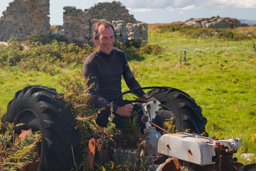
We came across a row of old tractors lined up behind the beach at Cara. Phil tried to get the most recent looking one started...


...but judging by the spider's web in its air intake, it obviously hadn't run for a while.


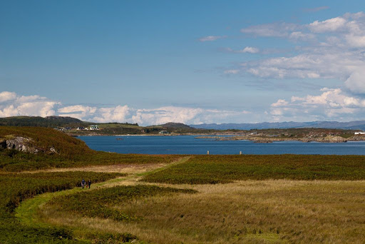
Giving up on the tractor, we started to walk up the track towards...


...Cara House, which was on the horizon.


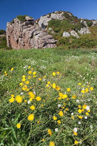
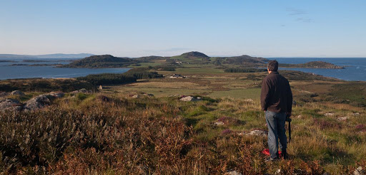
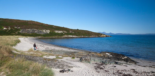
As we climbed, we enjoyed a fabulous view over Gigha to the Paps of Jura.


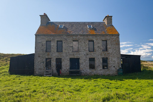
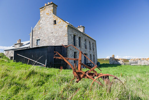
Cara House is a rather grim looking edifice. The MacDonalds of Largie on Kintyre built it for their resident tacksman on the island in about 1733. The house is now a private holiday residence, having been extensively renovated in the early '90s. The Brownie is said to haunt one of the attic rooms.


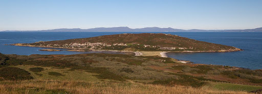
The island was last farmed in 1932 and the last permanent resident left in the 1940's.


We could not resist a peek through the window. Clearly the Brownie likes a drink though we were much surprised to find he was a lager drinker. We had him down as Newkie Broon man.

Thursday, September 23, 2010

Last day of summer on Cara.


We finally made landfall on this beautiful beach at the north end of Cara.


We gazed back at the stunning view over azure waters to verdant Gigha...


...and the distant rocky peaks of the Paps of Jura.

We don't get a great deal of sun in Scotland but when we do....! This last day of a short summer will need to keep us going for some time during the dark days of the coming winter.

Thunder heralds our return to Cara.


After lunch at Sammy's place, it seemed too early to return to Tayinloan. After all we did not want to end up in a traffic jam on Loch Lomond side. So we turned south towards Cara again.

A distant rumble of thunder from the east...


...drew our gaze towards towering clouds...


...but Donald heard nothing.


The isle of Cara grew steadily bigger...


...as we prepared to greet the Brownie once more. What with otters and Brownies, you need to be quite careful landing round these parts. We hoped the thunder had not upset the Brownie...

Wednesday, September 22, 2010

You shouldn't otter camp here.


It was quite busy at the Boathouse so we set off down the coast of Gigha to the apparently deserted Port an Sgiathain for a peaceful lunch.


This one of the loveliest spots on Gigha.


The clear waters lapping the shell sand beach beach lay below a line of low, rocky cliffs.


Drifts of wild flowers...


...grew in profusion on the meadow between the shore and the cliffs.


A little burn ran down through the meadow and trickled onto the sands. An animal had recently cleaned itself here, then marked the sand with its claws.


I knew straight away whose territory this was. The last time we were here, we came across Sammy otter who was out and about, bold as brass, at midday despite having a reputation as being a nocturnal recluse!


A quick scout round revealed what Sammy liked to eat.


It took slightly longer to find where he had left his spraint (poo). This one was left on top of a little rocky mound at the edge of the beach. It had dried out in the hot sun but still had a musty smell and had fragments of crab shell and fish bones in it.

Although otters hunt in the sea, they need a supply of fresh water to wash their fur afterwards. They are very territorial over favoured spots and mark with scratching and leaving spraint in prominent positions round their territory.

Although this would have been a lovely spot to camp it would have been be very selfish to do so. Sea kayakers should learn to read otter territorial markings. We left Sammy in peace.

Tuesday, September 21, 2010

Barnacles and ice creams on the east coast of Gigha.


After launching we made our way down through the reefs and skerries on Gigha's east coast.


Donald in his little inflatable had to keep further offshore but was rewarded with the sight of an otter on an outlying reef.


The east coast of Gigha is much more gentle than the exposed west and has rich farm land rising towards the summit slopes of Creag Bhan, 100m, which is the island's highest point.


It is not just on land that there are farms. The island has several fish farms which are among the most productive in Scotland.


Not all the east coast is arable land. Rock dominates the scene at Rubh'an Sternail.


Away to the east clouds towered into the sky but we enjoyed full sun on Gigha.


A light northerly breeze carried us across Druimyean Bay towards Ardminish Point.


Above the barnacle line, this headland is just bare polished rock...


...very much how it would have been cut by the glacier, which once slid down the Sound of Gigha.


After crossing Ardminish Bay it was time to stop at the Boathouse again. My thermometer was showing 25 degrees, the hottest day of the year so this time we ordered ice creams!

Monday, September 20, 2010

Views from the north of Gigha.


The north end of Gigha is a wonderful wild place. Its highest hill is only 56m high but from its summit this lovely isle can be seen stretching away to the south with the Mull of Kintyre and even Ireland beyond.


To the west, over the peninsula of Eilean Garbh, Islay stretches away to the Mull of Oa.


To the east, the mountains of Arran rise above the Kintyre peninsula and the Sound of Gigha.


Back at sea level, the Paps of Jura...


lie above the enchanting beach of white shell sand...


...which links Eilean Garbh to Gigha.


We hiked back over the rough country of north Gigha to our camp.


As we broke camp and loaded the boats, the MV Isle of Arran...


...was already well on her way back to Islay.

It was time for us to go.

Sunday, September 19, 2010

Two sisters of Islay.


The next morning, the 7am ferry from Kennacraig to Islay sailed past Gigha under the magnificent Paps of Jura. She was the MV Hebridean Isles, built in 1985. As her name suggests, she served the Skye, North Uist and Harris triangle until 2001 when she moved south to the Islay run. The white pillars at the rear is a large lifting car ramp which was used until all her ports were fitted with linkspans for a full RORO, roll on roll off, service.


A little later her sister ship the MV Isle of Arran made the early crossing from Islay to Kennacraig. She was built in 1983 for the Arran route but was moved to the Islay run in 1993. We followed the course of her voyage as she rounded the north end of Gigha. At first she was backed by the distant hills of Islay...


...with Gigha's Eilean Garbh in the foreground.


Then she passed below the mountains of Jura...


...before passing Ardpatrick Point...


...on her way into West Loch Tarbert and her home port of Kennacraig.