Saturday, March 13, 2010

Loud, discordant, half naked and very hairy Celts in Loch Creran!


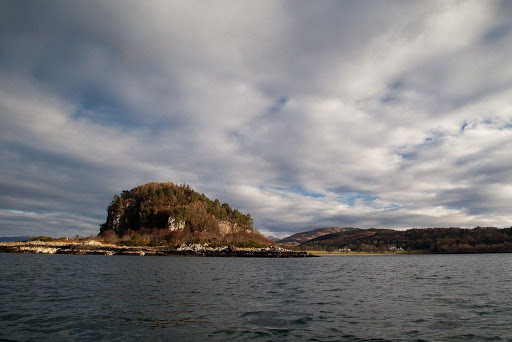
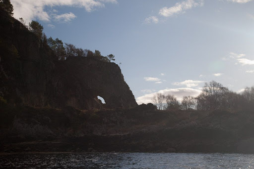
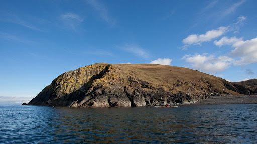
We continued round to the east side of Eriska. It is sheltered from the open sea and prevailing winds.


I knew there was a well known crannog on the south side of the island but I was very surprised to find another large ring of semi-submerged boulders connected to the shore by a line of boulders. It was another crannog! These were ancient artificial islands topped by dwelling houses and dating back some 5,000 years. They would have been built up with wooden stilts with a large wooden house on top. It just goes to show that you should keep your eyes open and not just do headland to headland, if you want to discover things and learn about the coast.


We then crossed to the south shore of Loch Creran and came to the old ferry jetty at South Shian. The ferry connected the lands of Benderloch to Appin on the way from Oban to Fort William. A rowing boat ferry operated here until 1948. A century before, in 1848, Lord Cockburn crossed here in his carriage. He said afterwards" These are disgraceful ferries...jerked by bad rowers, with unsafe oars, amidst a disorderly tumult of loud, discordant, half naked and very hairy Celts.."

In 1996, a 1797 copper two penny piece was discovered beside the jetty, perhaps it was intended as a fare.

In 1941 a German bomber dropped a bomb on Sgeir Caillich, the reef to the SE of the jetty. It is thought that from the air, the long thin reef looked like a camouflaged battle ship. The reef survived.


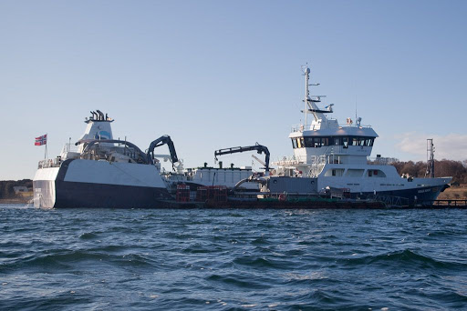
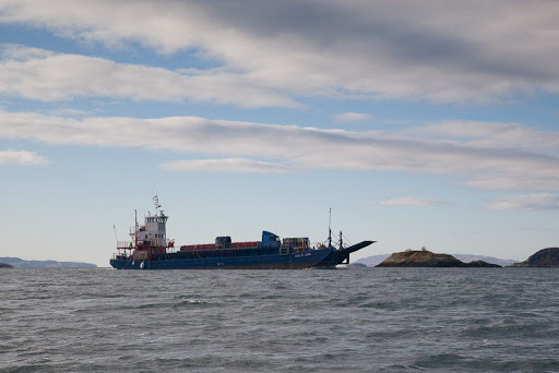
After paddling through the gap at the inshore end of the reef, we came across the 57m well ship, Ronja Nordic. She was offloading a cargo of mature live salmon at the South Shian fish processing plant. She sails under the Norwegian flag and was built in fitted out in 2008 by a yard in Norway after her hull was built in Poland.


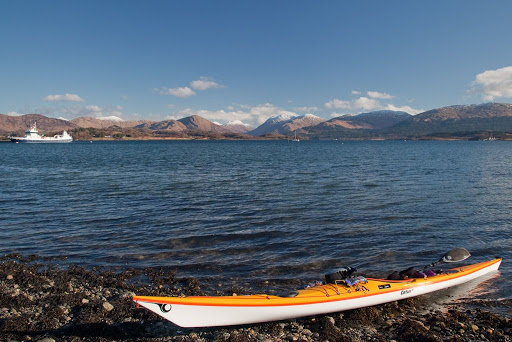
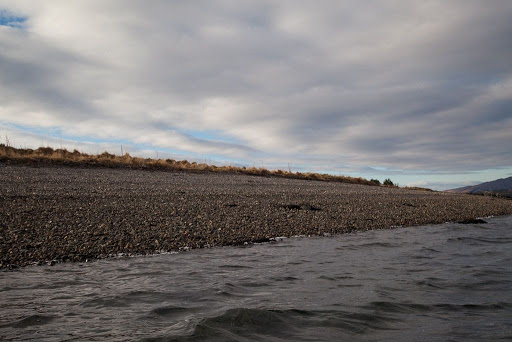
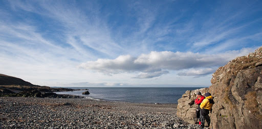
We stopped for a second breakfast on the South Shian shore...


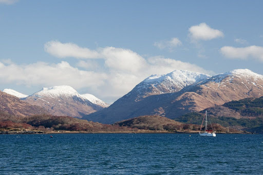
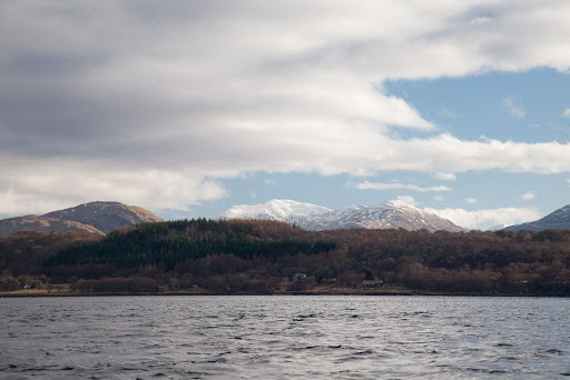
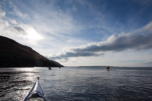
...and admired the view to the distant snow covered ridges of Ben Sgulaird, 937m. Our route was to take us 13km from the mouth to the head of Loch Creran which lies below the Ben.

Thursday, March 11, 2010

The hidden entrance to Loch Creran


Travelling south from Port Appin we paddled below this interesting former sea stack. It has a wooded summit, steep wave cut cliffs and it sits high and dry on a raised beach which connects it to the Appin mainland.


It even has a natural arch cut by a former higher sea level.


From the sea, the wooded isle of Eriska almost completely blocks the tortuous entrance to lovely Loch Creran which lies hidden below the distant mountains.


Suddenly this barge appeared from the midst of the woods! She is the MV Rose of Lorne and was built in 1965. She ferries supplies to the Glensanda quarry which has no road access but is one of the biggest quarries in Europe. In 2008 she gained a second storey to her wheelhouse. She was contracted to transport 8 giant dump trucks from Oban to Glensanda. The captain needed to be higher to see where he was going! Normally the Rose of Lorne operates between Barcaldine in Loch Creran and Glensanda.


We now entered the winding entrance to the loch. It is fringed by great banks of gravel, which were left by the melting glacier that once carved its way to the sea here.


Once we passed the gravel and woodlands of Eriska, we began to see our way round to the hidden loch.

Monday, March 08, 2010

Little and large on the road north to Appin


Back at the beginning of February, we took the great road north again past Buchaille Etive Mor, 1022m, and through the dark recesses of Glen Coe beyond.


At Loch Linnhe we turned south and entered the lands of Appin which were controlled by the bold fortress of...


Castle Stalker sitting on its little island. On the bigger island of Shuna beyond, you can just see the tiny remains of its rather inadequate neighbour, Castle Shuna.


Soon we were kayaking out into the Lynn of Lorne...


...where we set a southerly course.

Sunday, March 07, 2010

An excessive attachment to the land.


Today we enjoyed a fantastic trip to Holy Island off the east coast of Arran.


Holy Island is an ancient Christian site (St Molaise) but is currently owned by Buddhist monks. Although the "No Landing" signs have been removed (after a complaint by us to the Ayrshire and Arran Access Officer) this new sign has appeared. The monks clearly have little concept of the Land Reform (Scotland) Act. We resisted the temptation to burn the sign but will write again to the Access Officer.

Saturday, March 06, 2010

The Master of Ballantrae


Soon we were at the south end the great sweep of Ballantrae Bay. There was a bitingly cold north east wind blowing...


...so it was with some relief when we finally entered the shelter of the harbour.


We did not hang around and...


...as I issued instructions, the faithful support team warmed themselves by carrying the heavy kayaks up to the cars...


...while I swanned off to take in the glorious view.


I felt just like the Master of Ballantrae, as I surveyed the...


...magnificence of Ayrshire's Atlantic coast.

Friday, March 05, 2010

A pillow for a tired sea kayaker's head


All to soon it was time to leave delightful Portandea and...


...head north again, along the lichen encrusted, yellow cliffs of Ayrshire's Atlantic coast.


Despite the fact we had just passed this way, a change in tide and direction gave new channels to explore and we soon lost each other in the maze of skerries.


Sea kayaking is a very companionable activity and we discussed in depth...


...the amazing pillow lava formations that erupted under the sea from a long extinct volcanic vent. The examples here are some of the best in the world apart from the freshly formed pillows in Hawaii.


By now we were getting tired and hungry. Time for third luncheon.

Thursday, March 04, 2010

Fast birds and boats...


We continued in a southerly direction along the South Ayrshire coast leaving Ailsa Craig far behind.


We passed Dove Cove, where there are usually hundreds of rock doves. Today we saw only this fellow, a peregrine falcon, who was sitting bold as brass on his perch. I wonder what peregrines eat? (Sorry about the small image, I had my wide angle lens on at the time.)


The superb coastline continued...


...for headland after headland...


...until we came to Portandea...


...where it was time to partake of a second luncheon.


We watched the ferries enteringand leaving Loch Ryan at very scary speeds. You would need to have your wits about you to cross their path in a sea kayak.

Wednesday, March 03, 2010

P&H Cetus LV comparative test


We have nearly finished testing the P&H Cetus LV for Ocean Paddler magazine. We just needed some further comparative testing. Unfortunately the Cetus LV did not compare that well with this particular opposition! When up against the...


...Cetacea Delphinidae, she was well and truly outgunned. The Cetacea accelerated more quickly, was faster, more manoeuvrable, less affected by waves and wind, able to get out of the water more quickly... in fact, the only area the Cetus LV proved to be superior in, was nose diving!

Ah well, back to the drawing board.

Sunday, February 28, 2010

Curarrie Port, any port in a storm.


There are few breaches in the line of cliffs along this coast but Currarie Port is one. In 1869 the crew of the schooner Louisa had a lucky escape here. She came ashore here on the night of the second of November while sailing from Belfast to Ayr and was totally wrecked. By great good fortune all of her crew were saved. If her final course had been just 50m to either side, she would have been wrecked in deep water at the base of the cliffs and all would have been lost.


We decided the shelter of the port would make an excellent location for an early luncheon.


As we compared the lines of the P&H Cetus and Cetus LV, the skies cleared and the sun...


...warmed the rocks where we found some shelter from the chill wind. We chatted about how lucky those sailors were to end up here.


Fortified by our refreshments, we continued on our exploration of the south Ayrshire coast.

Saturday, February 27, 2010

Tony's special cave vision spectacles.


We left Ballantrae in beautiful early February sunshine. The bay and village were framed by Bennane Head and Knockdolian which in misty conditions could often be mistaken for Ailsa Craig. Many sailing ships found themselves foundering on the steep shingle shore instead of being in the deep water on either side of Ailsa Craig. To this day local seafarers call Knockdolian "False Ailsa Craig".


To the south banks of sea fog hid the south Ayrshire coast and the more distant Milleur Point.


Gradually the fog dispersed revealing a magnificent series of headlands receding into the distance and Loch Ryan.


Soon we were paddling below steep ramparts, deep in the shade of the low winter sun.


The cliffs have a number of caves at their base, inside one...


...this pair of black Guillemots were peacefully moulting into their adult summer plumage but turned their heads in amazement...


...when they saw Tony's special cave vision spectacles.